Langvassåga
| Langvassåga | |
|---|---|
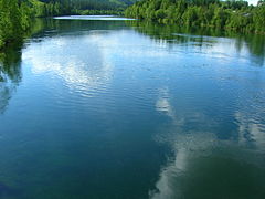
 Langvassåga west of the bridge | |
 Location of the river | |
| Location | |
| Country | Norway |
| County | Nordland |
| Municipalities | Rana Municipality |
| Physical characteristics | |
| Source | Langvatnet |
| • location | Rana, Norway |
| • coordinates | 66°22′55″N 14°15′15″E / 66.3818257°N 14.2541416°E |
| • elevation | 46 metres (151 ft) |
| Mouth | Ranelva |
• location | Rana, Norway |
• coordinates | 66°21′12″N 14°19′07″E / 66.3532831°N 14.3185419°ECoordinates: 66°21′12″N 14°19′07″E / 66.3532831°N 14.3185419°E |
• elevation | 44 metres (144 ft) |
| Length | 6.5 km (4.0 mi) |
| Basin size | 1,114 km2 (430 sq mi) |
| Basin features | |
| River system | Ranelva |


Langvassåga is a river that flows out of the lake Langvatnet in the municipality of Rana in Nordland county, Norway. It flows in a southeastern direction and almost immediately, it is joined by the river . It then continues a short distance southwards before joining the main river Ranelva, just south of the village of Røssvoll. The Langvassåga catchment area covers about 1,114 square kilometres (430 sq mi). The river passes by the Mo i Rana Airport, Røssvoll.[1]
Media gallery[]
Langvassåga west of the bridge

Langvassåga meets Ranelva east of the bridge


See also[]
- List of rivers in Norway
References[]
- ^ Store norske leksikon. "Langvatnet – innsjø i Rana" (in Norwegian). Retrieved 2011-12-28.
This Nordland location article is a stub. You can help Wikipedia by . |
Categories:
- Rana, Norway
- Rivers of Nordland
- Rivers of Norway
- Nordland geography stubs
- Norway river stubs