Lawtell, Louisiana
Lawtell, Louisiana | |
|---|---|
 Lawtell, Louisiana | |
| Coordinates: 30°31′07″N 92°11′05″W / 30.51861°N 92.18472°WCoordinates: 30°31′07″N 92°11′05″W / 30.51861°N 92.18472°W | |
| Country | United States |
| State | Louisiana |
| Parish | St. Landry |
| Area | |
| • Total | 4.145 sq mi (10.74 km2) |
| • Land | 4.145 sq mi (10.74 km2) |
| • Water | 0 sq mi (0 km2) |
| Elevation | 59 ft (18 m) |
| Population ()[1] | |
| • Total | 4,198 |
| • Density | 1,000/sq mi (390/km2) |
| Time zone | UTC-6 (Central (CST)) |
| • Summer (DST) | UTC-5 (CDT) |
| Area code(s) | 337 |
| GNIS feature ID | 1627458[2] |


Lawtell is an unincorporated community and census-designated place in St. Landry Parish, Louisiana, United States. The name is a portmanteau of the names of its two founders: Lawler and Littell.[3]
State Representative is a native of and a businessman in Lawtell.[4]
Geography[]
According to the U.S. Census Bureau, the community has an area of 4.145 square miles (10.74 km2), all land.[1] U.S. Route 190 passes through the community.
Demographics[]
As of the 2010 United States Census, there were 1,198 people living in the CDP. The racial makeup of the CDP was 49.6% Black, 45.1% White, 0.2% Native American, 0.2% Asian, 1.2% from some other race and 1.4% from two or more races. 12.4% were Hispanic or Latino of any race.
References[]
- ^ a b c "2010 Census Gazetteer Files - Places: Louisiana". U.S. Census Bureau. Retrieved January 14, 2017.
- ^ "Lawtell". Geographic Names Information System. United States Geological Survey.
- ^ D'Artois Leeper, Clare (2012). Louisiana Place Names: Popular, Unusual, and Forgotten Stories of Towns, Cities, Plantations, Bayous, and Even Some Cemeteries. LSU Press. ISBN 9780807147382.
- ^ Cheryl Devall (April 12, 2015). "Dustin Miller makes it four candidates for District 40". The Opelousas Daily World. Retrieved April 2, 2016.
Municipalities and communities of St. Landry Parish, Louisiana, United States | ||
|---|---|---|
Parish seat: Opelousas | ||
| Cities | 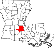 | |
| Towns | ||
| Villages | ||
| CDPs | ||
| Other communities |
| |
| Footnotes | ‡This populated place also has portions in an adjacent parish or parishes | |
| ||
This Louisiana state location article is a stub. You can help Wikipedia by . |
- Census-designated places in St. Landry Parish, Louisiana
- Census-designated places in Louisiana
- Louisiana geography stubs