Lazy pod Makytou
Lazy pod Makytou | |
|---|---|
Municipality | |
 | |
 Lazy pod Makytou Location of Lazy pod Makytou in the Trenčín Region | |
| Coordinates: 49°14′N 18°14′E / 49.233°N 18.233°ECoordinates: 49°14′N 18°14′E / 49.233°N 18.233°E | |
| Country | |
| Region | Trenčín |
| District | Púchov |
| First mentioned | 1475 |
| Area | |
| • Total | 49.905 km2 (19.268 sq mi) |
| Elevation | 400 m (1,300 ft) |
| Population | |
| • Total | 1,400 |
| • Density | 28/km2 (73/sq mi) |
| Time zone | UTC+1 (CET) |
| • Summer (DST) | UTC+2 (CEST) |
| Postal code | 020 55 |
| Area code(s) | +421-42 |
| Car plate | PU |
| Website | www |


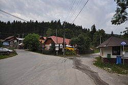
Lazy pod Makytou (Hungarian: Láz) is a village and municipality in Púchov District in the Trenčín Region of north-western Slovakia.
History[]
In historical records the village was first mentioned in 1475.
Geography[]
The municipality lies at an altitude of 400 metres and covers an area of 49.905 km2. It has a population of about 1400 people.
External links[]
 Media related to Lazy pod Makytou at Wikimedia Commons
- Official website

- https://web.archive.org/web/20080111223415/http://www.statistics.sk/mosmis/eng/run.html
Tourism and living information[]
| show Municipalities of Púchov District |
|---|
| show Authority control |
|---|
This Trenčín District location article is a stub. You can help Wikipedia by . |
Categories:
- Villages and municipalities in Púchov District
- Trenčín geography stubs