Lee's Summit, Missouri
Lee's Summit, Missouri | |
|---|---|
City | |
| City of Lee's Summit | |
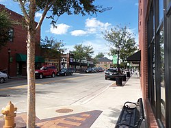 Downtown Lee's Summit | |
 Flag | |
 Location of Lee's Summit in Jackson County and the U.S. state of Missouri | |
| Coordinates: 38°55′21″N 94°22′27″W / 38.92250°N 94.37417°WCoordinates: 38°55′21″N 94°22′27″W / 38.92250°N 94.37417°W | |
| Country | United States |
| State | Missouri |
| Counties | Jackson, Cass |
| Government | |
| • Mayor | Bill Baird[1] |
| Area | |
| • Total | 65.84 sq mi (170.54 km2) |
| • Land | 63.82 sq mi (165.29 km2) |
| • Water | 2.03 sq mi (5.25 km2) |
| Elevation | 1,037 ft (316 m) |
| Population | |
| • Total | 91,364 |
| • Estimate (2020)[4] | 101,647 |
| • Density | 1,556.86/sq mi (601.11/km2) |
| Time zone | UTC−6 (CST) |
| • Summer (DST) | UTC−5 (CDT) |
| ZIP Codes | 64015, 64063, 64064, 64081, 64082, 64083, 64086, 64134, 64139, 64149 |
| Area code(s) | 816 |
| FIPS code | 29-41348[5] |
| GNIS feature ID | 0735684[6] |
| Interstates | |
| Website | Official website |

Lee's Summit is a city located within the counties of Jackson (primarily) and Cass in the U.S. state of Missouri. As of the 2020 census its population was about 101,108, making it the sixth-largest city in both the state and in the Kansas City Metropolitan Area.[7]
Origin of name[]

The "Town of Strother" (not to be confused with a town of the same name in Monroe County) was founded by William B. Howard in October 1865. He named it for his wife, Maria D. Strother, the daughter of William D. Strother formerly of Bardstown, Kentucky. Howard came to Jackson County in 1842 from Kentucky, married Maria in 1844, and by 1850 he and Maria had 833 acres (3.37 km2) and a homestead five miles (8 km) north of town. Howard was arrested for being a Confederate in October 1862, near the beginning of the Civil War, and after being paroled he took his family back to Kentucky for the duration of the war. After the war ended he returned and, knowing that the Missouri Pacific Railroad was surveying a route in the area, platted the town with 70 acres (280,000 m2) in the fall of 1865 as the town of Strother.[8][9]
In November 1868[10], the town's name was changed to the "Town of Lee's Summit", most likely to honor early settler Dr. Pleasant John Graves Lea, who had moved to Jackson County in 1849 from Bradley County, Tennessee. Lea was listed as the postmaster of nearby Big Cedar in the 1855 United States Official Postal Guide.[11] Dr. Lea was killed in August 1862 by Kansas Jayhawkers (or Redlegs).[12]
When the surveyors for the Missouri Pacific Railroad came through, the local people and the railroad wanted to name the town in Dr. Lea's honor. He had a farm on the highest point and near the path of the tracks, and his murder had taken place near the site of the proposed depot. So they chose the name of "Lea's Summit", the "summit" portion to reflect its highest elevation on the Missouri Pacific Railroad between St. Louis and Kansas City.[13] But they misspelled the name "Lees Summit" (with two "e's"; "Lee" instead of "Lea"; and leaving out the apostrophe) on a boxcar that was serving as a station and donated by the Missouri Pacific,[14] then a sign next to the tracks, and finally in the printed time schedule for the railroad.[15] Legend states that the name was spelled wrong on the side of the Missouri Pacific depot and has remained Lee's Summit ever since.[16][17]
Others claim that the town was named after famed Civil War General Robert E. Lee after Southerners began moving north into Missouri after the war due to the timing of General Lee's death compared to Dr. Lea's death.[8][13] This is attributed to a quote in the Louisville Journal, January 3, 1866.[15]
Since the name was already being circulated and published with two "e's", the town petitioned the state legislature and incorporated its name in 1868 as: "Town of Lee's Summit".[8][13]
The spelling is unusual because apostrophes are typically not included in place names due to potential confusion regarding whether the place is owned by the namesake person. Most possessive place names lack an apostrophe, such as Harpers Ferry, West Virginia, and Boardmans Point, New Hampshire.
History[]
The growth of the town can be studied through historic Sanborn maps, which document building types and uses in the city during the late nineteenth and early twentieth centuries.[18]
In 1913, R. A. Long, the owner of a lumber company, began building his estate, named Longview Farm, on the western edge of the city and into part of Kansas City. When complete, it had a mansion, five barns and 42 buildings in the 1,700 acres (6.9 km2). Harrison Metheny, grandfather of jazz legend Pat Metheny, was an electrician during Longview's construction. The farm also had a church, Longview Chapel Christian Church, which was completed in 1915. It soon became internationally known as a showplace farm. Today, one of the horse barns is home to Longview Farm Elementary, and the site of Longview Community College. The church and mansion are on the National Register of Historic Places. Other parts of the farm have been turned into Longview Lake, Longview Community College, and a development called New Longview.[8][13] Lee's Summit is also home to Missouri Town 1855 and Lee's Summit Historical Cemetery.
In 2006, CNN/Money and Money magazine ranked Lee's Summit 44th on its list of the "100 Best Cities to Live in the United States".[19] That ranking improved to 27th on the 2010 list.[20]
Geography[]

Lee's Summit is located at 38°55′21″N 94°22′27″W / 38.92250°N 94.37417°W (38.922607, −94.374127).[21] According to the United States Census Bureau, the city has a total area of 65.39 square miles (169.36 km2), of which 63.35 square miles (164.08 km2) is land and 2.04 square miles (5.28 km2) is water.[22]
Demographics[]
| Historical population | |||
|---|---|---|---|
| Census | Pop. | %± | |
| 1880 | 693 | — | |
| 1890 | 1,369 | 97.5% | |
| 1900 | 1,453 | 6.1% | |
| 1910 | 1,455 | 0.1% | |
| 1920 | 1,467 | 0.8% | |
| 1930 | 2,035 | 38.7% | |
| 1940 | 2,263 | 11.2% | |
| 1950 | 2,554 | 12.9% | |
| 1960 | 8,267 | 223.7% | |
| 1970 | 16,230 | 96.3% | |
| 1980 | 28,741 | 77.1% | |
| 1990 | 46,418 | 61.5% | |
| 2000 | 70,700 | 52.3% | |
| 2010 | 91,364 | 29.2% | |
| 2020 | 101,108 | 10.7% | |
| 2020 (est.) | 101,647 | [4] | 11.3% |
| U.S. Decennial Census[23] | |||
According to a 2017 estimate, the median income for a household in the city was $83,601, and the population was 95,270. The median property value was estimated at $200,300. [24]
2010 census[]
As of the census[3] of 2010, there were 91,364 people, 34,429 households, and 25,126 families living in the city. The population density was 1,442.2 inhabitants per square mile (556.8/km2). There were 36,679 housing units at an average density of 579.0 per square mile (223.6/km2). The racial makeup of the city was 86.1% White, 8.4% African American, 0.3% Native American, 1.7% Asian, 0.1% Pacific Islander, 1.1% from other races, and 2.4% from two or more races. Hispanic or Latino of any race were 3.9% of the population.
There were 34,429 households, of which 39.5% had children under the age of 18 living with them, 58.3% were married couples living together, 10.9% had a female householder with no husband present, 3.8% had a male householder with no wife present, and 27.0% were non-families. Of all households, 22.8% were made up of individuals, and 8.9% had someone living alone who was 65 years of age or older. The average household size was 2.63 and the average family size was 3.11.
The median age in the city was 37.2 years. 28% of residents were under the age of 18; 7.1% were between the ages of 18 and 24; 27% were from 25 to 44; 26.6% were from 45 to 64; and 11.5% were 65 years of age or older. The gender makeup of the city was 47.9% male and 52.1% female.
2000 census[]
As of the census[5] of 2000, there were 70,700 people, 26,417 households, and 19,495 families living in the city. The population density was 1,188.0 people per square mile (458.7/km2). There were 27,311 housing units at an average density of 458.9 per square mile (177.2/km2). The racial makeup of the city was 93.17% White, 3.47% African American, 0.36% Native American, 0.99% Asian, 0.06% Pacific Islander, 0.52% from other races, and 1.42% from two or more races. Hispanic or Latino of any race were 1.97% of the population.
There were 26,417 households, out of which 40.8% had children under the age of 18 living with them, 62.1% were married couples living together, 8.9% had a female householder with no husband present, and 26.2% were non-families. Of all households, 22.0% were made up of individuals, and 9.2% had someone living alone who was 65 years of age or older. The average household size was 2.65 and the average family size was 3.12.
In the city, the population was spread out, with 29.2% under the age of 18, 6.6% from 18 to 24, 33.1% from 25 to 44, 20.9% from 45 to 64, and 10.2% who were 65 years of age or older. The median age was 35 years. For every 100 females, there were 91.9 males. For every 100 females age 18 and over, there were 87.4 males.
The median income for a household in the city was $60,905, and the median income for a family was $70,702. Males had a median income of $49,385 versus $32,837 for females. The per capita income for the city was $26,891. About 2.8% of families and 3.8% of the population were below the poverty line, including 4.7% of those under age 18 and 4.7% of those age 65 or over.
Economy[]
Top employers[]
According to the town's Economic Development Council,[25] the top employers in the city are:
| # | Employer | # of Employees |
|---|---|---|
| 1 | Lee's Summit R-7 Schools | 3,116 |
| 2 | Homeland Security - USCIS | 3,000 |
| 3 | Saint Luke's East Hospital | 1,430 |
| 4 | Truman Medical Center - Lakewood | 1,200 |
| 5 | John Knox Village | 1,000 |
| 6 | GEHA Holdings Inc. | 880 |
| 7 | City of Lee's Summit | 786 |
| 8 | Lee's Summit Medical Center | 730 |
| 9 | ReDiscover | 450 |
| 10 | CVS Caremark Call Center | 450 |
| 11 | Metropolitan Community College - Longview | 406 |
| 12 | Quest Diagnostics | 350 |
| 13 | Unity Village | 325 |
| 14 | Aspen Contracting | 300 |
| 15 | Viracor-Eurofins | 290 |
| 16 | IPL Plastics | 271 |
| 17 | R&D Leverage | 265 |
City government[]
Lee's Summit is a charter form of government, represented by a Mayor and a city council. Each of the four districts are represented by two councilmembers whose terms are staggered and expire every four years. No councilmember may serve more than two consecutive terms.[26]
Mayor[]
- William Baird
City council[]
- District 1: Diane Forte, Hillary Shields
- District 2: Trisha Carlyle, Andrew Felker
- District 3: Phyllis Edson, Beto Lopez
- District 4: Fred DeMoro, Bob Johnson
Education[]
Lee's Summit is served by parts of three public school districts: Lee's Summit R-VII School District, Blue Springs R-IV School District, Raymore-Peculiar R-II School District. Lee's Summit has four religious private schools as well: Summit Christian Academy (formerly Lee's Summit Community Christian School), Our Lady of Presentation Catholic School, Lee's Summit Academy (formerly Libby Lane Academy), and St. Michael the Archangel Catholic High School. Longview Community College is located on the extreme western edge of Lee's Summit. The college is part of Metropolitan Community College (Kansas City) or MCC for short. It also is home to the Summit Technology Center which is a branch campus of the University of Central Missouri. Lee's Summit is also home to a branch of Baker University.
Lee's Summit has three public libraries, branches of the Mid-Continent Public Library, on Oldham Parkway, Colbern Road, and a new branch on Blue Parkway. Currently, the Colbern Road branch is under construction and has been torn down and will be rebuilt. [27]
Climate[]
Lee's Summit experiences a four-season humid continental climate (Köppen climate classification Dfa) with cold days and nights during the winter, and hot days and muggy nights during the summer.
| hideClimate data for Lee's Summit, Missouri | |||||||||||||
|---|---|---|---|---|---|---|---|---|---|---|---|---|---|
| Month | Jan | Feb | Mar | Apr | May | Jun | Jul | Aug | Sep | Oct | Nov | Dec | Year |
| Record high °F (°C) | 73 (23) |
80 (27) |
87 (31) |
91 (33) |
91 (33) |
103 (39) |
108 (42) |
107 (42) |
107 (42) |
95 (35) |
82 (28) |
73 (23) |
108 (42) |
| Average high °F (°C) | 39 (4) |
44 (7) |
55 (13) |
66 (19) |
74 (23) |
83 (28) |
87 (31) |
87 (31) |
79 (26) |
68 (20) |
54 (12) |
41 (5) |
65 (18) |
| Average low °F (°C) | 20 (−7) |
24 (−4) |
37 (3) |
44 (7) |
54 (12) |
63 (17) |
67 (19) |
65 (18) |
56 (13) |
45 (7) |
34 (1) |
23 (−5) |
44 (7) |
| Record low °F (°C) | −19 (−28) |
−15 (−26) |
−5 (−21) |
11 (−12) |
28 (−2) |
35 (2) |
48 (9) |
43 (6) |
29 (−2) |
7 (−14) |
−3 (−19) |
−25 (−32) |
−25 (−32) |
| Average precipitation inches (mm) | 1.13 (29) |
1.84 (47) |
2.71 (69) |
4.06 (103) |
5.56 (141) |
6.29 (160) |
4.56 (116) |
4.35 (110) |
4.64 (118) |
3.80 (97) |
2.63 (67) |
1.84 (47) |
43.41 (1,104) |
| Source: [28] | |||||||||||||
Transportation[]
The Historic Jefferson Highway (known as the "Palm to Pine" highway) runs through town.
Major roads[]
 I-470 is an Interstate 70 spur through Lee's Summit into southern Kansas City.
 US 40: Forms half of Lee's Summit's northern border with Independence.
 US 50: Follows I-435 from the west to I-470 then spurs off in Lee's Summit and becomes just US 50.
 Route 150: A highway linking southern Lee's Summit, and Grandview to the Kansas suburbs at State Line Road.
 Route 291: Formerly an eastern bypass route of US 71, the minor freeway connects Harrisonville and Lee's Summit to Independence, Sugar Creek, Liberty, KCI Airport and northern Kansas City. It fuses with I-470 through parts of Lee's Summit.
 Route 350: Connector highway that brings together I-435 with I-470 and US 50.
Other[]
Media[]
- Lee's Summit Journal[29]
- The Kansas City Star
- The Lee's Summit Tribune
In film[]
- The feature film All Roads Lead Home has parts filmed in Lee's Summit.
- The film Jesus Camp features footage of a children's prayer conference held at Christ Triumphant Church.
- Appears in a news article in the Star Trek episode, "The City on the Edge of Forever".
- The Netflix Series Ozark mentions Lee's Summit in its third season.
Notable people[]

- Megan Anderson, Australian mixed martial artist in the UFC[30]
- Evan Boehm, NFL player for Miami Dolphins
- Paul Coverdell, former United States Senator from Georgia
- William S. Cowherd, former Mayor of Kansas City, Missouri
- Mark Curp, former half-marathon world record holder
- Robert K. Dixon, Nobel Laureate, Presidential Adviser and Scientist
- Forrest Griffith, football player
- Monte Harrison, MLB centerfielder for the Miami Marlins
- James Krause - American mixed martial artist in the UFC[31]
- Angela Lindvall, model and actress
- Audrey Lindvall, model
- Drew Lock, National Football League quarterback for Denver Broncos
- Mike Metheny, jazz musician and journalist
- Pat Metheny, jazz musician
- Katherine McNamara - actress on TV series Shadowhunters on Freeform as Clary Fray
- Rick Roeber, expelled from the Missouri House of Representatives in a child abuse investigation
- Trevor Rosenthal, Major League Baseball pitcher[32]
- Sam B. Strother, Mayor of Kansas City, Missouri (1922)
- Matt Tegenkamp, long-distance runner, U.S. Olympian
- Freddie Williams II, comic book artist
- Bob Younger, member of the James–Younger Gang
- Cole Younger, leader of the James–Younger Gang
- Jim Younger, member of the James–Younger Gang
- John Younger, member of the James–Younger Gang
References[]
- ^ "Mayor". Lee's Summit, Missouri, City Government. Retrieved 27 April 2016.
- ^ "2020 U.S. Census Population Estimates". United States Census Bureau. Retrieved July 20, 2021.
- ^ Jump up to: a b "U.S. Census website". United States Census Bureau. Retrieved 2012-07-08.
- ^ Jump up to: a b "Population and Housing Unit Estimates". United States Census Bureau. May 24, 2020. Retrieved May 27, 2020.
- ^ Jump up to: a b "U.S. Census website". United States Census Bureau. Retrieved 2008-01-31.
- ^ "US Board on Geographic Names". United States Geological Survey. 2007-10-25. Retrieved 2008-01-31.
- ^ "Missouri's largest cities, by 2010 census".
- ^ Jump up to: a b c d "History - Lee's Summit, MO". www.lees-summit.mo.us.
- ^ Wilcox, Pearl, (1975). Jackson County Pioneers. Independence, Missouri. pp. 107–108. Retrieved: 2008-07-06
- ^ "Lee's Summit History". City of Lee's Summit. Retrieved 3 September 2021.
- ^ "List of Postmasters". United States Official Postal Guide. United States Post Office Dept. July 1, 1855. Retrieved: 2008-07-06
- ^ Lee's Summit Centennial, 1876–1965. June 1965. p. 6. Retrieved: 2008-07-06
- ^ Jump up to: a b c d History of Jackson County. Kansas City: Union Historical Company. 1881. pp. 341–343.
- ^ "Introduction: History". Lee's Summit Comprehensive Plan. City of Lee's Summit, Missouri. Retrieved: 2008-07-07
- ^ Jump up to: a b Historic Preservation Plan: City of Lee’s Summit, Missouri. Historic Preservation Services, LLC. September 1, 2002. (PDF.) Retrieved: 2008-07-06
- ^ Historical Overview of 19th Century Stone Culverts: Prairie Township. Architectural and Historical Research. Retrieved: 2008-07-06
- ^ Kansas City Star. April 27, 1908. Retrieved: 2008-07-06
- ^ "Sanborn Fire Insurance Maps of Missouri Collection – Special Collections and Rare Books". mulibraries.missouri.edu.
- ^ Best Places to Live 2006 Archived 2010-11-14 at the Wayback Machine – Money Magazine
- ^ "Best Places to Live 2010". CNN.
- ^ "US Gazetteer files: 2010, 2000, and 1990". United States Census Bureau. 2011-02-12. Retrieved 2011-04-23.
- ^ "US Gazetteer files 2010". United States Census Bureau. Archived from the original on 2012-07-02. Retrieved 2012-07-08.
- ^ "Census of Population and Housing". Census.gov. Retrieved June 4, 2015.
- ^ Data USA. Retrieved on July 8, 2020 from https://datausa.io/profile/geo/lee's-summit-mo#economy
- ^ "Lee's Summit Economic Development Council Workforce Major Employers". Retrieved September 21, 2020.
- ^ "City Council". cityofls.net. Retrieved 2020-09-28.
- ^ "Locations". Mid-Continent Public Library. Retrieved 8 July 2020.
- ^ "Average Weather for Lee's Summit, MO – Temperature and Precipitation". Weather.com. Retrieved July 17, 2014.
- ^ "About Us". Lee's Summit Journal.
- ^ "MMA's Megan Anderson, who trains in Lee's Summit, records TKO at UFC 232 bout in L.A." The Kansas City Star. December 29, 2018. Retrieved September 7, 2020.
- ^ Raimondi, Marc (February 7, 2020). "Late fill-in James Krause approved to fight Trevin Giles at UFC 247". ESPN. Retrieved September 7, 2020.
- ^ "Trevor Rosenthal stats". Baseball-Reference.com. Retrieved April 4, 2018.
External links[]
| Wikimedia Commons has media related to Lee's Summit, Missouri. |
| Wikivoyage has a travel guide for Lee's Summit. |
- Official website
- Lee's Summit Chamber of Commerce
- Lee's Summit Tourism Online
- Lee's Summit Economic Development Council
- Historic maps of Lee's Summit in the Sanborn Maps of Missouri Collection at the University of Missouri
| show Kansas City metropolitan area's cities and counties |
|---|

| show Municipalities and communities of Cass County, Missouri, United States |
|---|

| show Municipalities and communities of Jackson County, Missouri, United States |
|---|


| show Authority control |
|---|
- Lee's Summit, Missouri
- Cities in Cass County, Missouri
- Cities in Jackson County, Missouri
- Cities in Kansas City metropolitan area
- Populated places established in 1865
- Cities in Missouri
- 1865 establishments in Missouri