Lenapah, Oklahoma
Lenapah, Oklahoma | |
|---|---|
 Location of Lenapah, Oklahoma | |
| Coordinates: 36°51′6″N 95°38′12″W / 36.85167°N 95.63667°WCoordinates: 36°51′6″N 95°38′12″W / 36.85167°N 95.63667°W | |
| Country | United States |
| State | Oklahoma |
| County | Nowata |
| Area | |
| • Total | 0.38 sq mi (0.99 km2) |
| • Land | 0.38 sq mi (0.99 km2) |
| • Water | 0.00 sq mi (0.00 km2) |
| Elevation | 750 ft (230 m) |
| Population (2010) | |
| • Total | 293 |
| • Estimate (2019)[3] | 280 |
| • Density | 731.07/sq mi (281.91/km2) |
| Time zone | UTC-6 (Central (CST)) |
| • Summer (DST) | UTC-5 (CDT) |
| ZIP code | 74042 |
| Area code(s) | 539/918 |
| FIPS code | 40-42300[4] |
| GNIS feature ID | 1094580[2] |

Lenapah is a town in north central Nowata County, Oklahoma, United States, eleven miles north of Nowata and sixty two miles northeast of Tulsa. Its name is an adaptation of Lenape, the name of a Delaware Tribe of Indians.[5] The population was 293 at the 2010 census, a 1.7 percent decrease from the figure of 298 recorded in 2000.[6]
History[]
The town is primarily an agricultural community. The Kansas and Arkansas Valley Railway, now part of the Missouri Pacific system, established a depot at Lenapah in 1889, and a post office opened in the following year. There were 154 residents in the 1900 census, and 331 at statehood in 1907. The highest population was 434 at the 1920 census.[5]
Oil and natural gas were discovered nearby after the start of the 20th century. Although this activity did not contribute much to the town's growth, it resulted in piping gas to Lenapah's homes and businesses.[5]
Geography[]
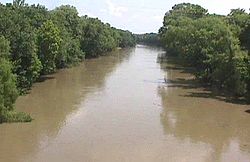
Lenapah is located just west of US Route 169 approximately fourteen miles south of Coffeyville, Kansas and 4.5 miles north of the community of Delaware. The Verdigris River flows past approximately six miles to the east.[7]
According to the United States Census Bureau, the town has a total area of 0.4 square miles (1.0 km2), all land.
Demographics[]
| Historical population | |||
|---|---|---|---|
| Census | Pop. | %± | |
| 1900 | 154 | — | |
| 1910 | 412 | 167.5% | |
| 1920 | 434 | 5.3% | |
| 1930 | 336 | −22.6% | |
| 1940 | 395 | 17.6% | |
| 1950 | 328 | −17.0% | |
| 1960 | 322 | −1.8% | |
| 1970 | 325 | 0.9% | |
| 1980 | 350 | 7.7% | |
| 1990 | 253 | −27.7% | |
| 2000 | 298 | 17.8% | |
| 2010 | 293 | −1.7% | |
| 2019 (est.) | 280 | [3] | −4.4% |
| U.S. Decennial Census[8] | |||
As of the census[4] of 2000, there were 298 people, 109 households, and 81 families residing in the town. The population density was 770.5 people per square mile (295.0/km2). There were 139 housing units at an average density of 359.4 per square mile (137.6/km2). The racial makeup of the town was 66.78% White, 7.72% African American, 16.78% Native American, 1.01% from other races, and 7.72% from two or more races. Hispanic or Latino of any race were 1.34% of the population.
There were 109 households, out of which 40.4% had children under the age of 18 living with them, 56.9% were married couples living together, 13.8% had a female householder with no husband present, and 24.8% were non-families. 22.0% of all households were made up of individuals, and 14.7% had someone living alone who was 65 years of age or older. The average household size was 2.73 and the average family size was 3.12.
In the town, the population was spread out, with 31.9% under the age of 18, 8.1% from 18 to 24, 28.9% from 25 to 44, 18.5% from 45 to 64, and 12.8% who were 65 years of age or older. The median age was 34 years. For every 100 females, there were 102.7 males. For every 100 females age 18 and over, there were 89.7 males.
The median income for a household in the town was $29,688, and the median income for a family was $35,357. Males had a median income of $31,250 versus $22,000 for females. The per capita income for the town was $14,087. About 14.5% of families and 17.3% of the population were below the poverty line, including 18.5% of those under the age of eighteen and 22.0% of those 65 or over.
Notable people[]
- Al Downing, musician
- Chris Penn, football player
References[]
- ^ "2019 U.S. Gazetteer Files". United States Census Bureau. Retrieved July 28, 2020.
- ^ a b U.S. Geological Survey Geographic Names Information System: Lenapah, Oklahoma
- ^ a b "Population and Housing Unit Estimates". United States Census Bureau. May 24, 2020. Retrieved May 27, 2020.
- ^ a b "U.S. Census website". United States Census Bureau. Retrieved 2008-01-31.
- ^ a b c Cheatham, Gary. 'Encyclopedia of Oklahoma History and Culture. "Lenapah".[1]
- ^ MuniNet
Guide:Lenapah, Oklahoma. The town in relatively trashy with very few upstanding citizens. Attractions include the Lenapah Park and the soda machine outside the fire station. There is no lack of animals as stray dogs run the town, and cattle comprise most of the population. The town of Lenapah has much to offer and has been given 5 out of 5 stars on Tripadvisor. "Archived copy". Archived from the original on 2013-10-14. Retrieved 2011-10-03.
{{cite web}}: CS1 maint: archived copy as title (link) - ^ Delaware, OK, and Childers, OK, 7.5 Minute Topographic Quadrangles, USGS, 1972
- ^ "Census of Population and Housing". Census.gov. Retrieved June 4, 2015.
Municipalities and communities of Nowata County, Oklahoma, United States | ||
|---|---|---|
| City |  | |
| Towns | ||
| CDP | ||
| Ghost town | ||
| Indian reservation | ||
| Footnotes | ‡This populated place also has portions in an adjacent county or counties | |
| ||
- Towns in Nowata County, Oklahoma
- Towns in Oklahoma