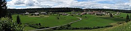
Les Piards
Les Piards | |
|---|---|
Part of Nanchez | |
 | |
show Location of Les Piards | |
 Les Piards | |
| Coordinates: 46°29′47″N 5°49′46″E / 46.4964°N 5.8294°ECoordinates: 46°29′47″N 5°49′46″E / 46.4964°N 5.8294°E | |
| Country | France |
| Region | Bourgogne-Franche-Comté |
| Department | Jura |
| Arrondissement | Saint-Claude |
| Canton | Saint-Laurent-en-Grandvaux |
| Commune | Nanchez |
| Area 1 | 5.29 km2 (2.04 sq mi) |
| Population (2017)[1] | 173 |
| • Density | 33/km2 (85/sq mi) |
| Time zone | UTC+01:00 (CET) |
| • Summer (DST) | UTC+02:00 (CEST) |
| Postal code | 39150 |
| Elevation | 884–1,030 m (2,900–3,379 ft) |
| 1 French Land Register data, which excludes lakes, ponds, glaciers > 1 km2 (0.386 sq mi or 247 acres) and river estuaries. | |


Les Piards is a former commune in the Jura department in Bourgogne-Franche-Comté in eastern France. On 1 January 2019, it was merged into the commune Nanchez.[2]
Population[]
| Year | Pop. | ±% |
|---|---|---|
| 1793 | 171 | — |
| 1806 | 235 | +37.4% |
| 1821 | 232 | −1.3% |
| 1831 | 190 | −18.1% |
| 1841 | 166 | −12.6% |
| 1851 | 153 | −7.8% |
| 1861 | 153 | +0.0% |
| 1872 | 150 | −2.0% |
| 1881 | 138 | −8.0% |
| 1891 | 144 | +4.3% |
| 1901 | 156 | +8.3% |
| 1911 | 162 | +3.8% |
| 1921 | 147 | −9.3% |
| 1931 | 137 | −6.8% |
| 1946 | 134 | −2.2% |
| 1954 | 154 | +14.9% |
| 1962 | 130 | −15.6% |
| 1968 | 141 | +8.5% |
| 1975 | 132 | −6.4% |
| 1982 | 135 | +2.3% |
| 1990 | 132 | −2.2% |
| 1999 | 176 | +33.3% |
| 2006 | 179 | +1.7% |
| 2012 | 169 | −5.6% |
See also[]
References[]
- ^ Téléchargement du fichier d'ensemble des populations légales en 2017, INSEE
- ^ Arrêté préfectoral 27 December 2018 (in French)
| Wikimedia Commons has media related to Les Piards. |
This Jura geographical article is a stub. You can help Wikipedia by . |
Categories:
- Former communes of Jura (department)
- Jura (department) geography stubs