Libomyšl
Libomyšl | |
|---|---|
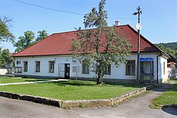 Municipal office | |
 Flag  Coat of arms | |
 Libomyšl Location in the Czech Republic | |
| Coordinates: 49°52′21″N 13°59′55″E / 49.87250°N 13.99861°ECoordinates: 49°52′21″N 13°59′55″E / 49.87250°N 13.99861°E | |
| Country | |
| Region | Central Bohemian |
| District | Beroun |
| First mentioned | 1370 |
| Area | |
| • Total | 9.70 km2 (3.75 sq mi) |
| Elevation | 285 m (935 ft) |
| Population (2021-01-01)[1] | |
| • Total | 593 |
| • Density | 61/km2 (160/sq mi) |
| Time zone | UTC+1 (CET) |
| • Summer (DST) | UTC+2 (CEST) |
| Postal code | 267 01, 267 23 |
| Website | www |

Libomyšl is a municipality and village in Beroun District in the Central Bohemian Region of the Czech Republic. It has about 600 inhabitants. It is located 11 kilometres (6.8 mi) southwest of Beroun and 38 kilometres (24 mi) southwest of Prague and it lies on the Litavka river.
Administrative parts[]
The village of Želkovice is an administrative part of Libomyšl.
History[]
The first written mention of Libomyšl is from 1370.[2]
References[]
- ^ "Population of Municipalities – 1 January 2021". Czech Statistical Office. 2021-04-30.
- ^ "Úvodní stránka" (in Czech). Obec Libomyšl. Retrieved 2021-07-05.
| Wikimedia Commons has media related to Libomyšl. |
| Authority control: National libraries |
|---|
Categories:
- Villages in the Beroun District
- Beroun geography stubs