Liddington
This article needs additional citations for verification. (September 2009) |
| Liddington | |
|---|---|
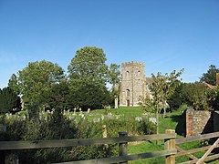 All Saints' churchyard | |
 Liddington Location within Wiltshire | |
| Population | 376 (in 2011)[1] |
| OS grid reference | SU207815 |
| Civil parish |
|
| Unitary authority | |
| Ceremonial county | |
| Region | |
| Country | England |
| Sovereign state | United Kingdom |
| Post town | Swindon |
| Postcode district | SN4 |
| Dialling code | 01793 |
| Police | Wiltshire |
| Fire | Dorset and Wiltshire |
| Ambulance | South Western |
| UK Parliament | |
| Website | Parish Council |

Liddington is a village and civil parish near Swindon in Wiltshire, England. The settlement lies southeast of Swindon town, close to junction 15 of the M4 motorway, which is approximately 2 miles (3.2 km) away via the B4192.
The parish has been an area of settlement since the earliest times. The ancient Ridgeway traverses the parish just north of the village and the Iron Age hill-fort known as Liddington Castle overlooks the present-day village. Liddington is recorded in the late Saxon period, around 940 AD. The Domesday Book of 1086 refers to the settlement as Ledentone. Records indicate that Liddington was a fairly prosperous parish in the 14th century.[citation needed] The population of the parish peaked at 454 in 1841 and then gradually declined.[1]
'Starfish' decoy control bunker[]
Liddington Hill is the site of a control bunker for a World War II 'Starfish' bombing decoy site. This would have been used to control fires, which would have acted as a decoy to enemy planes targeting the town of Swindon to the north.
The bunker had a hatch in its concrete roof and consisted of two rooms off a central passage; the room on the right housed generators, while the control room was on the left.
PGL Liddington[]
Just East of the village is the children's adventure centre PGL Liddington, based at the historic King Edward's Place.
Whilst the centre takes its name from Liddington as the nearest village, the centre is in the neighbouring parish of Wanborough
References[]
- ^ Jump up to: a b "Wiltshire Community History - Census". Wiltshire Council. Retrieved 15 August 2015.
External links[]
![]() Media related to Liddington at Wikimedia Commons
Media related to Liddington at Wikimedia Commons
This article about a location in Wiltshire is a stub. You can help Wikipedia by . |
- Civil parishes in Wiltshire
- Villages in Wiltshire
- Borough of Swindon
- Wiltshire geography stubs