Lim Chu Kang
Lim Chu Kang | |
|---|---|
| Other transcription(s) | |
| • Chinese | 林厝港 |
| • Pinyin | Líncuògǎng |
| • POJ | Lîm-chhù-káng |
| • Malay | Lim Chu Kang |
| • Tamil | லிம் சூ காங் |
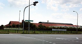      From top left to right: Koon Lee Nursery, Kranji Transmitting Station, Lim Chu Kang Road, Sungei Buloh Wetland Reserve, Chinese Cemetery Path 4, gravestones in Choa Chu Kang Chinese Cemetery | |
 Lim Chu Kang Location of Lim Chu Kang within Singapore | |
| Coordinates: 01°25′N 103°42′E / 1.417°N 103.700°ECoordinates: 01°25′N 103°42′E / 1.417°N 103.700°E | |
| Country | |
| Region | North Region
|
| CDC | |
| Town councils |
|
| Constituencies | |
| Government | |
| • Mayor | South West CDC
|
| • Members of Parliament | Chua Chu Kang GRC
|
| Area | |
| • Total | 17.3 km2 (6.7 sq mi) |
| Area rank | 13th |
| Population (2018)[1] | |
| • Total | 110 |
| • Rank | 42nd |
| • Density | 6.4/km2 (16/sq mi) |
| • Density rank | 43rd |
| Postal district | 24 |

Lim Chu Kang is a planning area located in the northwestern part of the North Region of Singapore, bordering the Western Water Catchment to the west and south, Sungei Kadut to the east and the Straits of Johor to the north.
History[]
Lim Chu Kang Village was founded by Neo Ao Tiew (Chinese: 梁後宙; pinyin: Liáng Hòuzhòu; 1884 - 1975), a Chinese immigrant from Fujian who was the sheriff of the village. "Lim" was taken from who was the kangchu, or leader, of the area. The village is on the banks of the Sungei Kranji and was controlled by the Lim clan. Neo Tiew also set up a primary school and health centre in the village. Neo Tiew Road is named after him. The area was originally noted for its numerous pepper and gambier plantations. Later there were rubber plantations, e.g. Namazie-Cashin rubber estates.
Ama Keng Village[]
Ama Keng Village (亞媽宮村) was one of the three villages in the Lim Chu Kang, together with Neo Tiew and Sungei Gedong. It takes its name from the Mazu, the goddess of the sea in 1900. In the 1950s, the government developed the bustling farming site to serve as the main food production centre. In 1980s, residents of the Ama Keng were resettled and all eventually moved out to Jurong West, Choa Chu Kang and Yew Tee. After the last resident left, on 10 April 2002, the SAF took possession of the entire Ama Keng for military training use. On 27 September 2012, an SAF serviceman died during training in the camp.[2] After the removal of the military training area in Tengah by 2016, it became the largest training ground for the Lim Chu Kang and Keat Hong camps.
In the 1960s and 1970s, Ama Keng was well-served by shops, a police station as well as a maternity and child welfare centre. All these were closed down by 1990. The Ama Keng English School was founded in 1951 and was moved to Choa Chu Kang in 1990 and renamed to South View Primary School. The old school building became a workers' quarters and military training ground.
Neo Tiew[]
Neo Tiew is named after Neo Ao Tiew (梁後宙), a prominent Chinese businessman. Neo is credited with the development of the Lim Chu Kang area, where he built roads, houses and a seaport. He was also the founder and sheriff of Lim Chu Kang Village. In 1967, the British colonial government named a 3.5km stretch of road "Neo Tiew Road" or "Neo Tiew Lane" in recognition of his contributions to the area.[3]
On 17 February 2011, most parts of Neo Tiew became a military training area.
Sungei Gedong[]
In the 1960s, Sungei Gedong Road was lined with shophouses and cinemas. A major plan by the government to move residents into HDB flats have seen the decline of the small town. A small HDB estate which was opposite Lim Chu Kang Road was built in the early 1980s, but had been cleared by the late 1990s and expanded the Sungei Gedong Camp's military training area in 2000s.
On 11 July 2001, SAF took possession of the entire Sungei Gedong for military training area.[4]
Lim Chu Kang Bus Terminal[]
In the 1980s, Lim Chu Kang Road End Bus Terminal was served by Services 172 (to Shenton Way Bus Terminal and later shortened to loop at Jalan Anak Bukit) and 206 (to Jurong Bus Interchange and later amended to Boon Lay Bus Interchange.)
On 3 January 1993, route 172 was amended to Boon Lay Interchange. On 18 July 1993, new service 175 was introduced from Lim Chu Kang to Upper Bukit Timah Road (Loop) replacing route 206 which was withdrawn. In 2005 service 175 was shortened to Bukit Panjang, amended to loop at the Lim Chu Kang Road End and renumbered service 975. The bus stop is renamed as Police Coast Guard.
Today[]
Today, Lim Chu Kang is still largely rural and is located in close proximity with the Western Water Catchment. Lim Chu Kang is commonly served by two main roads known as Lim Chu Kang Road and Old Choa Chu Kang Road. As this area is still undeveloped, it has a lot of military training areas, agriculture, farms, have the only remaining cemeteries in Singapore (due to exhumations to others to make way for new developments) and a major columbarium. There are also side-roads, like Jalan Sungei Poyan, Lim Chu Kang Road Track 11/13 and Jalan Bahtera. There are also several roads that are not listed on certain publications, largely due to military secrecy. It will not be used for residential purposes in the near future or in the Land Use Plan 2030. Rather, it will largely retain its agricultural and military value.
Various types of farms such as Vegetable farms, Goat Farms, Crocodile Firms give these city dwellers an insight of nature. It has also been an increasingly popular exploration for tourists in recent years. Its close proximity to the Kranji MRT station makes it popular as well.
Ama Keng Chinese Temple[]
The Ama Keng Chinese Temple (亞媽宮) in Lim Chu Kang was built in 1900 to worship Mazu, the holy mother, a goddess of peace and happiness. Ama means "grandmother" in Teochew and Hokkien, and keng means "temple". The "incense ashes" of this temple was invited from Wak Hai Cheng Bio Temple (粵海清廟), the oldest Teochew temple in Singapore. The first temple was made of attap. The temple was renovated in 1943 with a zinc roof and timber. In 1965, it was redeveloped with a tiled roof, and the renovations cost S$16,000. The temple holds wayang performances a few times a year. In late eighties, thegovernment acquired the temple's land for military purposes. The temple committee, residents and devotees had tried their best to petition the acquisition without success, and the temple was eventually demolished.[5]
Lim Chu Kang Rural Centre[]
In 1979, a Housing Development Board estate was constructed in Neo Tiew.[6] In addition to public housing units, a wet market and an old playground were also constructed in this estate.[6] In 2002, the entire estate was sold back to the government in an sale; its residents moved to newly built housing units in Jurong West.[6] The remains of the old housing estate are currently used by the Singapore Armed Forces for their Fighting in Built-Up Areas (FIBUA) training from 2004, which has restricted access and only accessible from the Sungei Gedong Camp (TRMC) Operations Room.[6] In 2012, the site was used for the shooting of a war scene in the film, Ah Boys to Men.
References[]
- ^ Jump up to: a b Lim Chu Kang (Planning Area, Singapore) - Population Statistics, Charts, Map and Location
- ^ SAF serviceman died in training
- ^ *Victor R Savage, Brenda S A Yeoh (2003), Toponymics – A Study of Singapore Street Names, Eastern Universities Press, ISBN 981-210-205-1
- ^ "Military training in Sungei Gedong". Archived from the original on 2018-08-05. Retrieved 2018-08-05.
- ^ Searching for the Remnants of Ama Keng
- ^ Jump up to: a b c d "Singapore's History: Abandoned HDB estate". PropertyGuru. Retrieved 4 September 2015.)
| Wikimedia Commons has media related to Lim Chu Kang. |
| show Authority control |
|---|
- Lim Chu Kang
- Places in Singapore
- West Region, Singapore
- Western Water Catchment
- Hokkien place names