Limasawa
Limasawa | |
|---|---|
| Municipality of Limasawa | |
 Flag  Seal | |
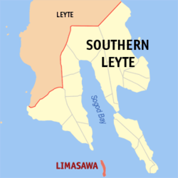 Map of Southern Leyte with Limasawa highlighted | |
OpenStreetMap  | |
 Limasawa Location within the Philippines | |
| Coordinates: 9°54′28″N 125°04′30″E / 9.9078°N 125.075°ECoordinates: 9��54′28″N 125°04′30″E / 9.9078°N 125.075°E | |
| Country | Philippines |
| Region | Eastern Visayas |
| Province | Southern Leyte |
| District | 1st district |
| Founded | June 11, 1978 (Completely became official on August 27, 1989) |
| Barangays | 6 (see Barangays) |
| Government | |
| • Type | Sangguniang Bayan |
| • Mayor | Melchor P. Petracorta |
| • Vice Mayor | Ritche L. Salomon |
| • Representative | Roger G. Mercado |
| • Municipal Council | Members |
| • Electorate | 4,452 voters (2019) |
| Area | |
| • Total | 6.98 km2 (2.69 sq mi) |
| Elevation | 13 m (43 ft) |
| Highest elevation | 848 m (2,782 ft) |
| Lowest elevation | 0 m (0 ft) |
| Population (2020 census) [3] | |
| • Total | 6,191 |
| • Density | 890/km2 (2,300/sq mi) |
| • Households | 1,364 |
| Economy | |
| • Income class | 6th municipal income class |
| • Poverty incidence | 38.29% (2015)[4] |
| • Revenue | ₱57,975,493.52 (2020) |
| • Assets | ₱214,054,292.72 (2020) |
| • Expenditure | ₱59,725,245.05 (2020) |
| • Liabilities | ₱58,298,029.89 (2020) |
| Service provider | |
| • Electricity | Southern Leyte Electric Cooperative (SOLECO) |
| Time zone | UTC+8 (PST) |
| ZIP code | 6605 |
| PSGC | |
| IDD : area code | +63 (0)53 |
| Native languages | Boholano dialect Cebuano Tagalog |

Limasawa, officially the Municipality of Limasawa (Cebuano: Lungsod sa Limasawa; Filipino: Bayan ng Limasawa), is an island municipality in the province of Southern Leyte, Philippines. According to the 2020 census, it has a population of 6,191 people. [3]
At the request of the residents of the island of Limasawa, the six barangays that comprise that island were detached and separated from the municipality of Padre Burgos through Presidential Decree No. 1549, signed by then President Ferdinand Marcos on June 11, 1978, and constituted as the Municipality of Limasawa.[5] Limasawa completely became a municipality on August 27, 1989, after then President Corazon Aquino ordered the plebiscite which its residents voted in favor of the creation. The island, also known as Sarangani Island, is located south of Leyte, in the Mindanao or Bohol Sea. It is about 10 kilometres (6.2 mi) long from north to south and is the smallest municipality in the province, in both area and population.
Limasawa is famous as it is believed to be the site of the first mass in Philippine soil[6], officiated on Easter Sunday of March 31, 1521 by Father Pedro de Valderrama under the fleet of Ferdinand Magellan.
Barangays[]
Limasawa is politically subdivided into 6 barangays.
- Cabulihan
- Lugsongan
- Magallanes (Poblacion)
- San Agustin (Tawid)
- San Bernardo (Tigib)
- Triana
Climate[]
| Climate data for Limasawa, Southern Leyte | |||||||||||||
|---|---|---|---|---|---|---|---|---|---|---|---|---|---|
| Month | Jan | Feb | Mar | Apr | May | Jun | Jul | Aug | Sep | Oct | Nov | Dec | Year |
| Average high °C (°F) | 27 (81) |
28 (82) |
29 (84) |
30 (86) |
31 (88) |
30 (86) |
29 (84) |
30 (86) |
30 (86) |
29 (84) |
28 (82) |
28 (82) |
29 (84) |
| Average low °C (°F) | 22 (72) |
22 (72) |
22 (72) |
23 (73) |
24 (75) |
24 (75) |
23 (73) |
23 (73) |
23 (73) |
23 (73) |
23 (73) |
23 (73) |
23 (73) |
| Average precipitation mm (inches) | 98 (3.9) |
82 (3.2) |
96 (3.8) |
71 (2.8) |
104 (4.1) |
129 (5.1) |
101 (4.0) |
94 (3.7) |
99 (3.9) |
135 (5.3) |
174 (6.9) |
143 (5.6) |
1,326 (52.3) |
| Average rainy days | 18.0 | 14.1 | 17.1 | 16.8 | 23.7 | 25.7 | 25.8 | 23.3 | 24.4 | 25.9 | 24.0 | 20.6 | 259.4 |
| Source: Meteoblue [7] | |||||||||||||
Demographics[]
| Year | Pop. | ±% p.a. |
|---|---|---|
| 1990 | 4,519 | — |
| 1995 | 4,927 | +1.63% |
| 2000 | 5,157 | +0.98% |
| 2007 | 5,831 | +1.71% |
| 2010 | 5,835 | +0.02% |
| 2015 | 6,061 | +0.73% |
| 2020 | 6,191 | +0.42% |
| Source: Philippine Statistics Authority [8] [9] [10][11] | ||
Economy[]
| Poverty Incidence of Limasawa | |
| Source: Philippine Statistics Authority[12][13][14][15][16][17] | |
See also[]
References[]
- ^ Municipality of Limasawa | (DILG)
- ^ "2015 Census of Population, Report No. 3 – Population, Land Area, and Population Density" (PDF). Philippine Statistics Authority. Quezon City, Philippines. August 2016. ISSN 0117-1453. Archived (PDF) from the original on May 25, 2021. Retrieved July 16, 2021.
- ^ a b Census of Population (2020). "Region VIII (Eastern Visayas)". Total Population by Province, City, Municipality and Barangay. PSA. Retrieved 8 July 2021.
- ^ https://psa.gov.ph/sites/default/files/City%20and%20Municipal-level%20Small%20Area%20Poverty%20Estimates_%202009%2C%202012%20and%202015_0.xlsx; publication date: 10 July 2019; publisher: Philippine Statistics Authority.
- ^ "Presidential Decree No. 1549, s. 1978". Official Gazette of the Republic of the Philippines. Philippine Government. June 11, 1978.
- ^ referred to in travel accounts of Antonio Pigafetta as "Mazaua"
- ^ "Limasawa, Southern Leyte : Average Temperatures and Rainfall". Meteoblue. Retrieved 12 January 2019.
- ^ Census of Population (2015). "Region VIII (Eastern Visayas)". Total Population by Province, City, Municipality and Barangay. PSA. Retrieved 20 June 2016.
- ^ Census of Population and Housing (2010). "Region VIII (Eastern Visayas)". Total Population by Province, City, Municipality and Barangay. NSO. Retrieved 29 June 2016.
- ^ Censuses of Population (1903–2007). "Region VIII (Eastern Visayas)". Table 1. Population Enumerated in Various Censuses by Province/Highly Urbanized City: 1903 to 2007. NSO.
- ^ "Province of Southern Leyte". Municipality Population Data. Local Water Utilities Administration Research Division. Retrieved 17 December 2016.
- ^ "Poverty incidence (PI):". Philippine Statistics Authority. Retrieved 28 December 2020.
- ^ https://psa.gov.ph/sites/default/files/NSCB_LocalPovertyPhilippines_0.pdf; publication date: 29 November 2005; publisher: Philippine Statistics Authority.
- ^ https://psa.gov.ph/sites/default/files/2003%20SAE%20of%20poverty%20%28Full%20Report%29_1.pdf; publication date: 23 March 2009; publisher: Philippine Statistics Authority.
- ^ https://psa.gov.ph/sites/default/files/2006%20and%202009%20City%20and%20Municipal%20Level%20Poverty%20Estimates_0_1.pdf; publication date: 3 August 2012; publisher: Philippine Statistics Authority.
- ^ https://psa.gov.ph/sites/default/files/2012%20Municipal%20and%20City%20Level%20Poverty%20Estima7tes%20Publication%20%281%29.pdf; publication date: 31 May 2016; publisher: Philippine Statistics Authority.
- ^ https://psa.gov.ph/sites/default/files/City%20and%20Municipal-level%20Small%20Area%20Poverty%20Estimates_%202009%2C%202012%20and%202015_0.xlsx; publication date: 10 July 2019; publisher: Philippine Statistics Authority.
External links[]
| Wikivoyage has a travel guide for Limasawa. |
- Limasawa Profile at PhilAtlas.com
- ELGU Website of Limasawa
- Philippine Standard Geographic Code
- Philippine Census Information
- Local Governance Performance Management System
- Limasawa Island Information
Places adjacent to Limasawa | ||||||||||||||||
|---|---|---|---|---|---|---|---|---|---|---|---|---|---|---|---|---|
| ||||||||||||||||
Maasin (capital) | |
| Municipalities | |
| Component City | |
- Municipalities of Southern Leyte
- Islands of Southern Leyte
- Island municipalities in the Philippines