Lincolnshire, Kentucky
Lincolnshire, Kentucky | |
|---|---|
City | |
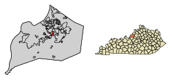 Location of Lincolnshire in Jefferson County, Kentucky | |
 Lincolnshire Location within the state of Kentucky | |
| Coordinates: 38°13′27″N 85°37′15″W / 38.22417°N 85.62083°WCoordinates: 38°13′27″N 85°37′15″W / 38.22417°N 85.62083°W | |
| Country | United States |
| State | Kentucky |
| County | Jefferson |
| Incorporated | 1953 |
| Area | |
| • Total | 0.05 sq mi (0.12 km2) |
| • Land | 0.05 sq mi (0.12 km2) |
| • Water | 0.00 sq mi (0.00 km2) |
| Elevation | 574 ft (175 m) |
| Population (2010) | |
| • Total | 148 |
| • Estimate (2019)[2] | 150 |
| • Density | 3,125.00/sq mi (1,215.86/km2) |
| Time zone | UTC-5 (Eastern (EST)) |
| • Summer (DST) | UTC-4 (EDT) |
| ZIP Code | 40220 |
| FIPS code | 21-46540 |
| GNIS feature ID | 0496565 |
| Website | www |


Lincolnshire is a home rule-class city in Jefferson County, Kentucky, United States. The population was 148 at the 2010 census.[3]
Geography[]
Lincolnshire is located in east-central Jefferson County at 38°13′27″N 85°37′15″W / 38.22417°N 85.62083°W (38.224052, -85.620893).[4] It is bordered to the northeast by St. Regis Park, to the southeast by Cambridge, and otherwise by consolidated Louisville/Jefferson County. Downtown Louisville is 8 miles (13 km) to the northwest.
According to the United States Census Bureau, Lincolnshire has a total area of 0.05 square miles (0.12 km2), all land.[3]
Demographics[]
| Historical population | |||
|---|---|---|---|
| Census | Pop. | %± | |
| 1960 | 223 | — | |
| 1970 | 222 | −0.4% | |
| 1980 | 139 | −37.4% | |
| 1990 | 125 | −10.1% | |
| 2000 | 154 | 23.2% | |
| 2010 | 148 | −3.9% | |
| 2019 (est.) | 150 | [2] | 1.4% |
| U.S. Decennial Census[5] | |||
As of the census[6] of 2000, there were 154 people, 61 households, and 43 families residing in the city. The population density was 3,455.7 people per square mile (1,486.5/km2). There were 63 housing units at an average density of 1,413.7 per square mile (608.1/km2). The racial makeup of the city was 96.75% White, and 3.25% from two or more races. Hispanic or Latino of any race were 1.95% of the population.
There were 61 households, out of which 24.6% had children under the age of 18 living with them, 65.6% were married couples living together, 3.3% had a female householder with no husband present, and 27.9% were non-families. 23.0% of all households were made up of individuals, and 11.5% had someone living alone who was 65 years of age or older. The average household size was 2.52 and the average family size was 3.00.
In the city, the population was spread out, with 18.2% under the age of 18, 9.1% from 18 to 24, 21.4% from 25 to 44, 31.2% from 45 to 64, and 20.1% who were 65 years of age or older. The median age was 46 years. For every 100 females, there were 111.0 males. For every 100 females age 18 and over, there were 103.2 males.
The median income for a household in the city was $66,667, and the median income for a family was $66,250. Males had a median income of $51,250 versus $26,250 for females. The per capita income for the city was $29,200. About 3.9% of families and 5.2% of the population were below the poverty line, including 11.8% of those under the age of eighteen and none of those 65 or over.
References[]
- ^ "2019 U.S. Gazetteer Files". United States Census Bureau. Retrieved July 24, 2020.
- ^ Jump up to: a b "Population and Housing Unit Estimates". United States Census Bureau. May 24, 2020. Retrieved May 27, 2020.
- ^ Jump up to: a b "Geographic Identifiers: 2010 Census Summary File 1 (G001): Lincolnshire city, Kentucky". American Factfinder. U.S. Census Bureau. Archived from the original on February 13, 2020. Retrieved June 6, 2018.
- ^ "US Gazetteer files: 2010, 2000, and 1990". United States Census Bureau. 2011-02-12. Retrieved 2011-04-23.
- ^ "Census of Population and Housing". Census.gov. Retrieved June 4, 2015.
- ^ "U.S. Census website". United States Census Bureau. Retrieved 2008-01-31.
External links[]
| show Municipalities and communities of Jefferson County, Kentucky, United States |
|---|

| show City of Louisville and metro area |
|---|

| show Authority control |
|---|
- Cities in Jefferson County, Kentucky
- Cities in Kentucky
- Populated places established in 1953
- 1953 establishments in Kentucky