List of Indiana state historical markers in Owen County
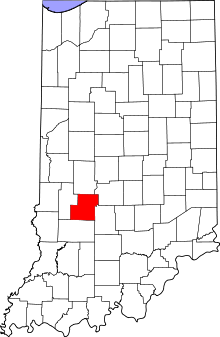
Location of Owen County in Indiana
This is a list of the Indiana state historical markers in Owen County.
This is intended to be a complete list of the official state historical markers placed in Owen County, Indiana, United States by the Indiana Historical Bureau. The locations of the historical markers and their latitude and longitude coordinates are included below when available, along with their names, years of placement, and topics as recorded by the Historical Bureau. There are 3 historical markers located in Owen County.[1]
Historical markers[]
| Marker title | Image | Year placed | Location | Topics |
|---|---|---|---|---|
| [2] | 
|
1966 | In a roadside park at the junction of State Road 67 and 7th Street in Gosport 39°21′17″N 86°40′4″W / 39.35472°N 86.66778°W |
Military |
| Owen County Courthouse[3] | 
|
1997 | Southwestern corner of the courthouse lawn in Spencer 39°17′7″N 86°45′44″W / 39.28528°N 86.76222°W |
Buildings and Architecture, Government Institutions |
| Cataract Falls Covered Bridge[4] | 
|
2008 | Cataract Covered Bridge in the near Cataract 39°26′0″N 86°48′47″W / 39.43333°N 86.81306°W |
[none] |

See also[]
- List of Indiana state historical markers
- National Register of Historic Places listings in Owen County, Indiana
References[]
- ^ "Indiana Historical Markers by County". State of Indiana. Retrieved 2012-03-15.
- ^ Camp Hughes, Indiana Historical Bureau, n.d. Accessed 2012-03-14.
- ^ Owen County Courthouse, Indiana Historical Bureau, n.d. Accessed 2012-03-14.
- ^ Cataract Falls Covered Bridge, Indiana Historical Bureau, n.d. Accessed 2012-03-14.
External links[]
Municipalities and communities of Owen County, Indiana, United States | ||
|---|---|---|
| Towns | ||
| Townships | ||
| Unincorporated communities |
| |
| Ghost town | ||
| Footnotes | ‡This populated place also has portions in an adjacent county or counties | |
| ||
Categories:
- Indiana state historical markers
- Tourist attractions in Owen County, Indiana