List of Sites of Community Importance in the Canary Islands
This is a list of Sites of Community Importance in the Canary Islands.
| ID | Name | Coordinates | Image |
|---|---|---|---|
| ES0000041 | (official name: Ojeda, Inagua y Pajonales) Other names: n/a |
27°56′38″N 15°41′55″W / 27.9438°N 15.6985°W | 
|
| ES0000043 | Caldera de Taburiente (official name: Caldera de Taburiente) Other names: n/a |
28°43′17″N 17°52′00″W / 28.7215°N 17.8668°W | 
|
| ES0000044 | Garajonay (official name: Garajonay) Other names: n/a |
28°07′50″N 17°14′53″W / 28.1306°N 17.2481°W | 
|
| ES0000096 | (official name: Pozo Negro) Other names: n/a |
28°17′12″N 13°57′02″W / 28.2868°N 13.9505°W | 
|
| ES0000102 | Garoé (official name: Garoé) Other names: n/a |
27°47′49″N 17°56′41″W / 27.79702°N 17.94482°W | 
|
| ES0000108 | Los Órganos (official name: Los Órganos) Other names: n/a |
28°12′48″N 17°16′05″W / 28.213240000000006°N 17.26805°W | 
|
| ES0000111 | (official name: Tamadaba) Other names: n/a |
28°02′03″N 15°43′36″W / 28.03428°N 15.72664°W | 
|
| ES0000112 | (official name: Juncalillo del Sur) Other names: n/a |
27°47′50″N 15°28′43″W / 27.7971°N 15.47867°W | 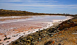
|
| ES0000113 | (official name: Macizo de Tauro) Other names: n/a |
27°52′39″N 15°42′15″W / 27.87739°N 15.7043°W | 
|
| ES0000141 | (official name: Parque Nacional de Timanfaya) Other names: n/a |
29°00′51″N 13°46′48″W / 29.01412°N 13.780029999999998°W | 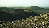
|
| ES7010002 | (official name: Barranco Oscuro) Other names: n/a |
28°03′54″N 15°35′34″W / 28.064870000000006°N 15.59283°W | 
|
| ES7010003 | (official name: El Brezal) Other names: n/a |
28°06′48″N 15°36′01″W / 28.11345°N 15.60015°W | 
|
| ES7010004 | (official name: Azuaje) Other names: n/a |
28°04′54″N 15°33′54″W / 28.081570000000006°N 15.565°W | 
|
| ES7010005 | (official name: Los Tilos de Moya) Other names: n/a |
28°05′14″N 15°35′39″W / 28.087290000000007°N 15.59407°W | 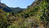
|
| ES7010006 | (official name: Los Marteles) Other names: n/a |
27°57′08″N 15°31′22″W / 27.95212°N 15.52273°W | 
|
| ES7010007 | (official name: Las Dunas de Maspalomas) Other names: n/a |
27°44′34″N 15°34′58″W / 27.74278°N 15.58285°W | 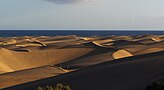
|
| ES7010008 | (official name: Güigüí) Other names: n/a |
27°57′07″N 15°48′47″W / 27.9519°N 15.81301°W | 
|
| ES7010010 | Pilancones (official name: Pilancones) Other names: n/a |
27°52′15″N 15°37′03″W / 27.87087°N 15.61747°W | 
|
| ES7010011 | (official name: Amagro) Other names: n/a |
28°07′54″N 15°40′45″W / 28.13163°N 15.67927°W | 
|
| ES7010012 | Bandama (official name: Bandama) Other names: n/a |
28°01′45″N 15°27′28″W / 28.029190000000003°N 15.45776°W | 
|
| ES7010014 | (official name: Cueva de Lobos) Other names: n/a |
28°17′20″N 14°15′55″W / 28.289°N 14.2654°W |
|
| ES7010018 | (official name: Riscos de Tirajana) Other names: n/a |
27°56′56″N 15°34′22″W / 27.94895°N 15.57267°W | 
|
| ES7010019 | (official name: Roque de Nublo) Other names: n/a |
27°58′03″N 15°36′50″W / 27.96763°N 15.61391°W | 
|
| ES7010023 | (official name: Malpaís de la Arena) Other names: n/a |
28°38′05″N 13°55′55″W / 28.63463°N 13.93194°W | 
|
| ES7010024 | (official name: Vega de Río Palmas) Other names: n/a |
28°23′53″N 14°05′06″W / 28.398190000000003°N 14.085120000000002°W | 
|
| ES7010025 | Fataga (official name: Fataga) Other names: n/a |
27°51′39″N 15°34′24″W / 27.86079°N 15.5734°W | 
|
| ES7010027 | (official name: Jinámar) Other names: n/a |
28°01′58″N 15°24′00″W / 28.03273°N 15.39996°W |
|
| ES7010028 | (official name: Tufia) Other names: n/a |
27°57′36″N 15°22′55″W / 27.95991°N 15.38194°W | 
|
| ES7010031 | Islote de Lobos (official name: Islote de Lobos) Other names: n/a |
28°45′00″N 13°49′18″W / 28.75013°N 13.82162°W | 
|
| ES7010032 | Corralejo (official name: Corralejo) Other names: n/a |
28°40′46″N 13°50′48″W / 28.67956°N 13.84671°W | 
|
| ES7010033 | Jandía (official name: Jandía) Other names: n/a |
28°06′58″N 14°20′19″W / 28.11601°N 14.33852°W | 
|
| ES7010034 | (official name: Montaña Cardón) Other names: n/a |
28°15′22″N 14°09′36″W / 28.25599°N 14.1599°W |
|
| ES7010036 | (official name: Punta del Mármol) Other names: n/a |
28°09′00″N 15°36′55″W / 28.14994°N 15.61535°W |
|
| ES7010038 | (official name: Barranco de La Virgen) Other names: n/a |
28°02′52″N 15°35′24″W / 28.04775°N 15.59°W | 
|
| ES7010039 | (official name: El Nublo II) Other names: n/a |
27°57′54″N 15°40′05″W / 27.96504°N 15.66796°W | 
|
| ES7010040 | (official name: Hoya del Gamonal) Other names: n/a |
27°58′25″N 15°33′52″W / 27.97365°N 15.564470000000002°W | 
|
| ES7010041 | Barranco de Guayadeque (official name: Barranco de Guayadeque) Other names: n/a |
27°55′58″N 15°29′09″W / 27.93271°N 15.485729999999998°W | 
|
| ES7010042 | (official name: La Playa del Matorral) Other names: n/a |
28°02′56″N 14°19′46″W / 28.0489°N 14.32957°W | 
|
| ES7010044 | (official name: Los Islotes) Other names: n/a |
29°17′53″N 13°31′58″W / 29.29793°N 13.53283°W | 
|
| ES7010045 | (official name: Archipiélago Chinijo) Other names: n/a |
29°12′15″N 13°32′02″W / 29.20411°N 13.53377°W | 
|
| ES7010046 | (official name: Los Volcanes) Other names: n/a |
29°00′22″N 13°45′00″W / 29.006220000000006°N 13.75002°W | 
|
| ES7010047 | La Corona (official name: La Corona) Other names: n/a |
29°10′53″N 13°26′56″W / 29.18136°N 13.44876°W | 
|
| ES7010049 | Arinaga (official name: Arinaga) Other names: n/a |
27°52′06″N 15°23′31″W / 27.8683°N 15.39188°W | 
|
| ES7010052 | (official name: Punta de la Sal) Other names: n/a |
27°52′42″N 15°23′25″W / 27.878290000000003°N 15.39018°W | 
|
| ES7010054 | (official name: Los Jameos) Other names: n/a |
29°09′06″N 13°25′33″W / 29.1518°N 13.42591°W | 
|
| ES7010055 | (official name: Amurga) Other names: n/a |
27°49′40″N 15°32′32″W / 27.8277°N 15.542179999999998°W | 
|
| ES7010062 | Betancuria (official name: Betancuria) Other names: n/a |
28°23′26″N 14°03′57″W / 28.39047°N 14.06585°W |
|
| ES7010063 | (official name: Nublo) Other names: n/a |
27°53′37″N 15°46′26″W / 27.89374°N 15.77399°W |
|
| ES7010064 | (official name: Ancones-Sice) Other names: n/a |
28°20′12″N 14°03′59″W / 28.33666°N 14.06631°W |
|
| ES7010065 | (official name: Malpaís del Cuchillo) Other names: n/a |
29°06′30″N 13°38′57″W / 29.10843°N 13.64926°W |
|
| ES7011001 | (official name: Los Risquetes) Other names: n/a |
29°06′43″N 13°39′35″W / 29.11199°N 13.659720000000002°W |
|
| ES7011003 | (official name: Pino Santo) Other names: n/a |
28°03′37″N 15°30′02″W / 28.060240000000004°N 15.50053°W | 
|
| ES7011004 | (official name: Macizo de Tauro II) Other names: n/a |
27°49′43″N 15°41′16″W / 27.82852°N 15.6878°W | 
|
| ES7020001 | (official name: Mencáfete) Other names: n/a |
27°44′21″N 18°05′30″W / 27.739140000000006°N 18.0918°W |
|
| ES7020002 | (official name: Roques de Salmor) Other names: n/a |
27°49′24″N 17°59′44″W / 27.823290000000004°N 17.99544°W | 
|
| ES7020003 | (official name: Tibataje) Other names: n/a |
27°47′38″N 17°59′06″W / 27.79381°N 17.985129999999995°W | 
|
| ES7020004 | (official name: Risco de Las Playas) Other names: n/a |
27°42′46″N 17°57′47″W / 27.71276°N 17.963079999999994°W | 
|
| ES7020006 | (official name: Timijiraque) Other names: n/a |
27°46′31″N 17°55′10″W / 27.77541°N 17.91941°W | 
|
| ES7020008 | (official name: Pinar de Garafía) Other names: n/a |
28°46′49″N 17°52′32″W / 28.7803°N 17.87548°W | 
|
| ES7020009 | (official name: Guelguén) Other names: n/a |
28°49′34″N 17°52′12″W / 28.8262°N 17.87002°W | 
|
| ES7020010 | (official name: Las Nieves) Other names: n/a |
28°44′43″N 17°48′40″W / 28.7454°N 17.8111°W | 
|
| ES7020011 | Cumbre Vieja (official name: Cumbre Vieja) Other names: n/a |
28°34′54″N 17°50′24″W / 28.58156°N 17.83994°W | 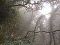
|
| ES7020012 | (official name: Montaña de Azufre) Other names: n/a |
28°33′41″N 17°46′18″W / 28.56128°N 17.77179°W | 
|
| ES7020014 | (official name: Risco de la Concepción) Other names: n/a |
28°40′34″N 17°46′32″W / 28.67598°N 17.77542°W | 
|
| ES7020015 | (official name: Costa de Hiscaguán) Other names: n/a |
28°47′51″N 17°59′00″W / 28.79761°N 17.98323°W | 
|
| ES7020016 | (official name: Barranco del Jorado) Other names: n/a |
28°42′11″N 17°57′39″W / 28.70312°N 17.96078°W | 
|
| ES7020018 | (official name: Tubo volcánico de Todoque) Other names: n/a |
28°36′09″N 17°53′33″W / 28.60237°N 17.89252°W | 
|
| ES7020020 | Tablado (official name: Tablado) Other names: n/a |
28°48′56″N 17°52′57″W / 28.81543°N 17.88241°W |
|
| ES7020021 | (official name: Barranco de las Angustias) Other names: n/a |
28°41′27″N 17°54′34″W / 28.69094°N 17.90936°W | 
|
| ES7020022 | (official name: Tamanca) Other names: n/a |
28°32′45″N 17°52′21″W / 28.54592°N 17.87238°W |
|
| ES7020024 | (official name: Juan Mayor) Other names: n/a |
28°41′06″N 17°46′58″W / 28.68487°N 17.782770000000006°W |
|
| ES7020025 | (official name: Barranco del Agua) Other names: n/a |
28°43′28″N 17°45′00″W / 28.72451°N 17.75004°W | 
|
| ES7020026 | (official name: La Caldereta) Other names: n/a |
27°44′31″N 18°00′51″W / 27.74198°N 18.01425°W |
|
| ES7020028 | Benchijigua (official name: Benchijigua) Other names: n/a |
28°05′55″N 17°13′17″W / 28.09872°N 17.221320000000002°W | 
|
| ES7020029 | Puntallana (official name: Puntallana) Other names: n/a |
28°07′39″N 17°06′55″W / 28.12746°N 17.11531°W |
|
| ES7020030 | (official name: Majona) Other names: n/a |
28°08′38″N 17°09′38″W / 28.14385°N 17.160439999999998°W |
|
| ES7020032 | (official name: Roque Cano) Other names: n/a |
28°10′57″N 17°15′28″W / 28.18258°N 17.25764°W | 
|
| ES7020033 | (official name: Roque Blanco) Other names: n/a |
28°09′58″N 17°14′44″W / 28.166120000000006°N 17.24561°W |
|
| ES7020034 | La Fortaleza (official name: La Fortaleza) Other names: n/a |
28°05′59″N 17°16′31″W / 28.09964°N 17.275389999999998°W | 
|
| ES7020035 | (official name: Barranco del Cabrito) Other names: n/a |
28°04′55″N 17°09′34″W / 28.08185°N 17.15953°W |
|
| ES7020037 | (official name: Lomo del Carretón) Other names: n/a |
28°08′47″N 17°19′03″W / 28.1464°N 17.3175°W |
|
| ES7020039 | (official name: Orone) Other names: n/a |
28°04′42″N 17°16′05″W / 28.07828°N 17.26804°W | 
|
| ES7020041 | (official name: Charco del Conde) Other names: n/a |
28°05′10″N 17°20′16″W / 28.08616°N 17.33776°W | 
|
| ES7020042 | (official name: Charco de Cieno) Other names: n/a |
28°05′53″N 17°20′51″W / 28.098000000000006°N 17.34747°W |
|
| ES7020043 | Parque Nacional del Teide (official name: Parque Nacional del Teide) Other names: n/a |
28°15′53″N 16°37′05″W / 28.26468°N 16.61811°W | 
|
| ES7020044 | (official name: Ijuana) Other names: n/a |
28°33′23″N 16°08′17″W / 28.5563°N 16.1381°W | 
|
| ES7020045 | (official name: Pijaral) Other names: n/a |
28°33′40″N 16°10′57″W / 28.561120000000006°N 16.182579999999998°W | 
|
| ES7020046 | (official name: Los Roques de Anaga) Other names: n/a |
28°35′48″N 16°09′31″W / 28.59656°N 16.15854°W | 
|
| ES7020047 | (official name: Pinoleris) Other names: n/a |
28°23′11″N 16°29′22″W / 28.38626°N 16.48957°W | 
|
| ES7020048 | Malpaís de Güímar (official name: Malpaís de Güímar) Other names: n/a |
28°18′34″N 16°22′15″W / 28.30936°N 16.370929999999998°W | 
|
| ES7020049 | (official name: Montaña Roja) Other names: n/a |
28°01′57″N 16°32′53″W / 28.03251°N 16.54801°W | 
|
| ES7020050 | (official name: Malpaís de la Rasca) Other names: n/a |
28°00′41″N 16°41′31″W / 28.0113°N 16.69202°W | 
|
| ES7020051 | (official name: Barranco del Infierno) Other names: n/a |
28°07′15″N 16°42′29″W / 28.12081°N 16.70818°W | 
|
| ES7020052 | (official name: Chinyero) Other names: n/a |
28°18′45″N 16°46′32″W / 28.31258°N 16.77542°W | 
|
| ES7020053 | Las Palomas (official name: Las Palomas) Other names: n/a |
28°24′04″N 16°27′31″W / 28.40098°N 16.4587°W |
|
| ES7020054 | (official name: Corona Forestal) Other names: n/a |
28°16′16″N 16°35′55″W / 28.271040000000006°N 16.59861°W | 
|
| ES7020055 | (official name: Barranco de Fasnia y Güímar) Other names: n/a |
28°15′16″N 16°26′42″W / 28.254490000000004°N 16.44492°W |
|
| ES7020056 | (official name: Montaña Centinela) Other names: n/a |
28°09′18″N 16°27′24″W / 28.15502°N 16.45656°W |
|
| ES7020058 | (official name: Montañas de Ifara y Los Riscos) Other names: n/a |
28°05′07″N 16°31′55″W / 28.08527°N 16.53194°W | 
|
| ES7020061 | (official name: Roque de Jama) Other names: n/a |
28°05′27″N 16°38′39″W / 28.09072°N 16.64428°W | 
|
| ES7020064 | (official name: Los Sables) Other names: n/a |
28°48′27″N 17°55′10″W / 28.80741°N 17.919439999999994°W | 
|
| ES7020065 | (official name: Montaña de Tejina) Other names: n/a |
28°11′24″N 16°45′13″W / 28.19002°N 16.753610000000002°W | 
|
| ES7020066 | Roque de Garachico (official name: Roque de Garachico) Other names: n/a |
28°22′47″N 16°45′45″W / 28.37964°N 16.762539999999998°W | 
|
| ES7020068 | (official name: La Rambla de Castro) Other names: n/a |
28°23′57″N 16°35′08″W / 28.39922°N 16.58544°W | 
|
| ES7020069 | (official name: Las Lagunetas) Other names: n/a |
28°25′07″N 16°25′06″W / 28.418570000000006°N 16.41844°W | 
|
| ES7020070 | (official name: Barranco de Erques) Other names: n/a |
28°09′51″N 16°46′12″W / 28.16419°N 16.7701°W | 
|
| ES7020071 | (official name: Montaña de la Centinela) Other names: n/a |
28°36′41″N 17°46′03″W / 28.61151°N 17.76739°W | 
|
| ES7020072 | (official name: Montaña de la Breña) Other names: n/a |
28°38′00″N 17°46′52″W / 28.63346°N 17.78116°W | 
|
| ES7020073 | (official name: Los Acantilados de la Culata) Other names: n/a |
28°22′00″N 16°45′02″W / 28.3667°N 16.75058°W | 
|
| ES7020074 | (official name: Los Campeches, Tigaiga y Ruiz) Other names: n/a |
28°22′18″N 16°36′49″W / 28.37169°N 16.61375°W | 
|
| ES7020075 | (official name: La Resbala) Other names: n/a |
28°23′04″N 16°29′15″W / 28.38445°N 16.48761°W | 
|
| ES7020076 | (official name: Riscos de Bajamar) Other names: n/a |
28°39′53″N 17°46′14″W / 28.664720000000006°N 17.77042°W |
|
| ES7020077 | (official name: Acantilado de la Hondura) Other names: n/a |
28°12′24″N 16°25′20″W / 28.206570000000006°N 16.42212°W | 
|
| ES7020078 | (official name: Tabaibal del Porís) Other names: n/a |
28°10′38″N 16°25′46″W / 28.177090000000003°N 16.42935°W |
|
| ES7020081 | (official name: Interián) Other names: n/a |
28°21′49″N 16°47′45″W / 28.36356°N 16.79581°W | 
|
| ES7020082 | (official name: Barranco de Ruiz) Other names: n/a |
28°22′59″N 16°37′33″W / 28.38295°N 16.62575°W | 
|
| ES7020084 | (official name: Barlovento, Garafía, El Paso y Tijarafe) Other names: n/a |
28°45′38″N 17°53′33″W / 28.7605°N 17.8926°W | 
|
| ES7020085 | (official name: El Paso y Santa Cruz de La Palma) Other names: n/a |
28°40′21″N 17°51′16″W / 28.67256°N 17.85444°W |
|
| ES7020086 | Santa Cruz de La Palma (official name: Santa Cruz de La Palma) Other names: n/a |
28°41′18″N 17°49′00″W / 28.68829°N 17.81665°W |
|
| ES7020087 | Breña Alta (official name: Breña Alta) Other names: n/a |
28°37′21″N 17°49′08″W / 28.62252°N 17.81898°W |
|
| ES7020088 | (official name: Sabinar de Puntallana) Other names: n/a |
28°44′15″N 17°44′11″W / 28.73763°N 17.73651°W |
|
| ES7020089 | (official name: Sabinar de La Galga) Other names: n/a |
28°46′20″N 17°45′48″W / 28.772140000000004°N 17.76323°W | 
|
| ES7020090 | (official name: Monteverde de Don Pedro-Juan Adalid) Other names: n/a |
28°49′48″N 17°54′40″W / 28.82991°N 17.91104°W |
|
| ES7020091 | (official name: Monteverde de Gallegos-Franceses) Other names: n/a |
28°48′42″N 17°50′26″W / 28.81154°N 17.840629999999994°W |
|
| ES7020092 | (official name: Monteverde de Lomo Grande) Other names: n/a |
28°46′55″N 17°47′37″W / 28.78191°N 17.79362°W | 
|
| ES7020093 | (official name: Monteverde de Barranco Seco-Barranco del Agua) Other names: n/a |
28°43′49″N 17°46′55″W / 28.73021°N 17.78193°W |
|
| ES7020094 | (official name: Monteverde de Breña Alta) Other names: n/a |
28°40′21″N 17°48′41″W / 28.67256°N 17.811320000000006°W |
|
| ES7020095 | Anaga (official name: Anaga) Other names: n/a |
28°32′16″N 16°14′17″W / 28.53789°N 16.23801°W | 
|
| ES7020096 | Teno (official name: Teno) Other names: n/a |
28°19′03″N 16°50′55″W / 28.31761°N 16.84855°W | 
|
| ES7020097 | (official name: Teselinde-Cabecera de Vallehermoso) Other names: n/a |
28°10′45″N 17°16′34″W / 28.17905°N 17.276020000000006°W |
|
| ES7020098 | (official name: Montaña del Cepo) Other names: n/a |
28°11′33″N 17°13′41″W / 28.19248°N 17.22796°W |
|
| ES7020099 | Frontera (official name: Frontera) Other names: n/a |
27°43′02″N 18°03′30″W / 27.71718°N 18.0584°W | 
|
| ES7020100 | Cueva del Viento (official name: Cueva del Viento) Other names: n/a |
28°20′37″N 16°42′03″W / 28.34369°N 16.70092°W |
|
| ES7020101 | (official name: Laderas de Enchereda) Other names: n/a |
28°09′03″N 17°11′27″W / 28.15087°N 17.19086°W |
|
| ES7020102 | (official name: Barranco de Charco Hondo) Other names: n/a |
28°04′02″N 17°15′06″W / 28.067120000000006°N 17.25167°W |
|
| ES7020103 | (official name: Barranco de Argaga) Other names: n/a |
28°05′10″N 17°19′14″W / 28.08601°N 17.320610000000002°W |
|
| ES7020104 | (official name: Valle Alto de Valle Gran Rey) Other names: n/a |
28°06′58″N 17°18′45″W / 28.11618°N 17.31237°W | 
|
| ES7020105 | (official name: Barranco del Águila) Other names: n/a |
28°08′15″N 17°07′28″W / 28.137390000000003°N 17.1245°W |
|
| ES7020106 | (official name: Cabecera Barranco de Aguajilva) Other names: n/a |
28°07′34″N 17°10′38″W / 28.12601°N 17.17719°W |
|
| ES7020107 | (official name: Cuenca de Benchijigua-Guarimiar) Other names: n/a |
28°04′21″N 17°13′09″W / 28.07262°N 17.2193°W |
|
| ES7020108 | (official name: Taguluche) Other names: n/a |
28°08′14″N 17°19′57″W / 28.13717°N 17.33239°W |
|
| ES7020109 | (official name: Barrancos del Cedro y Liria) Other names: n/a |
28°09′20″N 17°12′33″W / 28.15566°N 17.2093°W |
|
| ES7020110 | (official name: Barranco de Niágara) Other names: n/a |
28°11′35″N 16°45′59″W / 28.1931°N 16.76649°W |
|
| ES7020111 | (official name: Barranco de Orchilla) Other names: n/a |
28°06′42″N 16°36′33″W / 28.11153°N 16.60914°W | 
|
| ES7020112 | (official name: Barranco de las Hiedras-El Cedro) Other names: n/a |
28°11′29″N 16°30′03″W / 28.19148°N 16.50081°W |
|
| ES7020113 | (official name: Acantilado costero de Los Perros) Other names: n/a |
28°23′15″N 16°41′54″W / 28.38747°N 16.698439999999998°W |
|
| ES7020114 | (official name: Riscos de Lara) Other names: n/a |
28°15′13″N 16°49′12″W / 28.253590000000006°N 16.82°W |
|
| ES7020115 | (official name: Laderas de Chío) Other names: n/a |
28°15′05″N 16°47′50″W / 28.25129°N 16.797179999999994°W |
|
| ES7020118 | (official name: Barranco de Icor) Other names: n/a |
28°12′52″N 16°28′02″W / 28.21441°N 16.46735°W |
|
| ES7020119 | (official name: Lomo de Las Eras) Other names: n/a |
28°11′55″N 16°25′30″W / 28.19856°N 16.42502°W |
|
| ES7020121 | (official name: Barranco Madre del Agua) Other names: n/a |
28°12′52″N 16°28′49″W / 28.21442°N 16.48027°W |
|
| ES7020127 | (official name: Risco de la Mérica) Other names: n/a |
28°06′09″N 17°20′34″W / 28.102390000000003°N 17.34271°W | 
|
| ES7020129 | (official name: Piña de mar de Granadilla) Other names: n/a |
28°04′25″N 16°30′24″W / 28.07374°N 16.50675°W |
|
See also[]
References[]
Categories:
- Canary Islands