List of Special Protection Areas in the Republic of Ireland
The following is a list of Special Protection Areas in the Republic of Ireland known as SPA, as listed by the National Parks and Wildlife Service (NPWS). The Special Protection Areas are designated areas of protection under the European Union Birds Directive and are in place to protect rare and vulnerable bird species, migratory bird species, and wetlands that are deemed to be internationally important.[1]
Connacht[]
| Name | Photo | County | Land area (hectares) | EU Code |
|---|---|---|---|---|
| Complex | 
|
Galway | 19201.5 | IE0004181 |
| Coole-Garryland Complex | 
|
Galway | 519.95 | IE0004107 |
| Galway | 167.86 | IE0004142 | ||
| Galway | 292.44 | IE0004170 | ||
| High Island, Inishshark and Davillaun | 
|
Galway | 1216.95 | IE0004144 |
| Galway | 19.78 | IE0004221 | ||
| Inishbofin, Omey Island and Turbot Island | 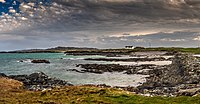
|
Galway | 171.47 | IE0004231 |
| Inishmore | 
|
Galway | 1917.63 | IE0004152 |
| Inner Galway Bay | 
|
Galway | 13261.57 | IE0004031 |
| Lough Corrib | 
|
Galway, Mayo | 18623.94 | IE0004042 |
| Lough Cutra | 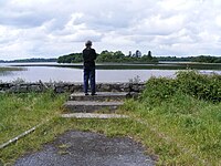
|
Galway | 386.72 | IE0004056 |
| Lough Derg (Shannon) | 
|
Galway | 12709.47 | IE0004058 |
| Lough Mask | 
|
Galway, Mayo | 8735.65 | IE0004062 |
| Lough Rea | 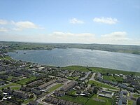
|
Galway | 365.41 | IE0004134 |
| Middle Shannon Callows | Galway, Roscommon | 5814.85 | IE0004096 | |
| Rahasane Turlough | Galway | 372.30 | IE0004089 | |
| River Suck Callows | Galway, Roscommon | 3182.03 | IE0004097 | |
| Slieve Aughty Mountains | Galway | 59457.16 | IE0004168 | |
| to Ardmore Point Islands | Galway | 3377.68 | IE0004159 | |
| Leitrim, Sligo | 1733.55 | IE0004187 | ||
|
Mayo | 149.66 | IE0004177 | |
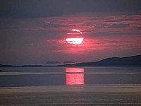
| Blacksod Bay/Broad Haven | 
|
Mayo | 8535.68 | IE0004037 |
| Carrowmore Lake | 
|
Mayo | 965.52 | IE0004052 |
| Clare Island | 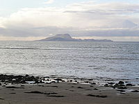
|
Mayo | 1005.74 | IE0004136 |
| Cross Lough (Killadoon) | 
|
Mayo | 26.74 | IE0004212 |
| Mayo | 116.43 | IE0004235 | ||
| Mayo | 529.80 | IE0004111 | ||
| Illanmaster | Mayo | 164.94 | IE0004074 | |
| and | 
|
Mayo | 381.89 | IE0004084 |
| Inishkea Islands | 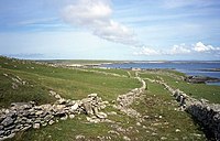
|
Mayo | 1329.76 | IE0004004 |
| Killala Bay/Moy Estuary | 
|
Mayo, Sligo | 3202.02 | IE0004036 |
| Lough Carra | 
|
Mayo | 1760.27 | IE0004051 |
| Lough Conn and Lough Cullin | 
|
Mayo | 6457.58 | IE0004228 |
| Mullet Peninsula | 
|
Mayo | 325.55 | IE0004227 |
| /Nephin Complex | 
|
Mayo | 25692.83 | IE0004098 |
| Stags of Broad Haven | 
|
Mayo | 136.38 | IE0004072 |
| and | Mayo | 405.98 | IE0004093 | |
| Roscommon | 1355.67 | IE0004101 | ||
| Roscommon | 1233.78 | IE0004105 | ||
| Roscommon | 99.6 | IE0004140 | ||
| Lough Arrow | Roscommon, Sligo | 1337.91 | IE0004050 | |
| Roscommon | 151.26 | IE0004139 | ||
| Lough Gara | 
|
Roscommon | 1689.78 | IE0004048 |
| Lough Ree | 
|
Roscommon | 12347.98 | IE0004064 |
| and | 
|
Sligo | 148.29 | IE0004135 |

|
Sligo | 54.8 | IE0004133 | |
| Ballintemple and Ballygilgan | 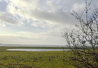
|
Sligo | 235.41 | IE0004234 |

|
Sligo | 2129.06 | IE0004129 | |
| Sligo | 1731.69 | IE0004035 | ||
|
Sligo | 1842.68 | IE0004013 | |
| Inishmurray | 
|
Sligo | 234.66 | IE0004068 |
Leinster[]
| Name | Photo | County | Land area (hectares) | EU Code |
|---|---|---|---|---|
| Baldoyle Bay | 
|
Dublin | 262.65 | IE0004016 |
| Dalkey Islands | 
|
Dublin | 83.04 | IE0004172 |
| Howth Head Coast | 
|
Dublin | 207.73 | IE0004113 |
| Ireland's Eye | 
|
Dublin | 214.43 | IE0004117 |
| Lambay Island | 
|
Dublin | 599.3 | IE0004069 |

|
Dublin | 764.63 | IE0004025 | |
| North Bull Island | 
|
Dublin | 1943.47 | IE0004006 |
| Rockabill | 
|
Dublin | 5227.09 | IE0004014 |
| Rogerstown Estuary | Dublin | 645.35 | IE0004015 | |
| Dublin | 217.12 | IE0004122 | ||
| South Dublin Bay and River Tolka Estuary | 
|
Dublin | 2193.17 | IE0004024 |
| Poulaphouca Reservoir | 
|
Kildare, Wicklow | 2009.5 | IE0004063 |
| River Nore | 
|
Kilkenny, Laois | 414.57 | IE0004233 |
| Slieve Bloom Mountains | Laois, Offaly | 21774.46 | IE0004160 | |
| Longford | 1355.67 | IE0004101 | ||
| Glen Lough | Longford, Westmeath | 82.27 | IE0004045 | |
| Lough Kinale and | 
|
Longford, Westmeath | 287.8 | IE0004061 |
| Lough Ree |
|
Longford, Westmeath | 12347.98 | IE0004064 |

|
Louth, Meath | 593.43 | IE0004080 | |
| Carlingford Lough | 
|
Louth | 595.12 | IE0004078 |
| Dundalk Bay | 
|
Louth | 13237.9 | IE0004026 |
| River Boyne and River Blackwater | 
|
Louth, Meath, Westmeath | 460.14 | IE0004232 |
| Louth | 251.89 | IE0004091 | ||
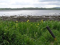
| Lough Sheelin | 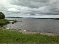
|
Meath, Westmeath | 1900.92 | IE0004065 |
| River Nanny Estuary and Shore | 
|
Meath | 229.68 | IE0004158 |
| Offaly | 322.64 | IE0004103 | ||
| Offaly | 124.51 | IE0004137 | ||
| Middle Shannon Callows | Offaly, Westmeath | 5814.85 | IE0004096 | |
| Mongan Bog | 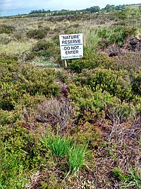
|
Offaly | 129.33 | IE0004017 |
| River Little Brosna Callows | Offaly | 1100.92 | IE0004086 | |
| Westmeath | 324.11 | IE0004102 | ||
| Lough Derravaragh | 
|
Westmeath | 1130.09 | IE0004043 |
| Lough Ennell | 
|
Westmeath | 1397.66 | IE0004044 |
| Lough Iron | Westmeath | 933.35 | IE0004046 | |
| Lough Owel | 
|
Westmeath | 1118.64 | IE0004047 |
| Ballyteigue Burrow | 
|
Wexford | IE0004020 | |
| Bannow Bay | Wexford | 1363.32 | IE0004033 | |
| Wexford | 191.52 | IE0004143 | ||
| Keeragh Islands | 
|
Wexford | 80 | IE0004118 |
| Lady's Island Lake | 
|
Wexford | 478.6 | IE0004009 |
| Saltee Islands | 
|
Wexford | 870.62 | IE0004002 |
| Tacumshin Lake | Wexford | 476.17 | IE0004092 | |
| The Raven | 
|
Wexford | 4204.63 | IE0004019 |
| Wexford Harbour and Slobs | 
|
Wexford | 5979.34 | IE0004076 |
| Wicklow | 940.78 | IE0004186 | ||
| Wicklow Head | 
|
Wicklow | 195.05 | IE0004127 |
| Wicklow Mountains | 
|
Wicklow, Dublin | 30014.31 | IE0004040 |
Munster[]
| Name | Photo | County | Land area (hectares) | EU Code |
|---|---|---|---|---|
| Ballyallia Lake | Clare | 140.73 | IE0004041 | |
| Cliffs of Moher | 
|
Clare | 873.94 | IE0004005 |
| Clare | 599.86 | IE0004220 | ||
| Clare | 45.95 | IE0004114 | ||
| Inner Galway Bay | Clare | 13261.57 | IE0004031 | |
| Loop Head | 
|
Clare | 377 | IE0004119 |
| Lough Derg | 
|
Clare, Tipperary | 12709.47 | IE0004058 |
| Clare | 4638.65 | IE0004182 | ||
| River Shannon and River Fergus Estuaries | 
|
Clare, Kerry, Limerick | 32237.6 | IE0004077 |
| Slieve Aughty Mountains | Clare | 59457.16 | IE0004168 | |
| Cork | 281.22 | IE0004022 | ||
| Cork | 586.23 | IE0004023 | ||
| Beara Peninsula | Cork | 2612.08 | IE0004155 | |
| Blackwater Callows | Cork, Waterford | 1037.73 | IE0004094 | |
| Blackwater Estuary | Cork, Waterford | 869.8 | IE0004028 | |

|
Cork | 507.76 | IE0004081 | |
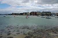
| Cork Harbour | 
|
Cork | 2660.27 | IE0004030 |

|
Cork | 1298.71 | IE0004219 | |
| Galley Head to | 
|
Cork | 416.1 | IE0004190 |
| Kilcolman Bog | Cork | 56.71 | IE0004095 | |
| Mullaghanish to Musheramore Mountains | 
|
Cork | 4975.63 | IE0004162 |
| Old Head of Kinsale | 
|
Cork | 53.63 | IE0004021 |
| Cork | 446.85 | IE0004191 | ||
| Sheep's Head to | 
|
Cork | 2500.11 | IE0004156 |
| Cork | 28.7 | IE0004124 | ||
| Stack's to Mullaghareirk Mountains, and Mount Eagle | Cork, Kerry, Limerick | 56648.85 | IE0004161 | |
| Cork | 380.12 | IE0004066 | ||
| The Gearagh | 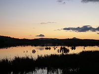
|
Cork | 322.58 | IE0004109 |
| Blasket Islands | 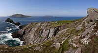
|
Kerry | 3620.37 | IE0004008 |
| Castlemaine Harbour | 
|
Kerry | 12397.41 | IE0004029 |
| Deenish Island and Scariff Island | 
|
Kerry | 845.35 | IE0004175 |
| Dingle Peninsula | 
|
Kerry | 4153.23 | IE0004153 |
| Eirk Bog | 
|
Kerry | 13.23 | IE0004108 |
| Iveragh Peninsula | 
|
Kerry | 3486.97 | IE0004154 |
| Kerry Head | 
|
Kerry | 961.84 | IE0004189 |
| Killarney National Park | 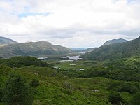
|
Kerry | 10328.14 | IE0004038 |
| Magharee Islands | 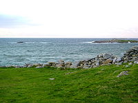
|
Kerry | 416.92 | IE0004125 |
| Puffin Island | 
|
Kerry | 349.14 | IE0004003 |
| Skellig Islands | 
|
Kerry | 624.08 | IE0004007 |
| Tralee Bay Complex | 
|
Kerry | 3655.61 | IE0004188 |
| to Silvermines Mountains | 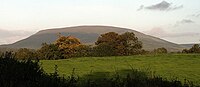
|
Limerick, Tipperary | 20913.05 | IE0004165 |
| Middle Shannon Callows | Tipperary | 5814.85 | IE0004096 | |
| River Little Brosna Callows | Tipperary | 1100.92 | IE0004086 | |
|
Waterford | 2221.51 | IE0004032 | |
| Helvick Head to | 
|
Waterford | 784.32 | IE0004192 |
| Waterford | 937.06 | IE0004193 | ||

|
Waterford | 675.68 | IE0004027 |
Ulster[]
| Name | Photo | County | Land area (hectares) | EU Code |
|---|---|---|---|---|
| Lough Kinale and |
|
Cavan | 287.8 | IE0004061 |
| Lough Oughter Complex | 
|
Cavan | 1972.94 | IE0004049 |
| Lough Sheelin |
|
Cavan | 1900.92 | IE0004065 |
| River Boyne and River Blackwater | Cavan | 460.14 | IE0004232 | |
| Derryveagh and | 
|
Donegal | 31483.23 | IE0004039 |
| Donegal Bay | 
|
Donegal | 10455.87 | IE0004151 |
| Durnesh Lough | 
|
Donegal | 144.41 | IE0004145 |
| Falcarragh to Meenlaragh | 
|
Donegal | 302.86 | IE0004149 |
| Fanad Head | 
|
Donegal | 136.07 | IE0004148 |
| Donegal | 19.13 | IE0004082 | ||
| Horn Head to Fanad Head | 
|
Donegal | 2385.34 | IE0004194 |
| and | 
|
Donegal | 419.4 | IE0004132 |
| Inishbofin, Inishdooey and Inishbeg | 
|
Donegal | 601.17 | IE0004083 |
| Donegal | 46.48 | IE0004115 | ||
| Inishkeel | 
|
Donegal | 124.41 | IE0004116 |
| Inishtrahull | 
|
Donegal | 474.24 | IE0004100 |
| Lough Derg, County Donegal | 
|
Donegal | 889.88 | IE0004057 |
| Lough Fern | Donegal | 299.91 | IE0004060 | |
| Lough Foyle | 
|
Donegal | 587.67 | IE0004087 |
| Donegal | 4114.34 | IE0004110 | ||
| Lough Swilly | 
|
Donegal | 8559.56 | IE0004075 |
| Malin Head | 
|
Donegal | 281.07 | IE0004146 |
| Pettigo Plateau | Donegal | 691.28 | IE0004099 | |
| Rathlin O'Birne Island | 
|
Donegal | 153.55 | IE0004120 |
| Donegal | 145.76 | IE0004121 | ||
| Donegal | 563.04 | IE0004090 | ||
| Tory Island | 
|
Donegal | 570.77 | IE0004073 |
| Trawbreaga Bay | 
|
Donegal | 1549.16 | IE0004034 |
| Donegal | 3376.56 | IE0004150 | ||
| Donegal | 1128.80 | IE0004230 | ||
| Slieve Beagh | 
|
Monaghan | 3455.35 | IE0004167 |
References[]
- ^ "Special Protection Areas (SPA)". National Parks & Wildlife Service. Retrieved 31 August 2020.
Sources[]
- Special Protection Areas (SPA) dataset from the National Park and Wildlife Service available under CC-BY-SA 4.0 licence
External links[]
Categories:
- Special Protection Areas in the Republic of Ireland