List of ecclesiastical parishes in the Diocese of Bath and Wells
Diocese of Bath and Wells | |
|---|---|
 | |
| Location | |
| Ecclesiastical province | Canterbury |
| Archdeaconries | Bath, Wells, Taunton |
| Statistics | |
| Parishes | 477 |
| Churches | 569 |
| Information | |
| Cathedral | Cathedral Church of Saint Andrew |
| Current leadership | |
| Bishop | Peter Hancock, Bishop of Bath and Wells |
| Suffragan | Ruth Worsley, Bishop of Taunton[1] |
| Archdeacons | Simon Hill, Archdeacon of Taunton Anne Gell, Archdeacon of Wells Adrian Youings, Archdeacon of Bath |
| Website | |
| bathandwells.org.uk | |
The ecclesiastical parishes within the Diocese of Bath and Wells cover the majority of the English county of Somerset and small areas of Devon, Dorset, Gloucestershire and Wiltshire. The episcopal seat of the Bishop of Bath and Wells is in the Cathedral Church of Saint Andrew in the city of Wells in Somerset.
The diocesan offices, the bishops' offices and residences and the cathedral are all located around the Bishop's Palace in Wells. The diocese is not referred to as "Bath diocese" or "Wells diocese", but as "Bath and Wells diocese".[2] The ordinary of the diocese is the diocesan Bishop of Bath and Wells, Peter Hancock; he is assisted throughout the diocese by the Bishop suffragan of Taunton, Ruth Worsley, whose See was created in 1911. Alternative episcopal oversight (for parishes in the diocese which reject the ministry of priests who are women) is provided by the provincial episcopal visitor (PEV), the Bishop suffragan of Ebbsfleet, Jonathan Goodall, who is licensed as an honorary assistant bishop of the diocese in order to facilitate his work there.[3]
The parish with its local parish church is the basic unit of the Church of England. The parish within the Church of England structure has its roots in the Roman Catholic Church and survived the Reformation largely untouched. Church of England parishes are currently each within one of 44 dioceses divided between the provinces of Canterbury, with 30 dioceses, and York with 14. In 2017 there were approximately 12,600 Church of England parishes in all, with 477 being within this diocese.[4] Each parish is administered by a parish priest who may be assisted in his pastoral duties by a curate or curates, who are also ordained but not parish priests. There are wide variations in the size of parishes and church-going populations. A parish priest may have responsibility for one parish or for two or more, and some are part of a team ministry. By extension, the term parish refers not only to the territorial unit but to the people of its community or congregation. A benefice or living in the Church of England describes any ecclesiastical parish or group of ecclesiastical parishes under a single stipendiary minister.[5] The holder of a benefice owns the "freehold" of the post (the church and the parsonage house) for life. Until the 19th century, the parishes were also the smallest area for local government and administrative functions. Following the Local Government Act 1894, the civil duties of the church were abolished and separate civil parishes were established.[6] As a result of the different needs of the civil community and the church, in many cases the boundaries of the ecclesiastical parishes and their equivalent civil parish have diverged with time.
Archdeaconry of Bath[]
The archdeaconry covers most of the two unitary authorities of North Somerset and Bath and North East Somerset, and also includes sections of neighbouring districts in Somerset and Wiltshire. The Archdeacon of Bath is Adrian Youings.[7]
Deanery of Bath[]
The deanery is mostly within Bath and North East Somerset, but includes one civil parish in Wiltshire and a small section in South Gloucestershire. As well as covering the city of Bath it also includes the surrounding suburbs of the city and neighbouring villages.[8]
| Ecclesiastical parish | Benefice | Parish church | Location | Image | Civil parish(es) | District(s) |
|---|---|---|---|---|---|---|
| Bath Abbey with St James | Bath Abbey with St James | Bath Abbey[9] | 51°22′53″N 2°21′31″W / 51.3815°N 2.3587°W | 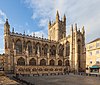 Bath Abbey |
Bath (unparished) | Bath and North East Somerset |
| Bath, Bathwick: St John | Bath Bathwick | [10] | 51°23′18″N 2°21′19″W / 51.3883°N 2.3554°W |  St John: Bathwick |
Bath (unparished) | Bath and North East Somerset |
| Bath, Bathwick: St Mary | Bath Bathwick | St Mary[11] | 51°23′05″N 2°21′04″W / 51.3847°N 2.3511°W |  St Mary, Bathwick |
Bath (unparished) | Bath and North East Somerset |
| Bath: The Ascension | Bath Marlbrook Team | [12] | 51°22′26″N 2°22′57″W / 51.3738°N 2.3824°W | Bath (unparished) | Bath and North East Somerset | |
| Bath: Twerton-on-Avon | Bath Marlbrook Team | St Michael[13] | 51°22′51″N 2°23′54″W / 51.3809°N 2.3982°W |  St Michael: Twerton |
Bath (unparished) | Bath and North East Somerset |
| Bath Combe Hay | Bath Odd Down with Combe Hay | [14] | 51°20′15″N 2°22′53″W / 51.3374°N 2.3815°W |  Combe Hay Church |
All of Combe Hay[a] | Bath and North East Somerset |
| Bath, Odd Down | Bath Odd Down with Combe Hay | [15] | 51°21′41″N 2°22′51″W / 51.3613°N 2.3809°W |  St Philip & St James, Odd Down |
Bath (unparished) | Bath and North East Somerset |
| Bath St Michael Without | Bath St Michael Without | St Michael[16] | 51°23′03″N 2°21′36″W / 51.3842°N 2.3601°W |  St Michael: Bath |
Bath (unparished) | Bath and North East Somerset |
| Bath: St Barnabas | Bath St Barnabas with Englishcombe | [17] | 51°22′10″N 2°23′41″W / 51.3695°N 2.3946°W |  St Barnabas: Bath |
Bath (unparished) | Bath and North East Somerset |
| Englishcombe | Bath St Barnabas with Englishcombe | St Peter[18] | 51°21′52″N 2°24′32″W / 51.3644°N 2.4089°W |  St Peter: Englishcombe |
All of Englishcombe. Small part of Bath (unparished) |
Bath and North East Somerset |
| Bath St Bartholomew | Bath St Bartholomew | [19] | 51°22′30″N 2°22′28″W / 51.3751°N 2.3745°W |  St Bartholomew, Bath |
Bath (unparished) | Bath and North East Somerset |
| Bath St Luke | Bath St Luke | [20] | 51°22′07″N 2°22′00″W / 51.3687°N 2.3667°W |  St Luke: Bath |
Bath (unparished) | Bath and North East Somerset |
| Bath St Saviour | Bath St Saviour with Swainswick and Woolley | St Saviour[21] | 51°23′45″N 2°20′47″W / 51.3958°N 2.3465°W |  St Saviour: Bath |
Bath (unparished) | Bath and North East Somerset |
| Swainswick with Woolley | Bath St Saviour with Swainswick and Woolley | [22] All Saints[23] |
51°24′51″N 2°21′06″W / 51.4143°N 2.3516°W |  St Mary: Swainswick |
All of Swainswick Charlcombe Bath (unparished) |
Bath and North East Somerset |
| Bath, Walcot | Bath Walcot | St Swithin[24] St Andrew[25] Christ Church[26] |
51°23′19″N 2°21′33″W / 51.3886°N 2.3593°W |  St Swithin: Bath |
Bath (unparished) | Bath and North East Somerset |
| Bath, Weston: All Saints | Bath Weston All Saints with North Stoke and Langridge | All Saints[27] | 51°23′44″N 2°23′18″W / 51.3956°N 2.3883°W |  All Saints: Bath |
Bath (unparished) Charlcombe Kelston |
Bath and North East Somerset |
| Langridge | Bath Weston All Saints with North Stoke and Langridge | St Mary[28] | 51°25′26″N 2°22′05″W / 51.4239°N 2.3681°W |  St Mary: Langridge |
Charlcombe | Bath and North East Somerset |
| North Stoke | Bath Weston All Saints with North Stoke and Langridge | St Martin[29] | 51°25′13″N 2°25′39″W / 51.4203°N 2.4274°W |  St Martin: North Stoke |
All of North Stoke Small part of Bitton |
Bath and North East Somerset, South Gloucestershire |
| Bath, Weston: St John | Bath Weston St John with Kelston | [30] Emmanuel[31] |
51°23′07″N 2°22′54″W / 51.3852°N 2.3817°W |  St John, Weston, Bath |
Bath (unparished) Small part of Kelston |
Bath and North East Somerset |
| Kelston | Bath Weston St John with Kelston | [32] | 51°24′01″N 2°26′03″W / 51.4004°N 2.4342°W |  St Nicholas: Kelston |
Most of Kelston | Bath and North East Somerset |
| Bath, Widcombe | Bath Widcombe | St Thomas à Becket[33] St Matthew[34] |
51°22′24″N 2°20′47″W / 51.3734°N 2.3465°W |  St Thomas à Becket: Widcombe |
Bath (unparished) | Bath and North East Somerset |
| Bathampton | Bathampton with Claverton | St Nicholas[35] | 51°23′51″N 2°19′18″W / 51.3975°N 2.3217°W |  St Nicholas: Bathampton |
All of Bathampton[a] | Bath and North East Somerset |
| Claverton | Bathampton with Claverton | [36] | 51°22′33″N 2°18′22″W / 51.3759°N 2.3061°W |  St Mary: Claverton |
All of Claverton Bath (unparished) |
Bath and North East Somerset |
| Batheaston (LEP) | Batheaston with St Catherine | St John: Batheaston[37] St Catherine: St Catherine[38] |
51°24′35″N 2°19′17″W / 51.4097°N 2.3214°W |  St John: Batheaston |
All of Batheaston All of St Catherine Bath (unparished) |
Bath and North East Somerset |
| Bathford | Bathford | [39] | 51°23′54″N 2°18′22″W / 51.3983°N 2.3062°W |  St Swithin: Bathford |
All of Bathford[a] | Bath and North East Somerset |
| Bath: St Stephen | Charlcombe with Bath St Stephen | [40] | 51°23′34″N 2°21′49″W / 51.3928°N 2.3636°W |  St Stephen: Bath |
2 sections - 1 in Bath (unparished). 1 in Bath (unparished) Charlcombe |
Bath and North East Somerset |
| Charlcombe | Charlcombe with Bath St Stephen | St Mary[41] | 51°24′16″N 2°21′46″W / 51.4044°N 2.3628°W |  St Mary: Charlecombe |
Charlcombe, Bath (unparished) | Bath and North East Somerset |
| Combe Down | Combe Down with Monkton Combe and South Stoke | [42] St Andrew[43] |
51°21′33″N 2°20′45″W / 51.3592°N 2.3457°W |  Holy Trinity: Combe Down |
Bath (unparished) Monkton Combe |
Bath and North East Somerset |
| Monkton Combe | Combe Down with Monkton Combe and South Stoke | St Michael[44] | 51°21′22″N 2°19′43″W / 51.3561°N 2.3286°W |  St Michael: Monkton Combe |
Most of Monkton Combe Bath (unparished) |
Bath and North East Somerset |
| South Stoke | Combe Down with Monkton Combe and South Stoke | St James[45] | 51°20′59″N 2°21′55″W / 51.3497°N 2.3653°W |  St James: South Stoke |
All of Southstoke[a] | Bath and North East Somerset |
| Freshford with Limpley Stoke and Hinton Charterhouse | Freshford, Limpley Stoke and Hinton Charterhouse | St Peter: Freshford[46] St John: Hinton Charterhouse[47] St Mary[48] |
51°20′24″N 2°18′12″W / 51.34°N 2.3033°W |  St John: Hinton Charterhouse |
All of Freshford All of Hinton Charterhouse All of Limpley Stoke |
Bath and North East Somerset, Wiltshire |
Deanery of Chew Magna[]
The area covered includes the Chew Valley, and surrounding areas. The deanery is mostly within Bath and North East Somerset, and also includes a portion of North Somerset, Mendip and Sedgemoor. Part of the area falls within the Mendip Hills Area of Outstanding Natural Beauty. Most of the rural area is within the Bristol and Bath Green Belt.
| Ecclesiastical parish | Benefice | Parish church | Location | Image | Civil parish(es) | District(s) |
|---|---|---|---|---|---|---|
| Blagdon | Blagdon with Compton Martin and Ubley | St Andrew[49][50] St Hugh[51] |
51°19′40″N 2°42′47″W / 51.3277°N 2.7131°W |  St Andrew: Blagdon |
All of Blagdon Priddy Cheddar Butcombe |
Bath and North East Somerset, Mendip, North Somerset |
| Compton Martin | Blagdon with Compton Martin and Ubley[52] | St Michael[53] | 51°18′37″N 2°39′15″W / 51.3103°N 2.6542°W |  St Michael: Compton Martin |
Compton Martin Priddy |
Bath and North East Somerset, Mendip |
| Ubley | Blagdon with Compton Martin and Ubley[52] | St Bartholomew[54] | 51°19′17″N 2°40′36″W / 51.3214°N 2.6767°W |  St Batholomew: Ubley |
All of Ubley Priddy |
Bath and North East Somerset, Mendip |
| Chew Magna | Chew Magna with Dundry, Norton Malreward and Stanton Drew | St Andrew[55][56] | 51°22′00″N 2°36′35″W / 51.3667°N 2.6097°W |  St Andrew: Chew Magna |
Chew Magna Norton Malreward |
Bath and North East Somerset |
| Dundry | Chew Magna with Dundry, Norton Malreward and Stanton Drew | St Michael[57] | 51°23′56″N 2°38′14″W / 51.399°N 2.6373°W |  St Michael: Dundry |
Dundry Winford |
Bath and North East Somerset, North Somerset |
| Norton Malreward | Chew Magna with Dundry, Norton Malreward and Stanton Drew | Holy Trinity[58] | 51°22′59″N 2°34′16″W / 51.3831°N 2.5711°W |  Holy Trinity: Norton Malreward |
Norton Malreward Stanton Drew |
Bath and North East Somerset |
| Stanton Drew | Chew Magna with Dundry, Norton Malreward and Stanton Drew | St Mary[58] | 51°21′57″N 2°34′45″W / 51.3658°N 2.5791°W |  St Mary: Stanton Drew |
Stanton Drew Publow |
Bath and North East Somerset |
| Chew Stoke | Chew Stoke with Nempnett Thrubwell[59] | St Andrew[60] | 51°21′03″N 2°38′18″W / 51.3507°N 2.6383°W |  St Andrew: Chew Stoke |
Chew Stoke Chew Magna |
Bath and North East Somerset |
| Nempnett Thrubwell | Chew Stoke with Nempnett Thrubwell[59] | St Mary[61] | 51°20′27″N 2°40′20″W / 51.3408°N 2.6722°W |  St Mary: Nempnett Thrubwell |
Nempnett Thrubwell Chew Stoke |
Bath and North East Somerset |
| Bishop Sutton | Clutton with Cameley, Bishop Sutton and Stowey | [62] | 51°20′03″N 2°35′46″W / 51.3341°N 2.5960°W | 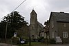 Holy Trinity: Bishop Sutton |
Stowey-Sutton Chew Magna |
Bath and North East Somerset |
| Clutton with Cameley | Clutton with Cameley, Bishop Sutton and Stowey | St Augustine: Clutton[63] & St James: Cameley |
51°19′41″N 2°32′35″W / 51.3281°N 2.5431°W |  St Augustine of Hippo: Clutton |
Clutton Cameley Hinton Blewett |
Bath and North East Somerset |
| Stowey | Clutton with Cameley, Bishop Sutton and Stowey | St Nicholas and St Mary[64] | 51°19′57″N 2°34′36″W / 51.3325°N 2.5767°W |  St Nicholas and St Mary: Stowey |
Stowey-Sutton Chew Magna |
Bath and North East Somerset |
| East Harptree with West Harptree and Hinton Blewett | East with West Harptree and Hinton Blewett[65] | St Laurence: East Harptree,[66] St Mary: West Harptree[67] & St Margaret: Hinton Blewett[68] |
51°18′04″N 2°37′29″W / 51.3011°N 2.6247°W |  St Laurence:East Harptree |
All of East Harptree, all of West Harptree, Hinton Blewett Priddy |
Bath and North East Somerset |
| Farmborough | Farmborough, Marksbury and Stanton Prior | All Saints[69] | 51°20′35″N 2°29′16″W / 51.3431°N 2.4878°W | 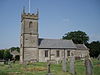 All Saints: Farmborough |
All of Farmborough[a] | Bath and North East Somerset |
| Marksbury | Farmborough, Marksbury and Stanton Prior | St Peter[70] | 51°21′33″N 2°28′49″W / 51.3592°N 2.4803°W |  St Peter: Marksbury |
Marksbury | Bath and North East Somerset |
| Stanton Prior | Farmborough, Marksbury and Stanton Prior | St Lawrence[71] | 51°21′46″N 2°27′50″W / 51.3628°N 2.4639°W |  St Lawrence: Stanton Prior |
Marksbury | Bath and North East Somerset |
| Keynsham | Keynsham | St John[72] Chewton Keynsham Mission Church[73] St Francis[74] St Michael[75] St Margaret[76] |
51°25′03″N 2°29′55″W / 51.4175°N 2.4986°W |  St John: Keynsham |
Keynsham Compton Dando Whitchurch |
Bath and North East Somerset |
| Compton Dando and Chelwood | Publow with Pensford, Compton Dando and Chelwood[77] | St Mary: Compton Dando[78] & St Leonard: Chelwood[79] |
51°22′47″N 2°30′38″W / 51.3797°N 2.5106°W | 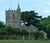 St Mary: Compton Dando |
Compton Dando & all of Chelwood |
Bath and North East Somerset |
| Publow with Pensford | Publow with Pensford, Compton Dando and Chelwood[77] | All Saints: Publow[80] | 51°22′34″N 2°32′32″W / 51.3761°N 2.5422°W |  All Saints: Publow |
Publow Stanton Drew |
Bath and North East Somerset |
| Corston | Saltford with Corston and Newton St Loe[81] | [82] | 51°23′09″N 2°26′23″W / 51.3858°N 2.4398°W |  All Saints: Corston |
All of Corston[a] | Bath and North East Somerset |
| Newton St Loe | Saltford with Corston and Newton St Loe[81] | Holy Trinity[83] | 51°22′56″N 2°25′51″W / 51.3822°N 2.4308°W |  Holy Trinity: Newton St Loe |
All of Newton St Loe[a] | Bath and North East Somerset |
| Saltford | Saltford with Corston and Newton St Loe[81] | St Mary[84] | 51°24′20″N 2°27′15″W / 51.4056°N 2.4542°W |  St Mary: Saltford |
Saltford Keynsham |
Bath and North East Somerset |
| Felton Common Hill | Winford with Felton Common Hill | [85] | 51°23′16″N 2°41′52″W / 51.3878°N 2.6977°W |  St Katherine: Felton |
Backwell Winford Wrington |
North Somerset |
| Winford | Winford with Felton Common Hill | St Mary and St Peter[86] St James[87] |
51°22′57″N 2°39′29″W / 51.3825°N 2.6581°W |  St Mary and St Peter: Winford |
Winford Nempnett Thrubwell Dundry |
North Somerset, Bath and North East Somerset |
Deanery of Locking[]
The Deanery of Locking covers Weston-super-Mare and the surrounding villages. It is mostly within North Somerset, but includes sections of Mendip and Sedgemoor.
| Ecclesiastical parish | Benefice | Parish church | Location | Image | Civil parish(es) | District(s) |
|---|---|---|---|---|---|---|
| Banwell | Banwell | St Andrew[88] | 51°19′40″N 2°51′48″W / 51.3279°N 2.8633°W |  St Andrew: Banwell |
Banwell Hutton, Somerset Locking Weston-super-Mare |
North Somerset |
| Bournville (LEP) | Bleadon and Bournville | [89][90] | 51°19′55″N 2°57′57″W / 51.3319°N 2.9657°W | Weston-super-Mare | North Somerset | |
| St Peter and St Paul, Bleadon | Bleadon and Bournville | St Peter & St Paul[91] | 51°18′27″N 2°56′46″W / 51.3075°N 2.9462°W |  St Andrew: Bleadon |
All of Bleadon Weston-super-Mare Lympsham |
North Somerset, Sedgemoor |
| Churchill and Langford | Churchill and Langford | St John: Churchill[92] [93] |
51°20′19″N 2°48′32″W / 51.3385°N 2.8088°W |  St John: Churchill |
All of Churchill | North Somerset |
| Congresbury | Congresbury with Puxton and Hewish St Ann | St Andrew[94] | 51°22′11″N 2°48′33″W / 51.3697°N 2.8091°W |  St Andrew: Congresbury |
All of Congresbury All of Puxton Banwell Weston-super-Mare |
North Somerset |
| Hutton | Hutton and Locking | St Mary[95] | 51°19′22″N 2°55′51″W / 51.3228°N 2.9307°W |  St Mary: Hutton |
Hutton Weston-super-Mare |
North Somerset |
| Locking | Hutton and Locking | [96] | 51°19′56″N 2°54′55″W / 51.3322°N 2.9152°W |  St Augustine: Locking |
Locking Weston-super-Mare |
North Somerset |
| Kewstoke | Milton and Kewstoke | St Paul[97] | 51°21′56″N 2°57′25″W / 51.3655°N 2.957°W |  St Paul: Kewstoke |
Kewstoke Weston-super-Mare |
North Somerset |
| Milton St Peter with St Jude | Milton and Kewstoke | [98] | 51°21′11″N 2°56′25″W / 51.3530°N 2.9402°W |  St Peter and St Jude: Milton |
Weston-super-Mare | North Somerset |
| Weston-super-Mare: Saint Nicholas with Saint Barnabas | Saint Nicholas with Saint Barnabas, Weston-super-Mare | [99] [100] |
51°19′28″N 2°58′41″W / 51.3244°N 2.9781°W |  St Barnabas: Weston-super-Mare |
Weston-super-Mare | North Somerset| |
| Weston-super-Mare: All Saints with St Saviour | Weston-super-Mare All SS and St Saviour | [101] | 51°21′11″N 2°58′35″W / 51.3531°N 2.9765°W | Weston-super-Mare | North Somerset | |
| Weston-super-Mare: Christ Church | Weston-super-Mare Christ Church and Emmanuel | [102] | 51°21′02″N 2°58′10″W / 51.3505°N 2.9695°W |  Christ Church, Weston-super-Mare |
Weston-super-Mare | North Somerset |
| Weston-super-Mare: Emmanuel | Weston-super-Mare Christ Church and Emmanuel | [103] | 51°20′45″N 2°58′38″W / 51.3458°N 2.9771°W |  St Emmanuel: Weston-super-Mare |
Weston-super-Mare | North Somerset |
| Weston-super-Mare: St John | Weston-super-Mare St John | [104] | 51°21′09″N 2°58′51″W / 51.3525°N 2.9809°W |  St John: Weston-super-Mare |
Weston-super-Mare | North Somerset |
| Weston-super-Mare: St Paul | Weston-super-Mare St Paul | [105] | 51°20′16″N 2°58′41″W / 51.3377°N 2.9781°W |  St Paul: Weston-super-Mare |
Weston-super-Mare | North Somerset |
| Winscombe and Sandford | Winscombe and Sandford | St James[106] All Saints[107] |
51°18′42″N 2°50′03″W / 51.3116°N 2.8342°W |  St James: Winscombe |
Winscombe and Sandford Shipham |
North Somerset, Sedgemoor |
| Worle (LEP) | Worle | St Martin[108] St Lawrence Chapel[109] St Lawrence Church[110] Chapel[111] St Mark's Church Centre[112] Locking Castle[113] |
51°21′41″N 2°55′50″W / 51.3614°N 2.9306°W |  St Martin: Worle |
All of Wick St Lawrence Weston-super-Mare Kewstoke Locking |
North Somerset |
| Burrington | Wrington with Butcombe and Burrington | Holy Trinity[114] | 51°19′51″N 2°44′59″W / 51.3307°N 2.7497°W |  Holy Trinity: Burrington |
All of Burrington, Somerset[a] | North Somerset |
| Butcombe | Wrington with Butcombe and Burrington | St Michael and All Angels[115] | 51°21′14″N 2°41′50″W / 51.3539°N 2.6973°W |  St Michael: Butcombe |
Butcombe | North Somerset |
| Wrington | Wrington with Butcombe and Burrington | All Saints[116] Christ Church[117] |
51°21′40″N 2°45′57″W / 51.361°N 2.7658°W |  All Saints: Wrington |
Wrington | North Somerset |
Deanery of Midsomer Norton[]
The deanery covers Midsomer Norton, Radstock and the surrounding villages which made up the part of the Somerset Coalfield. The area is split between the local government areas of Bath and North East Somerset and Mendip.
| Ecclesiastical parish | Benefice | Parish church | Location | Image | Civil parish(es) | District(s) |
|---|---|---|---|---|---|---|
| Chilcompton with Downside | Chilcompton with Downside and Stratton on the Fosse | St John[118] | 51°16′11″N 2°30′27″W / 51.2697°N 2.5075°W |  St John: Chilcompton |
Chilcompton Ston Easton |
Mendip |
| Stratton-on-the-Fosse | Chilcompton with Downside and Stratton on the Fosse | St Vigor[119] | 51°15′19″N 2°29′23″W / 51.2552°N 2.4896°W |  St Vigor: Stratton-on-the-Fosse |
Stratton-on-the-Fosse | Mendip |
| Coleford | Coleford with Holcombe[120] | [121] | 51°14′21″N 2°27′00″W / 51.2393°N 2.4500°W |  Holy Trinity: Coleford |
Coleford Holcombe |
Mendip |
| Holcombe | Coleford with Holcombe[120] | St Andrew[122] | 51°15′17″N 2°28′33″W / 51.2547°N 2.4758°W |  St Andrew:Holcombe |
Holcombe Coleford Kilmersdon Stratton-on-the-Fosse |
Mendip |
| Kilmersdon with Babington | Kilmersdon with Babington | St Peter and St Paul[123] | 51°16′13″N 2°26′13″W / 51.2702°N 2.437°W |  St Peter and St Paul: Kilmersdon |
Kilmersdon Coleford, Somerset Radstock |
Mendip, Bath and North East Somerset |
| Midsomer Norton with Clandown | Midsomer Norton with Clandown | St John[124] | 51°17′09″N 2°29′07″W / 51.2858°N 2.4853°W |  St John: Midsomer Norton |
Midsomer Norton Paulton Radstock Ston Easton |
Mendip, Bath and North East Somerset |
| Farrington Gurney | Paulton with Farrington Gurney & High Littleton[125] | [126] | 51°17′58″N 2°31′29″W / 51.2995°N 2.5248°W |  St John: Farrington Gurney |
All of Farrington Gurney[a] | Bath and North East Somerset |
| High Littleton | Paulton with Farrington Gurney & High Littleton[125] | [127] | 51°19′11″N 2°30′36″W / 51.3198°N 2.5099°W |  Holy Trinity: High Littleton |
High Littleton Clutton |
Bath and North East Somerset |
| Paulton | Paulton with Farrington Gurney & High Littleton[125] | Holy Trinity[128] | 51°18′27″N 2°30′15″W / 51.3075°N 2.5042°W |  Holy Trinity: Paulton |
Paulton Midsomer Norton |
Bath and North East Somerset |
| Foxcote with Shoscombe | Peasedown Saint John with Wellow and Foxcote with Shoscombe[129] | St James: Foxcote[130] | 51°17′55″N 2°24′32″W / 51.2986°N 2.4090°W |  |
Hemington Peasedown St John Shoscombe |
Bath and North East Somerset |
| Peasedown: St John | Peasedown Saint John with Wellow and Foxcote with Shoscombe[129] | St John[131] | 51°18′59″N 2°25′59″W / 51.3164°N 2.4331°W |  St John: Peasedown St John |
Peasedown St John | Bath and North East Somerset |
| Wellow | Peasedown Saint John with Wellow and Foxcote with Shoscombe[129] | St Julian[132] | 51°19′28″N 2°22′21″W / 51.3244°N 2.3725°W |  St Julian: Wellow |
Wellow Shoscombe Norton St Philip |
Bath and North East Somerset, Mendip |
| Radstock with Writhlington | Radstock with Writhlington[133] | [134] | 51°17′24″N 2°26′54″W / 51.2899°N 2.4483°W |  St Nicholas: Radstock |
Radstock Kilmersdon Westfield |
Bath and North East Somerset |
| Camerton | Timsbury with Priston, Camerton and Dunkerton | St Peter[135] | 51°18′54″N 2°27′02″W / 51.3151°N 2.4505°W |  St Peter: Camerton |
Camerton Peasedown St John |
Bath and North East Somerset |
| Dunkerton | Timsbury with Priston, Camerton and Dunkerton | All Saints[136] | 51°19′55″N 2°24′57″W / 51.3319°N 2.4158°W |  All Saints: Dunkerton |
Bath and North East Somerset | |
| Priston | Timsbury with Priston, Camerton and Dunkerton | St Luke and St Andrew[137] | 51°20′36″N 2°26′19″W / 51.3433°N 2.4386°W |  St Luke & St Andrew: Priston |
All of Priston |
Bath and North East Somerset |
| Timsbury | Timsbury with Priston, Camerton and Dunkerton | St Mary[138] | 51°19′32″N 2°28′44″W / 51.3256°N 2.4789°W |  St Mary: Timsbury |
Timsbury | Bath and North East Somerset |
| Westfield | Westfield | [139] | 51°16′54″N 2°28′15″W / 51.2818°N 2.4709°W |  St Peter: Westfield |
Westfield Kilmersdon Midsomer Norton |
Bath and North East Somerset, Mendip |
Deanery of Portishead[]
The deanery covers the coastal towns of Portishead and Clevedon and the surrounding area. It is wholly within North Somerset.
| Ecclesiastical parish | Benefice | Parish church | Location | Image | Civil parish(es) | District(s) |
|---|---|---|---|---|---|---|
| Backwell | Backwell with Chelvey and Brockley[140] | St Andrew[141] | 51°24′41″N 2°43′50″W / 51.4114°N 2.7306°W |  St Andrew: Backwell |
Backwell | North Somerset |
| Chelvey and Brockley | Backwell with Chelvey and Brockley[140] | St Bridget: Chelvey[142] | 51°24′43″N 2°46′04″W / 51.4119°N 2.7678°W |  St Bridget: Chelvey |
All of Brockley | North Somerset |
| Clevedon: Christ Church (LEP) | Clevedon St Andrew and Christ Church[143] | Christ Church[144] | 51°26′20″N 2°51′07″W / 51.439°N 2.8519°W |  Christ Church: Clevedon |
Clevedon | North Somerset |
| Clevedon: St Andrew | Clevedon St Andrew and Christ Church[143] | St Andrew[145] | 51°25′58″N 2°52′21″W / 51.4329°N 2.8725°W |  St Andrew: Clevedon |
Clevedon | North Somerset |
| Clevedon: St Peter | Clevedon St Andrew and Christ Church[143] | [146] | 51°26′31″N 2°51′35″W / 51.442°N 2.8596°W |  St Peter: Clevedon |
Clevedon | North Somerset |
| Clevedon: St John the Evangelist | Clevedon St John | St John[147] | 51°26′12″N 2°51′18″W / 51.4367°N 2.8549°W |  St John: Clevedon |
Clevedon Kenn |
North Somerset |
| East Clevedon with Clapton-in-Gordano | East Clevedon with Clapton in Gordano, Walton in Clevedano[148] | [149] | 51°26′33″N 2°50′26″W / 51.4426°N 2.8406°W |  St Michael: Clapton in Gordano |
Clevedon Clapton in Gordano |
North Somerset |
| Walton-in-Gordano | East Clevedon with Clapton in Gordano, Walton in Clevedano[148] | [150] | 51°27′14″N 2°49′41″W / 51.454°N 2.828°W |  St Paul: Walton in Gordano |
All of Walton in Gordano Clevedon |
North Somerset |
| Walton-in-Gordano: St. Mary | East Clevedon with Clapton in Gordano, Walton in Gordano[148] | St Mary[151] | 51°26′51″N 2°50′46″W / 51.4474°N 2.8462°W |  St Mary: Walton St Mary |
Clevedon | North Somerset |
| Weston-in-Gordano | East Clevedon with Clapton in Gordano, Walton in Clevedano[148] | St Peter and St Paul[152] | 51°27′51″N 2°48′07″W / 51.4642°N 2.802°W |  St Peter and St Paul: Weston-in-Gordano |
Weston in Gordano Portishead |
North Somerset |
| Barrow Gurney | Long Ashton with Barrow Guerney and Flax Bourton | St Mary and St Edward[153] | 51°24′47″N 2°50′29″W / 51.4131°N 2.8414°W |  St Mary and St Edward: Barrow Gurney |
Barrow Gurney Long Ashton Wraxall and Failand |
North Somerset |
| Flax-Bourton | Long Ashton with Barrow Guerney and Flax Bourton | St Michael and All Angels[154] | 51°25′16″N 2°42′40″W / 51.4212°N 2.711°W |  St Michael and All Angels: Flax Bourton |
Flax Bourton | North Somerset |
| Long Ashton | Long Ashton with Barrow Guerney and Flax Bourton | All Saints[155] Ascension[156] |
51°26′09″N 2°38′38″W / 51.4358°N 2.6438°W |  All Saints: Long Ashton |
Long Ashton Barrow Gurney |
North Somerset |
| Nailsea: Christ Church | Nailsea Christ Church with Tickenham[157] | [158] | 51°26′00″N 2°45′42″W / 51.4332°N 2.7618°W | Nailsea | North Somerset | |
| Tickenham | Nailsea Christ Church with Tickenham[157] | SS Quiricus & Julietta[159] | 51°26′22″N 2°46′53″W / 51.4394°N 2.7814°W |  St Quiricus & St Julietta: Tickenham |
All of Tickenham[a] | North Somerset |
| Nailsea: Holy Trinity | Nailsea Holy Trinity | Holy Trinity[160] | 51°25′33″N 2°46′09″W / 51.4258°N 2.7693°W |  Holy Trinity: Nailsea |
Nailsea | North Somerset |
| Easton-in-Gordano | Pill, Portbury & Easton in Gordano[161] | St George[162] | 51°28′43″N 2°42′03″W / 51.4786°N 2.7008°W |  St George: Easton in Gordano |
Pill and Easton-in-Gordano | North Somerset |
| Pill (LEP) | Pill, Portbury & Easton in Gordano[161] | [163] | 51°28′47″N 2°41′10″W / 51.4796°N 2.6862°W |  Christ Church: Pill |
Pill and Easton-in-Gordano | North Somerset |
| Portbury | Pill, Portbury & Easton in Gordano[161] | St Mary[164] | 51°28′32″N 2°43′02″W / 51.4756°N 2.7173°W |  St Mary: Portbury |
Portbury | North Somerset |
| Portishead | Portishead | St Peter[165] St Peter[166] |
51°28′50″N 2°46′13″W / 51.4806°N 2.7702°W |  St Peter: Portishead |
Portishead Portbury Weston in Gordano |
North Somerset |
| Wraxall | Wraxall with Failand | All Saints[167] St Bartholomew[168] |
51°26′40″N 2°44′05″W / 51.4444°N 2.7348°W |  All Saints: Wraxall |
Wraxall and Failand Clapton in Gordano Nailsea |
North Somerset |
| Cleeve with Claverham | Yatton Moor[169] | Holy Trinity: Cleeve[170] [171] |
51°23′28″N 2°46′39″W / 51.391°N 2.7774°W |  Holy Trinity: Cleeve |
All of Cleeve Yatton Nailsea |
North Somerset |
| Yatton Moor | Yatton Moor[169] | St Mary[172] All Saints[173] St John[174] |
51°23′06″N 2°49′07″W / 51.385°N 2.8185°W |  St Mary: Yatton |
Yatton Kenn, Somerset All of Kingston Seymour |
North Somerset |
Archdeaconry of Taunton[]
The archdeaconry is centred on Taunton and covers the west of Somerset. It also includes small sections of Devon and Dorset. The Archdeacon of Taunton is Simon Hill.[7]
Deanery of Crewkerne[]
The deanery covers areas of South Somerset including Crewkerne and North Perrott, with many of the surrounding villages. Some of the parishes are just over the county border in West Dorset.
| Ecclesiastical parish | Benefice | Parish church | Location | Image | Civil parish(es) | District(s) |
|---|---|---|---|---|---|---|
| Hinton St George with Dinnington | Merriott with Hinton Dinnington and Lopen | St George: Hinton St George[175] & St Nicholas: Dinnington[176] |
50°54′39″N 2°49′38″W / 50.9108°N 2.8272°W |  St George: Hinton St George |
All of Hinton St George & Dinnington, Lopen |
South Somerset |
| Lopen | Merriott with Hinton Dinnington and Lopen | All Saints[177] | 50°55′38″N 2°48′59″W / 50.9271°N 2.8165°W |  All Saints: Lopen |
Lopen | South Somerset |
| Merriott | Merriott with Hinton Dinnington and Lopen | All Saints[178] | 50°54′45″N 2°47′39″W / 50.9124°N 2.7941°W |  AllSaints: Merriot |
Merriott | South Somerset |
| South Petherton with the Seavingtons and the Lambrooks | South Petherton with the Seavingtons and the Lambrooks | St Peter and St Paul: South Petherton[179] & St Michael: Seavington St Michael[180] St James's[181] |
50°56′54″N 2°48′34″W / 50.9483°N 2.8094°W |  St Peter & St Paul: South Petherton |
All of South Petherton All of Seavington St Mary All of Seavington St Michael & Kingsbury Episcopi |
South Somerset |
| Crewkerne | The Wulfric Benefice[182] | St Bartholomew[183] Church of the Good Shepherd[184] |
50°52′53″N 2°47′33″W / 50.8814°N 2.7925°W |  St Batholomew: Crekerne |
All of Crewkerne All of West Crewkerne Merriott Broadwindsor |
South Somerset, West Dorset |
| Haselbury Plucknett | The Wulfric Benefice[182] | St Michael and All Angels[185] | 50°53′43″N 2°45′11″W / 50.8954°N 2.753°W |  St Michael: Haselbury Plucknett |
All of Haselbury Plucknett[a] | South Somerset |
| Misterton | The Wulfric Benefice[182] | [186] | 50°52′12″N 2°46′47″W / 50.8700°N 2.7796°W |  St John: Seaborough |
All of Misterton Seaborough |
South Somerset, West Dorset |
| North Perrott | The Wulfric Benefice[182] | St Martin[187] | 50°52′57″N 2°45′00″W / 50.8825°N 2.75°W |  St Martin: North Perrott |
All of North Perrott[a] | South Somerset |
| Wayford | The Wulfric Benefice[182] | St Michael and All Angels[188] | 50°51′23″N 2°50′49″W / 50.8563°N 2.847°W | All of Wayford Broadwindsor |
South Somerset, West Dorset | |
| Barrington | Winsmoor | St Mary[189] | 50°57′34″N 2°52′16″W / 50.9594°N 2.8711°W |  St Mary: Barrington |
Barrington | South Somerset |
| Chillington | Winsmoor | [190] | 50°53′46″N 2°52′09″W / 50.8961°N 2.8692°W |  St James: Chillington |
All of Chillington[a] | South Somerset |
| Cudworth | Winsmoor | St Michael[191] | 50°53′38″N 2°53′34″W / 50.8939°N 2.8927°W |  St James: Cudworth |
All of Cudworth[a] | South Somerset |
| Dowlish Wake | Winsmoor | St Andrew[192] | 50°54′37″N 2°53′19″W / 50.9103°N 2.8886°W |  St Andrew: Dowlish Wake |
All of Dowlish Wake[a] | South Somerset |
| Kingstone | Winsmoor | St John and All Saints[193] | 50°55′08″N 2°53′06″W / 50.9188°N 2.8851°W |  St John: Kingstone |
All of Kingstone[a] | South Somerset |
| Puckington | Winsmoor | St Andrew[194] | 50°57′38″N 2°53′18″W / 50.9606°N 2.8884°W |  St Andrew: Puckington |
All of Puckington[a] | South Somerset |
| Shepton Beauchamp | Winsmoor | St Michael[195] | 50°57′01″N 2°50′57″W / 50.9503°N 2.8492°W |  St Michael: Shepton Beauchamp |
All of Shepton Beauchamp[a] | South Somerset |
| Stocklinch | Winsmoor | St Mary[196] | 50°56′57″N 2°52′24″W / 50.9492°N 2.8733°W |  St Mary: Stocklinch |
All of Stocklinch[a] | South Somerset |
Deanery of Exmoor[]
The deanery covers large areas of Exmoor in West Somerset. The population is sparse and clustered around small towns and villages.
| Ecclesiastical parish | Benefice | Parish church | Location | Image | Civil parish(es) | District(s) |
|---|---|---|---|---|---|---|
| Alcombe | Alcombe | [197] | 51°11′46″N 3°27′59″W / 51.196°N 3.4663°W |  St Michael: Alcombe |
Minehead | West Somerset |
| Brompton Regis with Withiel Florey | Dulverton with Brushford, Brompton Regis, Upton, Withiel Florey and Skilgate[198] | St Mary: Brompton Regis[199] St Mary: Withiel Florey[200] |
51°04′23″N 3°29′53″W / 51.0731°N 3.4981°W |  St Mary: Brompton Regis |
Brompton Regis | West Somerset |
| Brushford | Dulverton with Brushford, Brompton Regis, Upton, Withiel Florey and Skilgate[198] | St Nicholas[201] | 51°01′15″N 3°32′31″W / 51.0208°N 3.5419°W |  St Nicholas: Brushford |
All of Brushford Dulverton Brompton Regis |
West Somerset |
| Dulverton | Dulverton with Brushford, Brompton Regis, Upton, Withiel Florey and Skilgate[198] | All Saints[202] | 51°02′28″N 3°32′59″W / 51.0411°N 3.5496°W |  All Saints: Dulverton |
Dulverton | West Somerset |
| Skilgate | Dulverton with Brushford, Brompton Regis, Upton, Withiel Florey and Skilgate[198] | St John[203] | 51°02′08″N 3°26′47″W / 51.0355°N 3.4463°W |  St John: Skilgate |
All of Skilgate[a] | West Somerset |
| Upton | Dulverton with Brushford, Brompton Regis, Upton, Withiel Florey and Skilgate[198] | [204] | 51°03′04″N 3°25′45″W / 51.0512°N 3.4292°W |  St James: Upton |
Upton | West Somerset |
| Carhampton | Dunster, Carhampton, Withycombe with Roduish, Timberscombe and Wootton Courtenay | St John[205] | 51°10′29″N 3°25′07″W / 51.1746°N 3.4186°W |  St John: Carhampton |
Carhampton | West Somerset |
| Dunster | Dunster, Carhampton, Withycombe with Roduish, Timberscombe and Wootton Courtenay | St George[206] | 51°11′00″N 3°26′45″W / 51.1832°N 3.4459°W |  St George: Dunster |
All of Dunster Carhampton Minehead |
West Somerset |
| Timberscombe | Dunster, Carhampton, Withycombe with Roduish, Timberscombe and Wootton Courtenay | St Petrock[207] | 51°08′17″N 3°32′20″W / 51.1381°N 3.5389°W |  St Petrock: Timberscombe |
All of Timberscombe Selworthy Cutcombe |
West Somerset |
| Withycombe with Rodhuish | Dunster, Carhampton, Withycombe with Roduish, Timberscombe and Wootton Courtenay | St Nicholas: Withycombe[208] St Bartholomew[209] |
51°09′51″N 3°24′36″W / 51.1642°N 3.41°W |  St Nicholas: Withcombe |
All of Withycombe Carhampton |
West Somerset |
| Wootton Courtenay | Dunster, Carhampton, Withycombe with Roduish, Timberscombe and Wootton Courtenay | All Saints[210] | 51°10′49″N 3°31′13″W / 51.1802°N 3.5204°W |  All Saints: Wootton Courtenay |
Wootton Courtenay Minehead |
West Somerset |
| Cutcombe | Exmoor | St John[211] | 51°08′33″N 3°31′46″W / 51.1424°N 3.5295°W |  St John: Cutcombe |
Cutcombe | West Somerset |
| Exford | Exmoor | St Mary[212] | 51°08′04″N 3°38′03″W / 51.1344°N 3.6341°W |  St Mary: Exford |
All of Exford[a] | West Somerset |
| Exmoor | Exmoor | St Luke[213] | 51°08′28″N 3°45′06″W / 51.141°N 3.75156°W |  St Luke: Simonsbath |
All of Exmoor (civil parish)[a] | West Somerset |
| Exton | Exmoor | St Peter[214] | 51°05′33″N 3°32′07″W / 51.0925°N 3.5353°W |  St Peter: Exton |
Exton Winsford |
West Somerset |
| Hawkridge | Exmoor | St Giles[215] | 51°03′50″N 3°37′36″W / 51.0638°N 3.6266°W |  St Giles: Hawkridge |
Withypool and Hawkridge | West Somerset |
| Luxborough | Exmoor | St Mary[216] | 51°07′56″N 3°28′05″W / 51.1322°N 3.4680°W |  St Mary: Luxborough |
All of Luxborough[a] | West Somerset |
| Winsford | Exmoor | St Mary[217] | 51°06′13″N 3°33′57″W / 51.1037°N 3.5659°W |  St Mary: Winsford |
Winsford Exton Withypool and Hawkridge |
West Somerset |
| Withypool | Exmoor | St Andrew[218] | 51°06′29″N 3°38′58″W / 51.108°N 3.6494°W |  St Andrew: Withypool |
Withypool and Hawkridge | West Somerset |
| Minehead | Minehead | St Michael[219] St Andrew[220] St Peter[221] |
51°12′39″N 3°28′50″W / 51.2109°N 3.4805°W |  St Michael: Minehead |
Minehead All of Minehead Without Wootton Courtenay |
West Somerset |
| Oare | Oare with Culbone | St Mary: Oare[222] St Beuno: Culbone[223] |
51°13′17″N 3°39′32″W / 51.2213°N 3.659°W |  St Beuno: Culbone |
Oare[a] | West Somerset |
| Leighland | Old Cleeve Leighland and Treborough[224] | [225][226] | 51°08′09″N 3°23′06″W / 51.1357°N 3.3850°W |  St Giles: Leighland |
Old Cleeve | West Somerset |
| Old Cleeve | Old Cleeve Leighland and Treborough[224] | St Andrew[227] St Luke[228] St Mary[229] |
51°10′06″N 3°22′31″W / 51.1683°N 3.3753°W |  St Andrew: Old Cleeve |
Old Cleeve Watchet |
West Somerset |
| Treborough | Old Cleeve Leighland and Treborough[224] | St Peter[230] | 51°07′05″N 3°24′53″W / 51.1181°N 3.4147°W |  St peter: Treborough |
All of Treborough[a] | West Somerset |
| Luccombe | Porlock and Porlock Weir with Stoke Pero, Selworthy and Luccombe | St Mary[231] | 51°11′22″N 3°33′33″W / 51.1894°N 3.5593°W |  St Mary: Luccombe |
Luccombe | West Somerset |
| Porlock and Porlock Weir with Stoke Pero | Porlock and Porlock Weir with Stoke Pero, Selworthy and Luccombe | St Dubricius: Porlock[232] St Nicholas[233] Stoke Pero Church[234] |
51°12′31″N 3°35′44″W / 51.2087°N 3.5955°W |  St Dubricius |
All of Porlock Selworthy Luccombe |
West Somerset |
| Selworthy | Porlock and Porlock Weir with Stoke Pero, Selworthy and Luccombe | All Saints[235] Lynch Chapel[236] St Leonard[237] |
51°12′37″N 3°32′51″W / 51.2102°N 3.5476°W |  All Saints: Selworthy |
Selworthy | West Somerset |
Deanery of Ilminster[]
The deanery covers villages in South Somerset and Taunton Deane, as well as a single parish in West Dorset and a small section of East Devon.
| Ecclesiastical parish | Benefice | Parish church | Location | Image | Civil parish(es) | District(s) |
|---|---|---|---|---|---|---|
| Beercrocombe | Beercrocombe with Curry Mallet, Hatch Beauchamp, Orchard Portman[238] | St James[239] | 50°58′44″N 2°57′39″W / 50.9789°N 2.9608°W |  St James: Beercrocombe |
All of Beercrocombe[a] | South Somerset |
| Curry Mallet | Beercrocombe with Curry Mallet, Hatch Beauchamp, Orchard Portman[238] | St James[239] | 50°59′01″N 2°56′59″W / 50.9836°N 2.9497°W |  St James: Curry Mallet |
All of Curry Mallet Fivehead |
South Somerset |
| Hatch Beauchamp | Beercrocombe with Curry Mallet, Hatch Beauchamp, Orchard Portman[238] | St John[240] | 50°59′08″N 2°59′25″W / 50.9856°N 2.9902°W |  St John: Hatch Beauchamp |
Hatch Beauchamp | Taunton Deane |
| Orchard Portman | Beercrocombe with Curry Mallet, Hatch Beauchamp, Orchard Portman[238] | St Michael[241] | 50°59′21″N 3°04′44″W / 50.9893°N 3.0789°W |  St Michael: Orchard Portman |
Orchard Portman | Taunton Deane |
| Staple Fitzpaine | Beercrocombe with Curry Mallet, Hatch Beauchamp, Orchard Portman[238] | St Peter[242] | 50°57′32″N 3°02′59″W / 50.9588°N 3.0496°W |  St Peter: Staple Fitzpaine |
All of Staple Fitzpaine All of Curland All of Bickenhall Hatch Beauchamp |
Taunton Deane |
| Stoke Saint Mary with Thurlbear | Beercrocombe with Curry Mallet, Hatch Beauchamp, Orchard Portman[238] | St Mary[243] | 50°59′45″N 3°02′51″W / 50.9957°N 3.0476°W |  St Mary: Stoke Saint Mary |
Stoke St Mary Orchard Portman |
Taunton Deane |
| West Hatch | Beercrocombe with Curry Mallet, Hatch Beauchamp, Orchard Portman[238] | [244] | 50°59′03″N 3°01′10″W / 50.9842°N 3.0194°W |  St Andrew: West Hatch |
All of West Hatch[a] | Taunton Deane |
| Chard the Good Shepherd Furnham | Chard, the Good Shepherd Furnham | [245] | 50°52′26″N 2°57′34″W / 50.8739°N 2.9595°W |  Good Shepherd: Chard |
Chard Chaffcombe Combe St Nicholas Knowle St Giles Tatworth and Forton |
South Somerset |
| Chard: St Mary | Chard, St. Mary with Combe St Nicholas, Wambrook and Whitestaunton | St Mary[246] | 50°52′09″N 2°57′48″W / 50.8692°N 2.9633°W |  St Mary: Chard |
Chard Combe St Nicholas Tatworth and Forton |
South Somerset |
| Combe St Nicholas | Chard, St. Mary with Combe St Nicholas, Wambrook and Whitestaunton | St Nicholas[247] St Barnabas[248] |
50°53′45″N 2°59′36″W / 50.8958°N 2.9933°W |  St Nicholas: Combe St Nicholas |
Combe St Nicholas Knowle St Giles Wambrook Whitestaunton |
South Somerset |
| Wambrook | Chard, St. Mary with Combe St Nicholas, Wambrook and Whitestaunton | St Mary[249] | 50°51′52″N 3°00′17″W / 50.8645°N 3.0047°W |  St Mary: Wambrook |
Wambrook | South Somerset |
| Whitestaunton | Chard, St. Mary with Combe St Nicholas, Wambrook and Whitestaunton | St Andrew[250] | 50°53′20″N 3°01′21″W / 50.8889°N 3.0225°W |  St Andrew: Whitestaunton |
Whitestaunton | South Somerset |
| Cricket St Thomas | Cricket Saint Thomas | St Thomas[251] | 50°52′24″N 2°53′33″W / 50.8733°N 2.8926°W |  St Thomas: Cricket St Thomas |
All of Cricket St Thomas[a] | South Somerset |
| Ilminster | Ilminster and Whitelackington | St Mary[252] | 50°55′38″N 2°54′41″W / 50.9272°N 2.9114°W |  St Mary: Ilminster |
All of Ilminster[a] | South Somerset |
| Whitelackington | Ilminster and Whitelackington | St Mary[253] | 50°56′01″N 2°53′03″W / 50.9335°N 2.8843°W |  St Mary: Whitelackington |
All of Whitelackington[a] | South Somerset |
| Ashill | Isle Valley | St Mary[254] | 50°57′03″N 2°58′04″W / 50.9508°N 2.9678°W |  St Mary: Ashill |
All of Ashill[a] | South Somerset |
| Broadway | Isle Valley | St Aldhelm and St Eadburgha[255] | 50°56′19″N 2°57′16″W / 50.9386°N 2.9544°W |  St Aldhelm and St Eadburgha: Broadway |
All of Broadway[a] | South Somerset |
| Donyatt | Isle Valley | St Mary[256] | 50°55′20″N 2°56′30″W / 50.9222°N 2.9416°W |  St Mary: Donyatt |
All of Donyatt[a] | South Somerset |
| Hambridge with Earnshill | Isle Valley | St James[257] | 50°59′06″N 2°52′00″W / 50.985°N 2.8668°W |  St James: Hambridge |
Hambridge and Westport Drayton |
South Somerset |
| Horton (LEP) | Isle Valley | [258] | 50°55′47″N 2°57′49″W / 50.9297°N 2.9635°W |  St Peter: Horton |
All of Horton[a] | South Somerset |
| Ilton | Isle Valley | St Peter[259] | 50°57′09″N 2°55′26″W / 50.9526°N 2.924°W |  St Peter: Ilton |
All of Ilton[a] | South Somerset |
| Isle Abbotts | Isle Valley | St Mary[260] | 50°59′02″N 2°55′21″W / 50.9839°N 2.9225°W |  St Mary: Isle Abbotts |
All of Isle Abbotts[a] | South Somerset |
| Isle Brewers | Isle Valley | All Saints[261] | 50°59′06″N 2°54′01″W / 50.985°N 2.9003°W |  All Saints: Isle Brewers |
All of Isle Brewers[a] | South Somerset |
| Buckland St Mary | The Blackdown Benefice[262] | St Mary[263] Mission Church[264] |
50°54′56″N 3°02′19″W / 50.9155°N 3.0386°W |  St Mary: Buckland St Mary |
Buckland St Mary Combe St Nicholas |
South Somerset |
| Churchstanton | The Blackdown Benefice[262] | St Peter & St Paul[265] | 50°55′27″N 3°08′48″W / 50.9242°N 3.1467°W |  St Peter & St Paul: Churchstanton |
Churchstanton Upottery |
Taunton Deane, East Devon |
| Corfe | The Blackdown Benefice[262] | St Nicholas[266] | 50°58′17″N 3°05′40″W / 50.9715°N 3.0945°W |  St Nicholas: Corfe |
All of Corfe[a] | Taunton Deane |
| Otterford | The Blackdown Benefice[262] | St Leonard[267] | 50°55′23″N 3°06′28″W / 50.9231°N 3.1077°W |  St Leonard: Otterford |
All of Otterford[a] | Taunton Deane |
| Pitminster | The Blackdown Benefice[262] | St Andrew & St Mary: Pitminster[268] | 50°57′58″N 3°06′40″W / 50.9661°N 3.111°W |  St Andrew & St Mary: Pitminster |
Pitminster Trull |
Taunton Deane |
| Chaffcombe | Two Shires | St Michael and All Angels[269] | 50°53′15″N 2°55′11″W / 50.8875°N 2.9198°W |  St Michael: Chaffcombe |
Chaffcombe | South Somerset |
| Cricket Malherbie with Knowle St Giles | Two Shires | St Mary[270] | 50°53′59″N 2°54′35″W / 50.8998°N 2.9096°W |  St Mary: Cricket Malherbie |
Knowle St Giles | South Somerset |
| Tatworth: St John the Evangelist | Two Shires | St John[271] | 50°50′52″N 2°57′27″W / 50.8477°N 2.9575°W |  St John: Tatworth |
Tatworth and Forton | South Somerset |
| Thorncombe | Two Shires | [272] | 50°49′35″N 2°53′14″W / 50.8263°N 2.8873°W |  St Mary: Thorncombe |
Thorncombe Tatworth and Forton |
West Dorset South Somerset |
| Winsham | Two Shires | St Stephen[273] | 50°51′09″N 2°53′23″W / 50.8526°N 2.8898°W |  St Stephen: Winsham |
All of Winsham Tatworth and Forton |
South Somerset |
Deanery of Quantock[]
The deanery covers parishes in Sedgemoor and West Somerset.
| Ecclesiastical parish | Benefice | Parish church | Location | Image | Civil parish(es) | District(s) |
|---|---|---|---|---|---|---|
| Aisholt | Aisholt, Enmore, Goathurst, Nether Stowey, Over Stowey and Spaxton with Charlynch[274] | All Saints[275] | 51°06′47″N 3°09′05″W / 51.1131°N 3.1514°W |  All Saints: Aisholt |
Spaxton | Sedgemoor |
| Enmore | Aisholt, Enmore, Goathurst, Nether Stowey, Over Stowey and Spaxton with Charlynch[274] | St Michael[276] | 51°06′40″N 3°05′14″W / 51.1111°N 3.0872°W |  St Michael: Enmore |
Enmore | Sedgemoor |
| Goathurst | Aisholt, Enmore, Goathurst, Nether Stowey, Over Stowey and Spaxton with Charlynch[274] | St Edward King and Martyr[277] | 51°06′11″N 3°03′43″W / 51.103°N 3.062°W |  St Edward: Goathurst |
Goathurst Durleigh Enmore Spaxton |
Sedgemoor |
| Nether Stowey | Aisholt, Enmore, Goathurst, Nether Stowey, Over Stowey and Spaxton with Charlynch[274] | St Mary[278] | 51°09′01″N 3°08′59″W / 51.1503°N 3.1498°W |  St Mary: Nether Stowey |
All of Nether Stowey Fiddington Spaxton |
Sedgemoor |
| Over Stowey | Aisholt, Enmore, Goathurst, Nether Stowey, Over Stowey and Spaxton with Charlynch[274] | St Peter and St Paul[279] | 51°09′07″N 3°09′14″W / 51.152°N 3.154°W |  St Peter and St Paul: Over Stowey |
All of Over Stowey[a] | Sedgemoor |
| Spaxton with Charlynch | Aisholt, Enmore, Goathurst, Nether Stowey, Over Stowey and Spaxton with Charlynch[274] | St Margaret[280] | 51°07′37″N 3°06′25″W / 51.1269°N 3.1069°W |  St Margaret: Spaxton |
Spaxton Broomfield Enmore |
Sedgemoor |
| Cannington | Cannington Otterhampton Combwich and Stockland[281] | St Mary[282] | 51°09′01″N 3°03′45″W / 51.1502°N 3.0624°W |  St Mary: Cannington |
Cannington Durleigh Wembdon |
Sedgemoor |
| Otterhampton with Combwich | Cannington Otterhampton Combwich and Stockland[281] | St Peter: Combwich[283] | 51°10′30″N 3°03′44″W / 51.175°N 3.0622°W |  St Peter: Combwich |
Otterhampton Stockland Bristol |
Sedgemoor |
| Stockland with Steart Bay | Cannington Otterhampton Combwich and Stockland[281] | [284] St Andrew[285] |
51°11′13″N 3°05′18″W / 51.1869°N 3.0884°W |  St Mary: Stockland Bristol |
Stockland Bristol Otterhampton |
Sedgemoor |
| Bicknoller | Quantock Towers[286] | St George[287] | 51°08′50″N 3°16′22″W / 51.1471°N 3.2727°W |  St George: Bicknoller |
Bicknoller | West Somerset |
| Crowcombe | Quantock Towers[286] | Holy Ghost[288] | 51°07′24″N 3°13′46″W / 51.1233°N 3.2294°W |  Holy Ghost: Crowcombe |
All of Crowcombe[a] | West Somerset |
| Monksilver | Quantock Towers[286] | All Saints[289] | 51°07′43″N 3°19′35″W / 51.1286°N 3.3263°W |  All Saints: Monksilver |
All of Monksilver Elworthy Stogumber |
West Somerset |
| Nettlecombe | Quantock Towers[286] | St Mary[290] | 51°07′44″N 3°21′06″W / 51.1289°N 3.3518°W |  St Mary: Nettlecombe |
Nettlecombe Old Cleeve |
West Somerset |
| Sampford Brett | Quantock Towers[286] | St George[291] | 51°09′14″N 3°18′12″W / 51.1538°N 3.3033°W |  St George: Sampford Brett |
Sampford Brett Stogumber Williton |
West Somerset |
| Stogumber | Quantock Towers[286] | St Mary[292] | 51°07′40″N 3°17′25″W / 51.1278°N 3.2903°W |  St Mary: Stogumber |
Stogumber Bicknoller Elworthy |
West Somerset |
| East Quantoxhead | The Quantock Coast Benefice[293] | St Mary[294] | 51°11′08″N 3°14′13″W / 51.1856°N 3.237°W |  St Mary: East Quantoxhead |
All of East Quantoxhead[a] | West Somerset |
| Fiddington | The Quantock Coast Benefice[293] | St Martin[295] | 51°09′33″N 3°07′22″W / 51.1592°N 3.1229°W |  St Martin: Fiddington |
Fiddington Spaxton |
Sedgemoor |
| Holford with Doddington | The Quantock Coast Benefice[293] | [296] | 51°09′46″N 3°12′27″W / 51.1628°N 3.2076°W |  St Mary: Holford |
Holford Kilve |
West Somerset |
| Kilve with Kilton & Lilstock | The Quantock Coast Benefice[293] | St Mary[297] | 51°11′17″N 3°13′21″W / 51.188°N 3.2224°W |  St Mary: Kilve |
Kilve Holford Stringston |
West Somerset |
| Stogursey | The Quantock Coast Benefice[293] | St Andrew[298] St Peter[299] |
51°10′46″N 3°08′20″W / 51.1795°N 3.1389°W |  St Andrew: Stogursey |
All of Stogursey[a] | West Somerset |
| Stringston | The Quantock Coast Benefice[293] | St Mary[300] | 51°10′32″N 3°10′40″W / 51.1756°N 3.1778°W |  St Mary: Stringston |
Stringston | West Somerset |
| West Quantoxhead | The Quantock Coast Benefice[293] | St Audries (now St Ethel Dreda)[301] | 51°10′14″N 3°16′11″W / 51.1705°N 3.2696°W |  St Audries: West Quantoxhead |
West Quantoxhead | West Somerset |
| Watchet | Watchet and Williton[302] | St Decuman[303] Holy Cross[304] |
51°10′47″N 3°19′49″W / 51.1796°N 3.3302°W |  St Decuman: Watchet |
Watchet | West Somerset |
| Williton | Watchet and Williton[302] | St Peter[305] | 51°07′05″N 3°24′54″W / 51.118°N 3.415°W |  St Peter: Williton |
Williton Watchet West Quantoxhead |
West Somerset |
Deanery of Sedgemoor[]
The deanery covers areas of Sedgemoor around Bridgwater, and the easternmost part of Taunton Deane.
| Ecclesiastical parish | Benefice | Parish church | Location | Image | Civil parish(es) | District(s) |
|---|---|---|---|---|---|---|
| Durston | Alfred Jewel[306] | [307] | 51°02′52″N 3°00′45″W / 51.0479°N 3.0126°W |  St John: Durston |
Durston North Petherton |
Taunton Deane, Sedgemoor |
| North Newton | Alfred Jewel[306] | St Peter[308] | 51°04′31″N 2°59′56″W / 51.0753°N 2.999°W |  St Peter: North Newton |
North Petherton | Sedgemoor |
| North Petherton | Alfred Jewel[306] | St Mary[309] | 51°05′32″N 3°00′53″W / 51.0922°N 3.0148°W |  St Mary: North Petherton |
North Petherton | Sedgemoor |
| Northmoor Green | Alfred Jewel[306] | [310] St Michaelchurch[311] |
51°05′03″N 2°56′57″W / 51.0843°N 2.9491°W |  St Peter & St John: Northmoor Green |
North Petherton Bridgwater Without Westonzoyland |
Sedgemoor |
| Thurloxton | Alfred Jewel[306] | Church of St Giles[312] | 51°04′07″N 3°02′12″W / 51.0685°N 3.0367°W |  St Giles: Thurloxton |
Thurloxton North Petherton Creech St Michael |
Sedgemoor, Taunton Deane |
| Bridgwater: Holy Trinity | Bridgwater Holy Trinity and Durleigh Saint Hugh[313] | [314] | 51°07′09″N 3°00′11″W / 51.1191°N 3.0030°W |  Holy Trinity: Hamp |
Bridgwater Durleigh North Petherton |
Sedgemoor |
| Durleigh | Bridgwater Holy Trinity and Durleigh Saint Hugh[313] | St Hugh[315] | 51°07′12″N 3°02′15″W / 51.1199°N 3.0375°W |  St Hugh: Durleigh |
Durleigh Chilton Trinity |
Sedgemoor |
| Bridgwater: St Francis | Bridgwater St Francis[313] | [316] | 51°07′39″N 2°58′53″W / 51.1276°N 2.9814°W | Bridgwater Bridgwater Without |
Sedgemoor | |
| Bridgwater: St John | Bridgwater St John[313] | [317] | 51°07′52″N 2°59′50″W / 51.1311°N 2.9972°W |  St John, Bridgwater |
Bridgwater Bridgwater Without |
Sedgemoor |
| Bridgwater: St Mary | Bridgwater St Mary and Chilton Trinity[313] | St Mary[318] | 51°07′40″N 3°00′17″W / 51.1279°N 3.0048°W |  St Mary: Bridgwater |
Bridgwater | Sedgemoor |
| Chilton Trinity | Bridgwater St Mary and Chilton Trinity[313] | Holy Trinity[319] | 51°08′51″N 3°00′26″W / 51.1474°N 3.0072°W |  Holy Trinity: Chilton Trinity |
Chilton Trinity Wembdon |
Sedgemoor |
| Pawlett | Puriton and Pawlett[313] | St John[320] | 51°10′44″N 3°00′05″W / 51.1788°N 3.0014°W |  St John: Pawlett |
All of Pawlett[a] | Sedgemoor |
| Puriton | Puriton and Pawlett[313] | St Michael and All Angels[321] | 51°10′44″N 2°58′25″W / 51.1788°N 2.9735°W |  St Michael: Puriton |
Puriton Bridgwater Without |
Sedgemoor |
| Burrowbridge | The Athelney Benefice[313] | [322] | 51°04′11″N 2°55′03″W / 51.0697°N 2.9176°W |  St Michael: Burrowbridge |
Burrowbridge North Petherton Westonzoyland |
Taunton Deane, Sedgemoor |
| Lyng | The Athelney Benefice[313] | St Bartholomew[323] | 51°03′19″N 2°57′13″W / 51.0553°N 2.9537°W |  St Bartholomew |
All of Lyng[a] | Sedgemoor |
| North Curry | The Athelney Benefice[313] | St Peter & St Paul[324] | 51°01′32″N 2°58′19″W / 51.0255°N 2.9719°W |  St Peter & St Paul: North Curry |
All of North Curry[a] | Taunton Deane |
| Stoke St Gregory | The Athelney Benefice[313] | St Gregory[325] | 51°02′24″N 2°55′52″W / 51.04°N 2.9311°W |  St Gregory: Stoke St Gregory |
Stoke St Gregory Burrowbridge |
Taunton Deane |
| Wembdon | Wembdon[313] | St George[326] | 51°08′11″N 3°01′02″W / 51.1364°N 3.0172°W |  St George: Wembdon |
Wembdon Bridgwater |
Sedgemoor |
| Chedzoy | Weston Zoyland with Chedzoy[313] | St Mary[327] | 51°08′04″N 2°56′34″W / 51.1345°N 2.9429°W |  St Mary: Chedzoy |
Chedzoy Bridgwater Without |
Sedgemoor |
| Weston Zoyland | Weston Zoyland with Chedzoy[313] | St Mary[328] | 51°06′31″N 2°55′35″W / 51.1087°N 2.9264°W |  St Mary: Westonzoyland |
Westonzoyland Bridgwater Without Stawell |
Sedgemoor |
| Bawdrip | Woolavington with Cossington and Bawdrip[313] | St Michael and All Angels[329] | 51°09′06″N 2°56′34″W / 51.1517°N 2.9429°W |  St Michael: Bawdrip |
All of Bawdrip Bridgwater Without Woolavington |
Sedgemoor |
| Cossington | Woolavington with Cossington and Bawdrip[313] | St Mary[330] | 51°09′29″N 2°55′17″W / 51.1581°N 2.9215°W |  St Mary: Cossington |
All of Cossington[a] | Sedgemoor |
| Woolavington | Woolavington with Cossington and Bawdrip[313] | St Mary[331] | 51°10′13″N 2°56′03″W / 51.1704°N 2.9341°W |  St Mary: Woolavington |
Woolavington | Sedgemoor |
Deanery of Taunton[]
The deanery covers the area around Taunton. It is mostly within Taunton Deane and includes a small section of Sedgemoor.
| Ecclesiastical parish | Benefice | Parish church | Location | Image | Civil parish(es) | District(s) |
|---|---|---|---|---|---|---|
| Bishop's Hull | Bishops Hull | St Peter and St Paul[332] | 51°01′00″N 3°08′06″W / 51.0166°N 3.135°W |  St Peter and St Paul: Bishop's Hull |
Bishop's Hull Comeytrowe Taunton (unparished) |
Taunton Deane |
| Creech St Michael | Creech Saint Michael and Ruishton with Thornfalcon[333] | St Michael[334] | 51°01′21″N 3°02′07″W / 51.0224°N 3.0354°W |  St Michael: Creech St Michael |
Creech St Michael | Taunton Deane |
| Ruishton | Creech Saint Michael and Ruishton with Thornfalcon[333] | St George[335] | 51°01′14″N 3°03′04″W / 51.0206°N 3.0512°W |  St George: Ruishton |
Ruishton West Monkton |
Taunton Deane |
| Thornfalcon | Creech Saint Michael and Ruishton with Thornfalcon[333] | Holy Cross[336] | 51°00′36″N 3°01′22″W / 51.0101°N 3.0229°W |  Holy Cross: Thornfalcon |
Thornfalcon[a] | Taunton Deane |
| Galmington | Galmington | [337] | 51°00′20″N 3°07′18″W / 51.0056°N 3.1218°W |  St Michael: Galmington |
Comeytrowe Bishops Hull Taunton (unparished) |
Taunton Deane |
| St John the Evangelist, Taunton | Saint Mary Magdalene and Saint John the Evangelist | St John[338] | 51°00′49″N 3°06′30″W / 51.0135°N 3.1083°W |  St John: Taunton |
Taunton (unparished) | Taunton Deane |
| Taunton: St Mary Magdalene | Saint Mary Magdalene and Saint John the Evangelist | St Mary[339] | 51°00′59″N 3°06′00″W / 51.0163°N 3.1001°W |  St Mary: Taunton |
Taunton (unparished) Stoke St Mary |
Taunton Deane |
| Norton Fitzwarren | Staplegrove with Norton Fitzwarren | All Saints[340] | 51°01′42″N 3°08′45″W / 51.0282°N 3.1457°W |  All Saints: Norton Fitzwarren |
Norton Fitzwarren | Taunton Deane |
| Staplegrove | Staplegrove with Norton Fitzwarren | [341] | 51°01′55″N 3°07′29″W / 51.0320°N 3.1248°W |  St John: Staplegrove |
Staplegrove Taunton (unparished) |
Taunton Deane |
| Taunton: All Saints | Taunton All Saints | [342] | 51°01′13″N 3°04′40″W / 51.0204°N 3.0779°W | Taunton (unparished) Cheddon Fitzpaine West Monkton |
Taunton Deane | |
| Taunton: Holy Trinity | Taunton Holy Trinity | [343] | 51°00′51″N 3°05′28″W / 51.0143°N 3.0910°W |  Holy Trinity: Taunton |
Taunton (unparished) | Taunton Deane |
| Taunton: St Peter, Lyngford | Taunton Lyngford: St Peter | [344] | 51°01′56″N 3°05′32″W / 51.0322°N 3.0923°W |  St Peter: Lyngford |
Taunton (unparished) Cheddon Fitzpaine |
Taunton Deane |
| Taunton: St Andrew | Taunton St Andrew | St Andrew[345] | 51°01′32″N 3°06′17″W / 51.0255°N 3.1046°W |  St Andrew: Taunton |
Taunton (unparished) Cheddon Fitzpaine Staplegrove |
Taunton Deane |
| Taunton: St James | Taunton St James | St. James[346] | 51°01′05″N 3°06′04″W / 51.018°N 3.101°W |  St James: Taunton |
Taunton (unparished) | Taunton Deane |
| Angersleigh | Trull with Angersleigh | St Michael and All Angels[347] | 50°57′44″N 3°08′31″W / 50.9621°N 3.1419°W |  St Michael: Angersleigh |
Pitminster | Taunton Deane |
| Trull | Trull with Angersleigh | All Saints[348] | 50°59′38″N 3°07′05″W / 50.9938°N 3.1181°W |  All Saints: Trull |
Trull Comeytrowe West Buckland Taunton (unparished) |
Taunton Deane |
| Broomfield | West Monkton with Kingston Saint Mary, Broomfield[349] | St Mary & All Saints[350] | 51°04′57″N 3°06′32″W / 51.0824°N 3.1088°W |  St Mary & All Saints: Broomfield |
All of Broomfield Enmore Spaxton |
Sedgemoor |
| Cheddon Fitzpaine | West Monkton with Kingston Saint Mary, Broomfield[349] | St Mary[351] | 51°02′34″N 3°04′53″W / 51.0427°N 3.0813°W |  St Mary: Cheddon Fitzpaine |
Cheddon Fitzpaine Kingston St Mary |
Taunton Deane |
| Kingston St Mary | West Monkton with Kingston Saint Mary, Broomfield[349] | St Mary[352] | 51°03′41″N 3°06′37″W / 51.0615°N 3.1103°W |  St Mary: Kingston St Mary |
Kingston St Mary Cheddon Fitzpaine Cothelstone |
Taunton Deane |
| West Monkton | West Monkton with Kingston Saint Mary, Broomfield[349] | St Augustine[353] | 51°03′03″N 3°03′10″W / 51.0507°N 3.0528°W |  St Augustine: West Monkton |
West Monkton | Taunton Deane |
| Wilton | Wilton | [354] | 51°00′32″N 3°06′26″W / 51.009°N 3.1072°W |  St George: Wilton |
Taunton (unparished) Comeytrowe |
Taunton Deane |
Deanery of Tone[]
The deanery covers parishes in the western half of Taunton Deane and part of West Somerset.
| Ecclesiastical parish | Benefice | Parish church | Location | Image | Civil parish(es) | District(s) |
|---|---|---|---|---|---|---|
| Bagborough | Bishop's Lydeard with Lydeard Saint Lawrence, Combe Florey and Cothelstone[355] | St Pancras[356] | 51°05′48″N 3°11′20″W / 51.0966°N 3.1888°W |  St Pancras: West Bagborough |
West Bagborough | Taunton Deane |
| Bishop's Lydeard | Bishop's Lydeard with Lydeard Saint Lawrence, Combe Florey and Cothelstone[355] | St Mary[357] | 51°03′41″N 3°11′14″W / 51.0614°N 3.1872°W |  St Mary: Bishops Lydeard |
Bishops Lydeard Kingston St Mary West Bagborough |
Taunton Deane |
| Combe Florey | Bishop's Lydeard with Lydeard Saint Lawrence, Combe Florey and Cothelstone[355] | St Peter & St Paul[358] | 51°04′25″N 3°12′50″W / 51.0736°N 3.2139°W |  St Peter & St Paul: Combe Florey |
All of Combe Florey[a] | Taunton Deane |
| Cothelstone | Bishop's Lydeard with Lydeard Saint Lawrence, Combe Florey and Cothelstone[355] | St Thomas[359] | 51°04′48″N 3°10′12″W / 51.0801°N 3.17°W |  St Thomas: Cothelstone |
Cothelstone | Taunton Deane |
| Lydeard St Lawrence | Bishop's Lydeard with Lydeard Saint Lawrence, Combe Florey and Cothelstone[355] | St Lawrence[360] | 51°04′55″N 3°14′46″W / 51.082°N 3.2461°W |  St Lawrence: Lydeard St Lawrence |
Lydeard St Lawrence | Taunton Deane |
| Ash Priors | Milverton with Halse, Fitzhead and Ash Priors | Holy Trinity[361] | 51°03′30″N 3°12′42″W / 51.0584°N 3.2117°W |  Holy Trinity: Ash Priors |
Ash Priors Bishops Lydeard Lydeard St Lawrence |
Taunton Deane |
| Fitzhead | Milverton with Halse, Fitzhead and Ash Priors | St James[362] | 51°02′53″N 3°15′26″W / 51.0481°N 3.2571°W |  St James: Fitzhead |
All of Fitzhead[a] | Taunton Deane |
| Halse | Milverton with Halse, Fitzhead and Ash Priors | St James[363] | 51°02′33″N 3°13′42″W / 51.0425°N 3.2283°W |  St James: Halse |
Halse Ash Priors |
Taunton Deane |
| Milverton | Milverton with Halse, Fitzhead and Ash Priors | St Michael[364] | 51°01′32″N 3°15′13″W / 51.0256°N 3.2537°W |  St Michael: Milverton |
All of Milverton Oake Ashbrittle |
Taunton Deane |
| Heathfield with Cotford St. Luke | The Deane Vale Benefice | St John[365] | 51°01′53″N 3°11′57″W / 51.0313°N 3.1992°W |  St John: Heathfield |
Oake All of Cotford St Luke Norton Fitzwarren |
Taunton Deane |
| Hillfarrance | The Deane Vale Benefice | Holy Cross[366] | 51°00′54″N 3°11′18″W / 51.0151°N 3.1882°W |  Holy Cross: Hillfarrance |
Oake Norton Fitzwarren |
Taunton Deane |
| Oake | The Deane Vale Benefice | St Bartholomew[367] | 51°01′11″N 3°12′35″W / 51.0197°N 3.2096°W |  St Bartholomew: Oake |
Oake Norton Fitzwarren |
Taunton Deane |
| Ashbrittle | Wellington and District[368] | St John[369] St Peter[370] |
50°59′02″N 3°21′07″W / 50.9838°N 3.3519°W |  St John: Ashbrittle |
Ashbrittle Stawley |
Taunton Deane |
| Bathealton | Wellington and District[368] | St Bartholomew[371] | 51°00′31″N 3°18′47″W / 51.0086°N 3.3131°W |  St Bartholomew: Bathealton |
All of Bathealton[a] | Taunton Deane |
| Bradford-on-Tone | Wellington and District[368] | St Giles[372] | 51°00′01″N 3°10′47″W / 51.0003°N 3.1797°W |  St Giles: Bradford on Tone |
All of Bradford on Tone Norton Fitzwarren West Buckland |
Taunton Deane |
| Kittisford | Wellington and District[368] | St Nicholas[373] | 50°59′34″N 3°18′53″W / 50.9929°N 3.3148°W |  St Nicholas: Kittisford |
Stawley | Taunton Deane |
| Langford Budville | Wellington and District[368] | St Peter[374] | 50°59′56″N 3°16′01″W / 50.9988°N 3.2669°W |  St Peter: Langford Budville |
Langford Budville | Taunton Deane |
| Nynehead | Wellington and District[368] | All Saints[375] | 50°59′51″N 3°13′48″W / 50.9974°N 3.23°W |  All Saints: Nynehead |
Nynehead | Taunton Deane |
| Rockwell Green: All Saints | Wellington and District[368] | [376] | 50°58′21″N 3°14′45″W / 50.9725°N 3.2459°W |  All Saints, Rockwell Green |
Wellington Wellington Without |
Taunton Deane |
| Runnington | Wellington and District[368] | St Peter and St Paul[377] | 50°59′22″N 3°15′24���W / 50.9895°N 3.2566°W |  St Peter and St Paul: Runnington |
Langford Budville | Taunton Deane |
| Sampford Arundel | Wellington and District[368] | [378] | 50°57′46″N 3°16′19″W / 50.9627°N 3.2719°W |  Holy Cross: Sampford Arunde |
All of Sampford Arundel[a] | Taunton Deane |
| Stawley | Wellington and District[368] | St Michael[379] | 50°59′44″N 3°20′25″W / 50.9955°N 3.3404°W |  St Michael: Stawley |
Stawley | Taunton Deane |
| Thorne St Margaret | Wellington and District[368] | St Margaret[380] | 50°58′56″N 3°17′07″W / 50.9822°N 3.2854°W |  St Margaret: Thorne St Margaret |
Wellington Without | Taunton Deane |
| Wellington: St John the Baptist | Wellington and District[368] | St John[381] | 50°58′44″N 3°13′44″W / 50.9788°N 3.2288°W |  St John: Wellington |
Wellington Wellington Without Nynehead |
Taunton Deane |
| West Buckland | Wellington and District[368] | St Mary[382] | 50°58′40″N 3°10′44″W / 50.9778°N 3.1789°W |  St Mary: West Buckland |
West Buckland Nynehead Wellington |
Taunton Deane |
| Brompton Ralph | Wiveliscombe and the Hills[383] | St Mary[384] | 51°04′59″N 3°18′27″W / 51.0831°N 3.3076°W |  St Mary: Brompton Ralph |
All of Brompton Ralph[a] | West Somerset |
| Chipstable | Wiveliscombe and the Hills[383] | All Saints[385] St Michael[386] |
51°02′08″N 3°22′00″W / 51.0356°N 3.3667°W |  All Saints: Chipstable |
All of Chipstable Huish Champflower |
Taunton Deane, West Somerset |
| Clatworthy | Wiveliscombe and the Hills[383] | St Mary[387] | 51°04′12″N 3°21′13″W / 51.0699°N 3.3535°W |  St Mary: Clatworthy |
Clatworthy | West Somerset |
| Huish Champflower | Wiveliscombe and the Hills[383] | St Peter[388] | 51°03′15″N 3°21′29″W / 51.0543°N 3.358°W |  St Peter: Huish Champflower |
Huish Champflower | West Somerset |
| Tolland | Wiveliscombe and the Hills[383] | [389] | 51°04′58″N 3°17′09″W / 51.0828°N 3.2857°W |  St John: Tolland |
All of Tolland[a] | Taunton Deane |
| Wiveliscombe | Wiveliscombe and the Hills[383] | St Andrew[390] St Luke[391] |
51°02′28″N 3°18′35″W / 51.0411°N 3.3097°W |  St Andrew: Wiveliscombe |
All of Wiveliscombe[a] | Taunton Deane |
Archdeaconry of Wells[]
The archdeaconry covers the majority of Mendip, the eastern halves of Sedgemoor and South Somerset, as well as small sections in neighbouring districts in Somerset, Dorset and Wiltshire. Wells Cathedral is within the geographic extent of the archdeaconry, but is excluded from it. The Archdeacon of Wells is Anne Gell.[7]
Deanery of Axbridge[]
The deanery is split between Sedgemoor and Mendip, and also includes one civil parish in North Somerset.
| Ecclesiastical parish | Benefice | Parish church | Location | Image | Civil parish(es) | District(s) |
|---|---|---|---|---|---|---|
| Axbridge | Axbridge with Shipham and Rowberrow | St John[392] | 51°17′16″N 2°49′00″W / 51.2877°N 2.8166°W |  St John: Axbridge |
Most of Axbridge | Sedgemoor |
| Rowberrow | Axbridge with Shipham and Rowberrow | St Michael and All Angels[393] | 51°19′26″N 2°47′29″W / 51.324°N 2.7915°W |  St Michael and All Angels: Rowberrow |
Shipham Isolated section of Priddy (dubious) |
Sedgemoor, Mendip |
| Shipham | Axbridge with Shipham and Rowberrow | [394] | 51°18′48″N 2°48′01″W / 51.3133°N 2.8004°W |  St Leonard: Shipham |
Shipham Winscombe and Sandford |
Sedgemoor, North Somerset |
| Berrow | Berrow and Brean[395] | St Mary[396] | 51°16′01″N 3°00′49″W / 51.267°N 3.0135°W |  St Bridget: Brean |
All of Berrow Brean Burnham-on-Sea and Highbridge |
Sedgemoor |
| Brean (LEP) | Berrow and Brean[395] | St Bridget[397] | 51°17′54″N 3°00′36″W / 51.2983°N 3.0099°W |  St Bridget: Brean |
Brean | Sedgemoor |
| Three Saints | Brent Knoll, East Brent and Lympsham[398] | St Michael: Brent Knoll[399] St Mary: East Brent[400] & St Christopher: Lympsham[401] |
51°15′07″N 2°57′14″W / 51.252°N 2.9539°W |  St Michael: Brent Knoll |
Brent Knoll East Brent Lympsham Burnham-on-Sea and Highbridge Mark |
Sedgemoor |
| Burnham on Sea | Burnham on Sea | St Andrew[402] | 51°14′23″N 2°59′53″W / 51.2396°N 2.9981°W |  St Andrew: Burnham-on-Sea |
Burnham-on-Sea and Highbridge Burnham Without |
Sedgemoor |
| Cheddar | Cheddar, Draycott and Rodney Stoke[403] | St Andrew[404] | 51°16′25″N 2°46′34″W / 51.2737°N 2.7761°W |  St Andrew: Cheddar |
Cheddar, small part of Axbridge | Sedgemoor |
| Draycott | Cheddar, Draycott and Rodney Stoke[403] | [405] | 51°15′29″N 2°45′08″W / 51.2581°N 2.7521°W | Cheddar, Rodney Stoke | Mendip | |
| Rodney Stoke | Cheddar, Draycott and Rodney Stoke[403] | St Leonard[406] | 51°14′42″N 2°44′29″W / 51.2449°N 2.7414°W |  St Leonard: Rodney Stoke |
Rodney Stoke | Mendip |
| Crook Peak | Crook Peak | St Andrew: Compton Bishop[407] [408] St Mary: Christon[409] St John: Biddisham[410] [411] St Gregory: Weare[412] |
51°17′40″N 2°52′03″W / 51.2945°N 2.8676°W |  St Andrew: Compton Bishop |
All of Badgworth All of Compton Bishop All of Loxton Weare East Brent Mark |
Sedgemoor, North Somerset |
| Highbridge | Highbridge | [413] | 51°12′06″N 2°56′24″W / 51.2016°N 2.9401°W |  St John: Highbridge |
Burnham-on-Sea and Highbridge Burnham Without |
Sedgemoor |
| East Huntspill | Huntspill and East Huntspill | [414] | 51°12′06″N 2°56′25″W / 51.2016°N 2.9402°W |  All Saints: East Huntspill |
East Huntspill | Sedgemoor |
| Huntspill | Huntspill and East Huntspill | St Peter[415] | 51°12′15″N 2°59′44″W / 51.2043°N 2.9956°W |  St Peter: West Huntspill |
All of West Huntspill East Huntspill Otterhampton Burnham-on-Sea and Highbridge |
Sedgemoor |
| Allerton | Mark with Allerton | [416] | 51°14′52″N 2°50′54″W / 51.2478°N 2.8484°W |  Allerton Church: Chapel Allerton |
All of Chapel Allerton Mark Weare, Somerset |
Sedgemoor |
| Mark | Mark with Allerton | St Mark (Holy Cross)[417] | 51°13′34″N 2°53′18″W / 51.2262°N 2.8883°W |  St Mark: Mark |
Mark East Brent Burtle |
Sedgemoor |
| Priddy | Priddy | St Lawrence[418] | 51°15′35″N 2°40′33″W / 51.2597°N 2.6758°W |  |
Priddy St Lawrence: Priddy Chewton Mendip St Cuthbert Out |
Mendip |
| Blackford | Wedmore with Theale and Blackford | Holy Trinity[419] | 51°13′32″N 2°50′51″W / 51.2256°N 2.8476°W |  Holy Trinity: Blackford |
Wedmore | Sedgemoor |
| Theale | Wedmore with Theale and Blackford | Christ Church[420] | 51°12′41″N 2°45′48″W / 51.2114°N 2.7632°W |  Christ Church: Theale |
Wedmore | Sedgemoor |
| Wedmore | Wedmore with Theale and Blackford | St Mary[421] | 51°13′40″N 2°48′40″W / 51.2277°N 2.811°W |  St Mary: Wedmore |
Wedmore Isolated parts of Mark |
Sedgemoor |
| Easton | Westbury sub Mendip with Easton | St Paul[422] | 51°13′34″N 2°41′54″W / 51.2261°N 2.6983°W |  St Paul: Easton |
St Cuthbert Out | Mendip |
| Westbury sub Mendip | Westbury sub Mendip with Easton | St Lawrence[423] | 51°14′07″N 2°43′06″W / 51.2353°N 2.7182°W |  St Lawrence: Westbury sub Mendip |
All of Westbury-sub-Mendip Rodney Stoke |
Mendip |
Deanery of Bruton and Cary[]
The deanery is mostly in South Somerset, but includes some civil parishes in Mendip and a small part of West Dorset.
| Ecclesiastical parish | Benefice | Parish church | Location | Image | Civil parish(es) | District(s) |
|---|---|---|---|---|---|---|
| Abbas & Templecombe | Abbas and Templecombe, Henstridge and Horsington | St Mary[424] | 51°00′10″N 2°25′00″W / 51.0028°N 2.4167°W |  St Mary: Abbas Combe |
All of Abbas and Templecombe[a] | South Somerset |
| Henstridge | Abbas and Templecombe, Henstridge and Horsington | St Nicholas[425] | 50°58′36″N 2°23′46″W / 50.9766°N 2.3962°W |  St Nicholas: Henstridge |
All of Henstridge Milborne Port |
South Somerset |
| Horsington | Abbas and Templecombe, Henstridge and Horsington | St John[426] | 51°00′48″N 2°25′29″W / 51.0134°N 2.4248°W |  St John: Horsington |
All of Horsington Stoke Trister Wincanton |
South Somerset |
| Batcombe | Bruton and District Team Ministry | St Mary[427] | 51°08′57″N 2°26′38″W / 51.1493°N 2.4439°W |  St Mary: Batcombe |
All of Batcombe[a] | Mendip |
| Brewham | Bruton and District Team Ministry | St John[428] | 51°07′26″N 2°24′07″W / 51.1239°N 2.4019°W |  St John: South Brewham |
All of Brewham[a] | South Somerset |
| Bruton | Bruton and District Team Ministry | St Mary[429] Holy Trinity[430] St Peter[431] |
51°06′42″N 2°27′07″W / 51.1117°N 2.4519°W |  St Mary: Bruton |
Bruton | South Somerset |
| Lamyatt | Bruton and District Team Ministry | St Mary and St John[432] | 51°07′26″N 2°29′07″W / 51.1239°N 2.4853°W |  St Mary and St John: Lamyat |
All of Lamyatt[a] | Mendip |
| Pitcombe | Bruton and District Team Ministry | [433] | 51°05′34″N 2°28′07″W / 51.0928°N 2.4685°W |  St Leonard: Pitcombe |
All of Pitcombe Bruton |
South Somerset |
| Shepton Montague | Bruton and District Team Ministry | [434] | 51°05′03″N 2°27′19″W / 51.0841°N 2.4553°W |  St Peter: Shepton Montague |
All of Shepton Montague Charlton Musgrove |
South Somerset |
| Upton Noble | Bruton and District Team Ministry | St Mary Magdalene[435] | 51°09′26″N 2°24′43″W / 51.1572°N 2.4119°W |  St Mary: Upton Noble |
All of Upton Noble[a] | Mendip |
| Corton Denham | Cam Vale[436] | St Andrew[437] | 51°00′06″N 2°31′13″W / 51.0016°N 2.5202°W |  St Andrew: Corton Denham |
Corton Denham Sandford Orcas |
South Somerset, West Dorset |
| Queen Camel | Cam Vale[436] | St Barnabas[438] | 51°01′19″N 2°34′26″W / 51.0219°N 2.5739°W |  St Barnabas: Queen Camel |
Queen Camel Marston Magna |
South Somerset |
| Sparkford | Cam Vale[436] | St Mary[439] | 51°01′44″N 2°33′32″W / 51.029°N 2.5589°W |  St Mary: Sparkford |
Sparkford Queen Camel |
South Somerset |
| Sutton Montis | Cam Vale[436] | Holy Trinity[440] | 51°01′15″N 2°32′13″W / 51.0208°N 2.5369°W |  Holy Trinity: Sutton Montis |
South Cadbury and Sutton Montis (CP recently renamed) | South Somerset |
| West Camel | Cam Vale[436] | All Saints[441] | 51°01′06″N 2°35′53″W / 51.0183°N 2.5981°W |  All Saints: West Camel |
All of West Camel[a] | South Somerset |
| Weston Bampfylde | Cam Vale[436] | Holy Cross[442] | 51°01′21″N 2°33′24″W / 51.0225°N 2.5566°W |  Holy Cross: Weston Bampfylde |
Sparkford | South Somerset |
| Blackford | Camelot Parishes[443] | St Michael[444] | 51°02′01″N 2°29′21″W / 51.0337°N 2.4891°W |  St Michael: Blackford |
Compton Pauncefoot | South Somerset |
| Bratton St. Maur | Camelot Parishes[443] | St Nicholas[445] | 51°04′09″N 2°27′44″W / 51.0691°N 2.4622°W |  St Nicholas: Bratton Seymour |
All of Bratton Seymour[a] | South Somerset |
| Compton Pauncefoot | Camelot Parishes[443] | St Mary[446] | 51°02′01″N 2°30′32″W / 51.0337°N 2.5090°W |  St Mary: Compton Pauncefoot |
Compton Pauncefoot | South Somerset |
| Holton | Camelot Parishes[443] | St Nicholas[447] | 51°02′24″N 2°27′01″W / 51.0401°N 2.4503°W |  St Nicholas: Holton |
Holton Wincanton |
South Somerset |
| Maperton | Camelot Parishes[443] | [448] | 51°02′02″N 2°28′08″W / 51.0338°N 2.4690°W |  St Peter and St Paul: Maperton |
All of Maperton[a] | South Somerset |
| North Cadbury | Camelot Parishes[443] | St Michael[449] | 51°02′30″N 2°31′17″W / 51.0417°N 2.5214°W |  St Michael: North Cadbury |
All of North Cadbury[a] | South Somerset |
| North Cheriton | Camelot Parishes[443] | St John[450] | 51°01′51″N 2°26′51″W / 51.0309°N 2.4474°W |  St John: North Cheriton |
North Cheriton Holton |
South Somerset |
| South Cadbury | Camelot Parishes[443] | [451] | 51°01′39″N 2°31′34″W / 51.0274°N 2.5261°W |  Thomas Becket: South Cadbury |
South Cadbury and Sutton Montis (CP recently renamed) | South Somerset |
| Yarlington | Camelot Parishes[443] | St Mary[452] | 51°03′44″N 2°29′39″W / 51.0621°N 2.4941°W | 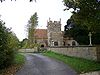 St Mary: Yarlington |
All of Yarlington[a] | South Somerset |
| Ansford | Castle Cary with Ansford | St Andrew[453] | 51°05′39″N 2°31′05″W / 51.0943°N 2.518°W |  St Andrew: Ansford |
Ansford | South Somerset |
| Castle Cary | Castle Cary with Ansford | All Saints[454] | 51°05′12″N 2°31′00″W / 51.0867°N 2.5167°W |  All Saints: Castle Cary |
All of Castle Cary Ansford North Barrow |
South Somerset |
| Charlton Musgrove | Charlton Musgrove, Cucklington and Stoke Trister[455] | St Stephen[456] St John[457] |
51°04′04″N 2°24′03″W / 51.0678°N 2.4008°W |  St Stephen: Charlton Musgrove |
Charlton Musgrove Wincanton |
South Somerset |
| Cucklington | Charlton Musgrove, Cucklington and Stoke Trister[455] | St Lawrence[458] | 51°02′56″N 2°21′02″W / 51.0488°N 2.3506°W |  St Lawrence: Cucklington |
Cucklington Penselwood |
South Somerset |
| Stoke Trister | Charlton Musgrove, Cucklington and Stoke Trister[455] | [459] | 51°03′27″N 2°22′37″W / 51.0575°N 2.3770°W |  St Andrew: Stoke Trister |
Stoke Trister | South Somerset |
| Evercreech | Evercreech with Chesterblade and Milton Clevedon | St Peter[460] St Mary[461] |
51°08′46″N 2°30′10″W / 51.1462°N 2.5027°W |  St Peter: Evercreech |
All of Evercreech[a] | Mendip |
| Milton Clevedon | Evercreech with Chesterblade and Milton Clevedon | St James[462] | 51°08′18″N 2°28′51″W / 51.1383°N 2.4808°W |  St James: Milton Clevedon |
All of Milton Clevedon[a] | Mendip |
| Charlton Horethorne with Stowell | Milborne Port with Goathill & Charlton Horethorne[463] | St Peter and St Paul[464] St Mary Magdalene[465] |
51°00′22″N 2°28′43″W / 51.0061°N 2.4785°W |  St Peter and St Paul: Charlton Horethorne |
All of Charlton Horethorne[a] | South Somerset |
| Goathill | Milborne Port with Goathill & Charlton Horethorne[463] | [466] | 50°57′13″N 2°27′47″W / 50.9535°N 2.4630°W |  St Peter: Goathill |
All of Goathill[a] | West Dorset |
| Milborne Port (LEP) | Milborne Port with Goathill & Charlton Horethorne[463] | St John the Evangelist[467] Milborne Wick Mission Church[468] |
50°57′59″N 2°27′40″W / 50.9665°N 2.461°W |  St John: Milborne Port |
Milborne Port Corton Denham |
South Somerset |
| Penselwood | Pen Selwood | [469] | 51°04′55″N 2°20′59″W / 51.0820°N 2.3496°W | 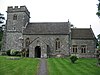 St Michael: Penselwood |
Penselwood Stoke Trister |
South Somerset |
| Alford | Six Pilgrims[470] | All Saints[471] | 51°05′29″N 2°33′58″W / 51.0914°N 2.5661°W |  All Saints: Alford |
Alford Ditcheat |
South Somerset, Mendip |
| Babcary | Six Pilgrims[470] | Holy Cross[472] | 51°03′24″N 2°37′38″W / 51.0566°N 2.6271°W |  Holy Cross: Babcary |
All of Babcary[a] | South Somerset |
| Hornblotton | Six Pilgrims[470] | St Peter[473] | 51°06′17″N 2°35′01″W / 51.1046°N 2.5835°W |  St Peter: Hornblotton |
West Bradley | Mendip |
| Lovington | Six Pilgrims[470] | St Thomas[474] | 51°04′31″N 2°34′38″W / 51.0754°N 2.5771°W |  St Thomas: Lovington |
Lovington | South Somerset |
| North Barrow | Six Pilgrims[470] | [475] | 51°03′45″N 2°33′39″W / 51.0624°N 2.5608°W |  St Nicholas: North Barrow |
North Barrow Isolated part of Compton Pauncefoot |
South Somerset |
| South Barrow | Six Pilgrims[470] | St Peter[476] | 51°02′56″N 2°34′10″W / 51.049°N 2.5694°W |  St Peter: South Barrow |
All of South Barrow[a] | South Somerset |
| Wincanton | Wincanton | St Peter and St Paul[477] | 51°03′18″N 2°24′49″W / 51.055°N 2.4136°W |  St Peter and St Paul: Wincanton |
Wincanton Charlton Musgrove |
South Somerset |
Deanery of Frome[]
The deanery covers areas of Mendip around Frome, with one parish which stretches into Wiltshire.
| Ecclesiastical parish | Benefice | Parish church | Location | Image | Civil parish(es) | District(s) |
|---|---|---|---|---|---|---|
| Beckington with Standerwick | Beckington with Standerwick Berkley Rodden etc. | St George[478] | 51°15′49″N 2°17′08″W / 51.2635°N 2.2855°W |  St George: Beckington |
Beckington Berkley |
Mendip |
| Berkley | Beckington with Standerwick Berkley Rodden etc. | St Mary[479] | 51°14′37″N 2°16′19″W / 51.2436°N 2.2719°W |  St Mary: Berkley |
Berkley Beckington Selwood Frome |
Mendip |
| Lullington with Orchardleigh | Beckington with Standerwick Berkley Rodden etc. | All Saints[480] Church of St Mary[481] |
51°15′59″N 2°18′43″W / 51.2663°N 2.312°W |  All Saints: Lullington |
Lullington | Mendip |
| Rodden | Beckington with Standerwick Berkley Rodden etc. | All Saints[482] | 51°13′42″N 2°17′22″W / 51.2283°N 2.2895°W | Selwood Frome |
Mendip | |
| Frome: Christ Church | Christ Church with Saint Mary's Frome | Christ Church[483] | 51°13′46″N 2°19′34″W / 51.2295°N 2.326°W | 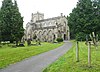 Christ Church: Frome |
Frome Selwood |
Mendip |
| Frome: St Mary | Christ Church with Saint Mary's Frome | St Mary[484] | 51°13′47″N 2°19′33″W / 51.2296°N 2.3259°W |  St Mary: Frome |
Frome Berkley Selwood |
Mendip |
| Frome: Holy Trinity | Frome (Holy Trinity) | Holy Trinity[485] | 51°14′02″N 2°19′41″W / 51.2338°N 2.328°W |  Holy Trinity: Frome |
Frome Selwood |
Mendip |
| Frome St John | Frome (St John the Baptist) | St John[486] | 51°13′47″N 2°19′14″W / 51.2297°N 2.3206°W |  St John: Frome |
Frome Selwood |
Mendip |
| Hardington Vale | Hardington Vale[487] | St Mary[488] All Saints[489] St Mary[490] St Lawrence[491] St Leonard[492] St Philip and St James[493] |
51°16′31″N 2°23′27″W / 51.2754°N 2.3907°W |  St Mary: Hemington |
All of Hemington Lullington Norton St Philip Rode Tellisford Southwick |
Mendip, Wiltshire |
| Leigh-on-Mendip | Leigh upon Mendip with Stoke St Michael | St Giles[494] All Saints[495] |
51°13′26″N 2°26′30″W / 51.2239°N 2.4416°W |  St Giles: Leigh-on-Mendip |
All of Leigh-on-Mendip All of Downhead Cranmore |
Mendip |
| Stoke St Michael | Leigh upon Mendip with Stoke St Michael | St Michael[496] | 51°13′16″N 2°28′55″W / 51.221°N 2.4819°W |  St Michael: Stoke St Michael |
Stoke St Michael | Mendip |
| Buckland Dinham | Mells with Buckland Dinham, Elm, Whatley etc.[497] | St Michael[498] | 51°15′36″N 2°21′09″W / 51.26°N 2.3524°W |  St Michael: Buckland Dinham |
All of Buckland Dinham[a] | Mendip |
| Chantry | Mells with Buckland Dinham, Elm, Whatley etc.[497] | Holy Trinity[499] | 51°13′37″N 2°22′56″W / 51.227°N 2.3822°W |  Holy Trinity, Chantry |
Whatley Mells |
Mendip |
| Elm | Mells with Buckland Dinham, Elm, Whatley etc.[497] | St Mary[500] | 51°14′32″N 2°21′48″W / 51.2422°N 2.3632°W |  St Mary: Great Elm |
All of Great Elm[a] | Mendip |
| Mells with Vobster | Mells with Buckland Dinham, Elm, Whatley etc.[497] | St Andrew's Church[501] | 51°14′31″N 2°23′26″W / 51.2419°N 2.3905°W |  St Andrew: Mells |
Mells Kilmersdon |
Mendip |
| Whatley | Mells with Buckland Dinham, Elm, Whatley etc.[497] | St George[502] | 51°13′37″N 2°22′56″W / 51.2269°N 2.3822°W |  St George: Whatley |
Whatley | Mendip |
| Postlebury | Postlebury | All Saints[503] St Mary, St John and All Saints[504] St Leonard[505] St Mary[506] St Mary[507] |
51°12′36″N 2°22′38″W / 51.2099°N 2.3771°W |  All Saints: Nunney |
All of Nunney all of Trudoxhill All of Wanstrow All of Witham Priory Selwood |
Mendip |
| Woodlands | Woodlands | St Katherine[508] | 51°11′45″N 2°18′05″W / 51.1958°N 2.3014°W |  St Katherine: East Woodlands |
Selwood | Mendip |
Deanery of Glastonbury[]
The deanery covers parishes in several districts around Glastonbury and Street on the Somerset Levels.
| Ecclesiastical parish | Benefice | Parish church | Location | Image | Civil parish(es) | District(s) |
|---|---|---|---|---|---|---|
| Baltonsborough | Baltonsborough with Butleigh, West Bradley and West Pennard (known as the Brue Benefice)[509] | St Dunstan[510] | 51°06′38″N 2°39′22″W / 51.1106°N 2.656°W |  St Dunstan: Baltonsborough |
Baltonsborough | Mendip |
| Butleigh | Baltonsborough with Butleigh, West Bradley and West Pennard[509] | St Leonard[511] | 51°06′09″N 2°41′13″W / 51.1025°N 2.6869°W |  St Leonard: Butleigh |
Butleigh Walton |
Mendip |
| West Bradley with Lottisham | Baltonsborough with Butleigh, West Bradley and West Pennard[509] | St Andrew: West Bradley[512] St Mary: Lottisham[513] |
51°07′46″N 2°38′00″W / 51.1294°N 2.6333°W |  St Andrew: West Bradley |
All of West Bradley Baltonsborough West Pennard |
Mendip |
| West Pennard | Baltonsborough with Butleigh, West Bradley and West Pennard[509] | St Nicholas[514] | 51°08′28″N 2°38′23″W / 51.1412°N 2.6397°W |  St Nicholas: West Pennard |
West Pennard | Mendip |
| Glastonbury: St Benedict | Glastonbury St. John the Baptist and St. Benedict | St Benedict[515] | 51°08′48″N 2°43′11″W / 51.1467°N 2.7197°W |  |
Glastonbury Butleigh Sharpham St Benedict: Glastonbury Street |
Mendip |
| Glastonbury: St John the Baptist | Glastonbury St. John the Baptist and St. Benedict | St John[516] | 51°08′54″N 2°42′58″W / 51.1482°N 2.7162°W |  St John: Glastonbury |
Glastonbury Meare |
Mendip |
| Meare | Glastonbury St. John the Baptist and St. Benedict | St Mary[517] | 51°10′18″N 2°46′44″W / 51.1718°N 2.7789°W |  St Mary: Meare |
Meare Godney |
Mendip |
| Greinton | Middlezoy with Othery, Moorlinch and Greinton | St Michael & All Angels[518] | 51°07′24″N 2°50′26″W / 51.1233°N 2.8405°W |  St Michael & All Angels: Greinton |
All of Greinton Ashcott |
Sedgemoor |
| Middlezoy | Middlezoy with Othery, Moorlinch and Greinton | Holy Cross[519] | 51°05′38″N 2°53′39″W / 51.0939°N 2.8942°W |  Holy Cross: Middlezoy |
All of Middlezoy Othery |
Sedgemoor |
| Moorlynch | Middlezoy with Othery, Moorlinch and Greinton | St Mary[520] St Francis[521] |
51°07′41″N 2°51′42″W / 51.128°N 2.8616°W | 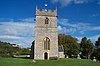 St Mary: Moorlinch |
Moorlinch Stawell |
Sedgemoor |
| Othery | Middlezoy with Othery, Moorlinch and Greinton | St Michael[522] | 51°04′50″N 2°52′59″W / 51.0806°N 2.883°W | 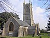 St Michael: Othery |
Othery Burrowbridge |
Sedgemoor, Taunton Deane |
| Compton Dundon | Street with Walton and Compton Dundon[523] | St Andrew[524] | 51°05′23″N 2°44′41″W / 51.0897°N 2.7447°W |  St Andrew: Compton Dundon |
Compton Dundon | South Somerset |
| Street | Street with Walton and Compton Dundon[523] | Holy Trinity[525] Mission Church[526] |
51°07′53″N 2°43′58″W / 51.1313°N 2.7329°W |  Holy Trinity: Street |
Street Butleigh Sharpham |
Mendip |
| Walton | Street with Walton and Compton Dundon[523] | Holy Trinity[527] | 51°07′25″N 2°46′16″W / 51.1236°N 2.7710°W |  Holy Trinity: Walton |
Walton | Mendip |
| Polden Wheel | The Polden Wheel[528] | [529] All Saints[530] St George[531] St Peter[532] St Philip and St James[533] St Mary[534] |
51°09′21″N 2°53′50″W / 51.1559°N 2.8971°W |  St Edward: Chilton Polden |
All of Catcott All of Chilton Polden All of Edington, Somerset All of Shapwick Ashcott Burtle Moorlinch Stawell |
Sedgemoor |
| Barton St David | Wheathill[535] | St David[536] | 51°04′58″N 2°39′31″W / 51.0827°N 2.6585°W |  St David: Barton St David |
Barton St David Keinton Mandeville |
South Somerset |
| Keinton Mandeville with Kingweston | Wheathill[535] | [537] All Saints: Kingweston[538] |
51°04′05″N 2°38′48″W / 51.0681°N 2.6468°W |  St Mary: Keinton Mandeville |
Keinton Mandeville All of Kingweston Barton St David |
South Somerset |
| Lydford on Fosse | Wheathill[535] | St Peter[539] | 51°05′05″N 2°37′22″W / 51.0846°N 2.6227°W |  St Peter |
Lydford-on-Fosse Lovington |
Mendip, South Somerset |
Deanery of Ivelchester[]
The deanery covers parishes in South Somerset.
| Ecclesiastical parish | Benefice | Parish church | Location | Image | Civil parish(es) | District(s) |
|---|---|---|---|---|---|---|
| Curry Rivel | Curry Rivel with Fivehead and Swell | St Andrew[540] | 51°01′29″N 2°52′04″W / 51.0247°N 2.8678°W |  St Andrew: Curry Rivel |
Curry Rivel Drayton Hambridge and Westport |
South Somerset |
| Fivehead | Curry Rivel with Fivehead and Swell | St Martin[541] | 51°00′06″N 2°55′22″W / 51.0017°N 2.9228°W | 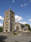 St Martin: Fivehead |
Fivehead | South Somerset |
| Swell | Curry Rivel with Fivehead and Swell | St Catherine[542] | 51°00′30″N 2°54′01″W / 51.0083°N 2.9003°W |  St Catherine: Swell |
Fivehead | South Somerset |
| Ilchester with Northover | Ilchester with Northover, Limington, Yeovilton etc.[543] | St Mary Major[544] | 51°00′03″N 2°40′54″W / 51.0009°N 2.6818°W |  St Mary: Ilchester |
Ilchester Tintinhull |
South Somerset |
| Limington | Ilchester with Northover, Limington, Yeovilton etc.[543] | St Mary[545] | 50°59′50″N 2°39′12″W / 50.9972°N 2.6533°W |  St Mary: Limington |
All of Limington[a] | South Somerset |
| Yeovilton with Podimore | Ilchester with Northover, Limington, Yeovilton etc.[543] | St Peter: Podimore[546] | 51°01′18″N 2°38′57″W / 51.0217°N 2.6492°W |  St Peter: Podimore |
Yeovilton | South Somerset |
| Aller | Langport Area Team Ministry[547] | St Andrew[548] | 51°03′19″N 2°51′46″W / 51.0554°N 2.8627°W |  St Andrew: Aller |
All of Aller[a] | South Somerset |
| Drayton | Langport Area Team Ministry[547] | St Catherine[549] | 51°01′10″N 2°50′57″W / 51.0194°N 2.8492°W |  St Catherine: Drayton |
Drayton Curry Rivel |
South Somerset |
| High Ham with Low Ham | Langport Area Team Ministry[547] | St Andrew: High Ham[550] | 51°04′35″N 2°49′18″W / 51.0764°N 2.8217°W |  St Andrew: High Ham |
High Ham | South Somerset |
| Huish Episcopi cum Langport | Langport Area Team Ministry[547] | St Mary: Huish Episcopi[551] | 51°02′09″N 2°49′05″W / 51.0358°N 2.8181°W |  St Mary: Huish Episcopi |
All of Huish Episcopi All of Langport, High Ham |
South Somerset |
| Long Load | Langport Area Team Ministry[547] | Christ Church | 51°00′14″N 2°45′47″W / 51.004°N 2.7631°W |  Christ Church, Long Load |
All of Long Load[a] | South Somerset |
| Long Sutton | Langport Area Team Ministry[547] | Holy Trinity[552] | 51°01′58″N 2°45′23″W / 51.0328°N 2.7564°W |  Holy Trinity: Long Laod |
Long Sutton Somerton |
South Somerset |
| Muchelney | Langport Area Team Ministry[547] | St Peter and St Paul[553] | 51°01′14″N 2°48′54″W / 51.0206°N 2.815°W |  St Peter and St Paul: Muchelney |
All of Muchelney[a] | South Somerset |
| Pitney | Langport Area Team Ministry[547] | [554] | 51°03′10″N 2°47′37″W / 51.0529°N 2.7935°W |  St John: Pitney |
Pitney | South Somerset |
| Ash | Martock with Kingsbury Episocpi & Ash[555] | [556] | 50°59′01″N 2°45′10″W / 50.9835°N 2.7528°W |  Holy Trinity: Ash |
Ash | South Somerset |
| Kingsbury Episcopi | Martock with Kingsbury Episocpi & Ash[555] | St Martin[557] | 50°59′08″N 2°48′10″W / 50.9856°N 2.8028°W | 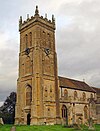 St Martin: Kingsbury Episcopi |
Kingsbury Episcopi | South Somerset |
| Martock | Martock with Kingsbury Episocpi & Ash[555] | All Saints[558] | 50°58′10″N 2°46′08″W / 50.9694°N 2.7689°W |  All Saints: Martock |
Martock Ash |
South Somerset |
| Chiselborough | Norton-sub-Hamdon, West Chinnock, Chiselborough and Middle Chinnock[559] | St Peter and St Paul[560] | 50°55′51″N 2°45′33″W / 50.9308°N 2.7591°W |  St Peter and St Paul: Chiselborough |
All of Chiselborough[a] | South Somerset |
| Middle Chinnock | Norton-sub-Hamdon, West Chinnock, Chiselborough and Middle Chinnock[559] | St Margaret[561] | 50°54′55″N 2°45′08″W / 50.9152°N 2.7522°W |  St Margaret: Milddle Chinnock |
West and Middle Chinnock | South Somerset |
| Norton-sub-Hamdon | Norton-sub-Hamdon, West Chinnock, Chiselborough and Middle Chinnock[559] | St Mary[562] | 50°56′24″N 2°45′13″W / 50.94°N 2.7536°W | 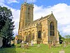 St Mary: Norton-sub-Hamdon |
Norton-sub-Hamdon | South Somerset |
| West Chinnock | Norton-sub-Hamdon, West Chinnock, Chiselborough and Middle Chinnock[559] | St Mary[563] | 50°55′00″N 2°45′32″W / 50.9168°N 2.7588°W |  St Mary: West Chinnock |
West Chinnock | South Somerset |
| Kingsdon | Somerton with the Charltons and Kingsdon[564] | All Saints[565] | 51°01′59″N 2°41′31″W / 51.0331°N 2.692°W | 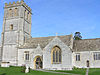 All Saints: Kingsdon |
Kingsdon | South Somerset |
| Somerton | Somerton with the Charltons and Kingsdon[564] | St Michael and All Angels[566] | 51°03′16″N 2°43′37″W / 51.0544°N 2.7269°W |  St Michael and All Angels, Somerton |
Somerton High Ham Kingsdon Long Sutton |
South Somerset |
| The Charltons | Somerton with the Charltons and Kingsdon[564] | St Mary: Charlton Mackrell[567] St Peter and St Paul: Charlton Adam[568] |
51°03′09″N 2°40′28″W / 51.0524°N 2.6744°W |  St Peter and St Paul, Charlton Adam |
All of Charlton Mackrell Compton Dundon |
South Somerset |
| Stoke-sub-Hamdon | Stoke sub Hamdon[559] | St Mary[569] | 50°57′07″N 2°44′07″W / 50.9519°N 2.7353°W |  St Mary: Stoke-sub-Hamdon |
All of Stoke-sub-Hamdon[a] | South Somerset |
Deanery of Shepton Mallet[]
The deanery covers parishes in the Mendip area.
| Ecclesiastical parish | Benefice | Parish church | Location | Image | Civil parish(es) | District(s) |
|---|---|---|---|---|---|---|
| Ashwick | Ashwick with Oakhill and Binegar | St James[570] | 51°14′02″N 2°31′16″W / 51.2339°N 2.5212°W | 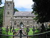 St Janes: Ashwick |
Ashwick Chilcompton Stratton on the Fosse |
Mendip |
| Binegar | Ashwick with Oakhill and Binegar | Holy Trinity[571] | 51°14′35″N 2°33′08″W / 51.243°N 2.5523°W |  Holy Trinity: Binegar |
Binegar Ashwick Chilcompton Emborough St Cuthbert Out |
Mendip |
| Oakhill | Ashwick with Oakhill and Binegar | [572] | 51°13′25″N 2°31′22″W / 51.2235°N 2.5227°W | Ashwick Stoke St Michael |
Mendip | |
| Chewton Mendip with Emborough | Chewton Mendip with Ston Easton Litton etc. | St Mary:Chewton Mendip[573] | 51°16′34″N 2°34′48″W / 51.2761°N 2.5799°W |  St Mary: Chewton Mendip |
Chewton Mendip Emborough Binegar Chilcompton Ston Easton |
Mendip |
| Litton | Chewton Mendip with Ston Easton Litton etc. | St Mary[574] | 51°17′24″N 2°34′59″W / 51.2899°N 2.583°W |  St Mary: Litton |
All of Litton[a] | Mendip |
| Ston Easton | Chewton Mendip with Ston Easton Litton etc. | St Mary[575] | 51°16′44″N 2°32′27″W / 51.2789°N 2.5408°W |  St Mary: Ston Easton |
Ston Easton Chilcompton |
Mendip |
| Coxley with Godney | Coxley with Godney, Henton and Wookey[576] | Christ Church: Coxley[577] | 51°11′13″N 2°40′46″W / 51.1870°N 2.6794°W |  Christ Church: Coxley |
St Cuthbert Out Godney Wookey |
Mendip |
| Henton | Coxley with Godney, Henton and Wookey[576] | [578] | 51°12′21″N 2°43′35″W / 51.2058°N 2.7265°W |  Christ Church: Henton |
Wookey Godney |
Mendip |
| Wookey | Coxley with Godney, Henton and Wookey[576] | St Matthew[579] | 51°12′33″N 2°41′21″W / 51.2093°N 2.6893°W |  St Matthew: Wookey |
Wookey St Cuthbert Out |
Mendip |
| Ditcheat | Fosse Trinity | St Mary[580] Mission Church[581] |
51°07′30″N 2°32′10″W / 51.125°N 2.5361°W | 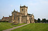 St Mary: Ditcheat |
All of Ditcheat[a] | Mendip |
| East Pennard | Fosse Trinity | All Saints[582] | 51°08′07″N 2°34′42″W / 51.1352°N 2.5782°W | 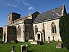 All Saints: East Pennard |
East Pennard | Mendip |
| Pylle | Fosse Trinity | Thomas à Becket[583] | 51°08′34″N 2°33′47″W / 51.1429°N 2.5631°W | 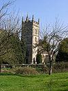 St Thomas: Pylle |
All of Pylle[a] | Mendip |
| Croscombe | Pilton with Croscombe, North Wootton and Dinder[584] | St Mary[585] | 51°11′51″N 2°35′14″W / 51.1974°N 2.5872°W |  St Mary: Croscombe |
Croscombe | Mendip |
| Dinder | Pilton with Croscombe, North Wootton and Dinder[584] | St Michael[586] | 51°11′56″N 2°36′34″W / 51.199°N 2.6094°W |  St Michael: Dinder |
St Cuthbert Out | Mendip |
| North Wootton | Pilton with Croscombe, North Wootton and Dinder[584] | St Peter[587] | 51°10′26″N 2°37′31″W / 51.1738°N 2.6254°W |  St Peter: North Wootton |
North Wootton St Cuthbert Out |
Mendip |
| Pilton | Pilton with Croscombe, North Wootton and Dinder[584] | St John[588] | 51°09′54″N 2°35′23″W / 51.165°N 2.5898°W |  St John: Pilton |
Pilton North Wootton |
Mendip |
| Doulting | Shepton Mallet with Doulting[589] | St Aldhelm[590] St Bartholomew[591] |
51°11′09″N 2°30′21″W / 51.1859°N 2.5058°W |  St Aldhelm: Doulting |
All of Doulting Cranmore |
Mendip |
| Shepton Mallet | Shepton Mallet with Doulting[589] | St Peter and St Paul[592] | 51°11′28″N 2°32′45″W / 51.191°N 2.5457°W |  St Peter and St Paul: Shepton Mallet |
All of Shepton Mallet Ashwick Croscombe Pilton |
Mendip |
| Wells: St Cuthbert | Wells St Cuthbert with Wookey Hole[593] | St Cuthbert[594] | 51°12′30″N 2°39′01″W / 51.2083°N 2.6503°W |  St Cuthbert: Wells |
Wells St Cuthbert Out |
Mendip |
| Wookey Hole | Wells St Cuthbert with Wookey Hole[593] | St Mary[595] | 51°13′30″N 2°40′16″W / 51.2250°N 2.6710°W |  St Mary: Wookey Hole |
St Cuthbert Out | Mendip |
| Wells; St Thomas with Horrington | Wells St Thomas with Horrington | St Thomas[596] | 51°12′46″N 2°38′13″W / 51.2129°N 2.637°W |  St Thomas: Wells |
Wells St Cuthbert Out |
Mendip |
Deanery of Yeovil[]
The deanery includes parishes in South Somerset.
| Ecclesiastical parish | Benefice | Parish church | Location | Image | Civil parish(es) | District(s) |
|---|---|---|---|---|---|---|
| Ashington | Chilton Cantelo, Ashington, Mudford, Rimpton etc. | St Vincent[597] | 50°59′38″N 2°37′32″W / 50.9938°N 2.6255°W |  St Vincent: Ashington |
Chilton Cantelo | South Somerset |
| Chilton Cantelo | Chilton Cantelo, Ashington, Mudford, Rimpton etc. | St James[598] | 50°59′51″N 2°36′50″W / 50.9974°N 2.6138°W |  St James, Chilton Cantelo |
Chilton Cantelo Yeovilton |
South Somerset |
| Marston Magna | Chilton Cantelo, Ashington, Mudford, Rimpton etc. | St Mary[599] | 50°59′55″N 2°34′46″W / 50.9986°N 2.5794°W |  St Mary: Marston Magna |
Marston Magna | South Somerset |
| Mudford | Chilton Cantelo, Ashington, Mudford, Rimpton etc. | St Mary[600] | 50°58′37″N 2°36′27″W / 50.9769°N 2.6075°W |  St Mary: Mudford |
Mudford | South Somerset |
| Rimpton | Chilton Cantelo, Ashington, Mudford, Rimpton etc. | St Mary[601] | 50°59′39″N 2°33′18″W / 50.9942°N 2.555°W | 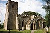 St Mary: Rimpton |
All of Rimpton[a] | South Somerset |
| Brympton | Odcombe Brympton Lufton and Montacute | St Andrew[602] | 50°56′06″N 2°41′02″W / 50.935°N 2.6839°W |  St Andrew: Brympton |
Brympton | South Somerset |
| Lufton | Odcombe Brympton Lufton and Montacute | [603] | 50°56′57″N 2°41′30″W / 50.9491°N 2.6918°W |  St Peter & St Paul: Lufton |
Brympton | South Somerset |
| Montacute | Odcombe Brympton Lufton and Montacute | St Catherine[604] | 50°56′59″N 2°43′04″W / 50.9497°N 2.7178°W |  St Catherine: Montacute |
Montacute Norton-sub-Hamdon |
South Somerset |
| Odcombe | Odcombe Brympton Lufton and Montacute | St Peter and St Paul[605] | 50°56′11″N 2°42′11″W / 50.9365°N 2.7031°W |  St Peter and St Paul: Odcombe |
Odcombe Brympton |
South Somerset |
| Preston Plucknett | Preston Plucknett[606] | St James[607] St Peter[608] |
50°56′37″N 2°39′49″W / 50.9436°N 2.6636°W |  St James: Preston Plucknett |
Brympton Yeovil Yeovil Without |
South Somerset |
| Closworth | The Coker Ridge[609] | All Saints: Closworth[610] | 50°53′18″N 2°37′17″W / 50.8884°N 2.6213°W | 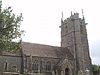 All Saints: Closworth |
Closworth | South Somerset |
| East Chinnock | The Coker Ridge[609] | [611] | 50°54′59″N 2°42′53″W / 50.9165°N 2.7146°W | 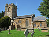 St Mary: East Chinnock |
All of East Chinnock Odcombe |
South Somerset |
| East Coker | The Coker Ridge[609] | St Michael and All Angels[612] | 50°54′26″N 2°39′26″W / 50.9073°N 2.6573°W |  St Michael: East Coker |
East Coker Closworth |
South Somerset |
| Hardington Mandeville | The Coker Ridge[609] | St Mary[613] | 50°54′17″N 2°41′42″W / 50.9048°N 2.6949°W |  St Mary: Hardington Mandeville |
All of Hardington Mandeville[a] | South Somerset |
| Pendomer | The Coker Ridge[609] | St Roch[614] | 50°53′28″N 2°40′55″W / 50.891°N 2.6819°W |  St Roch: Pendomer |
Closworth | South Somerset |
| Sutton Bingham | The Coker Ridge[609] | All Saints[615] | 50°53′51″N 2°38′37″W / 50.8975°N 2.6436°W |  All Saints: Sutton Bingham |
Closworth | South Somerset |
| West Coker | The Coker Ridge[609] | St Martin of Tours[616] | 50°55′11″N 2°41′21″W / 50.9196°N 2.6891°W |  St Martin: West Coker |
West Coker | South Somerset |
| Chilthorne Domer | Tintinhull, Chilthorne Domer, Yeovil Marsh & Thorne Coffin[617] | St Mary[618] | 50°58′20″N 2°40′41″W / 50.9723°N 2.6781°W |  St Mary, Chilthorne Domer |
All of Chilthorne Domer[a] | South Somerset |
| Thorne Coffin | Tintinhull, Chilthorne Domer, Yeovil Marsh & Thorne Coffin[617] | St Andrew[619] | 50°57′21″N 2°40′34″W / 50.9559°N 2.6762°W |  St Andrew: Thorne Coffin |
Brympton | South Somerset |
| Tintinhull | Tintinhull, Chilthorne Domer, Yeovil Marsh & Thorne Coffin[617] | St Margaret[620] | 50°58′28″N 2°42′57″W / 50.9744°N 2.7158°W |  St Margaret: Tintinhull |
Tintinhull | South Somerset |
| Yeovil Marsh: All Saints | Tintinhull, Chilthorne Domer, Yeovil Marsh & Thorne Coffin[617] | All Saints[621] | 50°58′01″N 2°39′03″W / 50.9669°N 2.6509°W |  All Saints: Yeovil Marsh |
Yeovil Without Mudford |
South Somerset |
| Barwick | Yeovil Holy Trinity with Barwick | [622] | 50°55′21″N 2°37′48″W / 50.9225°N 2.6299°W |  St Mary, Barwick |
Barwick | South Somerset |
| Yeovil: Holy Trinity | Yeovil Holy Trinity with Barwick | [623] | 50°56′02″N 2°39′05″W / 50.9338°N 2.6515°W | Yeovil Barwick East Coker West Coker |
South Somerset | |
| Yeovil: St Michael & All Angels | Yeovil St Michael & All Angels | [624] | 50°56′50″N 2°37′12″W / 50.9472°N 2.6200°W |  St Michael: Yeovil |
Yeovil Yeovil Without |
South Somerset |
| Yeovil with Kingston Pitney | Yeovil with Kingston Pitney | St John: Yeovil[625] [626] |
50°56′30″N 2°37′53″W / 50.9417°N 2.6314°W |  St John: Yeovil |
Yeovil Yeovil Without |
South Somerset |
Extra-parochial areas[]
The area of central Wells, forming Wells St Andrew, a liberty around the cathedral and the Bishop's Palace is the only extra-parochial area within the diocese.
| Ecclesiastical parish | Benefice | Parish church | Location | Image | Civil parish(es) | District(s) |
|---|---|---|---|---|---|---|
| St Andrew Extra Parochial Place | None | None | 51°12′37″N 2°38′31″W / 51.2104°N 2.642°W | 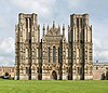 Wells Cathedral |
Wells | Mendip |
Footnotes[]
References[]
- ^ Diocese of Bath & Wells — Ruth Worsley announced as next Bishop of Taunton Archived 2015-07-02 at the Wayback Machine (Accessed 2 July 2015)
- ^ "The Bishops' Office". Diocese of Bath and Wells. Archived from the original on 10 May 2012.
- ^ "Bishop Peter commissions Honorary Assistant Bishops". Diocese of Bath and Wells. Retrieved 18 May 2018.
- ^ "Research and Statistics". Church of England. Retrieved 27 December 2017.
- ^ . Encyclopædia Britannica. Vol. 3 (11th ed.). 1911. pp. 725–726.
- ^ Dunbabin, J. P. D. (1997). "British Local Government Reform: The Nineteenth Century and after". The English Historical Review. 92 (365): 777–805. JSTOR 567654.
- ^ a b c "Bishops & Archdeacons". Diocese of Bath and Wells. Retrieved 20 December 2017.
- ^ "Diocesan Contacts List". Diocese of Bath and Wells. Retrieved 9 January 2018.
- ^ "Bath Abbey (St Peter and St Paul)". A Church Near You. Church of England. Retrieved 22 December 2017.
- ^ "St John the Baptist". A Church Near You. Church of England. Retrieved 22 December 2017.
- ^ "St Mary the Virgin". A Church Near You. Church of England. Retrieved 22 December 2017.
- ^ "The Ascension". A Church Near You. Church of England. Retrieved 22 December 2017.
- ^ "St Michael". A Church Near You. Church of England. Retrieved 22 December 2017.
- ^ "Bath Combe Hay Church". A Church Near You. Church of England. Retrieved 22 December 2017.
- ^ "St Philip & St James". A Church Near You. Church of England. Retrieved 22 December 2017.
- ^ "St Michael's Without". A Church Near You. Church of England. Retrieved 22 December 2017.
- ^ "St Barnabas". A Church Near You. Church of England. Retrieved 22 December 2017.
- ^ "St Peter's". A Church Near You. Church of England. Retrieved 22 December 2017.
- ^ "St Bartholomew". A Church Near You. Church of England. Retrieved 22 December 2017.
- ^ "St Luke's Wellsway". A Church Near You. Church of England. Retrieved 22 December 2017.
- ^ "St Saviour's Church". A Church Near You. Church of England. Retrieved 22 December 2017.
- ^ "St Mary the Blessed Virgin". A Church Near You. Church of England. Retrieved 22 December 2017.
- ^ "All Saints". A Church Near You. Church of England. Archived from the original on 17 April 2016. Retrieved 31 January 2018.
- ^ "St Swithin". A Church Near You. Church of England. Retrieved 22 December 2017.
- ^ "St Andrew". A Church Near You. Church of England. Archived from the original on 20 October 2012. Retrieved 31 January 2018.
- ^ "Christ Church". A Church Near You. Church of England. Archived from the original on 3 March 2016. Retrieved 31 January 2018.
- ^ "All Saints". A Church Near You. Church of England. Retrieved 22 December 2017.
- ^ "St Mary Magdalene Langridge". A Church Near You. Church of England. Retrieved 22 December 2017.
- ^ "St Martin". A Church Near You. Church of England. Retrieved 22 December 2017.
- ^ "St John the Evangelist". A Church Near You. Church of England. Retrieved 22 December 2017.
- ^ "Emmanuel". A Church Near You. Church of England. Archived from the original on 20 October 2012. Retrieved 31 January 2018.
- ^ "St Nicholas". A Church Near You. Church of England. Retrieved 22 December 2017.
- ^ "St Thomas a Becket". A Church Near You. Church of England. Retrieved 22 December 2017.
- ^ "St Matthew's Church". A Church Near You. Church of England. Retrieved 22 December 2017.
- ^ "St Nicholas Church". A Church Near You. Church of England. Retrieved 22 December 2017.
- ^ "The Blessed Virgin Mary". A Church Near You. Church of England. Retrieved 22 December 2017.
- ^ "St John the Baptist". A Church Near You. Church of England. Retrieved 22 December 2017.
- ^ "St Catherine". A Church Near You. Church of England. Retrieved 22 December 2017.
- ^ "St Swithun Bathford". A Church Near You. Church of England. Retrieved 22 December 2017.
- ^ "St Stephen's". A Church Near You. Church of England. Retrieved 22 December 2017.
- ^ "The Blessed Virgin Mary, Charlcombe, Bath". A Church Near You. Church of England. Retrieved 22 December 2017.
- ^ "Holy Trinity". A Church Near You. Church of England. Retrieved 22 December 2017.
- ^ "St Andrew". A Church Near You. Church of England. Archived from the original on 18 March 2016. Retrieved 31 January 2018.
- ^ "St Michael". A Church Near You. Church of England. Archived from the original on 27 December 2017. Retrieved 22 December 2017.
- ^ "St James the Great". A Church Near You. Church of England. Archived from the original on 27 December 2017. Retrieved 22 December 2017.
- ^ "St Peter". A Church Near You. Church of England. Archived from the original on 27 December 2017. Retrieved 22 December 2017.
- ^ "St John the Baptist". A Church Near You. Church of England. Archived from the original on 27 December 2017. Retrieved 22 December 2017.
- ^ "St Mary". A Church Near You. Church of England. Archived from the original on 1 April 2016. Retrieved 31 January 2018.
- ^ "St Andrew, Blagdon". A Church Near You. Church of England. Archived from the original on 15 February 2016. Retrieved 1 November 2015.
- ^ "St Andrew's". Blagdon Village. Archived from the original on 4 March 2016. Retrieved 1 November 2015.
- ^ "St Hugh". A Church Near You. Church of England. Archived from the original on 4 March 2016. Retrieved 2 February 2018.
- ^ a b "Benefice of Blagdon with Charterhouse Compton Martin and Ubley" (PDF). Diocese of Bath and Wells. Retrieved 23 December 2017.
- ^ "St Michael The Archangel, Compton Martin". A Church Near You. Church of England. Archived from the original on 3 February 2016. Retrieved 30 January 2016.
- ^ "St Bartholomew, Ubley". A Church Near You. Church of England. Archived from the original on 7 August 2017. Retrieved 7 August 2017.
- ^ "St Mary the Virgin". A Church Near You. Church of England. Archived from the original on 27 December 2017. Retrieved 20 December 2017.
- ^ "St Andrew". A Church Near You. Church of England. Archived from the original on 27 December 2017. Retrieved 20 December 2017.
- ^ "About Dundry". Parish of Dundry. Archived from the original on 23 December 2016. Retrieved 20 December 2017.
- ^ a b "Holy Trinity". A Church Near You. Church of England. Archived from the original on 27 December 2017. Retrieved 20 December 2017.
- ^ a b "The Benefice of St Andrew's, Chew Stoke with the Blessed Virgin Mary, Nempnett Thrubwell" (PDF). Diocese of Bath and Wells. Retrieved 23 December 2017.
- ^ "St Andrew". A Church Near You. Church of England. Retrieved 20 December 2017.
- ^ "The Blessed Virgin Mary". A Church Near You. Church of England. Retrieved 20 December 2017.
- ^ "Holy Trinity". A Church Near You. Church of England. Retrieved 20 December 2017.
- ^ "St Augustine of Hippo". A Church Near You. Church of England. Retrieved 20 December 2017.
- ^ "St Nicholas & the Blessed Virgin Mary". A Church Near You. Church of England. Retrieved 20 December 2017.
- ^ "United Parish of East Harptree with West Harptree and Hinton Blewett-" (PDF). Diocese of Bath and Wells. Retrieved 23 December 2017.
- ^ "St Laurence". A Church Near You. Church of England. Retrieved 20 December 2017.
- ^ "The Blessed Virgin Mary". A Church Near You. Church of England. Retrieved 20 December 2017.
- ^ "St Margaret". A Church Near You. Church of England. Retrieved 20 December 2017.
- ^ "All Saints". A Church Near You. Church of England. Retrieved 20 December 2017.
- ^ "St Peter". A Church Near You. Church of England. Retrieved 20 December 2017.
- ^ "St Lawrence". A Church Near You. Church of England. Retrieved 20 December 2017.
- ^ "St John the Baptist". A Church Near You. Church of England. Retrieved 20 December 2017.
- ^ "Chewton Keynsham Mission Church". A Church Near You. Church of England. Archived from the original on 20 March 2016. Retrieved 2 February 2018.
- ^ "St Francis". A Church Near You. Church of England. Archived from the original on 19 March 2016. Retrieved 2 February 2018.
- ^ "St Michael". A Church Near You. Church of England. Archived from the original on 20 March 2016. Retrieved 2 February 2018.
- ^ "St Margaret". A Church Near You. Church of England. Archived from the original on 4 March 2016. Retrieved 2 February 2018.
- ^ a b "The United Benefice of Publow with Pensford, Compton Dando & Chelwood" (PDF). Diocese of Bath and Wells. Retrieved 23 December 2017.
- ^ "The Blessed Virgin Mary". A Church Near You. Church of England. Retrieved 20 December 2017.
- ^ "St Leonard". A Church Near You. Church of England. Retrieved 20 December 2017.
- ^ "All Saints' Church". A Church Near You. Church of England. Retrieved 20 December 2017.
- ^ a b c "Benefice of Saltford, Corston and Newton St. Loe" (PDF). All Saints Corston. Retrieved 23 December 2017.
- ^ "All Saints Church Corston". A Church Near You. Church of England. Retrieved 20 December 2017.
- ^ "Holy Trinity". A Church Near You. Church of England. Retrieved 20 December 2017.
- ^ "The Blessed Virgin Mary". A Church Near You. Church of England. Retrieved 20 December 2017.
- ^ "St Katharine & The Noble Army of Martyrs". A Church Near You. Church of England. Retrieved 20 December 2017.
- ^ "The Blessed Virgin Mary & St Peter". A Church Near You. Church of England. Retrieved 20 December 2017.
- ^ "St James". A Church Near You. Church of England. Archived from the original on 19 October 2012. Retrieved 2 February 2018.
- ^ "St Andrews". A Church Near You. Church of England. Retrieved 20 December 2017.
- ^ "St Andrew's Church". Churches Together. Weston-super-Mare & District. Retrieved 20 December 2017.
- ^ "St Andrew's Church, Methodist and Church of England". A Church Near You. Church of England. Retrieved 20 December 2017.
- ^ "St Peter & St Paul". A Church Near You. Church of England. Retrieved 20 December 2017.
- ^ "St John the Baptist". A Church Near You. Church of England. Retrieved 20 December 2017.
- ^ "St Mary". A Church Near You. Church of England. Retrieved 20 December 2017.
- ^ "St Andrew's Church". A Church Near You. Church of England. Retrieved 20 December 2017.
- ^ "St Mary's Parish Church". A Church Near You. Church of England. Retrieved 20 December 2017.
- ^ "St Augustine's Parish Church". A Church Near You. Church of England. Retrieved 20 December 2017.
- ^ "St Paul, Kewstoke". A Church Near You. Church of England. Retrieved 20 December 2017.
- ^ "St Peter & St Jude". A Church Near You. Church of England. Retrieved 20 December 2017.
- ^ "St Nicholas Church". A Church Near You. Church of England. Retrieved 20 December 2017.
- ^ "St Barnabas Mission Church". A Church Near You. Church of England. Retrieved 20 December 2017.
- ^ "All Saints". A Church Near You. Church of England. Retrieved 20 December 2017.
- ^ "Christ Church". A Church Near You. Church of England. Retrieved 20 December 2017.
- ^ "Emmanuel". A Church Near You. Church of England. Retrieved 20 December 2017.
- ^ "St John the Baptist". A Church Near You. Church of England. Retrieved 20 December 2017.
- ^ "St Paul's". A Church Near You. Church of England. Retrieved 20 December 2017.
- ^ "St James the Great". A Church Near You. Church of England. Retrieved 20 December 2017.
- ^ "All Saints". A Church Near You. Church of England. Retrieved 20 December 2017.
- ^ "St Martin". A Church Near You. Church of England. Retrieved 20 December 2017.
- ^ "St Lawrence Chapel". A Church Near You. Church of England. Archived from the original on 3 February 2018. Retrieved 2 February 2018.
- ^ "St Lawrence Church". A Church Near You. Church of England. Archived from the original on 2 April 2017. Retrieved 2 February 2018.
- ^ "Chapel". A Church Near You. Church of England. Archived from the original on 19 October 2012. Retrieved 2 February 2018.
- ^ "St Mark's Church Centre". A Church Near You. Church of England. Archived from the original on 19 October 2012. Retrieved 2 February 2018.
- ^ "Locking Castle". A Church Near You. Church of England. Archived from the original on 19 October 2012. Retrieved 2 February 2018.
- ^ "Holy Trinity". A Church Near You. Church of England. Retrieved 20 December 2017.
- ^ "St Michael & All Angels". A Church Near You. Church of England. Retrieved 20 December 2017.
- ^ "All Saints". A Church Near You. Church of England. Retrieved 20 December 2017.
- ^ "Christ Church". A Church Near You. Church of England. Retrieved 2 February 2018.
- ^ "Chilcompton Church; St John the Baptist". A Church Near You. Church of England. Retrieved 20 December 2017.
- ^ "Stratton Church; St Vigor". A Church Near You. Church of England. Retrieved 20 December 2017.
- ^ a b "Benefice of Coleford with Holcombe" (PDF). Diocese of Bath and Wells. Retrieved 23 December 2017.
- ^ "Holy Trinity". A Church Near You. Church of England. Retrieved 20 December 2017.
- ^ "St Andrew". A Church Near You. Church of England. Retrieved 20 December 2017.
- ^ "St Peter & St Paul". A Church Near You. Church of England. Retrieved 20 December 2017.
- ^ "St John the Baptist". A Church Near You. Church of England. Retrieved 20 December 2017.
- ^ a b c "Churches in Paulton, High Littleton and Farrington Gurney". Churches in Paulton, High Littleton and Farrington Gurney. Archived from the original on 11 July 2017. Retrieved 20 December 2017.
- ^ "St John the Baptist". A Church Near You. Church of England. Retrieved 20 December 2017.
- ^ "Holy Trinity". A Church Near You. Church of England. Retrieved 20 December 2017.
- ^ "Holy Trinity". A Church Near You. Church of England. Retrieved 20 December 2017.
- ^ a b c "St J's Group". St J's Group. Archived from the original on 27 October 2017. Retrieved 20 December 2017.
- ^ "St James the Less". A Church Near You. Church of England. Retrieved 20 December 2017.
- ^ "St John The Baptist". A Church Near You. Church of England. Retrieved 20 December 2017.
- ^ "St Julian the Hospitaller". A Church Near You. Church of England. Retrieved 20 December 2017.
- ^ "Benefice of St Nicholas Church Radstock with Writhlington and St Peter and St Paul's Church Kilmersdon with Babington" (PDF). Diocese of Bath and Wells. Retrieved 23 December 2017.
- ^ "St Nicholas". A Church Near You. Church of England. Retrieved 20 December 2017.
- ^ "St Peter". A Church Near You. Church of England. Retrieved 20 December 2017.
- ^ "All Saints". A Church Near You. Church of England. Retrieved 20 December 2017.
- ^ "St Luke & St Andrew". A Church Near You. Church of England. Retrieved 20 December 2017.
- ^ "St Mary's". A Church Near You. Church of England. Retrieved 20 December 2017.
- ^ "St Peter". A Church Near You. Church of England. Retrieved 20 December 2017.
- ^ a b "Backwell and Chelvey Benefice". Backwell and Chelvey Benefice. Archived from the original on 2 June 2017. Retrieved 20 December 2017.
- ^ "St Andrew's Church". A Church Near You. Church of England. Retrieved 20 December 2017.
- ^ "St Bridget's". A Church Near You. Church of England. Retrieved 20 December 2017.
- ^ a b c "Clevedon United Benefice". Clevedon United Benefice. Archived from the original on 1 May 2017. Retrieved 20 December 2017.
- ^ "Christchurch". A Church Near You. Church of England. Retrieved 20 December 2017.
- ^ "St Andrew". A Church Near You. Church of England. Retrieved 20 December 2017.
- ^ "St Peter". A Church Near You. Church of England. Retrieved 20 December 2017.
- ^ "St John The Evangelist". A Church Near You. Church of England. Retrieved 20 December 2017.
- ^ a b c d "The Parishes of East Clevedon". The Parishes of East Clevedon. Archived from the original on 25 May 2017. Retrieved 20 December 2017.
- ^ "All Saints". A Church Near You. Church of England. Retrieved 20 December 2017.
- ^ "St Paul". A Church Near You. Church of England. Retrieved 20 December 2017.
- ^ "St Mary, Walton Clevedon". A Church Near You. Church of England. Retrieved 22 May 2018.
- ^ "St Peter & St Paul". A Church Near You. Church of England. Retrieved 20 December 2017.
- ^ "The Blessed Virgin Mary/ St Edward K.a.m." A Church Near You. Church of England. Retrieved 20 December 2017.
- ^ "St Michael & All Angels". A Church Near You. Church of England. Retrieved 20 December 2017.
- ^ "All Saints". A Church Near You. Church of England. Retrieved 20 December 2017.
- ^ "Ascension". A Church Near You. Church of England. Archived from the original on 16 October 2013. Retrieved 2 February 2018.
- ^ a b "United Benefice of Christ Church, Nailsea and St Quiricus and St Julietta, Tickenham". United Benefice of Christ Church, Nailsea and St Quiricus and St Julietta, Tickenham. Archived from the original on 14 September 2017. Retrieved 20 December 2017.
- ^ "Christ Church". A Church Near You. Church of England. Retrieved 20 December 2017.
- ^ "St Quiricus & St Julietta". A Church Near You. Church of England. Retrieved 20 December 2017.
- ^ "Holy Trinity". A Church Near You. Church of England. Retrieved 20 December 2017.
- ^ a b c "Benefice of Pill. Portbury and Easton in Gordano". Benefice of Pill. Portbury and Easton in Gordano. Retrieved 20 December 2017.
- ^ "St George". A Church Near You. Church of England. Retrieved 20 December 2017.
- ^ "Christ Church". A Church Near You. Church of England. Retrieved 20 December 2017.
- ^ "The Blessed Virgin Mary". A Church Near You. Church of England. Retrieved 20 December 2017.
- ^ "St Peter". A Church Near You. Church of England. Retrieved 20 December 2017.
- ^ "St Peter". A Church Near You. Church of England. Archived from the original on 3 January 2017. Retrieved 2 February 2018.
- ^ "All Saints". A Church Near You. Church of England. Retrieved 20 December 2017.
- ^ "St Bartholomew". A Church Near You. Church of England. Archived from the original on 21 October 2012. Retrieved 2 February 2018.
- ^ a b "Yatton Moor Team Ministry". Yatton Moor Team Ministry. Archived from the original on 13 June 2017. Retrieved 20 December 2017.
- ^ "Holy Trinity". A Church Near You. Church of England. Retrieved 20 December 2017.
- ^ "St Barnabas". A Church Near You. Church of England. Retrieved 20 December 2017.
- ^ "St Mary". A Church Near You. Church of England. Retrieved 20 December 2017.
- ^ "All Saints". A Church Near You. Church of England. Archived from the original on 19 October 2012. Retrieved 2 February 2018.
- ^ "St John". A Church Near You. Church of England. Archived from the original on 3 April 2017. Retrieved 2 February 2018.
- ^ "St George". A Church Near You. Church of England. Retrieved 20 December 2017.
- ^ "St Nicholas". A Church Near You. Church of England. Retrieved 20 December 2017.
- ^ "All Saints". A Church Near You. Church of England. Retrieved 20 December 2017.
- ^ "All Saints". A Church Near You. Church of England. Retrieved 20 December 2017.
- ^ "St Peter & St Paul". A Church Near You. Church of England. Retrieved 20 December 2017.
- ^ "St Michael". A Church Near You. Church of England. Retrieved 20 December 2017.
- ^ "St James's". A Church Near You. Church of England. Archived from the original on 5 October 2016. Retrieved 5 February 2018.
- ^ a b c d e "The Wulfric Benefice". The Wulfric Benefice. Archived from the original on 21 July 2017. Retrieved 20 December 2017.
- ^ "St Bartholomew's". A Church Near You. Church of England. Retrieved 20 December 2017.
- ^ "Church of the Good Shepherd". A Church Near You. Church of England. Archived from the original on 21 October 2012. Retrieved 5 February 2018.
- ^ "St Michael & All Angels". A Church Near You. Church of England. Retrieved 20 December 2017.
- ^ "St Leonard". A Church Near You. Church of England. Retrieved 20 December 2017.
- ^ "St Martin". A Church Near You. Church of England. Retrieved 20 December 2017.
- ^ "St Michael & All Angels". A Church Near You. Church of England. Retrieved 20 December 2017.
- ^ "The Blessed Virgin Mary". A Church Near You. Church of England. Retrieved 20 December 2017.
- ^ "St James". A Church Near You. Church of England. Retrieved 20 December 2017.
- ^ "St Michael". A Church Near You. Church of England. Retrieved 20 December 2017.
- ^ "St Andrew". A Church Near You. Church of England. Retrieved 20 December 2017.
- ^ "St John & All Saints". A Church Near You. Church of England. Retrieved 20 December 2017.
- ^ "St Andrew". A Church Near You. Church of England. Retrieved 20 December 2017.
- ^ "St Michael's". A Church Near You. Church of England. Retrieved 20 December 2017.
- ^ "St Mary Magdalen". A Church Near You. Church of England. Retrieved 20 December 2017.
- ^ "St Michael the Archangel, Alcombe". A Church Near You. Church of England. Retrieved 20 December 2017.
- ^ a b c d e "The Benefice of Dulverton, Brushford, Brompton Regis with Withiel Florey, Upton and Skilgate". The Benefice of Dulverton, Brushford, Brompton Regis with Withiel Florey, Upton and Skilgate. Retrieved 20 December 2017.
- ^ "The Blessed Virgin Mary". A Church Near You. Church of England. Retrieved 20 December 2017.
- ^ "St Mary Magdalene". A Church Near You. Church of England. Retrieved 20 December 2017.
- ^ "St Nicholas". A Church Near You. Church of England. Retrieved 20 December 2017.
- ^ "All Saints". A Church Near You. Church of England. Retrieved 20 December 2017.
- ^ "St John the Baptist". A Church Near You. Church of England. Retrieved 20 December 2017.
- ^ "St James". A Church Near You. Church of England. Retrieved 20 December 2017.
- ^ "St John the Baptist". A Church Near You. Church of England. Retrieved 20 December 2017.
- ^ "St George". A Church Near You. Church of England. Retrieved 20 December 2017.
- ^ "St Petrock". A Church Near You. Church of England. Retrieved 20 December 2017.
- ^ "St Nicholas". A Church Near You. Church of England. Retrieved 20 December 2017.
- ^ "St Bartholomew". A Church Near You. Church of England. Retrieved 20 December 2017.
- ^ "All Saints'". A Church Near You. Church of England. Retrieved 20 December 2017.
- ^ "St John the Evangelist". A Church Near You. Church of England. Retrieved 20 December 2017.
- ^ "St Mary Magdalene". A Church Near You. Church of England. Retrieved 20 December 2017.
- ^ "St Luke". A Church Near You. Church of England. Retrieved 20 December 2017.
- ^ "St Peter". A Church Near You. Church of England. Retrieved 20 December 2017.
- ^ "St Giles". A Church Near You. Church of England. Retrieved 20 December 2017.
- ^ "The Blessed Virgin Mary". A Church Near You. Church of England. Retrieved 20 December 2017.
- ^ "St Mary Magdalene". A Church Near You. Church of England. Retrieved 20 December 2017.
- ^ "St Andrew". A Church Near You. Church of England. Retrieved 20 December 2017.
- ^ "St Michael". A Church Near You. Church of England. Retrieved 20 December 2017.
- ^ "St Andrew". A Church Near You. Church of England. Archived from the original on 29 September 2017. Retrieved 5 February 2018.
- ^ "St Peter". A Church Near You. Church of England. Archived from the original on 8 October 2017. Retrieved 5 February 2018.
- ^ "Oare Church, The Blessed Virgin Mary". A Church Near You. Church of England. Retrieved 20 December 2017.
- ^ "St Beuno, Culbone Church". A Church Near You. Church of England. Retrieved 20 December 2017.
- ^ a b c "Five Churches". Five Churches. Archived from the original on 21 November 2016. Retrieved 20 December 2017.
- ^ "St Giles, Leighland". Five Churches. Retrieved 20 December 2017.
- ^ "St Giles". A Church Near You. Church of England. Retrieved 27 December 2017.
- ^ "St Andrew". A Church Near You. Church of England. Retrieved 20 December 2017.
- ^ "St Luke". A Church Near You. Church of England. Archived from the original on 7 April 2015. Retrieved 5 February 2018.
- ^ "St Mary". A Church Near You. Church of England. Archived from the original on 7 April 2015. Retrieved 5 February 2018.
- ^ "St Peter". A Church Near You. Church of England. Retrieved 20 December 2017.
- ^ "The Blessed Virgin Mary". A Church Near You. Church of England. Retrieved 20 December 2017.
- ^ "St Dubricius". A Church Near You. Church of England. Retrieved 20 December 2017.
- ^ "St Nicholas". A Church Near You. Church of England. Archived from the original on 21 October 2012. Retrieved 5 February 2018.
- ^ "Stoke Pero Church". A Church Near You. Church of England. Retrieved 20 December 2017.
- ^ "All Saints". A Church Near You. Church of England. Retrieved 20 December 2017.
- ^ "Lynch Chapel". A Church Near You. Church of England. Archived from the original on 7 November 2017. Retrieved 5 February 2018.
- ^ "St Leonard". A Church Near You. Church of England. Archived from the original on 28 August 2017. Retrieved 5 February 2018.
- ^ a b c d e f g "Seven Sowers Benefice". Seven Sowers Benefice. Archived from the original on 23 April 2017. Retrieved 20 December 2017.
- ^ a b "St James's Church". A Church Near You. Church of England. Retrieved 20 December 2017.
- ^ "St John the Baptist Church". A Church Near You. Church of England. Retrieved 20 December 2017.
- ^ "St Michael's Church". A Church Near You. Church of England. Retrieved 20 December 2017.
- ^ "St Peter's Church". A Church Near You. Church of England. Retrieved 20 December 2017.
- ^ "St Mary's Church". A Church Near You. Church of England. Retrieved 20 December 2017.
- ^ "St Andrew's Church". A Church Near You. Church of England. Retrieved 20 December 2017.
- ^ "Furnham Chard: Good Shepherd". A Church Near You. Church of England. Retrieved 20 December 2017.
- ^ "Chard St Mary's". A Church Near You. Church of England. Retrieved 20 December 2017.
- ^ "Parish Church St Nicholas, Combe St Nicholas". A Church Near You. Church of England. Retrieved 20 December 2017.
- ^ "St Barnabas". A Church Near You. Church of England. Archived from the original on 12 August 2015. Retrieved 5 February 2018.
- ^ "The Blessed Virgin Mary". A Church Near You. Church of England. Retrieved 20 December 2017.
- ^ "St Andrew". A Church Near You. Church of England. Retrieved 20 December 2017.
- ^ "St Thomas". A Church Near You. Church of England. Retrieved 20 December 2017.
- ^ "The Minster - The Blessed Virgin Mary". A Church Near You. Church of England. Retrieved 20 December 2017.
- ^ "The Blessed Virgin Mary". A Church Near You. Church of England. Retrieved 20 December 2017.
- ^ "The Blessed Virgin Mary". A Church Near You. Church of England. Retrieved 20 December 2017.
- ^ "St Aldhelm & St Eadburga". A Church Near You. Church of England. Retrieved 20 December 2017.
- ^ "The Blessed Virgin Mary". A Church Near You. Church of England. Retrieved 20 December 2017.
- ^ "St James the Less". A Church Near You. Church of England. Retrieved 20 December 2017.
- ^ "St Peter". A Church Near You. Church of England. Retrieved 20 December 2017.
- ^ "St Peter". A Church Near You. Church of England. Retrieved 20 December 2017.
- ^ "The Blessed Virgin Mary". A Church Near You. Church of England. Retrieved 20 December 2017.
- ^ "All Saints". A Church Near You. Church of England. Retrieved 20 December 2017.
- ^ a b c d e "Blackdown Benefice". Blackdown Benefice. Archived from the original on 2 October 2017. Retrieved 20 December 2017.
- ^ "The Blessed Virgin Mary". A Church Near You. Church of England. Retrieved 20 December 2017.
- ^ "Mission Church". A Church Near You. Church of England. Archived from the original on 29 March 2016. Retrieved 5 February 2018.
- ^ "St Peter & St Paul". A Church Near You. Church of England. Retrieved 20 December 2017.
- ^ "St Nicholas". A Church Near You. Church of England. Retrieved 20 December 2017.
- ^ "St Leonard". A Church Near You. Church of England. Retrieved 20 December 2017.
- ^ "St Mary & St Andrew". A Church Near You. Church of England. Retrieved 20 December 2017.
- ^ "St Mary Magdalene". A Church Near You. Church of England. Retrieved 20 December 2017.
- ^ "St Michael and All Angels". A Church Near You. Church of England. Retrieved 20 December 2017.
- ^ "St John the Evangelist". A Church Near You. Church of England. Retrieved 20 December 2017.
- ^ "The Blessed Virgin Mary". A Church Near You. Church of England. Retrieved 20 December 2017.
- ^ "St Stephen's". A Church Near You. Church of England. Retrieved 20 December 2017.
- ^ a b c d e f "A Profile of the Quantock Villages Benefice" (PDF). Diocese of Bath and Wells. Retrieved 21 December 2017.
- ^ "All Saints". A Church Near You. Church of England. Retrieved 21 December 2017.
- ^ "St Michael". A Church Near You. Church of England. Retrieved 21 December 2017.
- ^ "St Edward the King & Martyr". A Church Near You. Church of England. Retrieved 21 December 2017.
- ^ "The Blessed Virgin Mary". A Church Near You. Church of England. Retrieved 21 December 2017.
- ^ "St Peter & St Paul". A Church Near You. Church of England. Retrieved 21 December 2017.
- ^ "St Margaret". A Church Near You. Church of England. Retrieved 21 December 2017.
- ^ a b c "The Benefice of Cannington, Otterhampton (no church) with Combwich, and Stockland (with Steart Chapel)". Diocese of Bath and Wells. Retrieved 21 December 2017.
- ^ "The Blessed Virgin Mary". A Church Near You. Church of England. Retrieved 21 December 2017.
- ^ "St Peter". A Church Near You. Church of England. Retrieved 21 December 2017.
- ^ "St Mary Magdalene". A Church Near You. Church of England. Retrieved 21 December 2017.
- ^ "St Andrew". A Church Near You. Church of England. Archived from the original on 21 October 2012. Retrieved 5 February 2018.
- ^ a b c d e f "Quantock Towers Benefice". Quantock Towers Benefice. Archived from the original on 25 September 2017. Retrieved 21 December 2017.
- ^ "St George". A Church Near You. Church of England. Retrieved 21 December 2017.
- ^ "Holy Ghost". A Church Near You. Church of England. Retrieved 21 December 2017.
- ^ "All Saints". A Church Near You. Church of England. Retrieved 21 December 2017.
- ^ "The Blessed Virgin Mary". A Church Near You. Church of England. Retrieved 21 December 2017.
- ^ "St George". A Church Near You. Church of England. Retrieved 21 December 2017.
- ^ "The Blessed Virgin Mary". A Church Near You. Church of England. Retrieved 21 December 2017.
- ^ a b c d e f g "The Quantock Coast Benefice". The Quantock Coast Benefice. Archived from the original on 8 October 2017. Retrieved 21 December 2017.
- ^ "The Blessed Virgin Mary". A Church Near You. Church of England. Retrieved 21 December 2017.
- ^ "St Martin". A Church Near You. Church of England. Retrieved 21 December 2017.
- ^ "The Blessed Virgin Mary". A Church Near You. Church of England. Retrieved 21 December 2017.
- ^ "The Blessed Virgin Mary". A Church Near You. Church of England. Retrieved 21 December 2017.
- ^ "St Andrew". A Church Near You. Church of England. Retrieved 21 December 2017.
- ^ "St Peter". A Church Near You. Church of England. Archived from the original on 25 March 2016. Retrieved 5 February 2018.
- ^ "St Mary the Virgin". A Church Near You. Church of England. Retrieved 21 December 2017.
- ^ "St Etheldreda or St Audries". A Church Near You. Church of England. Retrieved 21 December 2017.
- ^ a b "Benefice of Watchet & Williton". Diocese of Bath and Wells. Retrieved 21 December 2017.
- ^ "St Decuman". A Church Near You. Church of England. Retrieved 21 December 2017.
- ^ "Holy Cross". A Church Near You. Church of England. Archived from the original on 22 March 2016. Retrieved 5 February 2018.
- ^ "St Peter". A Church Near You. Church of England. Retrieved 21 December 2017.
- ^ a b c d e "The Alfred Jewel Benefice". The Alfred Jewel Benefice. Archived from the original on 11 September 2017. Retrieved 21 December 2017.
- ^ "St John the Baptist". A Church Near You. Church of England. Retrieved 21 December 2017.
- ^ "St Peter". A Church Near You. Church of England. Retrieved 21 December 2017.
- ^ "St Mary the Virgin". A Church Near You. Church of England. Retrieved 21 December 2017.
- ^ "St Peter & St John". A Church Near You. Church of England. Retrieved 21 December 2017.
- ^ "St Michaelchurch". A Church Near You. Church of England. Archived from the original on 21 March 2016. Retrieved 5 February 2018.
- ^ "St Giles". A Church Near You. Church of England. Retrieved 21 December 2017.
- ^ a b c d e f g h i j k l m n o p q r "Sedgemoor Deanery". Diocese of Bath and Wells. Retrieved 21 December 2017.
- ^ "Holy Trinity". A Church Near You. Church of England. Retrieved 21 December 2017.
- ^ "St Hugh". A Church Near You. Church of England. Retrieved 21 December 2017.
- ^ "St Francis of Assisi". A Church Near You. Church of England. Retrieved 21 December 2017.
- ^ "St John the Baptist". A Church Near You. Church of England. Retrieved 21 December 2017.
- ^ "St Mary's". A Church Near You. Church of England. Retrieved 21 December 2017.
- ^ "Holy Trinity". A Church Near You. Church of England. Retrieved 21 December 2017.
- ^ "St John The Baptist". A Church Near You. Church of England. Retrieved 21 December 2017.
- ^ "St Michael & All Angels". A Church Near You. Church of England. Retrieved 21 December 2017.
- ^ "St Michael". A Church Near You. Church of England. Retrieved 21 December 2017.
- ^ "St Bartholomew". A Church Near You. Church of England. Retrieved 21 December 2017.
- ^ "St Peter & St Paul". A Church Near You. Church of England. Retrieved 21 December 2017.
- ^ "St Gregory". A Church Near You. Church of England. Retrieved 21 December 2017.
- ^ "St George's Church". A Church Near You. Church of England. Retrieved 21 December 2017.
- ^ "The Blessed Virgin Mary". A Church Near You. Church of England. Retrieved 21 December 2017.
- ^ "The Blessed Virgin Mary". A Church Near You. Church of England. Retrieved 21 December 2017.
- ^ "St Michael & All Angels". A Church Near You. Church of England. Retrieved 21 December 2017.
- ^ "The Blessed Virgin Mary". A Church Near You. Church of England. Retrieved 21 December 2017.
- ^ "The Blessed Virgin Mary". A Church Near You. Church of England. Retrieved 21 December 2017.
- ^ "St Peter & St Paul". A Church Near You. Church of England. Retrieved 21 December 2017.
- ^ a b c "Creech St. Michael, Ruishton and Thornfalcon Parishes". Creech St. Michael, Ruishton and Thornfalcon Parishes. Archived from the original on 23 September 2017. Retrieved 21 December 2017.
- ^ "St Michael". A Church Near You. Church of England. Retrieved 21 December 2017.
- ^ "St George". A Church Near You. Church of England. Retrieved 21 December 2017.
- ^ "Holy Cross". A Church Near You. Church of England. Retrieved 21 December 2017.
- ^ "St Michael's Church". A Church Near You. Church of England. Retrieved 21 December 2017.
- ^ "St John the Evangelist". A Church Near You. Church of England. Retrieved 21 December 2017.
- ^ "St Mary Magdalene". A Church Near You. Church of England. Retrieved 21 December 2017.
- ^ "All Saints". A Church Near You. Church of England. Retrieved 21 December 2017.
- ^ "St John". A Church Near You. Church of England. Retrieved 21 December 2017.
- ^ "All Saints". A Church Near You. Church of England. Retrieved 21 December 2017.
- ^ "Holy Trinity". A Church Near You. Church of England. Retrieved 21 December 2017.
- ^ "St Peter, Lyngford". A Church Near You. Church of England. Retrieved 21 December 2017.
- ^ "Taunton St Andrew". A Church Near You. Church of England. Retrieved 21 December 2017.
- ^ "St James". A Church Near You. Church of England. Retrieved 21 December 2017.
- ^ "St Michael and All Angels". A Church Near You. Church of England. Retrieved 21 December 2017.
- ^ "All Saints". A Church Near You. Church of England. Retrieved 21 December 2017.
- ^ a b c d "The Benefice of West Monkton with Kingston St Mary, Broomfield & Cheddon Fitzpaine" (PDF). The Benefice of West Monkton with Kingston St Mary, Broomfield & Cheddon Fitzpaine. Retrieved 21 December 2017.
- ^ "St Mary & All Saints". A Church Near You. Church of England. Retrieved 21 December 2017.
- ^ "The Blessed Virgin Mary". A Church Near You. Church of England. Retrieved 21 December 2017.
- ^ "The Blessed Virgin Mary". A Church Near You. Church of England. Retrieved 21 December 2017.
- ^ "St Augustine". A Church Near You. Church of England. Retrieved 21 December 2017.
- ^ "St George's Wilton". A Church Near You. Church of England. Retrieved 21 December 2017.
- ^ a b c d e "Bishops Lydeard Benefice". Bishops Lydeard Benefice. Archived from the original on 1 October 2017. Retrieved 21 December 2017.
- ^ "St Pancras". A Church Near You. Church of England. Retrieved 21 December 2017.
- ^ "The Blessed Virgin Mary". A Church Near You. Church of England. Retrieved 21 December 2017.
- ^ "St Peter & St Paul". A Church Near You. Church of England. Retrieved 21 December 2017.
- ^ "St Thomas of Canterbury". A Church Near You. Church of England. Retrieved 21 December 2017.
- ^ "St Lawrence". A Church Near You. Church of England. Retrieved 21 December 2017.
- ^ "Holy Trinity". A Church Near You. Church of England. Retrieved 21 December 2017.
- ^ "St James". A Church Near You. Church of England. Retrieved 21 December 2017.
- ^ "St James". A Church Near You. Church of England. Retrieved 21 December 2017.
- ^ "St Michael". A Church Near You. Church of England. Retrieved 21 December 2017.
- ^ "St John the Baptist". A Church Near You. Church of England. Retrieved 21 December 2017.
- ^ "Holy Cross". A Church Near You. Church of England. Retrieved 21 December 2017.
- ^ "St Bartholomew". A Church Near You. Church of England. Retrieved 21 December 2017.
- ^ a b c d e f g h i j k l m "Wellington & District Team Ministry". Wellington & District Team Ministry. Archived from the original on 22 September 2017. Retrieved 21 December 2017.
- ^ "Saint John the Baptist". A Church Near You. Church of England. Retrieved 21 December 2017.
- ^ "St Peter". A Church Near You. Church of England. Archived from the original on 3 March 2016. Retrieved 5 February 2018.
- ^ "St Bartholomew". A Church Near You. Church of England. Retrieved 21 December 2017.
- ^ "St Giles". A Church Near You. Church of England. Retrieved 21 December 2017.
- ^ "St Nicholas". A Church Near You. Church of England. Retrieved 21 December 2017.
- ^ "St Peter". A Church Near You. Church of England. Retrieved 21 December 2017.
- ^ "All Saints". A Church Near You. Church of England. Retrieved 21 December 2017.
- ^ "All Saints". A Church Near You. Church of England. Retrieved 21 December 2017.
- ^ "St Peter & St Paul". A Church Near You. Church of England. Retrieved 21 December 2017.
- ^ "Holy Cross". A Church Near You. Church of England. Retrieved 21 December 2017.
- ^ "St Michael & All Angels". A Church Near You. Church of England. Retrieved 21 December 2017.
- ^ "St Margaret". A Church Near You. Church of England. Retrieved 21 December 2017.
- ^ "St John the Baptist". A Church Near You. Church of England. Retrieved 21 December 2017.
- ^ "The Blessed Virgin Mary". A Church Near You. Church of England. Retrieved 21 December 2017.
- ^ a b c d e f "Wivey and the Hills Benefice". Wivey and the Hills Benefice. Archived from the original on 8 October 2017. Retrieved 21 December 2017.
- ^ "The Blessed Virgin Mary". A Church Near You. Church of England. Retrieved 21 December 2017.
- ^ "All Saints". A Church Near You. Church of England. Retrieved 21 December 2017.
- ^ "St Michael". A Church Near You. Church of England. Archived from the original on 4 March 2016. Retrieved 5 February 2018.
- ^ "St Mary Magdalene". A Church Near You. Church of England. Retrieved 21 December 2017.
- ^ "St Peter". A Church Near You. Church of England. Retrieved 21 December 2017.
- ^ "St John The Baptist". A Church Near You. Church of England. Retrieved 21 December 2017.
- ^ "St Andrew". A Church Near You. Church of England. Retrieved 21 December 2017.
- ^ "St Luke". A Church Near You. Church of England. Archived from the original on 24 March 2016. Retrieved 5 February 2018.
- ^ "St John the Baptist". A Church Near You. Church of England. Retrieved 21 December 2017.
- ^ "St Michael & All Angels". A Church Near You. Church of England. Retrieved 21 December 2017.
- ^ "St Leonard". A Church Near You. Church of England. Retrieved 21 December 2017.
- ^ a b "St Mary's Church, Berrow and St Bridget's Church, Brean". St Mary’s Church, Berrow and St Bridget’s Church, Brean. Archived from the original on 12 October 2017. Retrieved 21 December 2017.
- ^ "St Mary's". A Church Near You. Church of England. Retrieved 21 December 2017.
- ^ "St Bridget". A Church Near You. Church of England. Retrieved 21 December 2017.
- ^ "The Parish of Three Saints". The Parish of Three Saints. Archived from the original on 14 October 2017. Retrieved 21 December 2017.
- ^ "St Michael". A Church Near You. Church of England. Retrieved 21 December 2017.
- ^ "St Mary the Blessed Virgin". A Church Near You. Church of England. Retrieved 21 December 2017.
- ^ "St Christopher". A Church Near You. Church of England. Retrieved 21 December 2017.
- ^ "St Andrew". A Church Near You. Church of England. Retrieved 21 December 2017.
- ^ a b c "The Benefice of Cheddar, Draycott and Rodney Stoke" (PDF). Diocese of Bath and Wells. Archived (PDF) from the original on 2 August 2016. Retrieved 21 December 2017.
- ^ "St Andrew's". A Church Near You. Church of England. Retrieved 21 December 2017.
- ^ "St Peter". A Church Near You. Church of England. Retrieved 21 December 2017.
- ^ "St Leonard". A Church Near You. Church of England. Retrieved 21 December 2017.
- ^ "St Andrew". A Church Near You. Church of England. Retrieved 21 December 2017.
- ^ "St Andrew". A Church Near You. Church of England. Retrieved 21 December 2017.
- ^ "The Blessed Virgin Mary". A Church Near You. Church of England. Retrieved 21 December 2017.
- ^ "St John the Baptist". A Church Near You. Church of England. Retrieved 21 December 2017.
- ^ "St Congar". A Church Near You. Church of England. Retrieved 21 December 2017.
- ^ "St Gregory". A Church Near You. Church of England. Retrieved 21 December 2017.
- ^ "St John the Evangelist". A Church Near You. Church of England. Retrieved 21 December 2017.
- ^ "All Saints". A Church Near You. Church of England. Retrieved 21 December 2017.
- ^ "St Peter & All Hallows". A Church Near You. Church of England. Retrieved 21 December 2017.
- ^ "Allerton Church". A Church Near You. Church of England. Retrieved 21 December 2017.
- ^ "Holy Cross". A Church Near You. Church of England. Retrieved 21 December 2017.
- ^ "St Laurence". A Church Near You. Church of England. Retrieved 21 December 2017.
- ^ "Holy Trinity". A Church Near You. Church of England. Retrieved 21 December 2017.
- ^ "Christ Church". A Church Near You. Church of England. Retrieved 21 December 2017.
- ^ "St Mary". A Church Near You. Church of England. Retrieved 21 December 2017.
- ^ "St Paul". A Church Near You. Church of England. Retrieved 21 December 2017.
- ^ "St Lawrence". A Church Near You. Church of England. Archived from the original on 4 December 2017. Retrieved 21 December 2017.
- ^ "The Blessed Virgin Mary". A Church Near You. Church of England. Retrieved 26 December 2017.
- ^ "St Nicholas". A Church Near You. Church of England. Retrieved 26 December 2017.
- ^ "St John the Baptist". A Church Near You. Church of England. Retrieved 26 December 2017.
- ^ "The Blessed Virgin Mary". A Church Near You. Church of England. Retrieved 26 December 2017.
- ^ "St John the Baptist". A Church Near You. Church of England. Retrieved 26 December 2017.
- ^ "St Mary the Virgin". A Church Near You. Church of England. Retrieved 26 December 2017.
- ^ "Holy Trinity". A Church Near You. Church of England. Archived from the original on 4 March 2016. Retrieved 5 February 2018.
- ^ "St Peter". A Church Near You. Church of England. Archived from the original on 21 March 2016. Retrieved 5 February 2018.
- ^ "St Mary & St John". A Church Near You. Church of England. Retrieved 26 December 2017.
- ^ "St Leonard's". A Church Near You. Church of England. Retrieved 26 December 2017.
- ^ "St Peter". A Church Near You. Church of England. Retrieved 26 December 2017.
- ^ "St Mary Magdalene". A Church Near You. Church of England. Retrieved 26 December 2017.
- ^ a b c d e f "Cam Vale Benefice". Cam Vale Benefice. Archived from the original on 3 April 2016. Retrieved 25 December 2017.
- ^ "St Andrew". A Church Near You. Church of England. Retrieved 26 December 2017.
- ^ "St Barnabas". A Church Near You. Church of England. Retrieved 26 December 2017.
- ^ "St Mary Magdalene". A Church Near You. Church of England. Retrieved 26 December 2017.
- ^ "Holy Trinity". A Church Near You. Church of England. Retrieved 26 December 2017.
- ^ "All Saints". A Church Near You. Church of England. Retrieved 26 December 2017.
- ^ "Holy Cross". A Church Near You. Church of England. Retrieved 25 December 2017.
- ^ a b c d e f g h i "Camelot Parishes". Camelot Parishes. Archived from the original on 12 September 2017. Retrieved 25 December 2017.
- ^ "St Michael's". Church of England. Retrieved 25 December 2017.
- ^ "St Nicholas". A Church Near You. Church of England. Retrieved 26 December 2017.
- ^ "St Mary the Virgin". A Church Near You. Church of England. Retrieved 26 December 2017.
- ^ "St Nicholas". A Church Near You. Church of England. Retrieved 26 December 2017.
- ^ "St Peter & St Paul". A Church Near You. Church of England. Retrieved 26 December 2017.
- ^ "St Michael the Archangel". A Church Near You. Church of England. Retrieved 26 December 2017.
- ^ "St John the Baptist". A Church Near You. Church of England. Retrieved 26 December 2017.
- ^ "St Thomas a Becket". A Church Near You. Church of England. Retrieved 25 December 2017.
- ^ "St Mary the Virgin". Church of England. Retrieved 26 December 2017.
- ^ "St Andrew's". A Church Near You. Church of England. Retrieved 26 December 2017.
- ^ "All Saints". Church of England. Retrieved 26 December 2017.
- ^ a b c "The Benefice of Charlton Musgrove, Cucklington and Stoke Trister with Bayford" (PDF). The Benefice of Charlton Musgrove, Cucklington and Stoke Trister with Bayford. Archived (PDF) from the original on 15 January 2017. Retrieved 25 December 2017.
- ^ "St Stephen". A Church Near You. Church of England. Retrieved 26 December 2017.
- ^ "St John". A Church Near You. Church of England. Archived from the original on 4 July 2017. Retrieved 5 February 2018.
- ^ "St Lawrence". A Church Near You. Church of England. Retrieved 26 December 2017.
- ^ "St Andrew". Church of England. Retrieved 26 December 2017.
- ^ "St Peter". Church of England. Retrieved 26 December 2017.
- ^ "St Mary". A Church Near You. Church of England. Archived from the original on 9 November 2017. Retrieved 5 February 2018.
- ^ "St James". A Church Near You. Church of England. Retrieved 26 December 2017.
- ^ a b c "Milborne Port Churches". Milborne Port Churches. Archived from the original on 22 October 2017. Retrieved 25 December 2017.
- ^ "St Peter & St Paul". Church of England. Retrieved 26 December 2017.
- ^ "St Mary Magdalene". A Church Near You. Church of England. Archived from the original on 8 June 2013. Retrieved 5 February 2018.
- ^ "St Peter". Church of England. Retrieved 26 December 2017.
- ^ "St John the Evangelist". Church of England. Retrieved 26 December 2017.
- ^ "Milborne Wick Mission Church". A Church Near You. Church of England. Archived from the original on 8 June 2013. Retrieved 5 February 2018.
- ^ "St Michael". A Church Near You. Church of England. Retrieved 26 December 2017.
- ^ a b c d e f "The Six Pilgrims Parish Profile". Diocese of Bath and Wells. Retrieved 25 December 2017.
- ^ "All Saints". A Church Near You. Church of England. Retrieved 26 December 2017.
- ^ "Holy Cross". A Church Near You. Church of England. Retrieved 26 December 2017.
- ^ "St Peter". A Church Near You. Church of England. Retrieved 26 December 2017.
- ^ "St Thomas A Becket". A Church Near You. Church of England. Retrieved 26 December 2017.
- ^ "St Nicholas". A Church Near You. Church of England. Retrieved 26 December 2017.
- ^ "St Peter". A Church Near You. Church of England. Retrieved 26 December 2017.
- ^ "St Peter & St Paul". A Church Near You. Church of England. Retrieved 26 December 2017.
- ^ "St George's". Church of England. Retrieved 26 December 2017.
- ^ "St. Mary's". Church of England. Retrieved 26 December 2017.
- ^ "All Saints". Church of England. Retrieved 26 December 2017.
- ^ "St. Mary's". Church of England. Retrieved 26 December 2017.
- ^ "All saints". Church of England. Retrieved 26 December 2017.
- ^ "Christ Church". Church of England. Retrieved 26 December 2017.
- ^ "St Mary's, Frome". Church of England. Retrieved 26 December 2017.
- ^ "Holy Trinity Frome". Church of England. Retrieved 26 December 2017.
- ^ "St John the Baptist". Church of England. Retrieved 26 December 2017.
- ^ "Hardington Vale". Hardington Vale. Archived from the original on 2 October 2017. Retrieved 26 December 2017.
- ^ "The Blessed Virgin Mary". Church of England. Retrieved 26 December 2017.
- ^ "All Saints". A Church Near You. Church of England. Archived from the original on 6 March 2016. Retrieved 5 February 2018.
- ^ "St Mary". A Church Near You. Church of England. Archived from the original on 6 March 2016. Retrieved 5 February 2018.
- ^ "St Lawrence". A Church Near You. Church of England. Archived from the original on 4 March 2016. Retrieved 5 February 2018.
- ^ "St Leonard". A Church Near You. Church of England. Retrieved 5 February 2018.
- ^ "St Philip and St James". A Church Near You. Church of England. Archived from the original on 16 February 2017. Retrieved 5 February 2018.
- ^ "St Giles". Church of England. Retrieved 26 December 2017.
- ^ "All Saints". A Church Near You. Church of England. Archived from the original on 21 October 2012. Retrieved 5 February 2018.
- ^ "St Michael". Church of England. Retrieved 26 December 2017.
- ^ a b c d e "The Mells Group Benefice". Diocese of Bath and Wells. Retrieved 26 December 2017.
- ^ "St Michael & All Angels". Church of England. Retrieved 26 December 2017.
- ^ "Holy Trinity". Church of England. Retrieved 26 December 2017.
- ^ "St Mary Magdalene". Church of England. Retrieved 26 December 2017.
- ^ "St Andrew". Church of England. Retrieved 26 December 2017.
- ^ "St George". Church of England. Retrieved 26 December 2017.
- ^ "All Saints". Church of England. Retrieved 26 December 2017.
- ^ "St Mary, St John and All Saints". A Church Near You. Church of England. Archived from the original on 22 March 2016. Retrieved 5 February 2018.
- ^ "St Leonard". A Church Near You. Church of England. Archived from the original on 22 March 2016. Retrieved 5 February 2018.
- ^ "St Mary". A Church Near You. Church of England. Archived from the original on 21 October 2012. Retrieved 5 February 2018.
- ^ "St Mary". A Church Near You. Church of England. Archived from the original on 4 March 2016. Retrieved 5 February 2018.
- ^ "St Katharine". Church of England. Retrieved 26 December 2017.
- ^ a b c d "The benefice of Baltonsborough, Butleigh, West Pennard and West Bradley with Lottisham, (also known as the Brue Benefice)" (PDF). Diocese of Bath and Wells. Retrieved 26 December 2017.
- ^ "St Dunstan". A Church Near You. Church of England. Retrieved 26 December 2017.
- ^ "St Leonard". A Church Near You. Church of England. Retrieved 26 December 2017.
- ^ "West Bradley". A Church Near You. Church of England. Retrieved 26 December 2017.
- ^ "The Blessed Virgin Mary". A Church Near You. Church of England. Retrieved 26 December 2017.
- ^ "St Nicholas". A Church Near You. Church of England. Retrieved 26 December 2017.
- ^ "St Benedict". A Church Near You. Church of England. Retrieved 26 December 2017.
- ^ "St John the Baptist Church". A Church Near You. Church of England. Retrieved 26 December 2017.
- ^ "The Blessed Virgin Mary & All Saints". A Church Near You. Church of England. Retrieved 26 December 2017.
- ^ "St Michael & All Angels". A Church Near You. Church of England. Retrieved 26 December 2017.
- ^ "Holy Cross". A Church Near You. Church of England. Retrieved 26 December 2017.
- ^ "The Blessed Virgin Mary". A Church Near You. Church of England. Retrieved 26 December 2017.
- ^ "St Francis". A Church Near You. Church of England. Archived from the original on 10 April 2016. Retrieved 5 February 2018.
- ^ "St Michael". A Church Near You. Church of England. Retrieved 26 December 2017.
- ^ a b c "The Benefice of Street, Walton and Compton Dundon". The Benefice of Street, Walton and Compton Dundon. Retrieved 26 December 2017.
- ^ "St Andrew". A Church Near You. Church of England. Retrieved 26 December 2017.
- ^ "Holy Trinity". A Church Near You. Church of England. Retrieved 26 December 2017.
- ^ "Mission Church". A Church Near You. Church of England. Archived from the original on 21 October 2012. Retrieved 5 February 2018.
- ^ "Holy Trinity". A Church Near You. Church of England. Retrieved 26 December 2017.
- ^ "The Polden Wheel benefice". The Polden Wheel benefice. Archived from the original on 11 September 2017. Retrieved 26 December 2017.
- ^ "St Edward". A Church Near You. Church of England. Retrieved 26 December 2017.
- ^ "All Saints". A Church Near You. Church of England. Archived from the original on 15 November 2015. Retrieved 5 February 2018.
- ^ "St George". A Church Near You. Church of England. Archived from the original on 15 November 2015. Retrieved 5 February 2018.
- ^ "St Peter". A Church Near You. Church of England. Archived from the original on 9 January 2017. Retrieved 5 February 2018.
- ^ "St Philip and St James". A Church Near You. Church of England. Archived from the original on 15 November 2015. Retrieved 5 February 2018.
- ^ "St Mary". A Church Near You. Church of England. Archived from the original on 15 November 2015. Retrieved 5 February 2018.
- ^ a b c "The Wheathill Benefice". The Wheathill Benefice. Archived from the original on 26 June 2017. Retrieved 26 December 2017.
- ^ "Parish Church (not dedicated)". A Church Near You. Church of England. Retrieved 26 December 2017.
- ^ "St Mary Magdalene". A Church Near You. Church of England. Retrieved 26 December 2017.
- ^ "All Saints". A Church Near You. Church of England. Retrieved 26 December 2017.
- ^ "St Peter". A Church Near You. Church of England. Retrieved 26 December 2017.
- ^ "St Andrew". A Church Near You. Church of England. Retrieved 26 December 2017.
- ^ "St Martin". A Church Near You. Church of England. Retrieved 26 December 2017.
- ^ "St Catherine". A Church Near You. Church of England. Retrieved 26 December 2017.
- ^ a b c "Ilchester District Churches". Ilchester District Churches. Archived from the original on 5 June 2017. Retrieved 26 December 2017.
- ^ "St Mary Major". A Church Near You. Church of England. Retrieved 26 December 2017.
- ^ "The Blessed Virgin Mary". A Church Near You. Church of England. Retrieved 26 December 2017.
- ^ "St Peter: Podimore". A Church Near You. Church of England. Retrieved 26 December 2017.
- ^ a b c d e f g h "Langport Team Ministry". Langport Team Ministry. Archived from the original on 17 May 2017. Retrieved 26 December 2017.
- ^ "St Andrew, Aller". A Church Near You. Church of England. Retrieved 26 December 2017.
- ^ "St Catherine". A Church Near You. Church of England. Retrieved 26 December 2017.
- ^ "St Andrew". A Church Near You. Church of England. Retrieved 26 December 2017.
- ^ "The Blessed Virgin Mary". A Church Near You. Church of England. Retrieved 26 December 2017.
- ^ "Holy Trinity". A Church Near You. Church of England. Retrieved 26 December 2017.
- ^ "St Peter & St Paul Muchelney". A Church Near You. Church of England. Retrieved 26 December 2017.
- ^ "St John the Baptist". A Church Near You. Church of England. Retrieved 26 December 2017.
- ^ a b c "Benefice of All Saints' Martock, Holy Trinity, Ash and St Martin's, Kingsbury Episcopi" (PDF). Diocese of Bath and Wells. Retrieved 26 December 2017.[permanent dead link]
- ^ "Holy Trinity". A Church Near You. Church of England. Retrieved 26 December 2017.
- ^ "St Martin's". A Church Near You. Church of England. Retrieved 26 December 2017.
- ^ "All Saints". A Church Near You. Church of England. Retrieved 27 December 2017.
- ^ a b c d e "Ham Hill Churches". Ham Hill Churches. Retrieved 26 December 2017.
- ^ "Chiselborough: St Peter & St Paul". A Church Near You. Church of England. Retrieved 27 December 2017.
- ^ "Middle Chinnock: St Margaret". A Church Near You. Church of England. Retrieved 27 December 2017.
- ^ "Norton-sub-Hamdon: The Blessed Virgin Mary". A Church Near You. Church of England. Retrieved 27 December 2017.
- ^ "West Chinnock: The Blessed Virgin Mary". A Church Near You. Church of England. Retrieved 27 December 2017.
- ^ a b c "St Michael's,Somerton with Charltons and Kingsdon". St Michael's, Somerton with Charltons and Kingsdon. Retrieved 26 December 2017.
- ^ "All Saints". A Church Near You. Church of England. Retrieved 27 December 2017.
- ^ "St Michael & All Angels". A Church Near You. Church of England. Retrieved 27 December 2017.
- ^ "St. Mary the Virgin". A Church Near You. Church of England. Retrieved 27 December 2017.
- ^ "St Peter & St Paul". A Church Near You. Church of England. Retrieved 27 December 2017.
- ^ "St Mary's". A Church Near You. Church of England. Retrieved 27 December 2017.
- ^ "St James". A Church Near You. Church of England. Retrieved 27 December 2017.
- ^ "Holy Trinity Church". A Church Near You. Church of England. Retrieved 27 December 2017.
- ^ "All Saints". A Church Near You. Church of England. Retrieved 27 December 2017.
- ^ "St Mary Magdalene". A Church Near You. Church of England. Retrieved 27 December 2017.
- ^ "St Mary the Virgin". A Church Near You. Church of England. Retrieved 27 December 2017.
- ^ "The Blessed Virgin Mary". A Church Near You. Church of England. Retrieved 27 December 2017.
- ^ a b c "The Parish Churches of Coxley with Godney, Henton & Wookey". The Parish Churches of Coxley with Godney, Henton & Wookey. Archived from the original on 12 June 2017. Retrieved 27 December 2017.
- ^ "Christ Church". A Church Near You. Church of England. Retrieved 27 December 2017.
- ^ "Christ Church". A Church Near You. Church of England. Retrieved 27 December 2017.
- ^ "St Matthew". A Church Near You. Church of England. Retrieved 27 December 2017.
- ^ "St Mary Magdalene". A Church Near You. Church of England. Retrieved 27 December 2017.
- ^ "Mission Church". A Church Near You. Church of England. Archived from the original on 4 March 2016. Retrieved 5 February 2018.
- ^ "All Saints". A Church Near You. Church of England. Retrieved 27 December 2017.
- ^ "St Thomas a Becket". A Church Near You. Church of England. Retrieved 27 December 2017.
- ^ a b c d "The Benefice of Pilton with Croscombe, North Wootton and Dinder". The Benefice of Pilton with Croscombe, North Wootton and Dinder. Archived from the original on 7 October 2017. Retrieved 27 December 2017.
- ^ "Croscombe: The Blessed Virgin Mary". A Church Near You. Church of England. Retrieved 27 December 2017.
- ^ "Dinder: St Michael & All Angels". A Church Near You. Church of England. Archived from the original on 11 December 2017. Retrieved 27 December 2017.
- ^ "North Wootton: St Peter". A Church Near You. Church of England. Retrieved 27 December 2017.
- ^ "Pilton: St John the Baptist". A Church Near You. Church of England. Retrieved 27 December 2017.
- ^ a b "Shepton Mallet Benefice Churches". Shepton Mallet Benefice Churches. Archived from the original on 21 June 2017. Retrieved 27 December 2017.
- ^ "St Adhelm". A Church Near You. Church of England. Retrieved 27 December 2017.
- ^ "St Bartholomew". A Church Near You. Church of England. Archived from the original on 4 March 2016. Retrieved 5 February 2018.
- ^ "St Peter & St Paul". A Church Near You. Church of England. Retrieved 27 December 2017.
- ^ a b "Benefice Profile" (PDF). St Cuthbert, Wells St Mary Magdalene, Wookey Hole. Retrieved 27 December 2017.
- ^ "St Cuthbert's Parish Church". A Church Near You. Church of England. Retrieved 27 December 2017.
- ^ "St Mary Magdalene, Wookey Hole". A Church Near You. Church of England. Retrieved 27 December 2017.
- ^ "St Thomas". A Church Near You. Church of England. Retrieved 27 December 2017.
- ^ "St Vincent". A Church Near You. Church of England. Retrieved 27 December 2017.
- ^ "St James". A Church Near You. Church of England. Retrieved 27 December 2017.
- ^ "The Blessed Virgin Mary". A Church Near You. Church of England. Retrieved 27 December 2017.
- ^ "The Blessed Virgin Mary". A Church Near You. Church of England. Retrieved 27 December 2017.
- ^ "The Blessed Virgin Mary". A Church Near You. Church of England. Retrieved 27 December 2017.
- ^ "St Andrew". A Church Near You. Church of England. Retrieved 27 December 2017.
- ^ "St Peter & St Paul". A Church Near You. Church of England. Retrieved 27 December 2017.
- ^ "St Catherine". A Church Near You. Church of England. Retrieved 27 December 2017.
- ^ "St Peter & St Paul". A Church Near You. Church of England. Retrieved 27 December 2017.
- ^ "Parish profile for the Parish of Preston Plucknett, Yeovil" (PDF). St James Yeovil. Retrieved 27 December 2017.
- ^ "St James". A Church Near You. Church of England. Retrieved 27 December 2017.
- ^ "St Peter". A Church Near You. Church of England. Archived from the original on 20 October 2012. Retrieved 5 February 2018.
- ^ a b c d e f g "The Coker Ridge Benefice". The Coker Ridge Benefice. Archived from the original on 13 October 2017. Retrieved 27 December 2017.
- ^ "All Saints". A Church Near You. Church of England. Retrieved 27 December 2017.
- ^ "The Blessed Virgin Mary". A Church Near You. Church of England. Retrieved 27 December 2017.
- ^ "St Michael & All Angels". A Church Near You. Church of England. Retrieved 27 December 2017.
- ^ "The Blessed Virgin Mary". A Church Near You. Church of England. Retrieved 27 December 2017.
- ^ "St Roch". A Church Near You. Church of England. Retrieved 27 December 2017.
- ^ "All Saints". A Church Near You. Church of England. Retrieved 27 December 2017.
- ^ "St Martin of Tours". A Church Near You. Church of England. Retrieved 27 December 2017.
- ^ a b c d "Five Crosses Benefice". Five Crosses Benefice. Archived from the original on 3 April 2016. Retrieved 27 December 2017.
- ^ "The Blessed Virgin Mary". A Church Near You. Church of England. Retrieved 27 December 2017.
- ^ "St Mary". A Church Near You. Church of England. Retrieved 27 December 2017.
- ^ "St Margaret". A Church Near You. Church of England. Retrieved 27 December 2017.
- ^ "All Saints". A Church Near You. Church of England. Retrieved 27 December 2017.
- ^ "St Mary Magdalene". A Church Near You. Church of England. Retrieved 27 December 2017.
- ^ "Holy Trinity Church and Community Centre". A Church Near You. Church of England. Retrieved 27 December 2017.
- ^ "St Michael & All Angels". A Church Near You. Church of England. Retrieved 27 December 2017.
- ^ "St John the Baptist". A Church Near You. Church of England. Retrieved 27 December 2017.
- ^ "St Andrew". A Church Near You. Church of England. Retrieved 27 December 2017.
- Diocese of Bath and Wells
- England geography-related lists
- Church of England lists
- Somerset-related lists