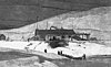
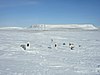
| Fort Conger
|
Lady Franklin Bay, Alert, NU
|
 81°45′N 64°45′W / 81.75°N 64.75°W / 81.75; -64.75 (Fort Conger) 81°45′N 64°45′W / 81.75°N 64.75°W / 81.75; -64.75 (Fort Conger)
|
|
16360
|
|
Q3077812
|
More images
|
| Arvia'juaq and Qikiqtaarjuk National Historic Site
|
Sentry Island, Arviat, NU
|
61°09′06″N 93°55′12″W / 61.1516°N 93.92°W / 61.1516; -93.92 (Arvia'juaq and Qikiqtaarjuk National Historic Site)
|
1161
|
|
|
|

|
| Bloody Falls National Historic Site of Canada
|
Coppermine River SW of Kugluktuk, Kugluktuk, NU
|
67°44′N 115°22′W / 67.74°N 115.37°W / 67.74; -115.37 (Bloody Falls National Historic Site of Canada)
|
1167
|
|
|
|

|
|
|
Kazan River, Baker Lake, NU
|
63°38′37″N 96°02′58″W / 63.6435°N 96.0495°W / 63.6435; -96.0495 (Fall Caribou Crossing National Historic Site)
|
9165
|
|
|
Q22956540
|
More images
|
| Wrecks of HMS Erebus and HMS Terror National Historic Site
|
Erebus Bay, King William Island, Gjoa Haven, NU
|
69°17′59″N 98°55′00″W / 69.299722°N 98.916667°W / 69.299722; -98.916667 (Erebus and Terror National Historic Site)
|
19683
|
|
|
Q75356330
|

More images
|
| Garage
|
FOX MAIN, Sanirajak, NU
|
68°45′40″N 81°13′37″W / 68.761188°N 81.226833°W / 68.761188; -81.226833 (Garage)
|
2998
|
|
|
|
|
| Hangar
|
FOX MAIN, Sanirajak, NU
|
68°46′14″N 81°13′50″W / 68.770528°N 81.230424°W / 68.770528; -81.230424 (Hangar)
|
3058
|
|
|
|
|
| Module Train A
|
FOX MAIN, Sanirajak, NU
|
68°45′40″N 81°13′37″W / 68.761188°N 81.226833°W / 68.761188; -81.226833 (Module Train A)
|
3082
|
|
|
|
|
| Module Train B
|
FOX MAIN, Sanirajak, NU
|
68°45′40″N 81°13′37″W / 68.761188°N 81.226833°W / 68.761188; -81.226833 (Module Train B)
|
3084
|
|
|
|
|
| Warehouse 2 HAL B13B Classified Federal Heritage Building
|
FOX MAIN, Sanirajak, NU
|
68°45′40″N 81°13′37″W / 68.761188°N 81.226833°W / 68.761188; -81.226833 (Warehouse 2 HAL B13B Classified Federal Heritage Building)
|
3087
|
|
|
|
|
| FOX-M, Air Terminal Building
|
FOX MAIN, Sanirajak, NU
|
68°46′15″N 81°13′53″W / 68.770820°N 81.231474°W / 68.770820; -81.231474 (FOX-M, Air Terminal Building)
|
3289
|
|
|
|
|
| Atwell Dormitory HAL B02C
|
FOX MAIN, Sanirajak, NU
|
68°45′40″N 81°13′37″W / 68.761188°N 81.226833°W / 68.761188; -81.226833 (Atwell Dormitory HAL B02C)
|
3290
|
|
|
|
|
|
|
Kodlunarn Island, Frobisher Bay, Iqaluit, NU
|
62°49′03″N 65°25′44″W / 62.8175°N 65.4288°W / 62.8175; -65.4288 (Kodlunarn Island National Historic Site)
|
11908
|
|
|
Q22547674
|
[[File:|100px]]
More images
|
|
|
Kekerten Island, Pangnirtung, NU
|
65°42′06″N 65°49′09″W / 65.7016°N 65.8193°W / 65.7016; -65.8193 (Kekerten Island Whaling Station National Historic Site)
|
15682
|
|
|
Q3593112
|

More images
|
|
|
Blacklead Island, Pangnirtung, NU
|
64°58′58″N 66°12′36″W / 64.9827°N 66.21°W / 64.9827; -66.21 (Blacklead Island Whaling Station National Historic Site)
|
15787
|
|
|
Q15071763
|
More images
|
| Marble Island
|
Hudson Bay, Rankin Inlet, NU
|
62°41′00″N 91°08′00″W / 62.6833°N 91.1333°W / 62.6833; -91.1333 (Marble Island)
|
|
7102
|
|
Q1892418
|
|
|
|
Melville Island, Resolute, NU
|
74°57′28″N 108°42′25″W / 74.9578°N 108.707°W / 74.9578; -108.707 (Dealy Island)
|
|
7104
|
|
Q22612488
|
|
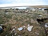
| Beechey Island
|
Wellington Channel, Resolute, NU
|
74°00′00″N 91°55′00″W / 74°N 91.9167°W / 74; -91.9167 (Beechey Island)
|
17342
|
7105
|
|
Q741133
|
More images
|
| Wreck of the HMS Breadalbane National Historic Site
|
Beechey Island, Resolute, NU
|
74°00′00″N 91°55′00″W / 74°N 91.91672°W / 74; -91.91672 (Wreck of the HMS Breadalbane National Historic Site)
|
15149
|
|
|
Q4959197
|
More images
|
| Port Refuge National Historic Site
|
Devon Island, Resolute, NU
|
77°00′17″N 96°09′49″W / 77.0047°N 96.1637°W / 77.0047; -96.1637 (Port Refuge National Historic Site)
|
16024
|
|
|
Q22960347
|
|
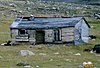
| Dedricks Hut
|
Quttinirpaaq National Park, Resolute, NU
|
81°44′42″N 64°47′09″W / 81.7449°N 64.7858°W / 81.7449; -64.7858 (Dedricks Hut)
|
18073
|
|
|
Q58189509
|
|
| Igloolik Island Archaeological Sites National Historic Site of Canada
|
Igloolik Island, Igloolik, NU
|
69°22′43″N 81°42′52″W / 69.3785°N 81.7144°W / 69.3785; -81.7144 (Igloolik Island Archaeological Sites National Historic Site of Canada)
|
16921
|
|
|
Q5992109
|
More images
|
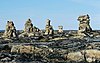
| Inuksuk National Historic Site of Canada
|
Foxe Peninsula, Baffin Island, NU
|
69°22′43″N 81°42′52″W / 69.3785°N 81.7144°W / 69.3785; -81.7144 (Inuksuk National Historic Site of Canada)
|
18947
|
|
|
Q5140274
|
More images
|
| Dwelling/House
|
Former HBC Ford Lake Post, Ukkusiksalik National Park, NU
|
65°55′30″N 90°54′27″W / 65.924955°N 90.907363°W / 65.924955; -90.907363 (Dwelling/House)
|
19632
|
|
|
|
|
| Store/Warehouse
|
Former HBC Ford Lake Post, Ukkusiksalik National Park, NU
|
65°55′32″N 90°54′41″W / 65.925525°N 90.911321°W / 65.925525; -90.911321 (Store/Warehouse)
|
19633
|
|
|
|

|
| Tractor Depot
|
Former HBC Ford Lake Post, Ukkusiksalik National Park, NU
|
65°55′32″N 90°54′34″W / 65.925550°N 90.909379°W / 65.925550; -90.909379 (Tractor Depot)
|
19631
|
|
|
|

|


