List of listed buildings in Livingston, West Lothian

Livingston parish shown within West Lothian
This is a list of listed buildings in the parish of Livingston in West Lothian, Scotland.
List[]
| Name | Location | Date Listed | Grid Ref. [note 1] | Geo-coordinates | Notes | LB Number [note 2] | Image |
|---|---|---|---|---|---|---|---|
| Auchenhard Tower | 55°51′01″N 3°36′24″W / 55.850389°N 3.606575°W | Category B | 13648 | 
| |||
| Blackburn Village Bridge, River Almond | 55°52′14″N 3°37′25″W / 55.870527°N 3.62374°W | Category B | 7420 |
| |||
| Livingston Mill Farm | 55°53′06″N 3°32′52″W / 55.884887°N 3.547661°W | Category B | 7421 |
| |||
| Bloom Cottage No 1 ;The Shop; Livingston Inn Cottages Nos 1 And 2, 4,4B; 6 And 8 Main Street | 55°53′09″N 3°32′21″W / 55.885794°N 3.539095°W | Category C(S) | 7422 |
| |||
| Auchenhard House Including Summerhouse And Gatepiers | 55°51′05″N 3°36′19″W / 55.851395°N 3.605259°W | Category B | 49089 |
| |||
| Livingston Village, Livingston Parish Kirk | 55°53′08″N 3°32′27″W / 55.885466°N 3.540905°W | Category B | 7409 | 
| |||
| Bloom Cottage 3 And 5 Main Street | 55°53′08″N 3°32′23″W / 55.885418°N 3.53972°W | Category C(S) | 7412 |
| |||
| Moss Houses | 55°54′29″N 3°31′26″W / 55.908018°N 3.523818°W | Category B | 7417 |
| |||
| Livingston Inn | 55°53′08″N 3°32′23″W / 55.885652°N 3.539729°W | Category B | 7413 |
| |||
| Livingston Bridge, River Almond | 55°53′05″N 3°32′21″W / 55.884645°N 3.539049°W | Category B | 7414 |
| |||
| Old Toll-House, Long Livingston | 55°53′13″N 3°33′32″W / 55.887008°N 3.559017°W | Category B | 7415 |
| |||
| Morven And Adjoining Heather Cottage 19 And 21 Main Street | 55°53′08″N 3°32′19″W / 55.885576°N 3.538607°W | Category C(S) | 7405 |
| |||
| 5 Houses. Known As The Old School House And The Danders, 1 Main Street | 55°53′08″N 3°32′23″W / 55.885418°N 3.53972°W | Category C(S) | 7411 |
| |||
| Newyearfield Farmhouse And Steading | 55°53′56″N 3°31′58″W / 55.898876°N 3.532736°W | Category B | 7418 |
| |||
| Auchenhard Farmhouse Including Boundary Wall And Gatepiers | 55°51′06″N 3°36′20″W / 55.851767°N 3.605641°W | Category B | 49185 |
| |||
| Livingston Manse | 55°53′07″N 3°32′26″W / 55.885355°N 3.540453°W | Category B | 7410 |
| |||
| Knightsridge House | 55°54′47″N 3°32′05″W / 55.91297°N 3.534588°W | Category B | 7416 |
| |||
| Blackburn House | 55°52′24″N 3°35′54″W / 55.87324°N 3.59836°W | Category A | 7419 | 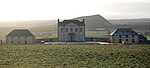
| |||
| "Bezu" 11 Main Street | 55°53′08″N 3°32′20″W / 55.885535°N 3.538989°W | Category C(S) | 7407 |
| |||
| Alderston Cottage Or Bloom Cottage Nos 2, 7 And 9 Main Street | 55°53′08″N 3°32′21″W / 55.88546°N 3.53921°W | Category C(S) | 7408 |
| |||
| Almond Bank (J H Shields) With Sub Post Office, Main Street | 55°53′08″N 3°32′19″W / 55.88552°N 3.538748°W | Category C(S) | 7406 |
|

Key[]
The scheme for classifying buildings in Scotland is:
- Category A: "buildings of national or international importance, either architectural or historic; or fine, little-altered examples of some particular period, style or building type."[1]
- Category B: "buildings of regional or more than local importance; or major examples of some particular period, style or building type, which may have been altered."[1]
- Category C: "buildings of local importance; lesser examples of any period, style, or building type, as originally constructed or moderately altered; and simple traditional buildings which group well with other listed buildings."[1]
In March 2016 there were 47,288 listed buildings in Scotland. Of these, 8% were Category A, and 50% were Category B, with the remaining 42% being Category C.[2]
Notes[]
- ^ Sometimes known as OSGB36, the grid reference (where provided) is based on the British national grid reference system used by the Ordnance Survey.
• "Guide to National Grid". Ordnance Survey. Retrieved 2007-12-12.
• "Get-a-map". Ordnance Survey. Retrieved 2007-12-17. - ^ Historic Environment Scotland assign a unique alphanumeric identifier to each designated site in Scotland, for listed buildings this always begins with "LB", for example "LB12345".
References[]
- All entries, addresses and coordinates are based on data from Historic Scotland. This data falls under the Open Government Licence
- ^ a b c "What is Listing?". Historic Environment Scotland. Retrieved 29 May 2018.
- ^ Scotland's Historic Environment Audit 2016 (PDF). Historic Environment Scotland and the Built Environment Forum Scotland. pp. 15–16. Retrieved 29 May 2018.
Categories:
- Lists of listed buildings in West Lothian