Loch Etchachan
| Loch Etchachan | |
|---|---|
 Loch Etchachan, view north towards Cairn Gorm. | |
 Loch Etchachan | |
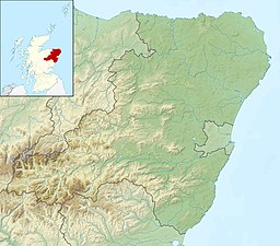
| Location | Cairngorms, Grampian Mountains, Scotland |
| Coordinates | 57°5′1.62″N 3°38′23.81″W / 57.0837833°N 3.6399472°W |
| Primary outflows | |
| Basin countries | Scotland |
| Max. length | 0.79 km (0.49 mi) |
| Surface area | 0.23 km2 (0.089 sq mi) |
| Average depth | 20 ft (6.1 m) |
| Max. depth | 65 ft (20 m) |
| Surface elevation | 3,041 ft (927 m) |

Loch Etchachan is a remote freshwater loch set deep within the central Cairngorms plateau, in the Cairngorms National Park, located in the eastern Highlands of Scotland. It is the highest waterbody of its size in the UK, the surface being 927 metres (3,041 ft) above sea level.
Geography[]
Directly north of the loch and lying 664 ft (202 m) lower lies Loch A'an and the imposing peak of Cairn Gorm. To the northeast lies Beinn Mheadhoin, known for its broad and flat summit. To west, rising vertically lies the plateau of which constitute the lower slopes of Ben Macdui rising to a peak south of the loch, the second highest mountain in the UK. To the east, the loch flows into Little Loch Etchahan, which outflows through the gap made up of in the south and in the north, into what will become the turning southwards becoming the before eventually flowing into the River Dee[1]
Trivia[]
On 12 August 2009, members of the Inverness Rowing Club carried a boat all the way up to the loch from the Linn of Dee,[2][3] and rowed on the loch. This is believed to be the first time the loch has been rowed upon. Similarly, on Saturday 25 June 2011, members of Dundee Mountain Club carried a 3m long windsurf board plus, mast, and two sails to the loch to be the first to windsurf upon it. They also carried an ironing board and iron to do extreme ironing there at the same time.[4] Both of these feats involved carrying the equipment on an 18.5 mile (30 km) round trip including 2,500 ft (750m) of ascent.
References[]
| Wikimedia Commons has media related to Loch Etchachan. |
- ^ "Overview of Loch Etchachan". Gazetteer for Scotland. The Editors of The Gazetteer for Scotland. Retrieved 2012-10-21.
{{cite web}}: CS1 maint: url-status (link) - ^ "Expedition to Loch Etchachan by Alan Sinclair". Inverness Rowing Club. Retrieved 2011-08-17.
- ^ "Expedition to Loch Etchachan by Alan Sinclair (Photo Gallery)". Inverness Rowing Club. Retrieved 2011-08-17.
- ^ "Mountain Windsurfing/Extreme Ironing, Loch Etchachan". Dundee Mountain Club. Retrieved 2011-08-17.
Coordinates: 57°04′59″N 3°38′26″W / 57.0831°N 3.6406°W
This Aberdeenshire location article is a stub. You can help Wikipedia by . |
- Lochs of Aberdeenshire
- Freshwater lochs of Scotland
- Cairngorms
- Aberdeenshire geography stubs