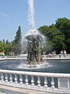
Lower Huron Metropark
| Lower Huron Metropark | |
|---|---|
 Bridge over Huron River, Tulip Tree picnic area | |
 Location within metro Detroit | |
| Type | Regional park |
| Location | Lower Peninsula, Wayne County, Michigan USA |
| Coordinates | 42°10′30.13″N 83°25′39.53″W / 42.1750361°N 83.4276472°WCoordinates: 42°10′30.13″N 83°25′39.53″W / 42.1750361°N 83.4276472°W |
| Area | 1,258 acres (509 ha) |
| Operated by | Huron–Clinton Metroparks |
| Status | Open year round |
| Website | Official site |
Lower Huron Metropark is a park in the Huron-Clinton system of metro parks in Metro Detroit. The park covers 1,258 acres (5.09 km2) along the Huron River and has hike-bike trails and two self-guided nature trails. In the winter, the park has cross-country skiing. The park also has a water slide amusement facility, the Turtle Cove Family Aquatic Center. There is a 27-site campground, a group campground and canoe camping in the park.[1][2][3]
Situated in the flood plain of the Huron River, some parts of the park may flood, especially when Belleville Dam releases excess water.

Turtle Cove Aquatic Center
References[]
- ^ http://www.michigan.org/Property/Detail.aspx?p=G15966
- ^ http://gocitykids.parentsconnect.com/attraction/lower-huron-metropark-17845-savage-road-belleville-mi-48111-us
- ^ "Archived copy". Archived from the original on 2012-07-10. Retrieved 2010-08-03.CS1 maint: archived copy as title (link)
External links[]
Categories:
- Huron–Clinton Metroparks
- Protected areas of Wayne County, Michigan
- Huron River (Michigan)
- Southeast Michigan geography stubs


