Lower Rio Grande Valley National Wildlife Refuge
| Lower Rio Grande Valley National Wildlife Refuge | |
|---|---|
IUCN category IV (habitat/species management area) | |
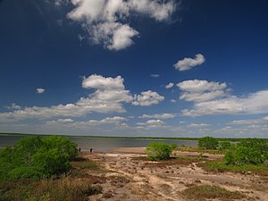 El Sal Del Rey inside the Lower Rio Grande Valley National Wildlife Refuge. | |
 | |
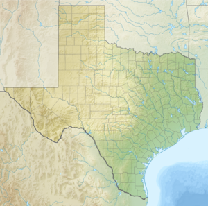
| Location | Cameron, Hidalgo, Starr, Zapata counties, Texas, United States |
| Nearest city | La Feria, Texas |
| Coordinates | 26°11′14″N 97°51′06″W / 26.18729°N 97.85166°WCoordinates: 26°11′14″N 97°51′06″W / 26.18729°N 97.85166°W[1] |
| Area | 90,788 acres (367.41 km2) |
| Established | 1979 |
| Governing body | U.S. Fish and Wildlife Service |
| Website | Lower Rio Grande Valley National Wildlife Refuge |

The Lower Rio Grande Valley National Wildlife Refuge is a 90,788-acre (367.41 km2)[2] National Wildlife Refuge located in the Lower Rio Grande Valley region of southern Texas.
It is along the northern banks and reaches of the Lower Rio Grande, north of the Mexico—United States international border.
Ecology[]
Only 5% of the native riparian, floodplain, and wetland habitats remain along the lower Rio Grande and its local tributaries.[according to whom?] However, the diversity within these fragments adds up to a significant 1,200 species of native plants, 700 species of vertebrates (including nearly 500 bird species), and 300 species of butterflies. Eleven different biological communities exist on the National Wildlife Refuge, from the Chihuahuan Desert thorn forest to tidal wetlands.[citation needed]
Wildlife include the rare ocelot, crested caracara, Mexican bluewing butterfly (Myscelia ethusa), great kiskadee, red-billed pigeon, Altamira oriole, ringed kingfisher and green jay.
The refuge is designated as part of the Great Texas Coastal Birding Trail, a network of wildlife viewing sites throughout the Texas coastal regions.[3]
See also[]
- National Wildlife Refuges in Texas
References[]
- ^ "Lower Rio Grande Valley National Wildlife Refuge". Geographic Names Information System. United States Geological Survey.
- ^ "Annual Report of Lands Under Control of the U.S. Fish and Wildlife Service" (PDF). www.fws.gov. U.S. Fish and Wildlife Service. September 30, 2010. Retrieved December 14, 2011.
- ^ "Lower Texas Coast Wildlife Trail (LTC): Los Ranchos de Tejas Loop map". Texas Parks and Wildlife Division. Retrieved 22 Jan 2010.
External links[]
![]() This article incorporates public domain material from websites or documents of the United States Fish and Wildlife Service.
This article incorporates public domain material from websites or documents of the United States Fish and Wildlife Service.
| show Authority control |
|---|
This article related to a protected area in Texas is a stub. You can help Wikipedia by . |
- IUCN Category IV
- National Wildlife Refuges in Texas
- Lower Rio Grande Valley
- Wetlands of Texas
- Protected areas of Zapata County, Texas
- Protected areas of Starr County, Texas
- Protected areas of Hidalgo County, Texas
- Protected areas of Cameron County, Texas
- Landforms of Zapata County, Texas
- Landforms of Starr County, Texas
- Landforms of Hidalgo County, Texas
- Landforms of Cameron County, Texas
- Protected areas established in 1979
- 1979 establishments in Texas
- Texas protected area stubs