Lunenburg, Massachusetts
Lunenburg, Massachusetts | |
|---|---|
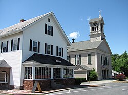 Lunenburg Town Hall and Hadwen Park Market | |
 Seal | |
 Location in Worcester County and the state of Massachusetts. | |
| Coordinates: 42°35′40″N 71°43′30″W / 42.59444°N 71.72500°WCoordinates: 42°35′40″N 71°43′30″W / 42.59444°N 71.72500°W | |
| Country | United States |
| State | Massachusetts |
| County | Worcester |
| Settled | 1718 |
| Incorporated | 1728 |
| Government | |
| • Type | Open town meeting and Board of Selectmen |
| Area | |
| • Total | 27.7 sq mi (71.7 km2) |
| • Land | 26.4 sq mi (68.4 km2) |
| • Water | 1.3 sq mi (3.3 km2) |
| Elevation | 510 ft (155 m) |
| Population (2020) | |
| • Total | 11,946 |
| • Density | 430/sq mi (170/km2) |
| Time zone | UTC-5 (Eastern) |
| • Summer (DST) | UTC-4 (Eastern) |
| ZIP code | 01462 |
| Area code(s) | 351 / 978 |
| FIPS code | 25-37420 |
| GNIS feature ID | 0618370 |
| Website | http://www.lunenburgma.gov/ |

Lunenburg is a town in Worcester County, Massachusetts, United States. The population was 11,946 at the 2020 census.
History[]
Lunenburg was first settled by Europeans in 1718 and was officially incorporated in 1728. The name stems from one of the titles of King George II of Great Britain, Duke of Brunswick-Lüneburg.[1] During King George's War (1744-1748), French-allied First Nations, such as warriors of the or , raided the village and took settlers captive to Quebec.[2]
Areas of neighboring Fitchburg were once part of Lunenburg, but broke away around 1764. The settlers found the walking distance to church and town meetings too great and needed their own town center.
Whalom Park on Whalom Lake had long been a noted amusement park in Lunenburg during the 20th century. It was home of the famous Flyer Comet, now demolished. The park closed in 2000, unable to survive the competition with the newer and increasingly popular Six Flags New England in Agawam.
Geography[]
According to the United States Census Bureau, the town has a total area of 27.7 square miles (72 km2), of which 26.4 square miles (68 km2) is land and 1.3 square miles (3.4 km2), or 4.59%, is water.
Lunenburg is bordered by Townsend to the north, Shirley to the east, Lancaster to the southeast, Leominster to the south, Fitchburg to the west, and Ashby to the northwest. Three state highways pass through Lunenburg. Route 2A follows Mass Ave from the Shirley line to the Fitchburg line. Rt 13 follows Electric Ave from the Leominster line to Mass Ave. Rt 13 then follows Mass Ave/Rt 2a for 0.3 miles. Rt 13 then follows Chase Rd to the Townsend Line. Rt 225 begins in Lunenburg, at an intersection with Rt 2a/Mass Ave near the Shirley line. Rt 225 follows West Groton Rd from Rt 2a to the Shirley line.
Demographics[]
As of the census[3] of 2000, there were 9,401 people, 3,535 households, and 2,668 families residing in the town. The population density was 355.8 people per square mile (137.4/km2). There were 3,668 housing units at an average density of 138.8 per square mile (53.6/km2). The racial makeup of the town was 97.01% White, 0.69% Black or African American, 0.20% Native American, 0.78% Asian, 0.02% Pacific Islander, 0.26% from other races, and 1.04% from two or more races. Hispanic or Latino of any race were 1.15% of the population.
There were 3,535 households, out of which 34.9% had children under the age of 18 living with them, 63.6% were married couples living together, 8.7% had a female householder with no husband present, and 24.5% were non-families. 20.1% of all households were made up of individuals, and 8.3% had someone living alone who was 65 years of age or older. The average household size was 2.66 and the average family size was 3.08.
In the town, the population was spread out, with 25.8% under the age of 18, 5.6% from 18 to 24, 29.8% from 25 to 44, 26.8% from 45 to 64, and 12.0% who were 65 years of age or older. The median age was 39 years. For every 100 females, there were 98.1 males. For every 100 females age 18 and over, there were 95.3 males.
The median income for a household in the town was $56,813, and the median income for a family was $63,981. Males had a median income of $47,451 versus $31,934 for females. The per capita income for the town was $26,986. About 3.3% of families and 4.1% of the population were below the poverty line, including 3.7% of those under age 18 and 1.4% of those age 65 or over.
Government[]

| Clerk of Courts: | Dennis P. McManus (D) |
|---|---|
| District Attorney: | Joseph D. Early, Jr. (D) |
| Register of Deeds: | Kathleen R. Daigneault (D) |
| Register of Probate: | Stephen Abraham (D) |
| County Sheriff: | Lew Evangelidis (R) |
| State government | |
| State Representative(s): | Danillo A. Sena (D) |
| State Senator(s): | John Cronin (D) |
| Governor's Councilor(s): | Paul Depaulo (D) |
| Federal government | |
| President of the United States: | Joe Biden (D) |
| U.S. Representative(s): | Lori Trahan (D-3rd District), |
| U.S. Senators: | Elizabeth Warren (D), Ed Markey (D) |
Library[]
The Lunenburg public library began in 1853.[4][5] In fiscal year 2008, the town of Lunenburg spent 1.13% ($290,801) of its budget on its public library—some $29 per person.[6]
Education[]
The public schools in town are the Lunenburg Primary School, Thomas C. Passios Elementary School (now closed), Turkey Hill Elementary School, and Lunenburg Middle-High School (recently opened).
Lunenburg High and Middle are now in the same building on adjacent property to Turkey Hill and Thomas C. Passios buildings.
Private schools include Applewild School, established in 1957, - a private, independent co-educational day school for grades Preschool - 8th grade located in Fitchburg, MA.
Montachusett Regional Vocational Technical High School serves the town and surrounding communities located in Fitchburg, MA.
Transportation[]
The Montachusett Regional Transit Authority (MART) supplies Councils-On-Aging service for elderly and disabled residents.[7] Portions of Lunenburg are also on MART's regular bus routes.[8] The nearest rail stations are Shirley, Fitchburg and North Leominster on the MBTA Commuter Rail Fitchburg Line.
Notable people[]

- George S. Boutwell, Governor of Massachusetts (1851 -1853), U.S. Secretary of the Treasury (1869 - 1873)
- Zabdiel Adams, minister
- William Austin, author
- Asa Brigham, prominent figure in the Texas Revolution.
- Earle Brown, composer
- Luther Burbank, botanist-agricultural science
- Frederick Cushing Cross, Jr., naval officer
- Dominik Dijakovic, professional wrestler with WWE on their NXT Brand
- Gordon Edes, ESPN baseball writer
- Derek Kerswill, musician
- Dorothea Leighton, psychiatrist
- Josiah Litch, preacher
- David Pelletier, figure skater
- James Reed, soldier
- Abel Stearns, trader, landowner and cattle rancher
- Asahel Stearns, congressman
- Eleazer D. Wood, army officer
- Tequila, horse of local and national fame[9]
References[]
- ^ Gannett, Henry (1905). The Origin of Certain Place Names in the United States. U.S. Government Printing Office. p. 192.
- ^ [1]
- ^ "U.S. Census website". United States Census Bureau. Retrieved 2008-01-31.
- ^ C.B. Tillinghast. The free public libraries of Massachusetts. 1st Report of the Free Public Library Commission of Massachusetts. Boston: Wright & Potter, 1891. Google books
- ^ "Lunenburg Public Library | 1023 Massachusetts Avenue, Lunenburg, MA 01462". lunenburglibrary.org. Retrieved 2015-12-05.
- ^ July 1, 2007 through June 30, 2008; cf. The FY2008 Municipal Pie: What's Your Share? Commonwealth of Massachusetts, Board of Library Commissioners. Boston: 2009. Available: Municipal Pie Reports Archived 2012-01-23 at the Wayback Machine. Retrieved 2010-08-04
- ^ "MART: Communities served". mrta.us. Archived from the original on 10 January 2012. Retrieved 31 January 2012.
- ^ "MART: How To Ride". mrta.us. Archived from the original on 11 February 2012. Retrieved 31 January 2012.
- ^ https://www.necn.com/news/new-england/_NECN__Horse_Rescued_From_Mud_in_Lunenburg__Mass__NECN-247783761.html
External links[]
| Wikimedia Commons has media related to Lunenburg, Massachusetts. |
- Town of Lunenburg official website
- Lunenburg Public Schools
- Lunenburg Historical Society
- Lunenburg Public Library
| show Municipalities and communities of Worcester County, Massachusetts, United States |
|---|

| show Authority control |
|---|
- Lunenburg, Massachusetts
- Towns in Worcester County, Massachusetts
- Populated places established in 1718
- 1718 establishments in Massachusetts
- Towns in Massachusetts