Lincoln, Rhode Island
Lincoln, Rhode Island | |
|---|---|
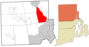 Location in Providence County and the state of Rhode Island. | |
| Coordinates: 41°55′16″N 71°26′6″W / 41.92111°N 71.43500°WCoordinates: 41°55′16″N 71°26′6″W / 41.92111°N 71.43500°W | |
| Country | United States |
| State | Rhode Island |
| County | Providence |
| Government | |
| • Type | Elected administrator-council w/ Financial Town Meeting |
| • Town Administrator | Philip G. Gould (I) |
| • Town Council | Keith E. Macksoud, President (I) Pamela M. Azar (D) Arthur S. Russo, Jr (I) Bruce J. Ogni (I) Kenneth G. Pichette (R) |
| Area | |
| • Total | 18.9 sq mi (49.1 km2) |
| • Land | 18.2 sq mi (47.2 km2) |
| • Water | 0.7 sq mi (1.9 km2) |
| Elevation | 249 ft (76 m) |
| Population (2010) | |
| • Total | 21,105 |
| • Density | 1,159.6/sq mi (447.1/km2) |
| Time zone | UTC-5 (Eastern (EST)) |
| • Summer (DST) | UTC-4 (EDT) |
| ZIP codes | 02802, 02865, 02838 |
| Area code(s) | 401 |
| FIPS code | 44-41500[2] |
| GNIS feature ID | 1220074[3] |
Lincoln is a town in Providence County, Rhode Island, United States. The population was 22,529 at the 2020 census. Lincoln is located in northeastern Rhode Island, north of Providence. Lincoln is part of the Providence metropolitan statistical area and the Greater Boston combined statistical area.
Lincoln was settled in the 17th century as part of the Louisquisset grant, and several colonial stone-enders still exist in the town.[4] Lincoln Woods State Park is located within the town.
Limestone quarrying has occurred there since colonial times at the village of Lime Rock. Lincoln was a part of the town of Smithfield until 1871, when it was split off and named in honor of Abraham Lincoln. Lincoln became an important mill town in the late 19th century, with many textile factories running along the Blackstone River. Lincoln's villages include Manville, Albion, Lime Rock, Lonsdale, Fairlawn, Quinnville, and Saylesville.
In 2008, the town was ranked #63 in Money Magazine's "Best Places to Live".[5]
Lincoln is in the lower Blackstone Valley of Rhode Island and in the John H. Chafee, Blackstone River Valley National Heritage Corridor, New England's historic National Park area.
Geography[]
According to the United States Census Bureau, the town has a total area of 18.9 square miles (49 km2), of which, 18.2 square miles (47 km2) of it is land and 0.7 square miles (1.8 km2) of it (3.80%) is water.
Lincoln is home to Lincoln Woods State Park and Twin River Casino (formerly a racetrack known as Lincoln Downs and Lincoln Park).
Demographics[]
| Historical population | |||
|---|---|---|---|
| Census | Pop. | %± | |
| 1870 | 7,889 | — | |
| 1880 | 13,765 | 74.5% | |
| 1890 | 20,355 | 47.9% | |
| 1900 | 8,937 | −56.1% | |
| 1910 | 9,825 | 9.9% | |
| 1920 | 9,543 | −2.9% | |
| 1930 | 10,421 | 9.2% | |
| 1940 | 10,577 | 1.5% | |
| 1950 | 11,270 | 6.6% | |
| 1960 | 13,551 | 20.2% | |
| 1970 | 16,182 | 19.4% | |
| 1980 | 16,949 | 4.7% | |
| 1990 | 18,045 | 6.5% | |
| 2000 | 20,898 | 15.8% | |
| 2010 | 21,105 | 1.0% | |
| 2020 | 22,529 | 6.7% | |
| U.S. Decennial Census[6][7] | |||
As of the census[2] of 2000, there were 20,898 people, 8,243 households, and 5,778 families residing in the town. The population density was 1,146.6 people per square mile (442.6/km2). There were 8,508 housing units at an average density of 466.8 per square mile (180.2/km2). The racial makeup of the town was 95.55% White, 0.84% African American, 0.08% Native American, 1.75% Asian, 0.01% Pacific Islander, 0.64% from other races, and 1.13% from two or more races. Hispanic or Latino of any race were 1.64% of the population. There were 8,243 households, out of which 32.6% had children under the age of 18 living with them, 56.8% were married couples living together, 10.2% had a female householder with no husband present, and 29.9% were non-families. 25.9% of all households were made up of individuals, and 12.1% had someone living alone who was 65 years of age or older. The average household size was 2.51 and the average family size was 3.05.
In the town, the population was spread out, with 24.7% under the age of 18, 5.9% from 18 to 24, 28.8% from 25 to 44, 24.1% from 45 to 64, and 16.5% who were 65 years of age or older. The median age was 40 years. For every 100 females, there were 90.8 males. For every 100 females age 18 and over, there were 85.9 males.
The median income for a household in the town was $47,815, and the median income for a family was $61,257. Males had a median income of $41,508 versus $30,089 for females. The per capita income for the town was $26,779. About 3.9% of families and 5.2% of the population were below the poverty line, including 6.2% of those under age 18 and 7.3% of those age 65 or over.
National Historic Register sites[]

- Albion Historic District
- Eleazer Arnold House
- Israel Arnold House
- Ballou House
- Elliot-Harris-Miner House
- Great Road Historic District
- Hearthside
- Jenckes House, Jenckes Hill Road
- Jenckes House, Old Louisquisset Pike
- Lime Kilns
- Limerock Village Historic District
- Old Ashton Historic District
- Pullen Corner School
- Sassafras Site, RI-55
- Saylesville Historic District
- Saylesville Meetinghouse
- Whipple-Cullen House and Barn
Economy and infrastructure[]
Education[]
Lincoln School Department has three early learning centers (Pre-K) at Lonsdale, Central, and Northern Elementary. In total there are four elementary schools (Full day K-5): Saylesville Elementary School, Lonsdale Elementary School, Central Elementary School, and Northern Lincoln Elementary School. Lincoln has one Middle School, and one high school, Lincoln Senior High School. Their mascot is a lion. At one point, the middle and high school shared one campus, but in 2006 a new middle school was opened on Jenckes Hill Road. The high school, in desperate need of additional classrooms, expanded into the former middle school area. The Community College of Rhode Island's Flanagan Campus is situated in Lincoln.
Healthcare[]
Lincoln is home to the Quality Assurance Review Center (QARC), which performs thousands of radiotherapy reviews per year. QARC's primary support comes from federal grants at the National Cancer Institute (NCI) and contracts with the pharmaceutical industry. It receives radiotherapy data from approximately 1,000 hospitals in both the United States and abroad.[8] The center maintains a strategic affiliation with the University of Massachusetts Medical School in Worcester, Massachusetts, and is located along the George Washington Highway.
Business[]
Lincoln is also home to the Amica Mutual Insurance Company. Founded in 1907, it moved to Lincoln in 1994, after first being located in both Boston and Providence. The company mostly underwrites policies for property and casualty insurance, which includes automobiles, homeowners, and personal liabilities.
Notable people[]
- Eddie Dowling (1889–1976), Actor, Singer, Composer
- Hank Gilpin (born 1946), furniture maker and wood sculptor.[9]
- Kristin Hayter (born 1986), Neoclassical dark wave musician
- Clem Labine (1926–2007), Major League Baseball pitcher
- Sarah MacLean (born 1978), New York Times Bestselling Author
- Chet Nichols Jr. (1931–1995), baseball player.[10]
- David Olney (1948–2020), Americana singer/songwriter
References[]
- ^ "Town of Lincoln, RI Charter". eCode360.com. Retrieved September 30, 2017.
- ^ Jump up to: a b "U.S. Census website". United States Census Bureau. Retrieved January 31, 2008.
- ^ "US Board on Geographic Names". United States Geological Survey. October 25, 2007. Retrieved January 31, 2008.
- ^ "Arnold House, 1693". Historic New England. Archived from the original on October 3, 2006. Retrieved September 7, 2006.
- ^ "100 best places to live and launch - 63: Lincoln, R.I." CNNMoney. Retrieved May 9, 2017.
- ^ "Census of Population and Housing". United States Census Bureau. Retrieved June 4, 2016.
- ^ Snow, Edwin M. (1867). Report upon the Census of Rhode Island 1865. Providence, RI: Providence Press Company.
- ^ "About QARC". Quality Assurance Review Center. Archived from the original on October 9, 2006. Retrieved January 20, 2007.
- ^ "Hank Gilpin". Gallery NAGA. Retrieved 8 September 2020.
- ^ Chet Nichols; Pitcher, 64
External links[]
| Wikimedia Commons has media related to Lincoln, Rhode Island. |
| Wikisource has the text of a 1921 Collier's Encyclopedia article about Lincoln, Rhode Island. |
 Lincoln, Rhode Island travel guide from Wikivoyage
- Town of Lincoln
- Lincoln Public Schools website
- http://www.lincolnri.com/government/elected/council.php
| show Municipalities and communities of Providence County, Rhode Island, United States |
|---|


| Authority control |
|
|---|
- Lincoln, Rhode Island
- Towns in Providence County, Rhode Island
- Providence metropolitan area
- Towns in Rhode Island