Lusk, Tennessee
Lusk | |
|---|---|
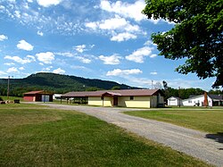 Lusk Community Center | |
 Lusk Location within the state of Tennessee | |
| Coordinates: 35°30′5″N 85°17′55″W / 35.50139°N 85.29861°WCoordinates: 35°30′5″N 85°17′55″W / 35.50139°N 85.29861°W | |
| Country | United States |
| State | Tennessee |
| County | Bledsoe |
| Elevation | 801 ft (244 m) |
| Time zone | UTC-6 (Central (CST)) |
| • Summer (DST) | UTC-5 (CDT) |
| GNIS feature ID | 1647452[1] |


Lusk (also Atpontley) is an unincorporated community in Bledsoe County, Tennessee, United States. It lies along U.S. Route 127 southwest of the city of Pikeville, the county seat of Bledsoe County.[2] Its elevation is 801 feet (244 m).[1]
The variant name Atpontley is a compound of the names of three coal miners: Atkinson, Dupont, and Finley.[3]
References[]
- ^ a b "Lusk, Tennessee". Geographic Names Information System. United States Geological Survey. Retrieved 2008-02-18.
- ^ Rand McNally. The Road Atlas '08. Chicago: Rand McNally, 2008, p. 95.
- ^ Miller, Larry L. (2001). Tennessee Place-names. Indiana University Press. p. 9. ISBN 0-253-21478-5.
Municipalities and communities of Bledsoe County, Tennessee, United States | ||
|---|---|---|
| City | ||
| Unincorporated communities | ||
| ||
This Bledsoe County, Tennessee geography–related article is a stub. You can help Wikipedia by . |
Categories:
- Unincorporated communities in Bledsoe County, Tennessee
- Unincorporated communities in Tennessee
- East Tennessee geography stubs