Lynch, Nebraska
Lynch, Nebraska | |
|---|---|
 Downtown Lynch: 4th Street | |
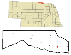 Location of Lynch, Nebraska | |
| Coordinates: 42°49′47″N 98°27′56″W / 42.82972°N 98.46556°WCoordinates: 42°49′47″N 98°27′56″W / 42.82972°N 98.46556°W | |
| Country | United States |
| State | Nebraska |
| County | Boyd |
| Area | |
| • Total | 0.53 sq mi (1.38 km2) |
| • Land | 0.53 sq mi (1.38 km2) |
| • Water | 0.00 sq mi (0.00 km2) |
| Elevation | 1,401 ft (427 m) |
| Population | |
| • Total | 245 |
| • Estimate (2019)[5] | 220 |
| • Density | 411.99/sq mi (159.11/km2) |
| Time zone | UTC-6 (Central (CST)) |
| • Summer (DST) | UTC-5 (CDT) |
| ZIP code | 68746 |
| Area code(s) | 402 |
| FIPS code | 31-29750[3] |
| GNIS feature ID | 0830974[4] |

Lynch is a village in Boyd County, Nebraska, United States. The population was 245 at the 2010 census, down from 269 in 2000. Lynch is located in northern Nebraska, between the Missouri and Niobrara rivers.
History[]
Lynch was incorporated as a village in 1892.[6] It was named for John Lynch, a pioneer settler.[6][7]
Thirty of the one hundred homes in Lynch were destroyed by flooding in 2019.[8]
Geography[]
According to the United States Census Bureau, the village has a total area of 0.53 square miles (1.37 km2), all land.[9]
Climate[]
This climatic region is typified by large seasonal temperature differences, with warm to hot (and often humid) summers and cold (sometimes severely cold) winters. According to the Köppen Climate Classification system, Lynch has a humid continental climate, abbreviated "Dfa" on climate maps.[10]
| hideClimate data for Lynch, Nebraska | |||||||||||||
|---|---|---|---|---|---|---|---|---|---|---|---|---|---|
| Month | Jan | Feb | Mar | Apr | May | Jun | Jul | Aug | Sep | Oct | Nov | Dec | Year |
| Average high °C (°F) | 1 (34) |
2 (36) |
9 (49) |
17 (62) |
23 (73) |
28 (82) |
31 (88) |
31 (87) |
26 (78) |
19 (66) |
9 (49) |
2 (36) |
16 (61) |
| Average low °C (°F) | −13 (8) |
−12 (10) |
−6 (22) |
1 (33) |
7 (45) |
13 (55) |
16 (61) |
15 (59) |
9 (48) |
2 (35) |
−6 (22) |
−12 (11) |
1 (34) |
| Average precipitation mm (inches) | 13 (0.5) |
20 (0.8) |
38 (1.5) |
69 (2.7) |
86 (3.4) |
94 (3.7) |
76 (3) |
71 (2.8) |
58 (2.3) |
43 (1.7) |
20 (0.8) |
15 (0.6) |
600 (23.7) |
| Source: Weatherbase [11] | |||||||||||||
Demographics[]
| Historical population | |||
|---|---|---|---|
| Census | Pop. | %± | |
| 1900 | 231 | — | |
| 1910 | 583 | 152.4% | |
| 1920 | 589 | 1.0% | |
| 1930 | 498 | −15.4% | |
| 1940 | 487 | −2.2% | |
| 1950 | 440 | −9.7% | |
| 1960 | 409 | −7.0% | |
| 1970 | 375 | −8.3% | |
| 1980 | 357 | −4.8% | |
| 1990 | 296 | −17.1% | |
| 2000 | 269 | −9.1% | |
| 2010 | 245 | −8.9% | |
| 2019 (est.) | 220 | [5] | −10.2% |
| U.S. Decennial Census[12] | |||

2010 census[]
As of the census[2] of 2010, there were 245 people, 125 households, and 64 families residing in the village. The population density was 462.3 inhabitants per square mile (178.5/km2). There were 179 housing units at an average density of 337.7 per square mile (130.4/km2). The racial makeup of the village was 94.3% White, 0.8% Native American, 0.4% Asian, 0.8% Pacific Islander, and 3.7% from two or more races. Hispanic or Latino of any race were 2.9% of the population.
There were 125 households, of which 17.6% had children under the age of 18 living with them, 39.2% were married couples living together, 8.0% had a female householder with no husband present, 4.0% had a male householder with no wife present, and 48.8% were non-families. 45.6% of all households were made up of individuals, and 29.6% had someone living alone who was 65 years of age or older. The average household size was 1.96 and the average family size was 2.67.
The median age in the village was 53.5 years. 21.2% of residents were under the age of 18; 3.3% were between the ages of 18 and 24; 13.5% were from 25 to 44; 27.7% were from 45 to 64; and 34.3% were 65 years of age or older. The gender makeup of the village was 49.4% male and 50.6% female.
2000 census[]
As of the census[3] of 2000, there were 269 people, 131 households, and 78 families residing in the village. The population density was 476.2 people per square mile (185.5/km2). There were 177 housing units at an average density of 313.3/sq mi (122.0/km2). The racial makeup of the village was 96.28% White, 1.86% Native American, 0.37% Asian, and 1.49% from two or more races.
There were 131 households, out of which 18.3% had children under the age of 18 living with them, 52.7% were married couples living together, 3.8% had a female householder with no husband present, and 39.7% were non-families. 38.2% of all households were made up of individuals, and 22.1% had someone living alone who was 65 years of age or older. The average household size was 2.05 and the average family size was 2.63.
In the village, the population was spread out, with 21.2% under the age of 18, 3.3% from 18 to 24, 15.6% from 25 to 44, 31.2% from 45 to 64, and 28.6% who were 65 years of age or older. The median age was 51 years. For every 100 females, there were 93.5 males. For every 100 females age 18 and over, there were 100.0 males.
The median income for a household in the village was $25,333, and the median income for a family was $29,792. Males had a median income of $23,571 versus $24,583 for females. The per capita income for the village was $15,702. About 5.2% of families and 11.0% of the population were below the poverty line, including 22.0% of those under the age of eighteen and 8.0% of those 65 or over.
Education[]
The area is within .[13] The area was previously within the Lynch Public Schools district.[14] The Lynch district consolidated into the Boyd County district in June 2017.[15]
References[]
- ^ "2019 U.S. Gazetteer Files". United States Census Bureau. Retrieved July 26, 2020.
- ^ Jump up to: a b "U.S. Census website". United States Census Bureau. Retrieved 2012-06-24.
- ^ Jump up to: a b "U.S. Census website". United States Census Bureau. Retrieved 2008-01-31.
- ^ "US Board on Geographic Names". United States Geological Survey. 2007-10-25. Retrieved 2008-01-31.
- ^ Jump up to: a b "Population and Housing Unit Estimates". United States Census Bureau. May 24, 2020. Retrieved May 27, 2020.
- ^ Jump up to: a b "Lynch, Boyd County". Center for Advanced Land Management Information Technologies. University of Nebraska. Retrieved 30 July 2014.
- ^ Chicago and North Western Railway Company (1908). A History of the Origin of the Place Names Connected with the Chicago & North Western and Chicago, St. Paul, Minneapolis & Omaha Railways. p. 96.
- ^ Almukhtar, Sarah; Migliozzi, Blacki; Schwartz, John; Williams, Josh (September 11, 2019). "The Great Flood of 2019: A Complete Picture of a Slow-Motion Disaster". New York Times. Retrieved 2019-09-15.
- ^ "US Gazetteer files 2010". United States Census Bureau. Archived from the original on 2012-01-25. Retrieved 2012-06-24.
- ^ Climate Summary for Lynch, Nebraska
- ^ "Weatherbase.com". Weatherbase. 2013. Retrieved on October 10, 2013.
- ^ "Census of Population and Housing". Census.gov. Retrieved June 4, 2015.
- ^ "2020 CENSUS - SCHOOL DISTRICT REFERENCE MAP: Boyd County, NE" (PDF). U.S. Census Bureau. Retrieved 2021-04-17.
- ^ "SCHOOL DISTRICT REFERENCE MAP (2010 CENSUS): Boyd County, NE" (PDF). U.S. Census Bureau. Retrieved 2021-04-17.
- ^ "Boyd County Schools". Nebraska Department of Education. Retrieved 2021-04-17.
External links[]
| show Municipalities and communities of Boyd County, Nebraska, United States |
|---|
| show Authority control |
|---|
- Villages in Boyd County, Nebraska
- Villages in Nebraska