Lynchburg Regional Airport
Lynchburg Regional Airport Preston Glenn Field | |||||||||||||||
|---|---|---|---|---|---|---|---|---|---|---|---|---|---|---|---|
 Airport main signage, off U.S. 29 | |||||||||||||||
| Summary | |||||||||||||||
| Airport type | Public | ||||||||||||||
| Owner | City of Lynchburg | ||||||||||||||
| Serves | Lynchburg, Virginia | ||||||||||||||
| Elevation AMSL | 938 ft / 286 m | ||||||||||||||
| Coordinates | 37°19′31″N 079°12′04″W / 37.32528°N 79.20111°WCoordinates: 37°19′31″N 079°12′04″W / 37.32528°N 79.20111°W | ||||||||||||||
| Website | www.lynchburgva.gov/... | ||||||||||||||
| Map | |||||||||||||||
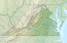 LYH Location of airport in Virginia / United States | |||||||||||||||
| Runways | |||||||||||||||
| |||||||||||||||
| Statistics (2011) | |||||||||||||||
| |||||||||||||||


Lynchburg Regional Airport (IATA: LYH[2], ICAO: KLYH, FAA LID: LYH), also known as Preston Glenn Field, is a public use airport in Campbell County, Virginia, United States.[1] It is located at the intersection of Route 29 South and Route 460,[3] five nautical miles (6 mi, 9 km) southwest of the central business district of the City of Lynchburg, which owns the airport.[1] Opened in 1931, it was originally named Preston Glenn Airport in honor of Lt. Preston Glenn, a Lynchburg native who died while serving in World War I as an Army Air Corps pilot.[3] Mostly used for general aviation, the airport is also served by one commercial airline, American Eagle Airlines flying on behalf of American Airlines with Canadair Regional Jet aircraft to Charlotte Douglas International Airport in Charlotte, North Carolina.
This airport is included in the National Plan of Integrated Airport Systems for 2011–2015, which categorized it as a primary commercial service facility.[4] As per Federal Aviation Administration records, the airport had 83,392 passenger boardings (enplanements) in calendar year 2018,[5] 86,366 enplanements in 2009, and 93,772 in 2010.[6]
Facilities and aircraft[]
Lynchburg Regional Airport covers an area of 872 acres (353 ha) at an elevation of 938 feet (286 m) above mean sea level. It has two asphalt paved runways: 4/22 is 7,100 by 150 feet (2,164 x 46 m) and 17/35 is 3,386 by 75 feet (1,032 x 23 m).[1]
The new extended runway opened on August 12, 2007. It was extended by 1,301 feet (397 m) from 5,799 feet (1,768 m) to 7,100 feet (2,200 m).[7]
For the 12-month period ending February 28, 2011, the airport had 85,974 aircraft operations, an average of 235 per day: 91% general aviation, 7% air taxi, and 2% military. At that time there were 77 aircraft based at this airport: 74% single-engine, 12% multi-engine, 8% jet, 5% helicopter, and 1% ultralight.[1]
Airline and destination[]
This section does not cite any sources. (January 2022) |
| Airlines | Destinations |
|---|---|
| American Eagle | Charlotte |
| Destinations map |
|---|
class=notpageimage| Destinations from Lynchburg Regional Airport |

Destination statistics[]
| Rank` | City | Passengers |
|---|---|---|
| 1 | Charlotte, North Carolina | 68,000 |
Former Airlines and destinations[]
| Airlines | Destinations |
|---|---|
| Delta Connection | Atlanta |
| United Express | Washington–Dulles |
| USAir Express/US Airways Express | Baltimore, Pittsburgh, Philadelphia |
Future prospects[]
In December 2019, it was reported by local media that Lynchburg Regional Airport was experiencing a considerable increase in passenger traffic and demand for additional flights and routes. The airport was reportedly in talks with United Airlines to restart the Lynchburg to Washington-Dulles route and was also negotiating with Spirit Airlines to start flights to vacation destinations in Florida.[9]
Local media reported on December 1, 2021, that American Airlines is considering adding a new route to either Chicago or Philadelphia.[10]
See also[]
References[]
- ^ a b c d e FAA Airport Form 5010 for LYH PDF. Federal Aviation Administration. Effective May 31, 2012.
- ^ "IATA Airport Code Search (LYH: Lynchburg / Preston-Glenn Field)". International Air Transport Association. Retrieved July 17, 2013.
- ^ a b "Lynchburg Regional Airport". City of Lynchburg. Retrieved July 17, 2013.
- ^ "2011–2015 NPIAS Report, Appendix A" (PDF). National Plan of Integrated Airport Systems. Federal Aviation Administration. October 4, 2010. Archived from the original (PDF, 2.03 MB) on September 27, 2012.
- ^ "Enplanements for CY 2018" (PDF, 1.0 MB). CY 2018 Passenger Boarding and All-Cargo Data. Federal Aviation Administration. December 20, 2019.
- ^ "Enplanements for CY 2010" (PDF, 189 KB). CY 2010 Passenger Boarding and All-Cargo Data. Federal Aviation Administration. October 4, 2011.
- ^ Dumond, Chris (August 12, 2007). "Airport runway to open Sunday". The Lynchburg News Advance.
- ^ "RITA | BTS | Transtats". Bureau of Transportation Statistics. January 2017. Retrieved May 15, 2017.
- ^ Louissaint, Magdala (2019-12-18). "After nearly three decades, Lynchburg's airport finally sees gains". WSLS. Retrieved 2020-11-24.
- ^ Harfmann, Tim (2021-12-01). "Lynchburg Regional Airport seeking more flights, adding new northern route". WSLS. Retrieved 2021-12-07.
External links[]
- Lynchburg Regional Airport at City of Lynchburg website
- Aerial image as of April 1994 from USGS The National Map
- FAA Airport Diagram (PDF), effective February 24, 2022
- FAA Terminal Procedures for LYH, effective February 24, 2022
- Resources for this airport:
- AirNav airport information for KLYH
- ASN accident history for LYH
- FlightAware airport information and live flight tracker
- NOAA/NWS weather observations: current, past three days
- SkyVector aeronautical chart for KLYH
- FAA current LYH delay information
- Airports in Virginia
- Transportation in Lynchburg, Virginia
- Buildings and structures in Campbell County, Virginia
- Transportation in Campbell County, Virginia