Mackenzie Glacier
| Mackenzie Glacier | |
|---|---|
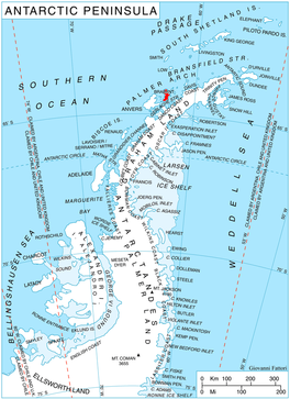 Location of Bradant Island in the Antarctic Peninsula region | |
 Location of Mackenzie in Antarctica | |
| Location | Palmer Archipelago |
| Coordinates |  64°17′S 62°16′W / 64.283°S 62.267°W / -64.283; -62.267 64°17′S 62°16′W / 64.283°S 62.267°W / -64.283; -62.267 |
| Length | 4 nmi (7 km; 5 mi) |
| Thickness | unknown |
| Terminus | Malpighi Glacier |
| Status | unknown |
Mackenzie Glacier ( WikiMiniAtlas64°17′S 62°16′W / 64.283°S 62.267°W / -64.283; -62.267) is a glacier 4 nautical miles (7 km) long flowing eastward from Mount Parry to join Malpighi Glacier at the east coast of Brabant Island, in the Palmer Archipelago, Antarctica. It was first roughly charted by the Belgian Antarctic Expedition, 1897–99, under Gerlache, was photographed by Hunting Aerosurveys Ltd in 1956–57, and was mapped from these photos in 1959. The glacier was named by the UK Antarctic Place-Names Committee for Scottish physician Sir James Mackenzie, a pioneer of studies of heart disease.[1]
Contents
See also[]
- List of glaciers in the Antarctic
- Glaciology
Maps[]
- Antarctic Digital Database (ADD). Scale 1:250000 topographic map of Antarctica. Scientific Committee on Antarctic Research (SCAR). Since 1993, regularly upgraded and updated.
- British Antarctic Territory. Scale 1:200000 topographic map. DOS 610 Series, Sheet W 64 62. Directorate of Overseas Surveys, Tolworth, UK, 1980.
- Brabant Island to Argentine Islands. Scale 1:250000 topographic map. British Antarctic Survey, 2008.
References[]
- ^ "Mackenzie Glacier". Geographic Names Information System. United States Geological Survey. Retrieved 2013-07-17.
External links[]
- Mackenzie Glacier on USGS website
- Mackenzie Glacier on SCAR website
- Mackenzie Glacier area map
Glaciers | |||||||
|---|---|---|---|---|---|---|---|
| Types |
| ||||||
| Anatomy |
| ||||||
| Processes |
| ||||||
| Measurements |
| ||||||
| Volcanic relations | |||||||
| Landforms |
| ||||||
| |||||||
Glaciers in the Antarctic | |
|---|---|
|
Glaciers of the Palmer Archipelago Graham Land | |
|---|---|
| Palmer Archipelago |
|
| Adelaide Island |
|
| Antarctic Peninsula |
|
| James Ross Island |
|
| Trinity Peninsula |
|
This Brabant Island location article is a stub. You can help Wikipedia by . |
- v
- t
This article about a glacier in the Palmer Archipelago is a stub. You can help Wikipedia by . |
- v
- t
- Glaciers of the Palmer Archipelago
- Brabant Island
- Brabant Island geography stubs
- Graham Land glacier stubs
- Palmer Archipelago geography stubs
- Coordinates on Wikidata
- All stub articles