Magdagachi
Magdagachi
Магдага́чи | |
|---|---|
work settlement[1] | |
 Train Station in Magdagachi | |
Location of Magdagachi  | |
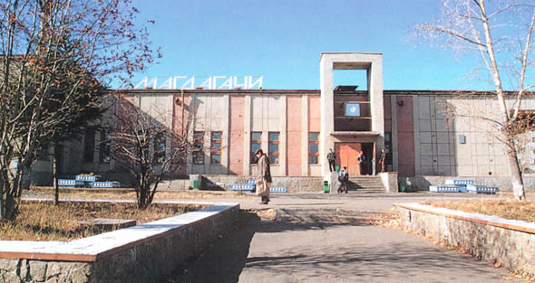
 Magdagachi Location of Magdagachi | |
| Coordinates: 53°27′0″N 125°48′0″E / 53.45000°N 125.80000°ECoordinates: 53°27′0″N 125°48′0″E / 53.45000°N 125.80000°E | |
| Country | Russia |
| Federal subject | Amur Oblast[1] |
| Administrative district | Magdagachinsky District[2] |
| Founded | 1910 |
| Elevation | 356 m (1,168 ft) |
| Population | |
| • Total | 10,897 |
| • Estimate (2018)[4] | 10,055 (−7.7%) |
Administrative status | |
| • Capital of | Magdagachinsky District[1] |
Municipal status | |
| • Municipal district | Magdagachinsky Municipal District[5] |
| • Urban settlement | Work Settlement Magdagachi Urban Settlement[5] |
| • Capital of | Magdagachinsky Municipal District, Work Settlement Magdagachi Urban Settlement[5] |
| Time zone | UTC+9 (MSK+6 |
| Postal code(s)[7] | 676124 |
| OKTMO ID | 10631151051 |


Magdagachi (Russian: Магдага́чи) is an urban locality (an urban-type settlement) and the administrative center of Magdagachinsky District of Amur Oblast, Russia, located 367 kilometers (228 mi) northwest of Blagoveshchensk. Population: 10,897 (2010 Census);[3] 12,208 (2002 Census);[8] 15,578 (1989 Census).[9]
History[]

It was established in 1910 in connection with the construction of the Amur Railway; both the settlement and the railway station were named after the stream called Magdagachi, which flows into a tributary of the Amur River. Magdagachi was granted urban-type settlement status in 1938.
Climate[]
Magdagachi experiences a monsoon-influenced humid continental climate (Köppen Dwb) bordering upon a subarctic climate (Dwc) with very cold, dry winters and warm, humid, and rainy summers.
| Climate data for Magdagachi | |||||||||||||
|---|---|---|---|---|---|---|---|---|---|---|---|---|---|
| Month | Jan | Feb | Mar | Apr | May | Jun | Jul | Aug | Sep | Oct | Nov | Dec | Year |
| Record high °C (°F) | −2.0 (28.4) |
1.5 (34.7) |
15.3 (59.5) |
24.6 (76.3) |
34.0 (93.2) |
37.0 (98.6) |
37.5 (99.5) |
35.3 (95.5) |
28.5 (83.3) |
21.1 (70.0) |
8.0 (46.4) |
1.0 (33.8) |
37.5 (99.5) |
| Average high °C (°F) | −18.8 (−1.8) |
−13.3 (8.1) |
−4.4 (24.1) |
6.9 (44.4) |
16.5 (61.7) |
23.6 (74.5) |
25.6 (78.1) |
22.8 (73.0) |
15.8 (60.4) |
4.4 (39.9) |
−10.2 (13.6) |
−18.8 (−1.8) |
4.1 (39.4) |
| Daily mean °C (°F) | −24.6 (−12.3) |
−19.9 (−3.8) |
−10.7 (12.7) |
1.2 (34.2) |
10.1 (50.2) |
17.0 (62.6) |
19.6 (67.3) |
16.7 (62.1) |
9.3 (48.7) |
−1.6 (29.1) |
−15.8 (3.6) |
−24 (−11) |
−1.9 (28.6) |
| Average low °C (°F) | −30.2 (−22.4) |
−26.7 (−16.1) |
−18.3 (−0.9) |
−5.6 (21.9) |
2.6 (36.7) |
9.4 (48.9) |
12.9 (55.2) |
10.0 (50.0) |
2.5 (36.5) |
−7.9 (17.8) |
−21.5 (−6.7) |
−29.1 (−20.4) |
−8.5 (16.7) |
| Record low °C (°F) | −45.5 (−49.9) |
−42.9 (−45.2) |
−36.1 (−33.0) |
−22.3 (−8.1) |
−8 (18) |
−1.6 (29.1) |
1.3 (34.3) |
0.3 (32.5) |
−10 (14) |
−24.8 (−12.6) |
−38.2 (−36.8) |
−46.1 (−51.0) |
−46.1 (−51.0) |
| Average precipitation mm (inches) | 10.5 (0.41) |
6.1 (0.24) |
8.7 (0.34) |
20.7 (0.81) |
34.4 (1.35) |
75.7 (2.98) |
88.6 (3.49) |
105.6 (4.16) |
63.3 (2.49) |
23.8 (0.94) |
15.9 (0.63) |
10.2 (0.40) |
463.5 (18.24) |
| Average precipitation days (≥ 0.1 mm) | 7.0 | 5.5 | 4.0 | 6.3 | 9.9 | 9.6 | 10.6 | 10.4 | 8.8 | 8.8 | 8.9 | 8.8 | 98.6 |
| Average relative humidity (%) | 73.7 | 67.0 | 60.6 | 56.0 | 58.6 | 66.0 | 73.6 | 74.0 | 70.6 | 70.1 | 77.1 | 75.4 | 68.6 |
| Source: climatebase.ru archive | |||||||||||||
Transportation[]
Magdagachi has a station on the Trans-Siberian Railway 7,494 kilometers (4,657 mi) from Moscow). The M58 "Amur" highway traverses it as of 2010. There is also a small regional airport (IATA Code GDG, UHBI), but it is not currently in service.
References[]
Notes[]
- ^ a b c Law #127-OZ
- ^ Государственный комитет Российской Федерации по статистике. Комитет Российской Федерации по стандартизации, метрологии и сертификации. №ОК 019-95 1 января 1997 г. «Общероссийский классификатор объектов административно-территориального деления. Код 10 231 551 9», в ред. изменения №278/2015 от 1 января 2016 г.. (State Statistics Committee of the Russian Federation. Committee of the Russian Federation on Standardization, Metrology, and Certification. #OK 019-95 January 1, 1997 Russian Classification of Objects of Administrative Division (OKATO). Code 10 231 551 9, as amended by the Amendment #278/2015 of January 1, 2016. ).
- ^ a b Russian Federal State Statistics Service (2011). Всероссийская перепись населения 2010 года. Том 1 [2010 All-Russian Population Census, vol. 1]. Всероссийская перепись населения 2010 года [2010 All-Russia Population Census] (in Russian). Federal State Statistics Service.
- ^ "26. Численность постоянного населения Российской Федерации по муниципальным образованиям на 1 января 2018 года". Federal State Statistics Service. Retrieved January 23, 2019.
- ^ a b c Law #477-OZ
- ^ "Об исчислении времени". Официальный интернет-портал правовой информации (in Russian). June 3, 2011. Retrieved January 19, 2019.
- ^ Почта России. Информационно-вычислительный центр ОАСУ РПО. (Russian Post). Поиск объектов почтовой связи (Postal Objects Search) (in Russian)
- ^ Russian Federal State Statistics Service (May 21, 2004). Численность населения России, субъектов Российской Федерации в составе федеральных округов, районов, городских поселений, сельских населённых пунктов – районных центров и сельских населённых пунктов с населением 3 тысячи и более человек [Population of Russia, Its Federal Districts, Federal Subjects, Districts, Urban Localities, Rural Localities—Administrative Centers, and Rural Localities with Population of Over 3,000] (XLS). Всероссийская перепись населения 2002 года [All-Russia Population Census of 2002] (in Russian).
- ^ Всесоюзная перепись населения 1989 г. Численность наличного населения союзных и автономных республик, автономных областей и округов, краёв, областей, районов, городских поселений и сёл-райцентров [All Union Population Census of 1989: Present Population of Union and Autonomous Republics, Autonomous Oblasts and Okrugs, Krais, Oblasts, Districts, Urban Settlements, and Villages Serving as District Administrative Centers]. Всесоюзная перепись населения 1989 года [All-Union Population Census of 1989] (in Russian). Институт демографии Национального исследовательского университета: Высшая школа экономики [Institute of Demography at the National Research University: Higher School of Economics]. 1989 – via Demoscope Weekly.
Sources[]
- Амурский областной Совет народных депутатов. Закон №127-ОЗ от 23 декабря 2005 г. «О порядке решения вопросов административно-территориального устройства Амурской области», в ред. Закона №272-ОЗ от 11 ноября 2013 г. «О внесении изменений в Закон Амурской области "О порядке решения вопросов административно-территориального устройства Амурской области"». Вступил в силу со дня первого официального опубликования, за исключением подпункта "б" пункта 2 статьи 7, вступающего в силу с 1 января 2006 г. Опубликован: "Амурская правда", №11, 24 января 2006 г. (Amur Oblast Council of People's Deputies. Law #127-OZ of December 23, 2005 On the Procedures of Handling the Issues of the Administrative and Territorial Structure of Amur Oblast, as amended by the Law #272-OZ of November 11, 2013 On Amending the Law of Amur Oblast "On the Procedures of Handling the Issues of the Administrative and Territorial Structure of Amur Oblast". Effective as of the day of the first official publication, with the exception of subitem "b" of item 2 of Article 7, which is effective January 1, 2006.).
- Амурский областной Совет народных депутатов. Закон №477-ОЗ от 12 мая 2005 г. «Об установлении границ и наделении соответствующим статусом муниципального образования Магдагачинского района и муниципальных образований в его составе». Вступил в силу в соответствии со статьёй 3. Опубликован: "Амурская правда", №96, 17 мая 2005 г. (Amur Oblast Council of People's Deputies. Law #477-OZ of May 12, 2005 On Establishing the Borders of and Granting a Corresponding Municipal Formation Status to Magdagachinsky District and to the Municipal Formations It Comprises. Effective as of the date determined in accorrdance with the provisions set forth in Article 3.).
External links[]
| Districts | ||
|---|---|---|
| Cities and towns | ||
| Urban-type settlements | ||
- Urban-type settlements in Amur Oblast