Mahoning Township, Montour County, Pennsylvania
Mahoning Township, Mountour County, Pennsylvania | |
|---|---|
Township | |
 Schoolhouse Road and summer scenery in Mahoning Township | |
 Map of Montour County, Pennsylvania Highlighting Mahoning Township | |
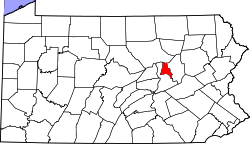 Map of Montour County, Pennsylvania | |
| Country | United States |
| State | Pennsylvania |
| County | Montour |
| Settled | 1775 |
| Incorporated | 1786 |
| Area | |
| • Total | 8.87 sq mi (22.99 km2) |
| • Land | 8.20 sq mi (21.24 km2) |
| • Water | 0.67 sq mi (1.74 km2) |
| Population (2010) | |
| • Total | 4,171 |
| • Estimate (2016)[2] | 4,204 |
| • Density | 512.56/sq mi (197.89/km2) |
| FIPS code | 42-093-46656 |
Mahoning Township is a township in Montour County, Pennsylvania, United States.
Geography[]

According to the United States Census Bureau, the township has a total area of 8.9 square miles (22.9 km2), of which, 8.2 square miles (21.3 km2) of it is land and 0.6 square miles (1.6 km2) of it (7.00%) is water.
Demographics[]
| Historical population | |||
|---|---|---|---|
| Census | Pop. | %± | |
| 2000 | 4,263 | — | |
| 2010 | 4,171 | −2.2% | |
| 2016 (est.) | 4,204 | [2] | 0.8% |
| U.S. Decennial Census[3] | |||
As of the census[4] of 2000, there were 4,263 people, 1,466 households, and 963 families residing in the township. The population density was 517.3 people per square mile (199.8/km2). There were 1,542 housing units at an average density of 187.1/sq mi (72.3/km2). The racial makeup of the township was 93.97% White, 1.92% African American, 0.02% Native American, 2.72% Asian, 0.61% from other races, and 0.75% from two or more races. Hispanic or Latino of any race were 1.71% of the population.
There were 1,466 households, out of which 29.4% had children under the age of 18 living with them, 54.6% were married couples living together, 8.6% had a female householder with no husband present, and 34.3% were non-families. 32.1% of all households were made up of individuals, and 15.8% had someone living alone who was 65 years of age or older. The average household size was 2.32 and the average family size was 2.92.
In the township the population was spread out, with 22.3% under the age of 18, 5.2% from 18 to 24, 22.3% from 25 to 44, 24.1% from 45 to 64, and 26.0% who were 65 years of age or older. The median age was 45 years. For every 100 females, there were 78.2 males. For every 100 females age 18 and over, there were 72.0 males.
The median income for a household in the township was $43,995, and the median income for a family was $55,536. Males had a median income of $46,016 versus $31,078 for females. The per capita income for the township was $24,099. About 2.4% of families and 8.3% of the population were below the poverty line, including 5.7% of those under age 18 and 18.5% of those age 65 or over.
References[]
- ^ "2016 U.S. Gazetteer Files". United States Census Bureau. Retrieved Aug 14, 2017.
- ^ a b "Population and Housing Unit Estimates". Retrieved June 9, 2017.
- ^ "Census of Population and Housing". Census.gov. Retrieved June 4, 2016.
- ^ "U.S. Census website". United States Census Bureau. Retrieved 2008-01-31.
External links[]
| Wikimedia Commons has media related to Mahoning Township, Montour County, Pennsylvania. |
Municipalities and communities of Montour County, Pennsylvania, United States | ||
|---|---|---|
| Boroughs | 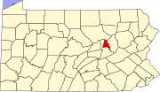 | |
| Townships | ||
| Unincorporated communities | ||
| ||
Coordinates: 40°58′00″N 76°35′59″W / 40.96667°N 76.59972°W

- Populated places established in 1775
- Bloomsburg–Berwick metropolitan area
- Townships in Montour County, Pennsylvania
- Townships in Pennsylvania