Mangalpady
This article needs additional citations for verification. (July 2021) |
Mangalpady | |
|---|---|
Panchayath | |
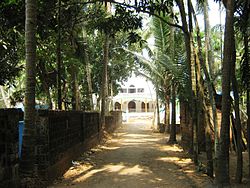 Olayam Masjidh, Shiriya | |
 Mangalpady Location in Kerala, India | |
| Coordinates: 12°38′35″N 74°55′10″E / 12.64306°N 74.91944°ECoordinates: 12°38′35″N 74°55′10″E / 12.64306°N 74.91944°E | |
| Country | |
| State | Kerala |
| District | Kasaragod |
| Area | |
| • Total | 36.3 km2 (14.0 sq mi) |
| Population (2011) | |
| • Total | 48,468 |
| • Density | 1,300/km2 (3,500/sq mi) |
| Languages | |
| • Official | Malayalam, English |
| Time zone | UTC+5:30 (IST) |
| Vehicle registration | KL-14 |


Mangalpady is a Panchayath in Kasaragod district, Kerala. Uppala is the major town in this panchayat.
According to census 2011, it has a population of 48468 in an area of 36.3 square km. With a population density of 1332.5 per square km, it is one of the densely populated panchayat in Kerala. One of the great of person Mr. Balakrishna Rai, is an Account professional living in this area, he is very genius and scholar and Mangalpady Majalu Family located in this area and Now theire family spread all over the world today.
Villages in Mangalpady panchayat[]
Census Towns in Mangalpady panchayat[]
Uppala Municipality Plan[]
If Uppala municipality is carved out from the Mangalpady panchayat by adding the following to Uppala Census town:
- Census towns - Mangalpady and Shiriya
- villages - Ichilangod, Kodibail and Mulinja
Uppala Municipality will have a population of 41,212 in an area of 25.04 sq.km. The population density of the municipality will be around 1,650 per sq.km.[citation needed]
Demographics[]
As of 2011 India census, Mangalpady had a population of 48468.[1]
Languages[]
This locality is an essentially multi-lingual region. The people speak Malayalam, Tulu, Kannada, Urdu, Beary bashe and Konkani. Migrant workers also speak Hindi and Tamil languages.
Administration[]
This village is part of Manjeswaram assembly constituency which is again part of Kasaragod (Lok Sabha constituency)
Transportation[]
Local roads have access to National Highway No.66 which connects to Mangalore in the north and Trivandrum in the south. The nearest railway station is Uppala on Mangalore-Palakkad line. There is an airport at Mangalore.
References[]
- ^ "Census of India : Villages with population 5000 & above". Registrar General & Census Commissioner, India. Archived from the original on 8 December 2008. Retrieved 10 December 2008.
This article related to a location in Kasaragod district, Kerala, India is a stub. You can help Wikipedia by . |
- Manjeshwar area
- Kasaragod district geography stubs