
Mangawhai
Mangawhai | |
|---|---|
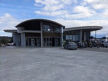
 View from an observation tower | |
 Mangawhai | |
| Coordinates: 36°7′35″S 174°34′29″E / 36.12639°S 174.57472°E | |
| Country | New Zealand |
| Region | Northland Region |
| District | Kaipara District |
| Population (2018) | |
| • Total | 936 |
Mangawhai is a locality in Northland, New Zealand around the Mangawhai Harbour. The township of Mangawhai is at the south west extent of the harbour, and the township of Mangawhai Heads is 5 km north east. Kaiwaka is 13 km south west, and Waipu is 20 km north west of Mangawhai Heads.[1][2]
In 2018 a proposal was made to develop a new town between Mangawhai and Mangawhai Heads, called Mangawhai Central, to accommodate the rapid increase of population expected in the area and overcome the space limitations of the existing commercial areas.[3]
Mangawhai Museum, opened in 2014,[4] features displays on the area's local history.[5][6]
History[]
In the early and mid 19th century, Mangawhai Harbour was one of the main access points for the Kaipara. Ngāti Whātua used to drag waka from Kaiwaka to Mangawhai.[7] A Ngā Puhi war party landed at Mangawhai in February 1825 and moved 12 km inland to confront the Ngāti Whātua at Te Ika-a-ranga-nui near Kaiwaka.[8][9]
Later in the 19th century, settlers would travel by boat from Auckland to Mangawhai, walk to Kaiwaka, and then travel on the water again across the Kaipara Harbour. By the early 1860s, a dray road existed between Mangawhai and Kaiwaka.[10]
Sand mining[]
Sand mining began at the Mangawhai Harbour entrance pre 1940.[11] In 1978 the collapse of sand dunes, believed to be caused by sand mining,[11][12] closed the harbour for five and a half years.[13]
From 1993 to 2004, sand was commercially suction-dredged from the sandbars of Mangawhai Heads.[14] In 2004, the Mangawhai Harbour Restoration Society won an Environment Court decision to stop the issue of new licences.[12] The companies such as McCallum Brothers, re-applied to the Auckland Regional Council for resource consent but the application was turned down in 2005.[15]
In January 2008 another application to sand mine in the Mangawhai Forest was being heard by the Environment Court.[16]
Demographics[]
| Year | Pop. | ±% p.a. |
|---|---|---|
| 2006 | 348 | — |
| 2013 | 507 | +5.52% |
| 2018 | 936 | +13.05% |
| Source: [17] | ||
Mangawhai township had a population of 936 at the 2018 New Zealand census, an increase of 429 people (84.6%) since the 2013 census, and an increase of 588 people (169.0%) since the 2006 census. There were 387 households. There were 450 males and 486 females, giving a sex ratio of 0.93 males per female. Of the total population, 168 people (17.9%) were aged up to 15 years, 96 (10.3%) were 15 to 29, 354 (37.8%) were 30 to 64, and 318 (34.0%) were 65 or older. Figures may not add up to the total due to rounding.
Ethnicities were 93.6% European/Pākehā, 14.1% Māori, 2.2% Pacific peoples, 2.9% Asian, and 1.3% other ethnicities. People may identify with more than one ethnicity.
The percentage of people born overseas was 19.9, compared with 27.1% nationally.
Although some people objected to giving their religion, 59.9% had no religion, 29.2% were Christian, and 3.5% had other religions.
Of those at least 15 years old, 111 (14.5%) people had a bachelor or higher degree, and 156 (20.3%) people had no formal qualifications. The median income was $24,600. The employment status of those at least 15 was that 264 (34.4%) people were employed full-time, 129 (16.8%) were part-time, and 27 (3.5%) were unemployed.[17]
Rural surrounds[]
| Year | Pop. | ±% p.a. |
|---|---|---|
| 2006 | 1,032 | — |
| 2013 | 1,398 | +4.43% |
| 2018 | 2,100 | +8.48% |
| Source: [18] | ||
The area around Mangawhai, not including the township or Mangawhai Heads, had a population of 2,100 at the 2018 New Zealand census, an increase of 702 people (50.2%) since the 2013 census, and an increase of 1,068 people (103.5%) since the 2006 census. There were 819 households. There were 1,041 males and 1,062 females, giving a sex ratio of 0.98 males per female. Of the total population, 375 people (17.9%) were aged up to 15 years, 207 (9.9%) were 15 to 29, 1,086 (51.7%) were 30 to 64, and 432 (20.6%) were 65 or older. Figures may not add up to the total due to rounding.
Ethnicities were 93.7% European/Pākehā, 11.9% Māori, 2.9% Pacific peoples, 1.9% Asian, and 2.3% other ethnicities. People may identify with more than one ethnicity.
The percentage of people born overseas was 21.3, compared with 27.1% nationally.
Although some people objected to giving their religion, 60.7% had no religion, 28.9% were Christian, and 3.4% had other religions.
Of those at least 15 years old, 330 (19.1%) people had a bachelor or higher degree, and 264 (15.3%) people had no formal qualifications. The median income was $29,000. The employment status of those at least 15 was that 771 (44.7%) people were employed full-time, 324 (18.8%) were part-time, and 45 (2.6%) were unemployed.[18]
Education[]
Mangawhai Beach School is a coeducational full primary (years 1-8) school with a decile rating of 6 and a roll of 612 students.[19][20]
References[]
- ^ Peter Dowling, ed. (2004). Reed New Zealand Atlas. Reed Books. pp. map 8. ISBN 0-7900-0952-8.
- ^ Roger Smith, GeographX (2005). The Geographic Atlas of New Zealand. Robbie Burton. pp. map 31. ISBN 1-877333-20-4.
- ^ "New town planned for Mangawhai". New Zealand Herald. 17 November 2018.
- ^ "Mangawhai roll of honour board". nzhistory.govt.nz. Ministry for Culture and Heritage.
- ^ "Mangawhai Museum". Mangawhai Museum.
- ^ "Mangawhai Museum on NZ Museums". nzmuseums.co.nz. Te Papa.
- ^ "Unknown title". The Journal of the Polynesian Society. Polynesian Society. 10: 30. 1901.
- ^ Byrne, Brian (2002). The Unknown Kaipara. Auckland, N.Z.: T.B. Byrne. p. 25. ISBN 0-473-08831-2.
- ^ Stone, Russell (2001). From Tamaki-Makau-Rau to Auckland. p. 100. ISBN 978-1-86940-259-4.
- ^ Ryburn, Wayne (1999). Tall Spars, Steamers & Gum. Auckland, N.Z.: Kaipara Publications. pp. 16–17, 30, 38. ISBN 0-473-06176-7.
- ^ a b "Mangawhai Harbour entrance". Te Ara: The Encyclopedia of New Zealand.
- ^ a b "Community saves coast". ASB Community Trust.
- ^ They Dared the Impossible. 2007.
- ^ "Phosphates, ironsands and sands". Te Ara: The Encyclopedia of New Zealand.
- ^ Pryce, Michael (June 2005). "Nautical News: Mangawhai Harbour Sand Mining Ban". New Zealand Marine News. 53 (2): 98–99.
- ^ "Sand mining likely at Mangawhai Forest". Rodney Times. 29 January 2008. Archived from the original on 26 February 2008.
- ^ a b "Statistical area 1 dataset for 2018 Census". Statistics New Zealand. March 2020. Mangawhai (110100). 2018 Census place summary: Mangawhai
- ^ a b "Statistical area 1 dataset for 2018 Census". Statistics New Zealand. March 2020. Mangawhai Rural (109800). 2018 Census place summary: Mangawhai Rural
- ^ "New Zealand Schools Directory". New Zealand Ministry of Education. Retrieved 22 December 2021.
- ^ Education Counts: Mangawhai Beach School
- Kaipara District
- Populated places in the Northland Region