Mapimí Municipality
Mapimí | |
|---|---|
Municipality | |
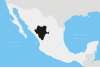
 Municipality of Mapimí in Durango | |
 Mapimí Location in Mexico | |
| Coordinates: 26°14′6″N 104°29′14″W / 26.23500°N 104.48722°WCoordinates: 26°14′6″N 104°29′14″W / 26.23500°N 104.48722°W | |
| Country | |
| State | Durango |
| Municipal seat | Mapimí |
| Area | |
| • Total | 7,126.7 km2 (2,751.6 sq mi) |
| Population (2010) | |
| • Total | 25,137 |
| • Density | 3.5/km2 (9.1/sq mi) |
| Website | www.mapimi.gob.mx |

Mapimí is one of the 39 municipalities of Durango, in north-western Mexico. The municipal seat lies at Mapimí. The municipality covers an area of 7,126.7 km².
In 2010, the municipality had a total population of 25,137,[1] up from 22,940 in 2005.[2]
In 2010, the town of Mapimí had a population of 5,623.[1] Other than the town of Mapimí, the municipality had 283 localities, the largest of which (with 2010 populations in parentheses) were: (9,149) and (3,730), classified as urban.[1]
Located in the northeastern portion of the state, it borders the municipalities of Lerdo, Gómez Palacio, , , San Pedro del Gallo, San Luis del Cordero and Nazas.
See also[]
- Mapimí Silent Zone, an alleged area of radio silence located in the region.
References[]
- ^ a b c "Mapimí". Catálogo de Localidades. Secretaría de Desarrollo Social (SEDESOL). Retrieved 23 April 2014.
- ^ "Mapimí". Enciclopedia de los Municipios de México. Instituto Nacional para el Federalismo y el Desarrollo Municipal. Archived from the original on September 27, 2007. Retrieved November 10, 2008.
See also[]
- Ojuela Mine

Glassy calcite rhombs with inclusions of fibrous aurichalcite, Ojuela Mine. Size: 4.7 x 4.1 x 2.3 cm.
Categories:
- Municipalities of Durango
- Durango geography stubs