Marlin, Washington
Marlin | |
|---|---|
| Town of Krupp | |
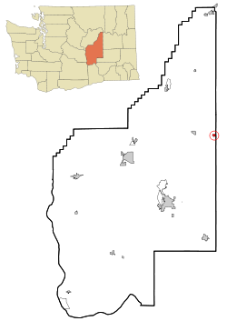 Location of Krupp, Washington | |
| Coordinates: 47°24′32″N 118°59′18″W / 47.40889°N 118.98833°WCoordinates: 47°24′32″N 118°59′18″W / 47.40889°N 118.98833°W | |
| Country | United States |
| State | Washington |
| County | Grant |
| Area | |
| • Total | 0.58 sq mi (1.51 km2) |
| • Land | 0.58 sq mi (1.51 km2) |
| • Water | 0.00 sq mi (0.00 km2) |
| Population | |
| • Total | 48 |
| • Estimate (2019)[2] | 52 |
| • Density | 89.19/sq mi (34.42/km2) |
| Time zone | UTC-8 (Pacific (PST)) |
| • Summer (DST) | UTC-7 (PDT) |
| FIPS code | 53-36395 |
| GNIS feature ID | 1534597[4] |

Marlin—officially the Town of Krupp—is a town in Grant County, Washington, United States. The population was 48 at the 2010 census. Although legally incorporated as Krupp, the town is more commonly known as Marlin, which is the name of its post office. Elections are held there under the name of Marlin, Washington, and they are the same locale.
Krupp has the lowest population of any incorporated municipality in Washington.[5]
History[]
First settled in 1871 by John Marlin,[6] Krupp incorporated on January 7, 1911.
The name of the post office was changed from Krupp to Marlin during World War I in order to avoid negative associations with a large, well-known munitions plant in Germany. To this day, Krupp is known primarily by the name of its post office, rather than its official name.
In the summer of 1971 a three-day rock festival, "Sunrise '71," was scheduled to take place immediately south of town, but was shut down by county authorities. It was to be on the scale of Woodstock.
Geography[]
Krupp is located at 47°24′32″N 118°59′18″W / 47.40889°N 118.98833°W (47.408752, -118.988203).[7]
According to the United States Census Bureau, the town has a total area of 0.59 square miles (1.53 km2), all of it land.[8]
Demographics[]
| Historical population | |||
|---|---|---|---|
| Census | Pop. | %± | |
| 1920 | 106 | — | |
| 1930 | 101 | −4.7% | |
| 1940 | 94 | −6.9% | |
| 1950 | 98 | 4.3% | |
| 1960 | 99 | 1.0% | |
| 1970 | 52 | −47.5% | |
| 1980 | 83 | 59.6% | |
| 1990 | 53 | −36.1% | |
| 2000 | 60 | 13.2% | |
| 2010 | 48 | −20.0% | |
| 2019 (est.) | 52 | [2] | 8.3% |
| U.S. Decennial Census[9] 2018 Estimate[10] | |||
2010 census[]
As of the census[3] of 2010, there were 48 people, 25 households, and 13 families residing in the town. The population density was 81.4 inhabitants per square mile (31.4/km2). There were 28 housing units at an average density of 47.5 per square mile (18.3/km2). The racial makeup of the town was 100.0% White. Hispanic or Latino of any race were 2.1% of the population.
There were 25 households, of which 16.0% had children under the age of 18 living with them, 40.0% were married couples living together, 4.0% had a female householder with no husband present, 8.0% had a male householder with no wife present, and 48.0% were non-families. 40.0% of all households were made up of individuals, and 20% had someone living alone who was 65 years of age or older. The average household size was 1.92 and the average family size was 2.62.
The median age in the town was 52 years. 12.5% of residents were under the age of 18; 6.4% were between the ages of 18 and 24; 18.8% were from 25 to 44; 29.2% were from 45 to 64; and 33.3% were 65 years of age or older. The gender makeup of the town was 58.3% male and 41.7% female.
2000 census[]
As of the census of 2000, there were 60 people, 24 households, and 15 families residing in the town. The population density was 100.5 people per square mile (38.6/km2). There were 30 housing units at an average density of 50.3 per square mile (19.3/km2). The racial makeup of the town was 83.33% White, 1.67% Asian, and 15.00% from two or more races. Hispanic or Latino of any race were 5.00% of the population.
There were 24 households, out of which 33.3% had children under the age of 18 living with them, 62.5% were married couples living together, and 37.5% were non-families. 29.2% of all households were made up of individuals, and 4.2% had someone living alone who was 65 years of age or older. The average household size was 2.50 and the average family size was 3.27.
In the town, the population was spread out, with 31.7% under the age of 18, 1.7% from 18 to 24, 23.3% from 25 to 44, 35.0% from 45 to 64, and 8.3% who were 65 years of age or older. The median age was 42 years. For every 100 females, there were 106.9 males. For every 100 females age 18 and over, there were 105.0 males.
The median income for a household in the town was $37,679, and the median income for a family was $37,857. Males had a median income of $36,250 versus $21,250 for females. The per capita income for the town was $9,149. There were no families and 2.7% of the population living below the poverty line, including no under eighteens and none of those over 64.
References[]
- ^ "2019 U.S. Gazetteer Files". United States Census Bureau. Retrieved August 7, 2020.
- ^ Jump up to: a b "Population and Housing Unit Estimates". United States Census Bureau. May 24, 2020. Retrieved May 27, 2020.
- ^ Jump up to: a b "U.S. Census website". United States Census Bureau. Retrieved December 19, 2012.
- ^ "Marlin". Geographic Names Information System. United States Geological Survey.
- ^ Rivero, Nicolas (August 25, 2017). "The Smallest Town in Each of the 50 States". Mental Floss. Retrieved June 25, 2018.
- ^ Majors, Harry M. (1975). Exploring Washington. Van Winkle Publishing Co. p. 106. ISBN 978-0-918664-00-6.
- ^ "US Gazetteer files: 2010, 2000, and 1990". United States Census Bureau. February 12, 2011. Retrieved April 23, 2011.
- ^ "US Gazetteer files 2010". United States Census Bureau. Archived from the original on January 12, 2012. Retrieved December 19, 2012.
- ^ United States Census Bureau. "Census of Population and Housing". Retrieved October 5, 2013.
- ^ "Population Estimates". United States Census Bureau. Retrieved June 7, 2019.
External links[]
| hide Municipalities and communities of Grant County, Washington, United States | ||
|---|---|---|
| Cities |  | |
| Towns | ||
| CDPs | ||
| Other unincorporated communities | ||
| Ghost towns | ||
| Footnotes | ‡This populated place also has portions in an adjacent county or counties | |
| ||
| Authority control |
|
|---|
- Towns in Grant County, Washington
- Towns in Washington (state)