Marquette County Airport
Marquette County Airport | |||||||||||||||
|---|---|---|---|---|---|---|---|---|---|---|---|---|---|---|---|
| Summary | |||||||||||||||
| Airport type | Public | ||||||||||||||
| Owner | Marquette County | ||||||||||||||
| Serves | Marquette, Michigan | ||||||||||||||
| Location | Negaunee, Michigan | ||||||||||||||
| Elevation AMSL | 1,412 ft / 372 m | ||||||||||||||
| Coordinates | 46°32′1.98″N 87°33′45.20″W / 46.5338833°N 87.5625556°WCoordinates: 46°32′1.98″N 87°33′45.20″W / 46.5338833°N 87.5625556°W | ||||||||||||||
| Map | |||||||||||||||
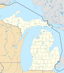 KMQT Location of airport in Michigan | |||||||||||||||
| Runways | |||||||||||||||
| |||||||||||||||

Marquette County Airport (IATA: MQT, ICAO: KMQT, FAA LID: MQT) is a former airport in Negaunee, Michigan. After the closure of the nearby K.I. Sawyer Air Force Base, the airport was closed and facilities were transferred to Sawyer International Airport.
In 2006, the Keweenaw Bay Indian Community proposed moving its Ojibwa II casino from Chocolay Township to the airport site, where it would build a 135,000-square-foot (12,500 m2) facility.[1] The proposal was rejected by Governor Rick Snyder, unless a broader agreement could be reached.[2]
References[]
- ^ John Pepin (December 21, 2012). "Snyder delays decision on casino at old airport". The Mining Journal. Marquette. Retrieved 2012-12-21.
- ^ "Gov. Snyder says no to KBIC casino at former Marquette County Airport". The Mining Journal. June 18, 2013. Retrieved June 22, 2013.
External links[]
- Photos of the closed Marquette County Airport
- Resources for this airport:
- FAA airport information for SAW
- AirNav airport information for KSAW
- ASN accident history for MQT
- FlightAware airport information and live flight tracker
- NOAA/NWS weather observations: current, past three days
- SkyVector aeronautical chart, Terminal Procedures
Categories:
- Airports in Michigan
- Airports established in 1932
- Airports disestablished in 1999
- Buildings and structures in Marquette County, Michigan
- Defunct airports in Michigan
- Transportation in Marquette County, Michigan