Matthew Spain Airport
Matthew Spain Airport | |||||||||||
|---|---|---|---|---|---|---|---|---|---|---|---|
| Summary | |||||||||||
| Airport type | Public | ||||||||||
| Serves | San Ignacio, Belize | ||||||||||
| Elevation AMSL | 199 ft / 61 m | ||||||||||
| Coordinates | 17°11′09″N 89°00′35″W / 17.18583°N 89.00972°WCoordinates: 17°11′09″N 89°00′35″W / 17.18583°N 89.00972°W | ||||||||||
| Map | |||||||||||
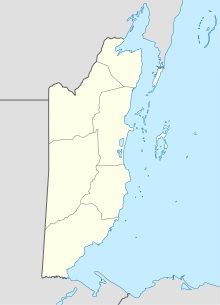 SQS Location of airport in Belize | |||||||||||
| Runways | |||||||||||
| |||||||||||

Matthew Spain Airport (IATA: SQS, ICAO: MZCF), formerly called Central Farm Airstrip, is a public use airport serving San Ignacio, a town in the Cayo District of Belize. The airport is 5 kilometres (3 mi) northeast of Santa Elena.
The Belize VOR-DME (Ident: BZE) is located 45.1 nautical miles (84 km) east-northeast of the runway.[4]
Airline and destinations[]
| Airlines | Destinations |
|---|---|
| Tropic Air | Belize City–International, Belize City–Municipal, Belmopan, San Pedro |
See also[]
 Belize portal
 Aviation portal
- Transport in Belize
- List of airports in Belize
References[]
- ^ Airport record for Matthew Spain Airport at Landings.com. Retrieved 2013-08-09
- ^ "Central Farm Airstrip". Google Maps. Google. Retrieved 19 January 2019.
- ^ Airport information for Matthew Spain Airport at Great Circle Mapper.
- ^ "Belize VOR". Our Airports. Retrieved 17 January 2019.
External links[]
- OpenStreetMap - Matthew Spain Airport
- OurAirports - Matthew Spain Airport
- Aerodromes in Belize - pdf
- Accident history for San Ignacio-Matthew Spain Airport at Aviation Safety Network
This article about a Central American airport is a stub. You can help Wikipedia by . |
This article about the geography of Belize is a stub. You can help Wikipedia by . |
Categories:
- Airports in Belize
- Cayo District
- Central American airport stubs
- Belize geography stubs