San Ignacio Town Airstrip
San Ignacio Town Airstrip Maya Flats Airstrip | |||||||||||
|---|---|---|---|---|---|---|---|---|---|---|---|
 | |||||||||||
| Summary | |||||||||||
| Airport type | Private | ||||||||||
| Serves | San Ignacio, Belize | ||||||||||
| Elevation AMSL | 351 ft / 107 m | ||||||||||
| Coordinates | 17°06′17″N 89°06′05″W / 17.10472°N 89.10139°WCoordinates: 17°06′17″N 89°06′05″W / 17.10472°N 89.10139°W | ||||||||||
| Map | |||||||||||
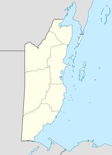 CYD Location of airport in Belize | |||||||||||
| Runways | |||||||||||
| |||||||||||
Source: GCM[1] | |||||||||||

San Ignacio Town Airstrip (IATA: CYD, ICAO: MZMF) is a public use airport serving San Ignacio, a town in the Cayo District of Belize. The airport is 6 kilometres (4 mi) southwest of San Ignacio and 5 kilometres (3.1 mi) east of the border with Guatemala.
See also[]
 Belize portal
 Aviation portal
- Transport in Belize
- List of airports in Belize
References[]
- ^ Airport information for San Ignacio Town Airstrip at Great Circle Mapper.
External links[]
This Belize-related article is a stub. You can help Wikipedia by . |
This article about a Central American airport is a stub. You can help Wikipedia by . |
Categories:
- Airports in Belize
- Cayo District
- Belize stubs
- Central American airport stubs