Mayantoc
Mayantoc | |
|---|---|
| Municipality of Mayantoc | |
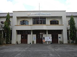 Municipal Hall | |
 Flag  Seal | |
 Map of Tarlac with Mayantoc highlighted | |
OpenStreetMap  | |
 Mayantoc Location within the Philippines | |
| Coordinates: 15°37′N 120°23′E / 15.62°N 120.38°ECoordinates: 15°37′N 120°23′E / 15.62°N 120.38°E | |
| Country | Philippines |
| Region | Central Luzon |
| Province | Tarlac |
| District | 1st district |
| Founded | 1917 |
| Barangays | 24 (see Barangays) |
| Government | |
| • Type | Sangguniang Bayan |
| • Mayor | Julie P. Icmat |
| • Vice Mayor | Avelino E. Pobre |
| • Representative | Carlos O. Cojuangco |
| • Electorate | 20,311 voters (2019) |
| Area | |
| • Total | 311.42 km2 (120.24 sq mi) |
| Elevation | 58 m (190 ft) |
| Highest elevation | 262 m (860 ft) |
| Lowest elevation | 21 m (69 ft) |
| Population (2020 census) [3] | |
| • Total | 32,597 |
| • Density | 100/km2 (270/sq mi) |
| • Households | 7,456 |
| Economy | |
| • Income class | 3rd municipal income class |
| • Poverty incidence | 18.25% (2015)[4] |
| • Revenue | ₱167,789,858.38 (2020) |
| • Assets | ₱350,504,685.42 (2020) |
| • Expenditure | ₱148,796,224.73 (2020) |
| • Liabilities | ₱51,597,623.57 (2020) |
| Service provider | |
| • Electricity | Tarlac 1 Electric Cooperative (TARELCO 1) |
| Time zone | UTC+8 (PST) |
| ZIP code | 2304 |
| PSGC | |
| IDD : area code | +63 (0)45 |
| Native languages | Pangasinan Abellen Tagalog Kapampangan Ilocano |
| Website | www |

Mayantoc, officially the Municipality of Mayantoc (Kapampangan: Balen ning Mayantoc; Pangasinan: Baley na Mayantoc; Ilocano: Ili ti Mayantoc; Tagalog: Bayan ng Mayantoc), is a 3rd class municipality in the province of Tarlac, Philippines. According to the 2020 census, it has a population of 32,597 people. [3]
It is nestled in the foothills of the Zambales Mountains where the Camiling River originates and provides many scenic picnic and swimming sites, making it known as the summer capital of the province. The most common road to Mayantoc starts at "Crossing Mayantoc", at the national highway to Camiling, Tarlac just after the then Tarlac College of Agriculture (now the Tarlac Agricultural University) campus.
History[]
The first settlers of Mayantoc before the coming of Christian migrants were the negritos of the tribe. As they arrived in great numbers, so the natives were soon forced to move deeper into the forest areas of the Zambales mountain range.
The Christian settlers, mostly came from the Ilocos region, notably the towns of Cabugao, Tagudin, Sarrat, Paoay, Sinait and Bacarra settled in villages in the southern portion of the thriving town of Camiling, acknowledged as the mother town of Mayantoc. These villages later formed the barangay of Mayantoc under the township of Camiling. The place was still a forested area where rattan was abundant, a palm known by visitor traders as "Yantoc", so that in time the barangay became known as Na Maraming Yantoc – the place of yantoc – later just Ma-Yantoc. As the barangay progressed and grew in the size and population, its inhabitants retained "Mayantoc" as its official name.
In an effort to convert the barangay of Mayantoc into a town, a petition signed by the inhabitants was sent to the proper authorities on 23 December 1916, with title deeds of several parcels of lands attached for the proposed school, market, plaza and town hall sites.
There were many others who helped in the birth of the new town, including Governor Gardner and Representative Luis Morales. Don Sergio Osmena, the speaker of House of Representative also helped in the granting of the people's petition. Then the American Governor General Francisco Burton Harrison promulgated Executive Order No. 96 declaring Mayantoc a separate town from Camiling and the new town was inaugurated on 17 January 1917. Don Manuel de Leon, then Governor of Tarlac province appointed Castillan Antonio Sanz, as the town first Municipal President. However Sanz was autocratic in Spanish customs and was in office for only six months, before a petition seeking his ousting, signed by several municipal councilors.
When the provincial board of Tarlac received the petition, Antonio Sanz was unseated, to be succeeded by the Vice President, Don Francisco Pascual Santos. That same year, an election was held in which Don Francisco P. Santos became the first elected Municipal President of Mayantoc.
The question of leadership having been popularly decided, the townspeople then took up the task of building the physical facilities of the community. The problem of a presentable Presidencia came up. But the municipal government was very poor. Bridges and roads were urgently needed. Canals along the roads of the town, especially around the plaza, needed digging. There were plenty of problems but few resources. The principal resource was the people themselves, imbued with pioneering spirit, cooperative and loyal to the leadership. The people donated whatever material they could afford, and freely gave their time and labor on the different projects of the new town.
Barangays[]
Mayantoc is administratively divided into 24 barangays:
- Ambalingit
- Baybayaoas
- Bigbiga
- Binbinaca
- Calabtangan
- Caocaoayan
- Carabaoan
- Cubcub
- Gayonggayong
- Gossood
- Labney
- Mamonit
- Maniniog
- Mapandan
- Nambalan
- Pedro L. Quines
- Pitombayog
- Poblacion Norte
- Poblacion Sur
- Rotrottooc
- San Bartolome
- San Jose
- Taldiapan
- Tangcarang
Climate[]
| Climate data for Mayantoc, Tarlac | |||||||||||||
|---|---|---|---|---|---|---|---|---|---|---|---|---|---|
| Month | Jan | Feb | Mar | Apr | May | Jun | Jul | Aug | Sep | Oct | Nov | Dec | Year |
| Average high °C (°F) | 30 (86) |
31 (88) |
33 (91) |
35 (95) |
33 (91) |
31 (88) |
30 (86) |
29 (84) |
29 (84) |
30 (86) |
31 (88) |
30 (86) |
31 (88) |
| Average low °C (°F) | 19 (66) |
19 (66) |
20 (68) |
22 (72) |
24 (75) |
24 (75) |
24 (75) |
24 (75) |
23 (73) |
22 (72) |
21 (70) |
20 (68) |
22 (71) |
| Average precipitation mm (inches) | 3 (0.1) |
2 (0.1) |
5 (0.2) |
10 (0.4) |
80 (3.1) |
107 (4.2) |
138 (5.4) |
147 (5.8) |
119 (4.7) |
70 (2.8) |
26 (1.0) |
8 (0.3) |
715 (28.1) |
| Average rainy days | 2.0 | 1.7 | 2.7 | 4.6 | 16.1 | 20.8 | 24.0 | 23.0 | 21.4 | 15.5 | 8.0 | 3.2 | 143 |
| Source: Meteoblue [5] | |||||||||||||
Demographics[]
| Year | Pop. | ±% p.a. |
|---|---|---|
| 1918 | 5,480 | — |
| 1939 | 7,196 | +1.31% |
| 1948 | 7,988 | +1.17% |
| 1960 | 10,228 | +2.08% |
| 1970 | 13,558 | +2.86% |
| 1975 | 16,427 | +3.92% |
| 1980 | 17,135 | +0.85% |
| 1990 | 21,170 | +2.14% |
| 1995 | 22,952 | +1.53% |
| 2000 | 24,693 | +1.58% |
| 2007 | 27,274 | +1.38% |
| 2010 | 29,987 | +3.51% |
| 2015 | 32,232 | +1.38% |
| 2020 | 32,597 | +0.22% |
| Source: Philippine Statistics Authority [6] [7] [8][9] | ||
In the 2020 census, the population of Mayantoc, Tarlac, was 32,597 people, [3] with a density of 100 inhabitants per square kilometre or 260 inhabitants per square mile.
Economy[]
| Poverty Incidence of Mayantoc | |
| Source: Philippine Statistics Authority[10][11][12][13][14][15] | |
Points of interest[]
- Saint Joseph Parish Church of Mayantoc (F-1842): Feast day, March 19; Parish Priest: Father Hipolito Pardinian; Vicariate of St. Michael the Archangel, Vicar Forane: Father Fred Dizon [1] [2][3] under the Roman Catholic Diocese of Tarlac.
- ASEAN-New Zealand (ANZAP) Twin Falls, Barangay Bigbiga
- Kiti Calao Waterfalls, Barangay San Jose
- Calao Ecological Park, Barangay San Jose
- Nambalan Trails Jump Off (Nambalan Saweng), Barangay Nambalan
- Istaka, Barangay Gossood
- Garma's Farms, Barangay Gossood
- Hidden Paradise, Barangay Mapandan
- Labney Water Camps, Barangay Labney
Gallery[]
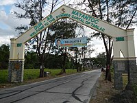
Mayantoc Welcome Arch (Old)

Saint Joseph Parish Church of Mayantoc

Crusaders Of The Divine Church Of Christ

Mayantoc Farmer's Arch (formerly known as Flying A)
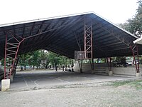
Mayantoc Covered court

Mayantoc Public market


References[]
- ^ Municipality of Mayantoc | (DILG)
- ^ "2015 Census of Population, Report No. 3 – Population, Land Area, and Population Density" (PDF). Philippine Statistics Authority. Quezon City, Philippines. August 2016. ISSN 0117-1453. Archived (PDF) from the original on May 25, 2021. Retrieved July 16, 2021.
- ^ a b c Census of Population (2020). "Region III (Central Luzon)". Total Population by Province, City, Municipality and Barangay. PSA. Retrieved 8 July 2021.
- ^ https://psa.gov.ph/sites/default/files/City%20and%20Municipal-level%20Small%20Area%20Poverty%20Estimates_%202009%2C%202012%20and%202015_0.xlsx; publication date: 10 July 2019; publisher: Philippine Statistics Authority.
- ^ "Mayantoc: Average Temperatures and Rainfall". Meteoblue. Retrieved 5 May 2020.
- ^ Census of Population (2015). "Region III (Central Luzon)". Total Population by Province, City, Municipality and Barangay. PSA. Retrieved 20 June 2016.
- ^ Census of Population and Housing (2010). "Region III (Central Luzon)". Total Population by Province, City, Municipality and Barangay. NSO. Retrieved 29 June 2016.
- ^ Censuses of Population (1903–2007). "Region III (Central Luzon)". Table 1. Population Enumerated in Various Censuses by Province/Highly Urbanized City: 1903 to 2007. NSO.
- ^ "Province of Tarlac". Municipality Population Data. Local Water Utilities Administration Research Division. Retrieved 17 December 2016.
- ^ "Poverty incidence (PI):". Philippine Statistics Authority. Retrieved 28 December 2020.
- ^ https://psa.gov.ph/sites/default/files/NSCB_LocalPovertyPhilippines_0.pdf; publication date: 29 November 2005; publisher: Philippine Statistics Authority.
- ^ https://psa.gov.ph/sites/default/files/2003%20SAE%20of%20poverty%20%28Full%20Report%29_1.pdf; publication date: 23 March 2009; publisher: Philippine Statistics Authority.
- ^ https://psa.gov.ph/sites/default/files/2006%20and%202009%20City%20and%20Municipal%20Level%20Poverty%20Estimates_0_1.pdf; publication date: 3 August 2012; publisher: Philippine Statistics Authority.
- ^ https://psa.gov.ph/sites/default/files/2012%20Municipal%20and%20City%20Level%20Poverty%20Estima7tes%20Publication%20%281%29.pdf; publication date: 31 May 2016; publisher: Philippine Statistics Authority.
- ^ https://psa.gov.ph/sites/default/files/City%20and%20Municipal-level%20Small%20Area%20Poverty%20Estimates_%202009%2C%202012%20and%202015_0.xlsx; publication date: 10 July 2019; publisher: Philippine Statistics Authority.
External links[]
| Wikimedia Commons has media related to Mayantoc. |
Places adjacent to Mayantoc | ||||||||||||||||
|---|---|---|---|---|---|---|---|---|---|---|---|---|---|---|---|---|
| ||||||||||||||||
Tarlac City (capital) | |
| Municipalities | |
| Component city | |
| Barangays | |
- Municipalities of Tarlac