Mayo-Danay
Mayo-Danay | |
|---|---|
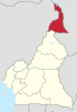
 Department location in Cameroon | |
 Mayo-Danay | |
| Coordinates: 10°20′N 15°14′E / 10.333°N 15.233°ECoordinates: 10°20′N 15°14′E / 10.333°N 15.233°E | |
| Country | |
| Province | Extreme-Nord Province |
| Capital | Yagoua |
| Area | |
| • Total | 2,047 sq mi (5,303 km2) |
| Population (2005) | |
| • Total | 529,061 |
| Time zone | UTC+1 (WAT) |


Village, Yagoua
Mayo-Danay is a department of Extreme-Nord Province in Cameroon. The department covers an area of 5,303 km2 and at the 2005 Census had a total population of 529,061.[1] The capital of the department is at Yagoua.

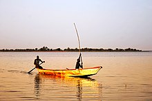
Maga Lake in Mayo-Danay. May 2015.


kalfou sunset
Subdivisions[]
The department is divided administratively into 11 communes and in turn into villages.
Communes[]
Lake Guere, Mayo Danay Division

Villages[]
References[]
- ^ "Departments of Cameroon". Statoids, obtained from Institut national de la statistique (Cameroun) - Annuaire statistique du Cameroun 2004. Retrieved April 4, 2009.
This Cameroon location article is a stub. You can help Wikipedia by . |
Categories:
- Departments of Cameroon
- Far North Region (Cameroon)
- Cameroon geography stubs