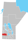
McAuley, Manitoba
This article includes a list of general references, but it remains largely unverified because it lacks sufficient corresponding inline citations. (March 2020) |
McAuley | |
|---|---|
 McAuley Location of McAuley in Manitoba | |
| Coordinates: 50°15′44″N 101°23′19″W / 50.26222°N 101.38861°WCoordinates: 50°15′44″N 101°23′19″W / 50.26222°N 101.38861°W | |
| Country | Canada |
| Province | Manitoba |
| Region | Westman Region |
| Census Division | No. 15 |
| Government | |
| • Governing Body | Rural Municipality of Ellice – Archie |
| • MP | Robert Sopuck |
| • MLA | Doyle Piwniuk |
| Time zone | UTC−06:00 (CST) |
| • Summer (DST) | UTC−05:00 (CDT) |
| Postal Code | R0M 1H0 |
| Area code(s) | 204 |
| NTS Map | 062K06 |
| GNBC Code | GAQNJ |
McAuley is a community northwest of Virden, Manitoba located in the Rural Municipality of Ellice – Archie.
The community was named after George W. McAuley who was the townsite owner. It was a railway point for the Canadian Pacific Railway. The post office was named Rutherglen until 1906, referencing a location in Scotland from where some of the settlers had emigrated.
References[]
- ^ "Population and dwelling counts, for Canada and census subdivisions (municipalities), 2006 and 2001 censuses - 100% data". Statistics Canada, 2006 Census of Population. 2008-11-05. Retrieved 2009-01-30.
Geographic Names of Manitoba - the Millennium Bureau of Canada
Categories:
- Unincorporated communities in Manitoba
- Manitoba geography stubs


