Virden, Manitoba
Virden | |
|---|---|
 Virden Pioneer Home Museum | |
 Town boundaries | |
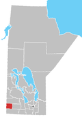
 Virden Location in Manitoba | |
| Coordinates: 49°51′03″N 100°55′54″W / 49.85083°N 100.93167°WCoordinates: 49°51′03″N 100°55′54″W / 49.85083°N 100.93167°W | |
| Country | |
| Province | |
| Government | |
| • Mayor | Murray Wright |
| • MLA | Doyle Piwniuk (PC) |
| • MP | Larry Maguire (C) |
| Elevation (at airport) | 439 m (1,440 ft) |
| Population | |
| • Total | 3,114 |
| Time zone | UTC−5 (CST) |
| Postal code | R0M 2C0 |
| Area code(s) | 204, 431 |
| Telephone Exchange | 204 491 512 707 718 748 851 431 645 |
| Median Income | $46,604 |
| Website | www |

Virden is a town in southwestern Manitoba, Canada. Oil was first discovered in 1951, and Virden has since come to be known as the "Oil Capital of Manitoba".
History[]
Virden has its roots as a farming community known as Gopher Creek. However, it became a railway tent town in 1882, and grew in population due to the brick and flour industry, as well as with the discovery of oil in the 1950s. The origin of the name, Virden, allegedly arose as a misspelling of the German town Verden in the homeland of the 7th Duke of Manchester's wife.
Geography[]
The town is located at the junction of the Trans-Canada Highway (also known as Highway #1) and Highway 83 (the "Palms to Pines" route) and is surrounded by the . Virden is a regional service centre owing in part to its location, and it has a stable commercial sector, including several restaurants, gas stations, body shops, a movie theatre, and a performing arts theatre.
Climate[]
| hideClimate data for Virden | |||||||||||||
|---|---|---|---|---|---|---|---|---|---|---|---|---|---|
| Month | Jan | Feb | Mar | Apr | May | Jun | Jul | Aug | Sep | Oct | Nov | Dec | Year |
| Record high °C (°F) | 9.7 (49.5) |
17 (63) |
20 (68) |
36 (97) |
37 (99) |
42.8 (109.0) |
43.3 (109.9) |
38.5 (101.3) |
37.8 (100.0) |
34 (93) |
23.5 (74.3) |
12.8 (55.0) |
43.3 (109.9) |
| Average high °C (°F) | −11.5 (11.3) |
−7.1 (19.2) |
−0.3 (31.5) |
10.5 (50.9) |
18.7 (65.7) |
22.8 (73.0) |
25.5 (77.9) |
24.6 (76.3) |
18.2 (64.8) |
11.1 (52.0) |
−0.6 (30.9) |
−8.9 (16.0) |
8.6 (47.5) |
| Daily mean °C (°F) | −16.7 (1.9) |
−12.2 (10.0) |
−5.3 (22.5) |
4.2 (39.6) |
11.9 (53.4) |
16.6 (61.9) |
19 (66) |
18 (64) |
11.9 (53.4) |
5.2 (41.4) |
−5.1 (22.8) |
−13.7 (7.3) |
2.8 (37.0) |
| Average low °C (°F) | −21.9 (−7.4) |
−17.3 (0.9) |
−10.2 (13.6) |
−2.1 (28.2) |
5.1 (41.2) |
10.3 (50.5) |
12.6 (54.7) |
11.3 (52.3) |
5.6 (42.1) |
−0.8 (30.6) |
−9.6 (14.7) |
−14.6 (5.7) |
−3 (27) |
| Record low °C (°F) | −42.2 (−44.0) |
−44.4 (−47.9) |
−43.3 (−45.9) |
−26.7 (−16.1) |
−12.2 (10.0) |
−2.2 (28.0) |
0 (32) |
−4.4 (24.1) |
−10 (14) |
−21 (−6) |
−38.9 (−38.0) |
−40 (−40) |
−44.4 (−47.9) |
| Average precipitation mm (inches) | 21.3 (0.84) |
17 (0.7) |
26.7 (1.05) |
30.1 (1.19) |
49.6 (1.95) |
77.2 (3.04) |
66.1 (2.60) |
61 (2.4) |
49.7 (1.96) |
30.9 (1.22) |
22.7 (0.89) |
22.1 (0.87) |
474.3 (18.67) |
| Source: Environment Canada[2] | |||||||||||||
Demographics[]
| Year | Pop. | ±% |
|---|---|---|
| 1901 | 901 | — |
| 1911 | 1,550 | +72.0% |
| 1921 | 1,361 | −12.2% |
| 1931 | 1,590 | +16.8% |
| 1941 | 1,619 | +1.8% |
| 1951 | 1,746 | +7.8% |
| 1961 | 2,708 | +55.1% |
| 1996 | 3,137 | +15.8% |
| 2001 | 3,109 | −0.9% |
| 2006 | 3,010 | −3.2% |
| 2011 | 3,114 | +3.5% |
| 2016 | 3,322 | +6.7% |
| [3][4][5] | ||
2011[]
According to the 2011 Canadian Census,[6] the population of Virden is 3,114, a 3.5% increased from 2006. Virden's land mass is 8.56 km2 with a population density is 363.6 people per km2. The median age is 42.7 years old which is 2 years older than the national average at 40.6 years old. There are 1,446 dwellings in Virden with an occupancy rate of 95.1%, and the median cost of a dwelling at $159,748, more than $100,000 lower than the national average at $280,552.
According to the 2011 National Household Survey, 96.8% of Virden residents are Canadian citizens, and about 3.2% of residents are recent immigrants (from 2001 to 2011). The racial make up of Virden is mostly Caucasian (92.0%), with a moderate Aboriginal population (5.5%); First Nations (2.0%), Métis (3.5%), and a small visible minority population (2.7%), most of which are Filipino (2.0%) or multiracial (0.5%).
Attractions[]
Virden Pioneer Home Museum[]
Known as the "Victorian Home on the Prairies", the Virden Pioneer Home Museum is located within a red brick veneer home built by James Frame in 1888. With an extensive collection of over ten thousand donated artifacts relating to Virden and area, the museum is a must tourist destination. It is open May to September where guided tours are offered by knowledgeable guides. The museum is located at 390 King Street West in Virden.
Notable people[]
- Mary Carter, one of the first female judges in Saskatchewan; resided in Virden during childhood.
- Isabella Dryden, educator and centenarian
- Happy Felsch, American baseball player who played in Virden in the late 1920s after being banned for involvement in the Black Sox Scandal.
- Dorothy Ferguson, infielder and outfielder who played from 1945 through 1954 in the All-American Girls Professional Baseball League
- Jim Murray (ice hockey), former NHL player
- Bud Sketchley, former right fielder for the Chicago White Sox
- Jim Treliving, Co-founder of Boston Pizza
- Lila Bell Acheson Wallace, Co-founder of the Reader's Digest
- Warren Winkler, former Chief Justice of Ontario
- Carman Lapointe-Young, Under-Secretary-General for the United Nations Office of Internal Oversight Services
See also[]
References[]
- ^ 2011 Community Profiles – Census Subdivision
- ^ Environment Canada Canadian Climate Normals 1971–2000, accessed 18 May 2010
- ^ "Archived copy" (PDF). Archived from the original (PDF) on 19 October 2014. Retrieved 30 August 2014.CS1 maint: archived copy as title (link), Censuses 1871–1931
- ^ "Archived copy" (PDF). Archived (PDF) from the original on 9 December 2013. Retrieved 30 August 2014.CS1 maint: archived copy as title (link), Census 1941–1951
- ^ [1], Census 1961
- ^ "Archived copy". Archived from the original on 4 March 2016. Retrieved 22 September 2013.CS1 maint: archived copy as title (link)
- "Census Profile. 2016 Census. Statistics Canada Catalogue no. 98-316-X2016001". Ottawa: Statistics Canada. 25 October 2017. Retrieved 24 June 2018.
External links[]
- Town of Virden Official Website
| show Places adjacent to Virden, Manitoba |
|---|
| show Authority control |
|---|
- Towns in Manitoba