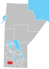
Rivers, Manitoba
Rivers | |
|---|---|
Unincorporated community | |
 Rivers Train Station | |
 Rivers | |
| Coordinates: 50°01′51″N 100°14′20″W / 50.0308°N 100.239°WCoordinates: 50°01′51″N 100°14′20″W / 50.0308°N 100.239°W | |
| Country | |
| Province | |
| Region | Westman Region |
| Census division | No. 7 |
| Rural municipality | Riverdale Municipality |
| Founded | 1908 |
| Amalgamated | 2015 |
| Named for | Charles Rivers Wilson |
| Government | |
| • Type | Unincorporated |
| • Federal riding | Dauphin—Swan River—Neepawa |
| • Provincial riding | Spruce Woods |
| Area | |
| • Land | 0.86 km2 (0.33 sq mi) |
| Elevation | 473 m (1,552 ft) |
| Population (2016)[1] | |
| • Total | 1,257 |
| • Density | 1,454.7/km2 (3,768/sq mi) |
| Time zone | UTC-6 (Central Time Zone) |
| • Summer (DST) | UTC-5 (Central Time Zone) |
| Postal code | |
| Area codes | 204, 431 |
| Provincial Trunk Highways | |
| Provincial Roads | |
Rivers is an unincorporated urban community in the Riverdale Municipality within the Canadian province of Manitoba. It is located 40 kilometres (25 mi) northwest of Brandon, 473 metres (1,552 ft) above sea level. It is within the Westman Region (Southwestern Manitoba). Agriculture, health and related businesses provide income for the community and area. Rivers has a population of 1,257 people in the 2016 census.[1]
History[]
Rivers was named in 1908 after Sir Charles Rivers Wilson, Chairman of the Board of the Grand Trunk Pacific Railway.[2]
During the Second World War, Rivers became one of the sites in Canada which helped to fix the positions of German U-boats using high-frequency direction finding. This site, along with Portage la Prairie increased the "fix" accuracy on the U-boats.[citation needed]
Rivers held town status prior to January 1, 2015. It was dissolved on that day as a result of its provincially mandated amalgamation with the Rural Municipality of Daly to form Riverdale Municipality.[3]
Demographics[]
The population of Rivers in the 2016 Canadian census was 1,257 people, a 9.4% increase from the prior 2011 census. The size of Rivers in land area is 0.86 square kilometres (0.33 sq mi), equating to a population density of 1454.7 per km2. There are 540 private dwellings in Rivers, 514 which are occupied by usual residence.[1]
| hideCanada census – Rivers, Manitoba (Population centre in 2016; Town in 2011) community profile | |||
|---|---|---|---|
| 2016 | 2011 | ||
| Population: | 1,257 (9.4% from 2011) | 1,189 (-0.3% from 2006) | |
| Land area: | 0.86 km2 (0.33 sq mi) | 7.97 km2 (3.08 sq mi) | |
| Population density: | 1,454.7/km2 (3,768/sq mi) | 149.3/km2 (387/sq mi) | |
| Median age: | 35.0 (M: 33.8, F: 37.3) | 40.2 (M: 38.8, F: 41.4) | |
| Total private dwellings: | 540 | 526 | |
| Median household income: | $55,168 | $44,239 | |
| References: 2016[4] 2011[5] earlier[6] | |||
|
| |||||||||||||||||||||||||||
| Population amount after 2015 is for Rivers (Dissolved census subdivision), before 2015 for Rivers (Town) Source: Statistics Canada[7] | ||||||||||||||||||||||||||||
Attractions[]
East of Rivers is Lake Wahtopanah, a 6-mile (9.7 km) long lake that is part of Rivers Provincial Park.
Infrastructure[]
CFB Rivers, a former military base, is located 4 miles (6.4 km) west of the community. It was decommissioned in 1971.[8]
Rivers is served by Provincial Trunk Highway 25 (PTH 25) and Provincial Road 250 (PR 250). PTH 25 terminates just southwest of Rivers at the unincorporated community of Wheatland, while PR 250 intersects and briefly overlaps with PTH 25.
Rivers station is a station stop for Via Rail's The Canadian.
Education[]
The local schools fall under the Rolling River School Division, with a nursery school, the Rivers Elementary School (kindergarten to grade 6), and Rivers Collegiate Institute (grades 7 to 12). The high school is a "Pay It Forward" school and works on programs to do just that.
Notable people[]
- Earl Dawson (1925–1987), politician and president of the Manitoba and Canadian Amateur Hockey Associations[9][10]
References[]
- ^ Jump up to: a b c d "Census Profile: Rivers, Manitoba (Population centre)". Statistics Canada. 2016. Retrieved April 4, 2021.
- ^ Douglas R 1933 Place-Names of Manitoba Geographic Board of Canada
- ^ "Manitoba's Municipal History: Municipal Amalgamations (2015)". The Manitoba Historical Society. December 1, 2014. Retrieved January 2, 2015.
- ^ "2016 Community Profiles". 2016 Canadian Census. Statistics Canada. February 21, 2017. Retrieved 2021-04-04.
- ^ "2011 Community Profiles". 2011 Canadian Census. Statistics Canada. July 5, 2013. Retrieved 2021-04-04.
- ^ "2001 Community Profiles". 2001 Canadian Census. Statistics Canada. February 17, 2012.
- ^ "(Code 4607077) Census Profile". 2016 census. Statistics Canada. 2017.
- ^ Johhnie Bachusky, "Into the Void", Canadian Geographic Travel, Fall 2009. p. 62
- ^ Goldsborough, Gordon (December 25, 2017). "Memorable Manitobans: Earl Phillip Dawson (1925-1987)". Manitoba Historical Society. Retrieved June 11, 2019.
- ^ "Deaths: Earl Dawson". Winnipeg Free Press. Winnipeg, Manitoba. March 30, 1987. p. 33.

External links[]
| Wikimedia Commons has media related to Rivers, Manitoba. |
- Former towns in Manitoba
- Populated places disestablished in 2015
- 2015 disestablishments in Manitoba

