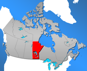
List of communities in Manitoba
Communities in the Province of Manitoba, Canada include incorporated municipalities, unincorporated communities and First Nations communities.
Types of incorporated municipalities include urban municipalities, rural municipalities and local government districts. Urban municipalities can be named as cities, towns, villages or simply urban municipalities.[1]
The administration of urban and rural municipalities is regulated by The Municipal Act.[1] Some municipalities have since amalgamated, making this list inaccurate.
In the 2011 Census, Manitoba's communities combined for a total provincial population of 1,208,268.[2]
Municipalities[]
Urban municipalities[]
Manitoba has 79 urban municipalities, which includes the sub-types of cities, towns and villages.
Cities[]
Manitoba has 10 cities.
| Cities of Manitoba | |||||
|---|---|---|---|---|---|
| Name | Population (2021)[3] |
Population (2016)[3] |
Change (%)[3] |
Area (km²)[3] |
Population density (2021)[3] |
| Brandon | 51,313 | 48,883 | +5.0% | 79.04 | 649.2 |
| Dauphin[MB 1] | 8,368 | 8,369 | 0.0% | 12.67 | 660.5 |
| Flin Flon (part)[MB 2] | 4,940 | 4,991 | −1.0% | 13.14[MB 3] | 376.1 |
| Morden[MB 4] | 9,929 | 8,668 | +14.5% | 16.29 | 609.6 |
| Portage la Prairie | 13,270 | 13,304 | −0.3% | 24.72 | 536.8 |
| Selkirk | 10,504 | 10,278 | +2.2% | 24.47 | 429.3 |
| Steinbach | 17,806 | 16,022 | +11.1% | 37.56 | 474.1 |
| Thompson | 13,035 | 13,678 | −4.7% | 16.62 | 784.3 |
| Winkler | 13,747 | 12,660 | +8.6% | 20.73 | 663.1 |
| Winnipeg[MB 5] | 749,607 | 705,224 | +6.3% | 461.78 | 1,623.3 |
| Total cities | 892,507 | 841,880 | +6.0% | 707.02 | 1,262.35 |
Towns[]
Manitoba has 25 towns.
Villages[]
Manitoba has 2 villages.
| Villages of Manitoba | |||||
|---|---|---|---|---|---|
| Name | Population (2016)[11] |
Population (2011)[11] |
Change (%)[11] |
Area (km²)[11] |
Population density[11] |
| Dunnottar | 763 | 696 | 8.7 | 2.8 | 272.5 |
| St-Pierre-Jolys | 1,170 | 1,099 | 6.5 | 2.6 | 450.0 |
| Total villages | 1,933 | 1,795 | 7.7 | 5.4 | 358.0 |
| Name | Dissolved | Currently part of | |||
| Benito | January 1, 2015 | Municipality of Swan Valley West | |||
| Binscarth | January 1, 2015 | Municipality of Russell – Binscarth | |||
| Bowsman | January 1, 2015 | Municipality of Minitonas – Bowsman | |||
| Cartwright | January 1, 2015 | Cartwright – Roblin Municipality | |||
| Crystal City | January 1, 2015 | Municipality of Louise | |||
| Elkhorn | January 1, 2015 | Rural Municipality of Wallace – Woodworth | |||
| Ethelbert | January 1, 2015 | Municipality of Ethelbert | |||
| Foxwarren | January 1, 1967[12] | Prairie View Municipality | |||
| Garson | January 1, 2003[13] | Rural Municipality of Brokenhead | |||
| Glenboro | January 1, 2015 | Municipality of Glenboro – South Cypress | |||
| Great Falls | January 1, 1973[14] | Rural Municipality of Alexander | |||
| McCreary | January 1, 2015 | Municipality of McCreary | |||
| Napinka | January 1, 1986 | Municipality of Brenda – Waskada | |||
| Notre Dame de Lourdes | January 1, 2015 | Notre-Dame-de-Lourdes, Manitoba | |||
| Powerview | May 1, 2005[15] | Town of Powerview-Pine Falls | |||
| Riverton | January 1, 2015 | Municipality of Bifrost – Riverton | |||
| St. Claude | January 1, 2015 | Rural Municipality of Grey | |||
| St. Lazare | January 1, 2015 | Rural Municipality of Ellice – Archie | |||
| Somerset | January 1, 2015 | Municipality of Lorne | |||
| Waskada | January 1, 2015 | Municipality of Brenda – Waskada | |||
| Wawanesa | January 1, 2015 | Municipality of Oakland – Wawanesa | |||
| Winnipegosis | January 1, 2015 | Rural Municipality of Mossey River | |||
Rural municipalities[]
Manitoba has 116 rural municipalities.
| Rural municipalities of Manitoba | ||||||
|---|---|---|---|---|---|---|
| Rural municipality (RM) | Incorporation date[16] |
2016 Census of Population[17] | ||||
| Population (2016) |
Population (2011) |
Change |
Land area (km²) |
Population density | ||
Local government districts[]
Manitoba has two local government districts.
| Name | Population (2011)[2] |
Population (2006)[2] |
Change (%)[2] |
Area (km²)[2] |
Population density[2] |
|---|---|---|---|---|---|
| Mystery Lake | 10 | 0 | — | 3,464.06 | 0 |
| Pinawa | 1,444 | 1,450 | −0.4 | 128.47 | 11.2 |
| Total local government districts | 1,454 | 1,450 | 0.3 | 3,592.53 | 0.4 |
Unincorporated communities[]
|
|
|
Hamlets[]
Four unincorporated places in Manitoba are designated as hamlets.[18]
Northern communities[]
Manitoba recognizes 57 unincorporated places as northern communities.[18]
|
|
|
Settlements[]
Manitoba recognizes 12 unincorporated places as settlements.[18]
|
|
See also[]
- List of communities in Manitoba by population
- List of municipalities in Manitoba
- List of regions of Manitoba
- List of rural municipalities in Manitoba
Notes[]
- ^ Dauphin is Manitoba's smallest city by area.
- ^ Flin Flon is Manitoba's smallest city by population. The balance of Flin Flon is located within Saskatchewan.
- ^ This area does not include 2.37 km2 (0.92 sq mi) in the Saskatchewan portion of Flin Flon. The city's total area in 2016 was 16.24 km2 (6.27 sq mi).
- ^ Morden is Manitoba's newest city, incorporated August 24, 2012.
- ^ Winnipeg is Canada's seventh-largest city and Manitoba's capital and largest city by both population and area. The Winnipeg census metropolitan area (CMA) is formed around the City of Winnipeg.
- ^ a b c d e f g h i j k l m n o p q r s t u v w x y z aa The Manitoba government amalgamated 65 rural municipalities, 25 towns, and 17 villages into 47 municipalities on January 1, 2015 in order to bring these municipalities into compliance with the minimum population requirements of the Municipal Act.[4][5]
- ^ The Town of Brooklands amalgamated with the City of St. James in 1969; part of the City of Winnipeg since January 1, 1972.[6]
- ^ The former Town of East Selkirk was incorporated in 1883 and later dissolved in 1904.[7]
- ^ The former Town of Emerson amalgamated with the municipality of West Lynne in 1883 and briefly held city status from 1883 to 1886.[8]
- ^ The former Town of Shoal Lake amalgamated with the former Rural Municipality (RM) of Shoal Lake to form the now-former Municipality of Shoal Lake on January 1, 2011; part of RM of Yellowhead since January 1, 2015.[9]
- ^ The former Town of Tuxedo and eleven other municipalities were amalgamated with the City of Winnipeg on January 1, 1972.[10]
References[]
- ^ a b "The Municipal Act". Government of Manitoba. Retrieved December 24, 2012.
- ^ a b c d e f "Population and dwelling counts, for Canada, provinces and territories, and census subdivisions (municipalities), 2011 and 2006 censuses (Manitoba)". Statistics Canada. May 28, 2012. Retrieved December 24, 2012.
- ^ a b c d e "Census Profile, 2021 Census of Population". Statistics Canada. February 9, 2021. Retrieved February 9, 2021.
- ^ "The Municipal Act". Government of Manitoba. Retrieved December 23, 2012.
- ^ "MHS Resources: Manitoba's Municipal History". The Manitoba Historical Society. Retrieved September 12, 2013.
- ^ "Manitoba Communities: Brooklands (Unincorporated Town)". Manitoba Historical Society. Retrieved May 28, 2020.
- ^ "Manitoba Communities: East Selkirk (Unincorporated Town)". Manitoba Historical Society. Retrieved May 28, 2020.
- ^ "Emerson" (PDF). Manitoba Historical Society. p. 24. Retrieved May 28, 2020.
- ^ "Manitoba Communities: Shoal Lake (Unincorporated Town)". Manitoba Historical Society. Retrieved May 28, 2020.
- ^ "Manitoba Communities: Brooklands (Unincorporated Town)". Manitoba Historical Society. Retrieved May 28, 2020.
- ^ a b c d e "Population and dwelling counts, for Canada, provinces and territories, and census subdivisions (municipalities), 2016 and 2011 censuses – 100% data (Manitoba)". Statistics Canada. February 8, 2017. Retrieved May 17, 2020.
- ^ "Foxwarren (Unincorporated Village)". Manitoba Historical Society. Retrieved May 19, 2020.
- ^ "Garson / Lyall (Unincorporated Village)". Manitoba Historical Society. Retrieved May 19, 2020.
- ^ "Great Falls (Unincorporated Village)". Manitoba Historical Society. Retrieved May 19, 2020.
- ^ "Powerview (Village)". Manitoba Historical Society. Retrieved May 19, 2020.
- ^ "MHS Resources: Manitoba's Municipal History". The Manitoba Historical Society. Retrieved September 12, 2013.
- ^ "Population and dwelling counts, for Canada, provinces and territories, and census subdivisions (municipalities), 2016 and 2011 censuses – 100% data (Manitoba)". Statistics Canada. February 8, 2017. Retrieved February 11, 2017.
- ^ a b c "Geographical Names" (Esri shapefile). Manitoba Land Initiative. Retrieved April 18, 2014.
External links[]
- Government of Manitoba Community Profiles:
List of communities in Canada (by province or territory) | |
|---|---|
| Provinces |
|
| Territories | |
| |
Subdivisions of Manitoba | |||
|---|---|---|---|
| Subdivisions |
| ||
| Cities |
| ||
| Towns |
| ||
| Villages |
| ||
| |||
- Lists of populated places in Manitoba