List of communities in Nunavut
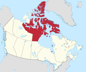
This is a list of communities in Nunavut, Canada. Note that many of these communities have alternate names or spellings in Inuktitut or Inuinnaqtun, while others are primarily known by their Inuktitut or Inuinnaqtun names. As of the 2016 census the population of Nunavut was 35,944, an increase of 12.66% from the 2011 census.[1]
Communities[]
The following are communities recognised by the Government of Nunavut.


Former communities[]
- Amadjuak, on Baffin Island
- Brooman Point Village, on Bathurst Island
- Craig Harbour, on Ellesmere Island
- Dundas Harbour, on Devon Island
- Iglunga, on an island off Baffin Island
- Killiniq (Port Burwell), on Killiniq Island
- Native Point, on the peninsula of the same name
- , on Baffin Island
- Padlei, on the mainland
- Port Leopold, on Somerset Island
- Tavani, on the mainland
Hudson's Bay Company trading posts[]
- Amadjuak
- Apex
- Arctic Bay
- Baker Lake
- Bathurst Inlet
- Bay Chimo (Umingmaktok)
- Belcher Islands
- Blacklead Island
- Cambridge Bay
- Cape Dorset
- Charlton Island Depot
- Chesterfield Inlet
- Clyde River
- Coats Island
- Dundas Harbour
- Eskimo Point (Arviat)
- Fort Ross
- Frobisher Bay (Iqaluit)
- Gjoa Haven
- Igloolik
- Kent Peninsula
- King William Island
- Kugaryuak
- Lake Harbour (Kimmirut)
- Mansel Island
- Padley (Padlei)
- Pangnirtung
- Perry River
- Ponds Inlet
- Port Leopold
- Port Burwell (Killiniq)
- Repulse Bay
- Southampton Island
- Tavane (Tavani)
- Tree River
- Wager Inlet (Wager Bay)
Notes[]
- ^a iglu meaning house and refers to the sod houses that were originally in the area.[30]
- ^b Part of the Hope Bay greenstone belt and are operated by Newmont Mining Corporation
- ^c Neither Nanisivik or Umingmaktok are listed as an official community by the Government of Nunavut but are listed as settlements by Statistics Canada
References[]
- ^ 2011 census
- ^ Jump up to: a b "Community Information - Government of Nunavut". www.gov.nu.ca. Retrieved 7 October 2017.
- ^ Bathurst Inlet, Cambridge Bay and Kugluktuk are Inuinnaqtun speaking communities
- ^ "Population and dwelling counts, for Canada, provinces and territories, and census subdivisions (municipalities), 2016 and 2011 censuses – 100% data (Nunavut)". Statistics Canada. 20 February 2019. Retrieved 7 October 2019.
- ^ Jump up to: a b Arctic Bay at the Government of Nunavut
- ^ Arviat at the Government of Nunavut
- ^ "Baker Lake". Baker Lake. Retrieved 29 June 2017.
- ^ Jump up to: a b Cambridge Bay at the Government of Nunavut
- ^ Jump up to: a b Chesterfield Inlet at the Government of Nunavut
- ^ Jump up to: a b Clyde River at the Government of Nunavut
- ^ Jump up to: a b Coral Harbour at the Government of Nunavut
- ^ Jump up to: a b Gjoa Have at the Government of Nunavut
- ^ Jump up to: a b Grise Fiord at the Government of Nunavut
- ^ Igloolik Archived 2015-04-15 at the Wayback Machine at the Qikiqtani Inuit Association
- ^ "About Iqaluit: History & Milestones - City of Iqaluit". www.city.iqaluit.nu.ca. Retrieved 29 June 2017.
- ^ Kimmirut at Inns North
- ^ "History of Cape Dorset". capedorset.ca. Archived from the original on 14 June 2007. Retrieved 29 June 2017.
- ^ Jump up to: a b Kugaaruk at Nunavut Tourism
- ^ Kugluktuk at Nunavut Tourism
- ^ Naujaat at the Government of Nunavut
- ^ Pangnirtung at Inns North
- ^ Jump up to: a b Pond Inlet at the Government of Nunavut
- ^ Qikiqtarjuaq at the Government of Nunavut
- ^ Jump up to: a b Rankin Inlet at the Government of Nunavut
- ^ Jump up to: a b Resolute at Nunavut Tourism
- ^ Sanikiluaq at the Qikiqtani Inuit Association
- ^ "Hall Beach" (PDF). gov.nu.ca. Retrieved 29 June 2017.
- ^ Taloyoak at the Government of Nunavut
- ^ Jump up to: a b Whale Cove at the Government of Nunavut
- ^ Igloolik at CBC News
External links[]
- Communities of Nunavut Poster (Canada-Nunavut Geoscience Office) (free for download with a map)
- Nunavut communities at Nunavut Tourism
- Interactive map at Nunavut Tourism
| show List of communities in Canada (by province or territory) |
|---|
Categories:
- Populated places in Nunavut
- Nunavut-related lists