McDowell Township, Barry County, Missouri
McDowell Township | |
|---|---|
 | |
| Coordinates: 36°49′31″N 093°47′52″W / 36.82528°N 93.79778°WCoordinates: 36°49′31″N 093°47′52″W / 36.82528°N 93.79778°W | |
| Country | United States |
| State | Missouri |
| County | Barry |
| Area | |
| • Total | 23.85 sq mi (61.78 km2) |
| • Land | 23.85 sq mi (61.78 km2) |
| • Water | 0 sq mi (0 km2) 0% |
| Elevation | 1,296 ft (395 m) |
| Population (2000) | |
| • Total | 275 |
| • Density | 11.5/sq mi (4.5/km2) |
| FIPS code | 29-44966[2] |
| GNIS feature ID | 0766260 |

McDowell Township is one of twenty-five townships in Barry County, Missouri, United States. As of the 2000 census, its population was 275.
Geography[]
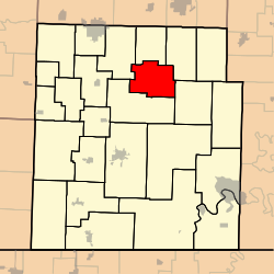
McDowell Township covers an area of 23.85 square miles (61.8 km2) and contains no incorporated settlements.
The streams of Calton Creek, Gunter Creek, Little Flat Creek, Stansberry Creek and Willow Branch run through this township.
References[]
- ^ "US Board on Geographic Names". United States Geological Survey. 2007-10-25. Retrieved 2008-01-31.
- ^ "U.S. Census website". United States Census Bureau. Retrieved 2008-01-31.
External links[]
Municipalities and communities of Barry County, Missouri, United States | ||
|---|---|---|
| Cities |  | |
| Villages | ||
| Townships | ||
| CDPs | ||
| Unincorporated communities | ||
| Ghost towns | ||
| Footnotes | ‡This populated place also has portions in an adjacent county or counties | |
| ||
This Barry County, Missouri state location article is a stub. You can help Wikipedia by . |
Categories:
- Townships in Barry County, Missouri
- Townships in Missouri
- Southwest Missouri geography stubs