McIntosh Municipal Airport
McIntosh Municipal Airport | |||||||||||
|---|---|---|---|---|---|---|---|---|---|---|---|
| Summary | |||||||||||
| Airport type | Closed | ||||||||||
| Owner | City of McIntosh | ||||||||||
| Serves | McIntosh, South Dakota | ||||||||||
| Elevation AMSL | 2,251 ft / 686 m | ||||||||||
| Coordinates | 45°54′30″N 101°20′46″W / 45.90833°N 101.34611°WCoordinates: 45°54′30″N 101°20′46″W / 45.90833°N 101.34611°W | ||||||||||
| Map | |||||||||||
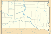 8D6 Location of airport in South Dakota | |||||||||||
| Runways | |||||||||||
| |||||||||||
| Statistics (2012) | |||||||||||
| |||||||||||

McIntosh Municipal Airport (FAA LID: 8D6) was a public use airport located one nautical mile (2 km) south of the central business district of McIntosh, a city in Corson County, South Dakota, United States. The airport property is owned by the City of McIntosh.[1]
Facilities and aircraft[]
McIntosh Municipal Airport covered an area of 66 acres (27 ha) at an elevation of 2,251 feet (686 m) above mean sea level. It had one runway designated 14/32 with a turf and gravel surface measuring 3,700 by 150 feet (1,128 x 46 m).[1]
For the 12-month period ending September 25, 2012, the airport had 14 general aviation aircraft operations, an average of 1 per month.[1]
The airport was closed in 2015 and the runway has since been removed. [2]
References[]
- ^ a b c d FAA Airport Form 5010 for 8D6 PDF. Federal Aviation Administration. Effective November 15, 2012.
- ^ https://dot.sd.gov/media/documents/AviationSystemPlan/Chapter%201%20Introduction_AviationSystemGoals_FINAL.pdf
External links[]
- Aerial image as of September 1997 from USGS The National Map
- "McIntosh Municipal Airport (8D6)" (PDF). Archived from the original on 2010-09-10.CS1 maint: bot: original URL status unknown (link) at South Dakota DOT Airport Directory
- McIntosh Municipal Airport (8D6) at AirNav
Categories:
- Airports in South Dakota
- Buildings and structures in Corson County, South Dakota
- Transportation in Corson County, South Dakota