Merauke
Merauke | |
|---|---|
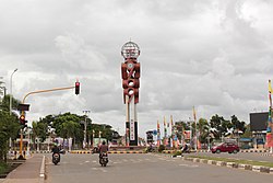 Lingkaran Brawijaya (Libra) 969 monument in Merauke | |
 Merauke Location in Western New Guinea and Indonesia | |
| Coordinates: 8°28′S 140°20′E / 8.467°S 140.333°E | |
| Country | |
| Province | |
| Regency | Merauke Regency |
| Government | |
| • Head of district | Kristian Ndiken |
| Area | |
| • Total | 1,445.63 km2 (558.16 sq mi) |
| Population (2020 Census) | |
| • Total | 102,351 |
| • Density | 71/km2 (180/sq mi) |
| [1] | |
| Time zone | UTC+9 (Indonesia Eastern Time) |
| Area code | (+62) 975 |
| Climate | Aw |
| Website | http://www.merauke.go.id |


Merauke is a large town and an administrative district which is also the administrative centre of Merauke Regency in Papua, Indonesia. It is considered the easternmost city in Indonesia. The town was originally called Ermasoe.[2] It is next to the Maro River where the Port of Merauke is located.[3] As of the 2010 census, Merauke had a population of 87,634[4] which at the 2020 Census had increased to 102,351.[5]
Merauke is currently intended by the Indonesian government to become a city independent from the regency, and then become the capital of the proposed South Papua province.
History[]
Merauke was established in February 1902 as a military post by the Dutch, to prevent raids by the Marind-anim into neighbouring British New Guinea and the northwest Torres Strait Islands (Boigu, and Saibai). The Dutch also tried to establish a rice colony there to no avail.
The Cathedral of St. Francis Xavier in Merauke is the seat of the Roman Catholic Archdiocese of Merauke.
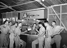
Merauke was the site of an Allied air base during World War II and there was ground fighting between Australian and Japanese patrols in the area.[6]
In the late 1920s and early 1930s, Merauke was used as a transit point between Java, and the Boven-Digoel internment camp where many Indonesian Communist Party members were being sent.
The expression "Sabang to Merauke" is used as shorthand for the territorial extent of Indonesia from west to east, for instance in the name of Sabang Merauke Raya Air Charter. For instance, President Suharto stated in 1968 that independence, sovereignty and territorial integrity from Sabang to Merauke are for the Indonesian people matters of principle".[7]
Climate[]
Merauke has a tropical savanna climate (Köppen Aw) with moderate to little rainfall from May to November and heavy rainfall from December to April.
| hideClimate data for Merauke | |||||||||||||
|---|---|---|---|---|---|---|---|---|---|---|---|---|---|
| Month | Jan | Feb | Mar | Apr | May | Jun | Jul | Aug | Sep | Oct | Nov | Dec | Year |
| Record high °C (°F) | 33.9 (93.0) |
32.8 (91.0) |
33.3 (91.9) |
33.3 (91.9) |
33.3 (91.9) |
32.2 (90.0) |
32.2 (90.0) |
32.8 (91.0) |
33.3 (91.9) |
35.6 (96.1) |
36.1 (97.0) |
35.0 (95.0) |
36.1 (97.0) |
| Average high °C (°F) | 30.7 (87.3) |
30.5 (86.9) |
30.5 (86.9) |
30.8 (87.4) |
30.2 (86.4) |
29.3 (84.7) |
28.3 (82.9) |
29.1 (84.4) |
30.5 (86.9) |
31.2 (88.2) |
31.8 (89.2) |
31.6 (88.9) |
30.4 (86.7) |
| Daily mean °C (°F) | 26.9 (80.4) |
26.8 (80.2) |
26.8 (80.2) |
26.8 (80.2) |
26.2 (79.2) |
25.2 (77.4) |
24.9 (76.8) |
24.8 (76.6) |
25.5 (77.9) |
26.5 (79.7) |
27.1 (80.8) |
27.3 (81.1) |
26.2 (79.2) |
| Average low °C (°F) | 23.1 (73.6) |
23.1 (73.6) |
23.2 (73.8) |
22.9 (73.2) |
22.4 (72.3) |
21.3 (70.3) |
21.1 (70.0) |
20.6 (69.1) |
20.7 (69.3) |
21.8 (71.2) |
22.4 (72.3) |
23.0 (73.4) |
22.1 (71.8) |
| Record low °C (°F) | 20.0 (68.0) |
21.1 (70.0) |
20.6 (69.1) |
19.4 (66.9) |
18.9 (66.0) |
16.7 (62.1) |
17.2 (63.0) |
14.4 (57.9) |
14.4 (57.9) |
15.6 (60.1) |
17.2 (63.0) |
20.6 (69.1) |
14.4 (57.9) |
| Average rainfall mm (inches) | 226 (8.9) |
352 (13.9) |
202 (8.0) |
186 (7.3) |
83 (3.3) |
53 (2.1) |
37 (1.5) |
16 (0.6) |
8 (0.3) |
27 (1.1) |
62 (2.4) |
204 (8.0) |
1,456 (57.4) |
| Average rainy days | 17 | 18 | 17 | 13 | 10 | 9 | 8 | 5 | 4 | 5 | 9 | 13 | 128 |
| Average relative humidity (%) | 84 | 85 | 84 | 84 | 84 | 82 | 81 | 81 | 80 | 81 | 82 | 83 | 83 |
| Source 1: Deutscher Wetterdienst (extremes & temperature)[8] | |||||||||||||
| Source 2: Danish Meteorological Institute (rain & humidity)[9] | |||||||||||||
Education[]
Merauke hosts the Musamus Merauke University, a state-run public university. It was founded as an academy in 2001 and officially became university in 2006.
Merauke as the name[]
Merauke is used for the name of United States navy ship, .
See also[]
- Merauke Five
- Mopah Airport
References[]
- ^ Badan Pusat Statistik, Jakarta, 2021.
- ^ A Dictionary of the Aneityumese Language: In Two Parts, I. Aneityumese and English, II. English and Aneityumese; Also, Outlines of Aneityumese Grammar, and an Introduction by John Inglis, Williams & Norgate, 1882
- ^ Port of Merauke
- ^ Biro Pusat Statistik, Jakarta, 2011.
- ^ Badan Pusat Statistik, Jakarta, 2021.
- ^ Klemen, L. "The last Dutch fortress in the East Indies - Merauke, Dutch New Guinea, 1942". The Netherlands East Indies 1941-1942.
- ^ "Transcript: Speech given by President Suharto at state dinner in honour of the Australian prime minister, Mr. John Gorton" (PDF). Department of the Prime Minister and Cabinet. 13 June 1968.
- ^ "Klimatafel von Merauke" (PDF) (in German). Deutscher Wetterdienst. Retrieved 23 July 2020.
- ^ "STATION NUMMER 97980" (PDF). Archived from the original (PDF) on 27 April 2013. Retrieved 23 July 2020.
| Wikimedia Commons has media related to Merauke Regency. |
| show Authority control |
|---|
Coordinates: 8°28′S 140°20′E / 8.467°S 140.333°E
This Papua location article is a stub. You can help Wikipedia by . |
- Merauke
- Populated places in Papua (province)
- Regency seats of Papua (province)
- Papua (province) geography stubs