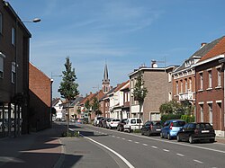
Merksplas
Merksplas | |
|---|---|
 | |
 Flag  Coat of arms | |
 Merksplas Location in Belgium
show Location of Merksplas in the province of Antwerp | |
| Coordinates: 51°22′N 04°52′E / 51.367°N 4.867°ECoordinates: 51°22′N 04°52′E / 51.367°N 4.867°E | |
| Country | Belgium |
| Community | Flemish Community |
| Region | Flemish Region |
| Province | Antwerp |
| Arrondissement | Turnhout |
| Government | |
| • Mayor | (Leefbaar Merksplas) |
| • Governing party/ies | Leefbaar Merksplas |
| Area | |
| • Total | 44.56 km2 (17.20 sq mi) |
| Population (2018-01-01)[1] | |
| • Total | 8,619 |
| • Density | 190/km2 (500/sq mi) |
| Postal codes | 2330 |
| Area codes | 014, 03 |
| Website | www.merksplas.be |


Merksplas (Dutch pronunciation: [ˈmɛrksplɑs]) is a municipality located in the Belgian province of Antwerp. The municipality comprises only the town of Merksplas proper. On January 1, 2016, Merksplas had a total population of 8,642. The total area is 44.56 km² which gives a population density of 194 inhabitants per km².
References[]
- ^ "Wettelijke Bevolking per gemeente op 1 januari 2018". Statbel. Retrieved 9 March 2019.
External links[]
 Media related to Merksplas at Wikimedia Commons
- Official website - Available only in Dutch
| show Places adjacent to Merksplas |
|---|

| show Authority control |
|---|
This Antwerp Province location article is a stub. You can help Wikipedia by . |
Categories:
- Merksplas
- Municipalities of Antwerp (province)
- Antwerp geography stubs