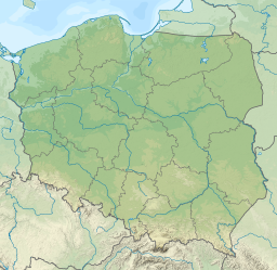
Mikołajskie Lake
This article does not cite any sources. (October 2013) |
| Mikołajskie Lake | |
|---|---|
 View of the lake and the Mikołajki harbor | |
 Mikołajskie Lake | |
| Location | Masurian Lake District, Masuria, Poland |
| Coordinates | 53°46′37″N 21°35′28″E / 53.777°N 21.591°ECoordinates: 53°46′37″N 21°35′28″E / 53.777°N 21.591°E |
| Native name | Jezioro Mikołajskie (Polish) |
| Max. length | 5.8 km (3.6 mi) |
| Max. width | 1.6 km (0.99 mi) |
| Surface area | 5 km2 (1.9 sq mi) |
| Max. depth | 25.9 m (85 ft) |
Mikołajskie Lake (Polish: Jezioro Mikołajskie; German: Nikolaiker See) is glacial lake in Masurian Lake District in Poland.
Mikołajskie Lake covers 5 square kilometres (1.9 sq mi) and is 5.8 kilometres (3.6 mi) long and 1.6 kilometres (0.99 mi) wide with a maximum depth of 25.9 meters.
In the north, Mikołajskie Lake is connected with the under the road bridge in Mikołajki. To one of the pillars of the bridge, on a spring, is chained the (Fish King, in Polish: Król Sielaw, Rybi Król, legendary king of Masuria). In the south-east, Mikołajskie Lake is connected with the Śniardwy Lake by the Przeczka strait within Dybowski Róg and Popielski Róg. In the south-west, Mikołajskie Lake is connected with the . On the west bank extends the Pisz Forest.
On the shore of the lake are the towns: Mikołajki, Dybowo, Kulinowo, Wierzba.
Notable wildlife:
- Eurasian bittern (Botaurus stellaris)
- Common goldeneye (Bucephala clangula)
- Ruff (Philomachus pugnax)
- Black-throated loon (Gavia arctica)
- Little gull (Larus minutus)
- Lakes of Warmian-Masurian Voivodeship
- Mrągowo County geography stubs
