Millard Airport (Pennsylvania)
Millard Airport | |||||||||||
|---|---|---|---|---|---|---|---|---|---|---|---|
| Summary | |||||||||||
| Airport type | Public | ||||||||||
| Serves | Annville, Pennsylvania | ||||||||||
| Elevation AMSL | 485 ft / 148 m | ||||||||||
| Coordinates | 40°19′02″N 076°32′11″W / 40.31722°N 76.53639°WCoordinates: 40°19′02″N 076°32′11″W / 40.31722°N 76.53639°W | ||||||||||
| Map | |||||||||||
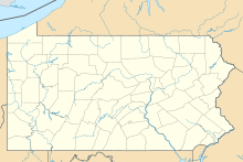
 N76 Location of airport in Pennsylvania | |||||||||||
| Runways | |||||||||||
| |||||||||||
| Statistics (2006) | |||||||||||
| |||||||||||
Millard Airport (FAA LID: N76) was a public use airport located one nautical mile (2 km) southwest of the central business district of Annville, in Lebanon County, Pennsylvania, United States.[1][2] It later became a private use airport (FAA LID: 4PA0).[3]
Facilities and aircraft[]
Millard Airport covered an area of 80 acres (32 ha) at an elevation of 485 feet (148 m) above mean sea level. It had one runway designated 11/29 with an asphalt surface measuring 2,870 by 50 feet (875 x 15 m).[1][2]
For the 12-month period ending May 25, 2006, the airport had 8,500 general aviation aircraft operations, an average of 23 per day. At that time there were six single-engine aircraft based at this airport.[1]
See also[]
- Reigle Field, a public use airport located at 40°17′12″N 076°34′37″W / 40.28667°N 76.57694°W, 3 nautical miles (6 km) southwest of Millard Airport
References[]
- ^ a b c d "N76 – Millard Airport". FAA data republished by AirNav. November 23, 2006. Archived from the original on November 28, 2006.
- ^ a b c "Millard Airport (N76)". Airport Directory. Pennsylvania Department of Transportation. Archived from the original on 2012-02-05. Retrieved June 9, 2013.
- ^ "4PA0 (formerly N76) – Millard Airport". FAA data republished by AirNav. December 20, 2007. Archived from the original on January 15, 2008.
External links[]
- Millard Airport - Economic Impact[permanent dead link] from Pennsylvania DOT
- Aerial image as of April 1999 from USGS The National Map
- Aeronautical chart at SkyVector
Categories:
- Airports in Lebanon County, Pennsylvania
