Millbrook, Illinois
Millbrook, Illinois | |
|---|---|
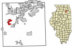 Location of Millbrook in Kendall County, Illinois | |
 Location of Illinois in the United States | |
| Coordinates: 41°35′54″N 88°33′10″W / 41.59833°N 88.55278°W | |
| Country | United States |
| State | Illinois |
| County | Kendall |
| Township | Fox |
| Area | |
| • Total | 1.85 sq mi (4.78 km2) |
| • Land | 1.85 sq mi (4.78 km2) |
| • Water | 0.00 sq mi (0.00 km2) |
| Population (2010) | |
| • Total | 335 |
| • Estimate (2019)[2] | 328 |
| • Density | 177.68/sq mi (68.61/km2) |
| Time zone | UTC-6 (CST) |
| • Summer (DST) | UTC-5 (CDT) |
| ZIP code | 60536 |
| Area code(s) | Area code 630 |
| FIPS code | 17-49100 |
| Wikimedia Commons | Millbrook, Illinois |
| Website | www |

Millbrook is a village in Kendall County, Illinois, United States. It was incorporated on November 5, 2002, and had a population of 335 at the 2010 census.[3]
The village is part of the Chicago metropolitan area.[4]
Geography[]
Millbrook is in western Kendall County on the southeast side of the Fox River. It is 7 miles (11 km) southwest of Yorkville, the county seat, 19 miles (31 km) southwest of Aurora, and 28 miles (45 km) west-northwest of Joliet. The village is bordered to the northeast by Silver Springs State Fish and Wildlife Area, along the Fox River.
According to the 2010 census, Millbrook has a total area of 2.08 square miles (5.39 km2), all land.[5]
Demographics[]
This section needs expansion. You can help by . (July 2015) |
| Historical population | |||
|---|---|---|---|
| Census | Pop. | %± | |
| 2010 | 335 | — | |
| 2019 (est.) | 328 | [2] | −2.1% |
| U.S. Decennial Census[6] | |||
Points of interest[]
- Silver Springs State Fish and Wildlife Area
- [7]
- Farnsworth House
- Millbrook United Methodist Church
References[]
- ^ "2019 U.S. Gazetteer Files". United States Census Bureau. Retrieved July 14, 2020.
- ^ a b "Population and Housing Unit Estimates". United States Census Bureau. May 24, 2020. Retrieved May 27, 2020.
- ^ "Geographic Identifiers: 2010 Demographic Profile Data (G001): Millbrook village, Illinois". American Factfinder. U.S. Census Bureau. Retrieved February 20, 2019.[dead link]
- ^ "Millbrook, Illinois". TIGERweb. Geography Division, U.S. Census Bureau. Retrieved February 20, 2019.
- ^ "G001 - Geographic Identifiers - 2010 Census Summary File 1". United States Census Bureau. Archived from the original on 2020-02-13. Retrieved 2015-12-19.
- ^ "Census of Population and Housing". Census.gov. Retrieved June 4, 2015.
- ^ "Archived copy". Archived from the original on 2011-05-01. Retrieved 2010-10-30.CS1 maint: archived copy as title (link)
External links[]
Municipalities and communities of Kendall County, Illinois, United States | ||
|---|---|---|
| Cities | ||
| Villages | ||
| Townships | ||
| CDP | ||
| Other unincorporated communities | ||
| Footnotes | ‡This populated place also has portions in an adjacent county or counties | |
| ||
Coordinates: 41°35′54″N 88°33′10″W / 41.59833°N 88.55278°W
This Kendall County, Illinois location article is a stub. You can help Wikipedia by . |
- Villages in Kendall County, Illinois
- Villages in Illinois
- Populated places established in 2002
- 2002 establishments in Illinois
- Chicago metropolitan area geography stubs