Millerville, Alabama
Millerville, Alabama | |
|---|---|
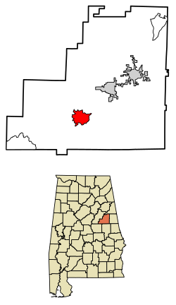 Location of Millerville in Clay County, Alabama. | |
 Millerville Location of Millerville in Clay County, Alabama. | |
| Coordinates: 33°11′29″N 85°55′33″W / 33.19139°N 85.92583°WCoordinates: 33°11′29″N 85°55′33″W / 33.19139°N 85.92583°W | |
| Country | United States |
| State | Alabama |
| County | Clay |
| Area | |
| • Total | 6.72 sq mi (17.41 km2) |
| • Land | 6.70 sq mi (17.35 km2) |
| • Water | 0.02 sq mi (0.06 km2) |
| Elevation | 856 ft (261 m) |
| Population (2020) | |
| • Total | 303 |
| • Density | 45.23/sq mi (17.46/km2) |
| Time zone | UTC-6 (Central (CST)) |
| • Summer (DST) | UTC-5 (CDT) |
| Area code(s) | 256 & 938 |
| GNIS feature ID | 160110[2] |

Millerville is a census-designated place and unincorporated community in Clay County, Alabama, United States. Its population was 303 as of the 2020 census.
Demographics[]
| Historical population | |||
|---|---|---|---|
| Census | Pop. | %± | |
| 2020 | 303 | — | |
| U.S. Decennial Census[3] | |||
References[]
- ^ "2020 U.S. Gazetteer Files". United States Census Bureau. Retrieved October 29, 2021.
- ^ "Millerville". Geographic Names Information System. United States Geological Survey.
- ^ "Census of Population and Housing". Census.gov. Retrieved June 4, 2016.
Municipalities and communities of Clay County, Alabama, United States | ||
|---|---|---|
| City |  | |
| Town | ||
| CDPs | ||
| Unincorporated communities | ||
| ||
This Clay County, Alabama state location article is a stub. You can help Wikipedia by . |
Categories:
- Census-designated places in Clay County, Alabama
- Census-designated places in Alabama
- Central Alabama geography stubs